Overview
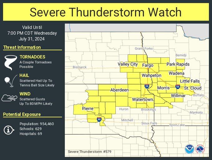
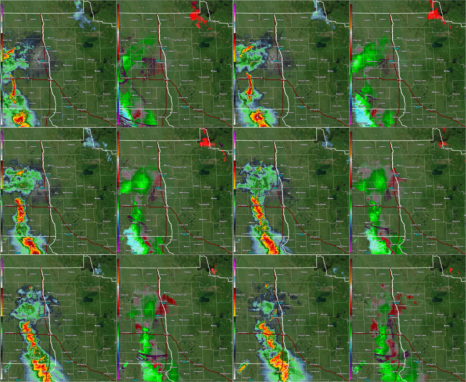
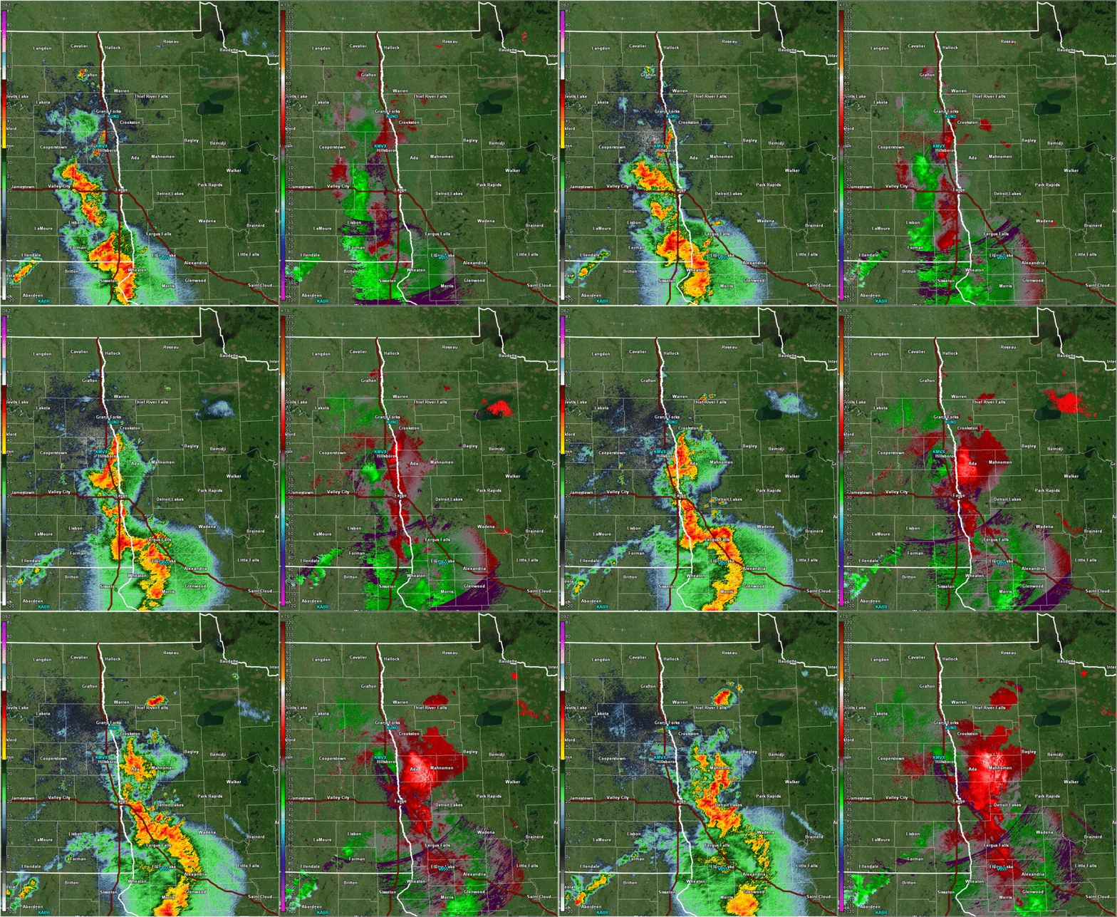
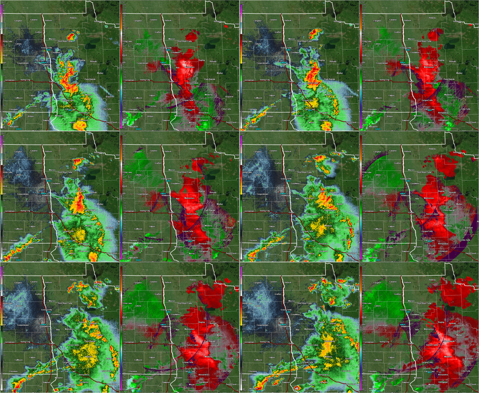
A complex of thunderstorms moving into eastern North Dakota during the late morning hours of July 31st gained strength as it approached then crossed the Red River into a more favorable environment in west central Minnesota by early afternoon. The storms produced damaging winds across portions of Richland county in far southeastern North Dakota and the Fergus Falls, Detroit Lakes, and Bemidji areas in Minnesota.Storm Reports
Header
 |
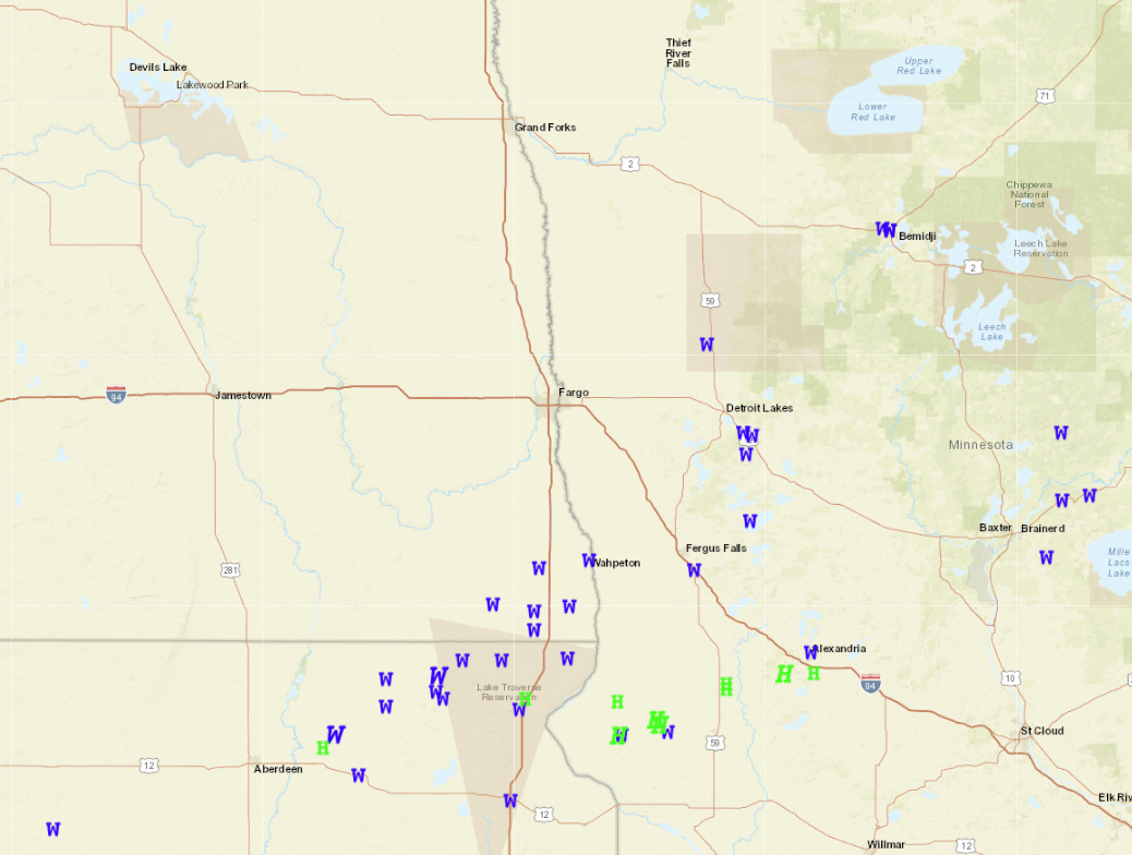 |
| Severe Thunderstorm Watch Valid 12pm to 7pm | Preliminary Storm Reports |
266
NOUS43 KFGF 012259
PNSFGF
MNZ001>009-013>017-022>024-027>032-040-NDZ006>008-014>016-024-026>030-038-
039-049-052>054-021059-

Public Information Statement
National Weather Service Grand Forks ND
559 PM CDT Thu Aug 1 2024

...HIGHEST WIND REPORTS...

Location                     Speed     Time/Date
4 E Vergas                   73 MPH    0228 PM 07/31
7 SSW Hankinson              67 MPH    1237 PM 07/31
Frazee MN DOT                67 MPH    0235 PM 07/31
2 NE Wilton                  67 MPH    0340 PM 07/31
Wahpeton AP ND               66 MPH    0135 PM 07/31
3 SSW Mooreton               64 MPH    0103 PM 07/31
Fergus Falls MN DOT          60 MPH    0140 PM 07/31
5 WNW Dalton                 60 MPH    0140 PM 07/31
6 W Fairmount                59 MPH    0103 PM 07/31
8 NNW Hastings               57 MPH    1145 AM 07/31
1 ESE Phelps                 53 MPH    0144 PM 07/31
2 W Foxhome                  52 MPH    0118 PM 07/31
Halstad MN DOT               52 MPH    0135 PM 07/31
1 SW Valley City             51 MPH    1157 AM 07/31
Herman MN DOT                51 MPH    0115 PM 07/31
Bemidji AP MN                51 MPH    0335 PM 07/31

Observations are collected from a variety of sources with varying
equipment and exposures. We thank all volunteer weather observers
for their dedication. Not all data listed are considered official.

$$
Photos
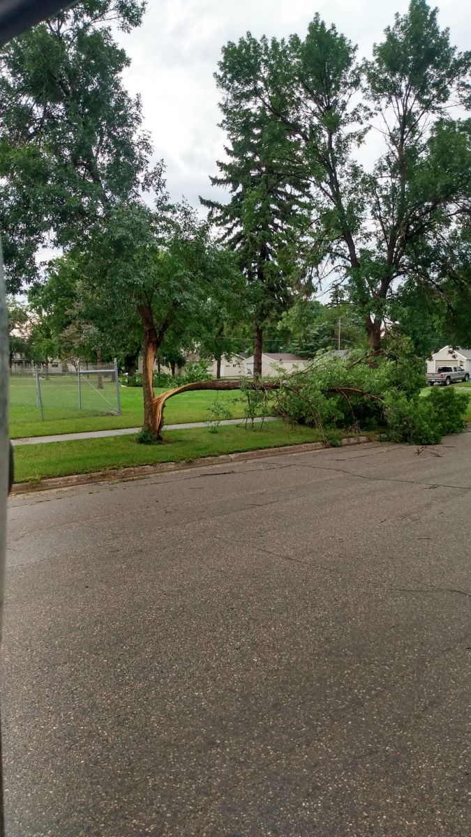
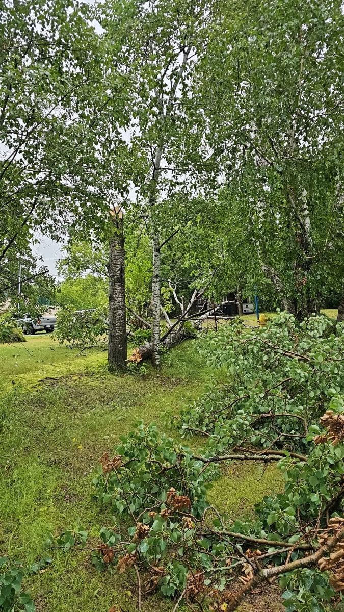
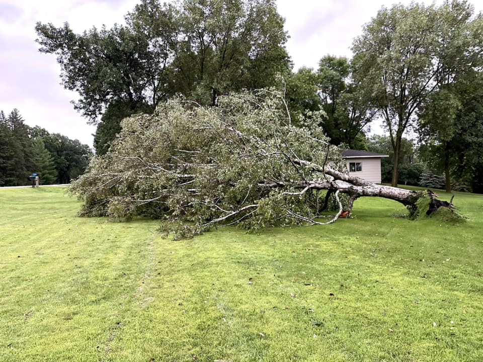
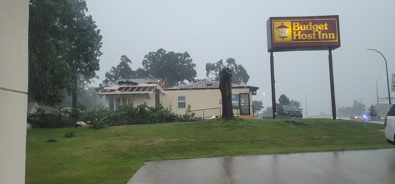
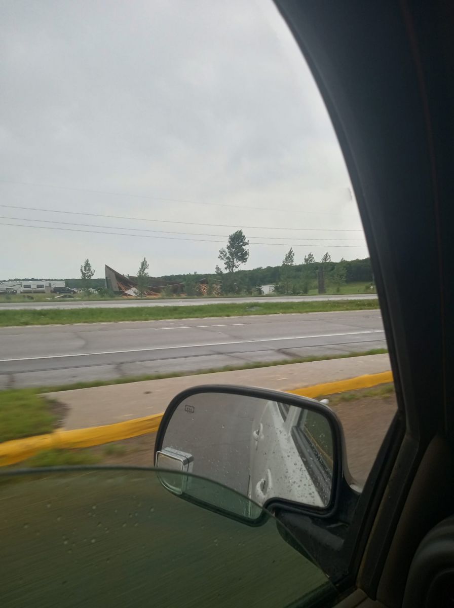
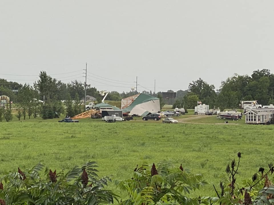
Multiple reports of trees uprooted, as well as building damage.
 |
 |
|
|
Breckenridge Joshua Schwebach |
Bemidji Kyrstan Bewley |
Bemidji Christopher Muller |
 |
 |
 |
 |
|
Fergus Falls Margene Newton |
Detroit Lakes Jared Hammer |
Frazee Steven Torres |
West of Frazee Karen Mitchell |
Radar
 |
 |
 |
|
Radar loop from around 11:10 AM to 12:35 PM. Reflectivity on left and Velocity on right. |
Radar loop from around 12:37 PM to 1:45 PM. Reflectivity on left and Velocity on right. | Radar loop from around 1:45 PM to 2:15 PM. Reflectivity on left and Velocity on right. |
Environment
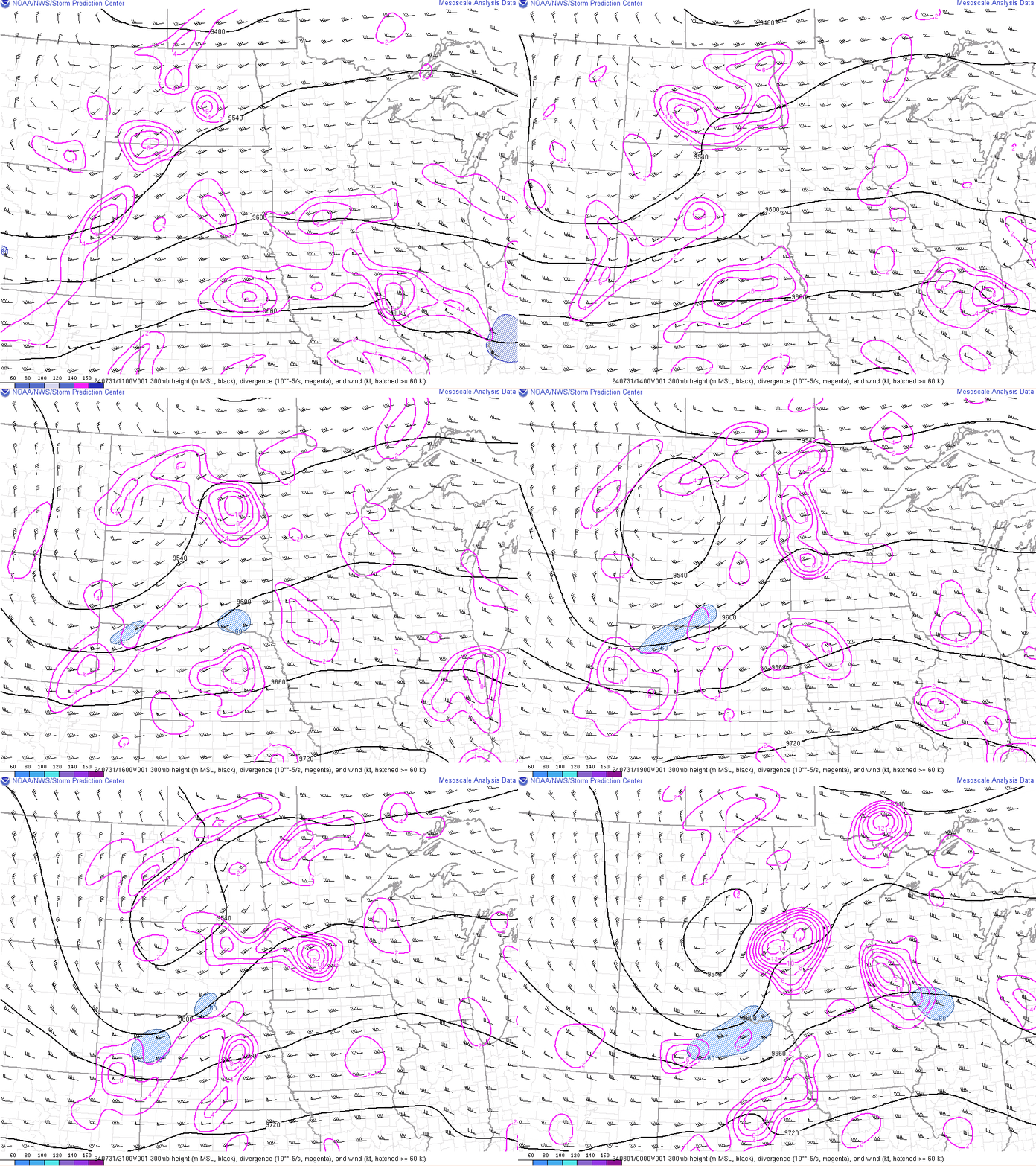
The synoptic environment for this event included an upper level trough traveling eastward, across the Red River Valley, with areas of divergence aloft pushing through the environment (Figure 1). The trough pattern, consistent with divergence aloft downstream, is indicative of rising motion in these areas. Temperature advection at 700mb (Figure 2), shows warm air moving eastward in the late morning/early afternoon, leading to an environment conducive for storm development.
 |
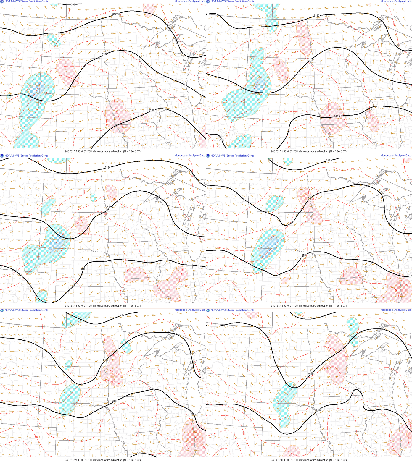 |
| Figure 1: 300mb height (black). divergence (magenta), wind (blue hatched >=60kts). | Figure 2: 700mb Temperature Advection |
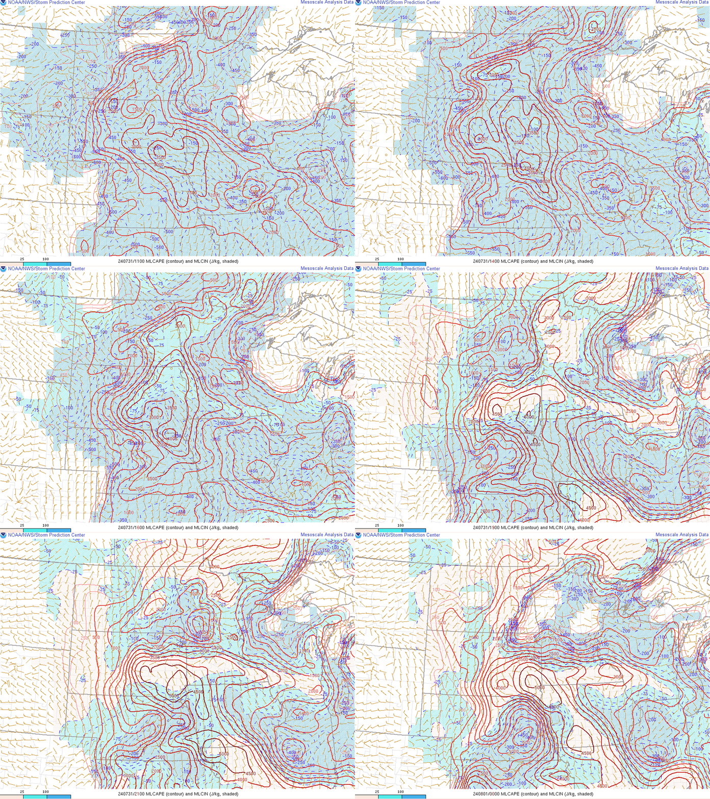
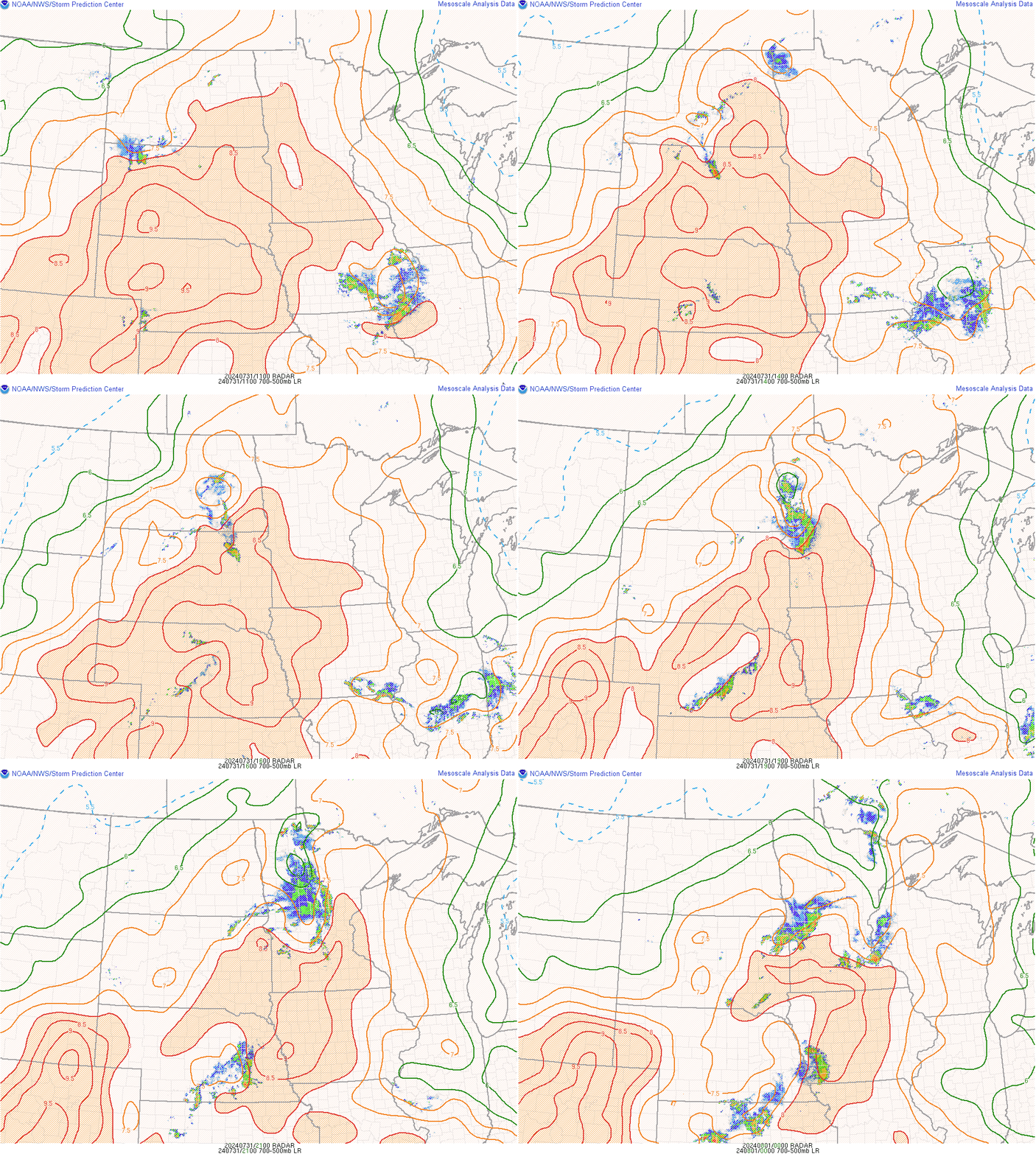
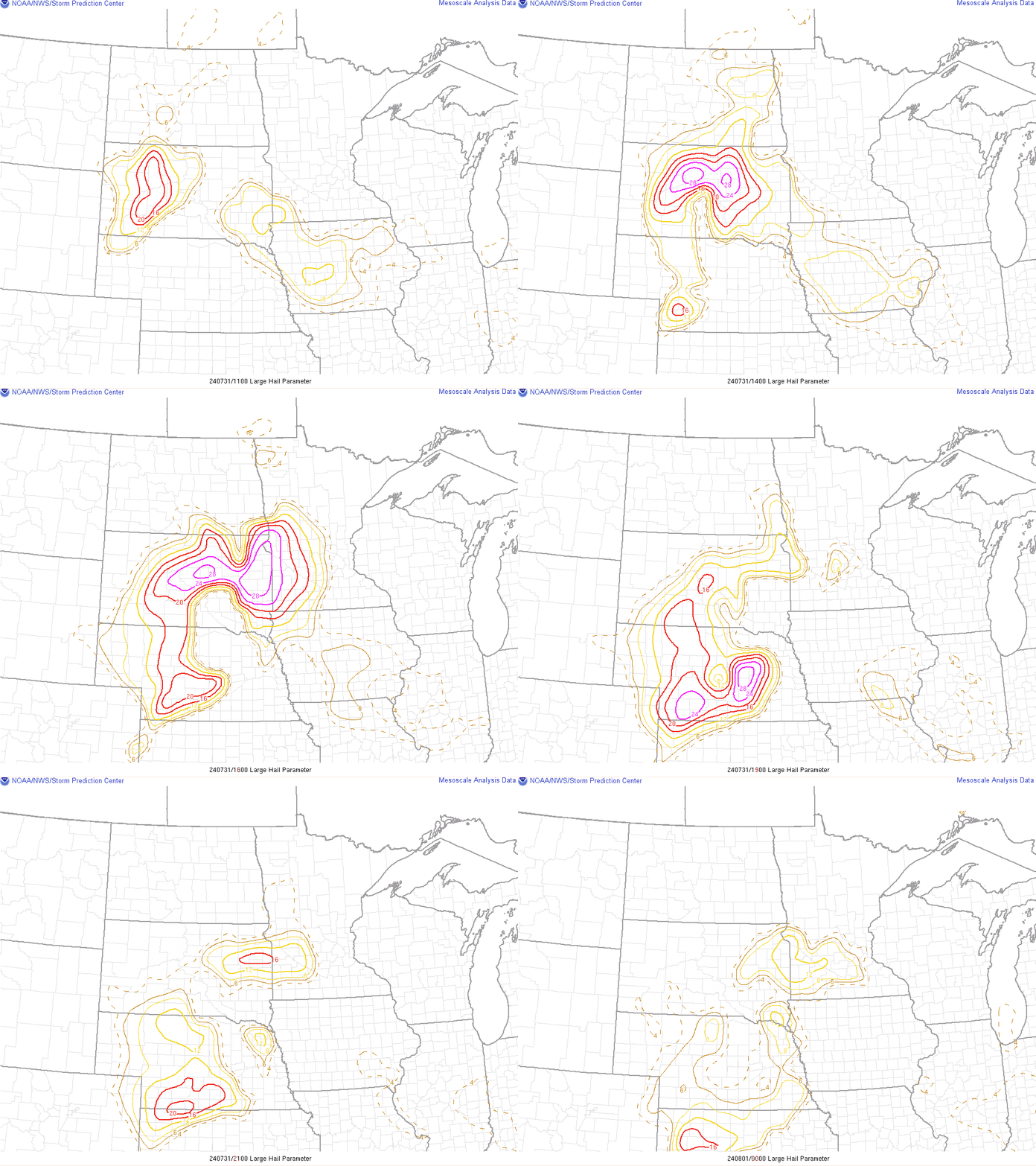
There was an ample amount of CAPE (>3000 J/Kg) for storm development (Figure 3). Steep mid-level lapse rates also indicate an unstable environment able to support storm development (Figure 4). The Surface - 3km shear (Figure 5) shows shear vectors >=35kts in the late afternoon/early morning behind the storms leading to stronger inflow fueling the storms, and thus stronger winds as indicated by the "bowing" pattern seen using radar reflectivity. Due to the high shear and unstable environment, there was potential for large hail in our area (Figure 6.) Hail of 1.25in was reported in Grant County, MN - our southernmost county.
 |
 |
|
 |
| Figure 3: MLCAPE (contour), MLCIN (Shaded) |
Figure 4: 700mb - 500mb Lapse Rates (contour, shaded), Radar Reflectivity |
Figure 5: Surface - 3km Shear (contour), Radar Reflectivity | Figure 6: Large Hail Parameter |
To view more storm reports, and the weather event review, you can visit the SPC Storm Report for this date.
 |
Media use of NWS Web News Stories is encouraged! Please acknowledge the NWS as the source of any news information accessed from this site. |
 |