Overview
First round of clustered severe thunderstorms developed in west central and central Minnesota around 4:00pm bringing quarter to 2 inch sized hail and 55-65mph damaging winds. Warnings where issued promptly across lakes country as the storms tracked into central and northeast Minnesota. A brief break in severe activity occurred through the late evening hours before another round of thunderstorms began to develop along a frontal boundary near the North Dakota and South Dakota around 9:00pm. Storm began to affect Ransom, Sargent, and Richland counties after 10:30pm, with multiple reports of wind damage. Wind damage ranged from blown over sheds to broken trees. Storms continued past midnight into west central Minnesota where multiple reports of broken trees to displaced playgrounds where reported.
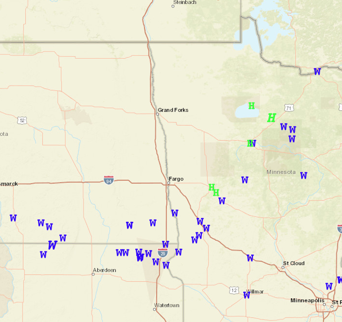
Wind & Hail:
Green H's are Hail reports, Blue W's are Wind reports, and Red T's are for Tornado reports.
Photos & Video
 |
 |
 |
|
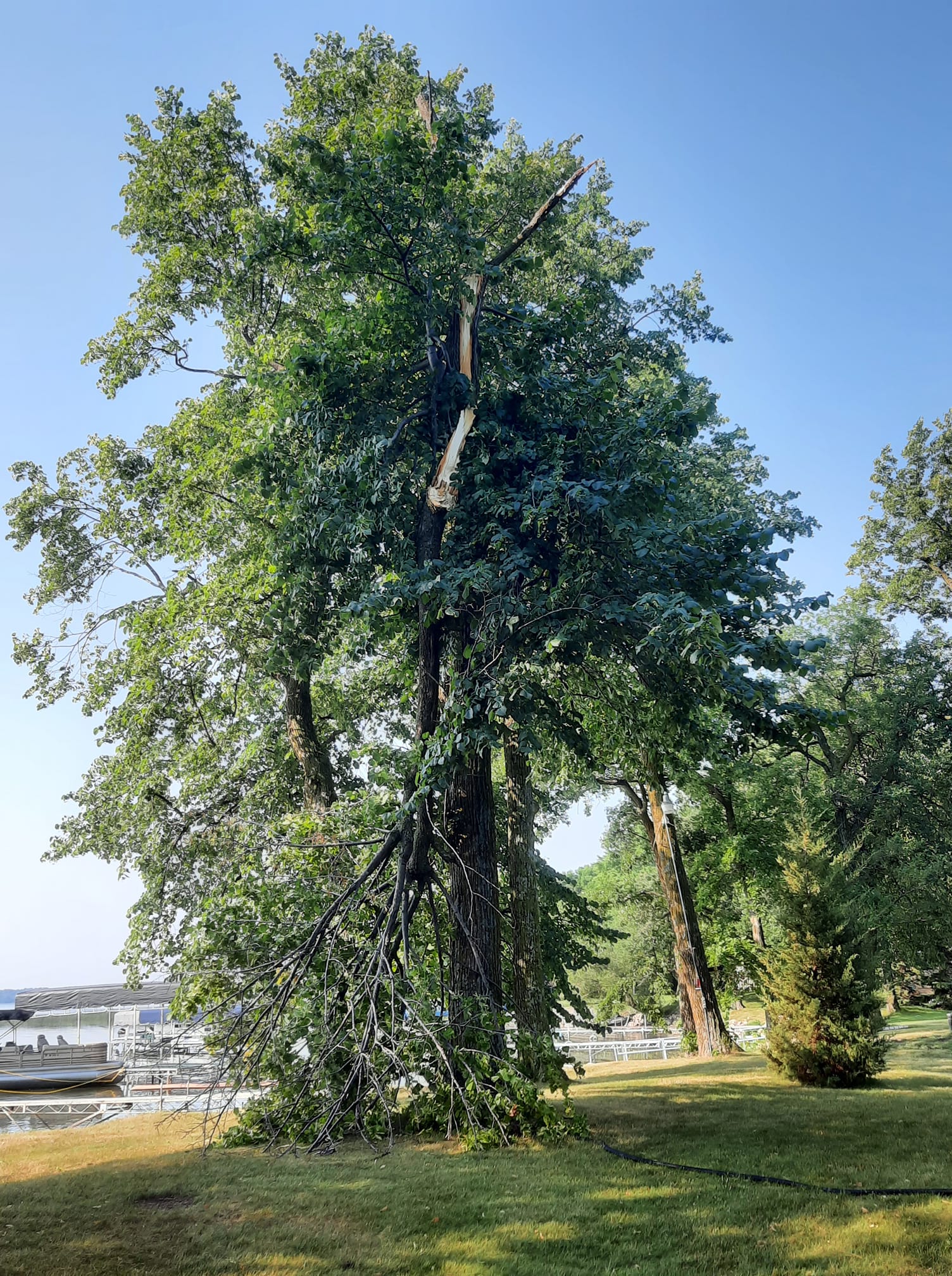
Snapped trees - Lake Lizzie, MN Marcia Lindholm Bettenhausen |
Hail - Frazee, MN Kari Honer |
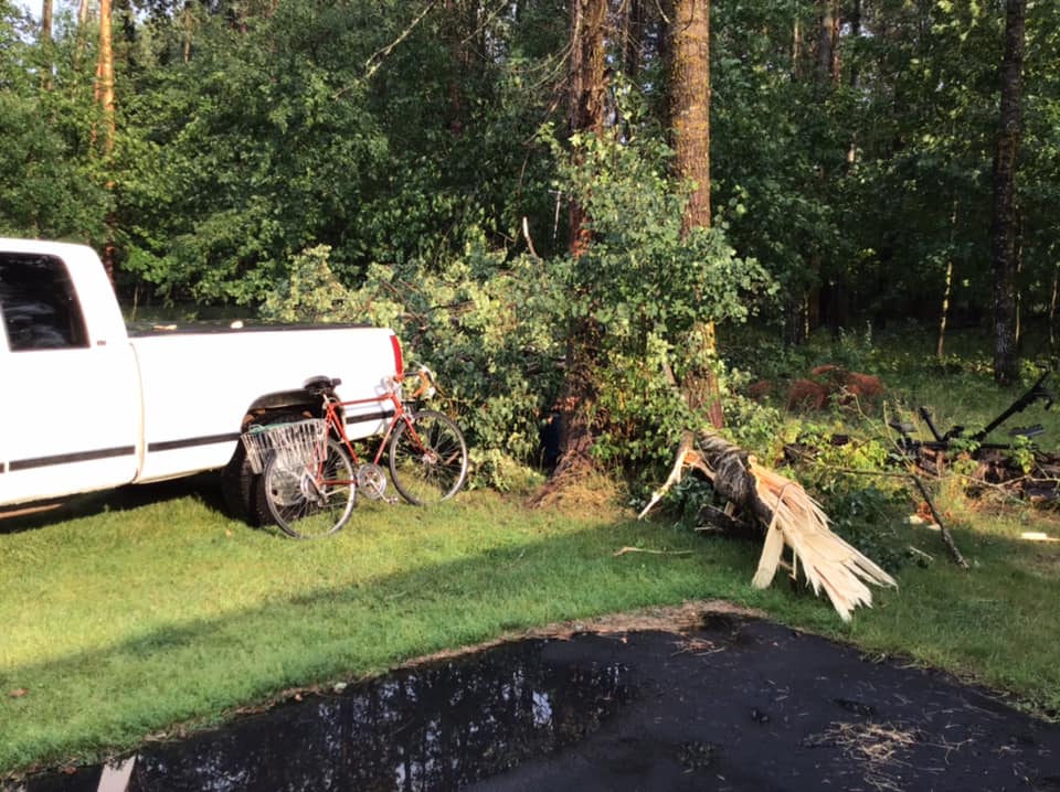
Snapped trees - Bemidji, MN Becky Carlson |
 |
|
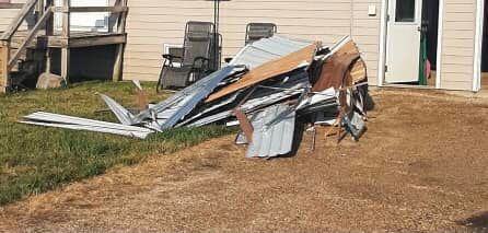
Blown shed - Gwinner, ND AimeeHaring |
Radar
Storm Reports
A link to the preliminary storm reports.
https://nwschat.weather.gov/lsr/#FGF/202107232105/202107240738
Rain Reports
Estimated Storm Total Rainfall from July 23th 2021.
https://nwschat.weather.gov/p.php?pid=202107241823-KFGF-NOUS43-PNSFGF

 |
Media use of NWS Web News Stories is encouraged! Please acknowledge the NWS as the source of any news information accessed from this site. |
|

