Overview
A National Weather Service storm damage survey team has located and investigated several significant storm damage areas from downburst winds along a route from roughly 4 miles south of Drayton North Dakota to about 4 miles North of Roseau Minnesota. This included the communities of Drayton...Donaldson...Karlstad...Stranquist...Greenbush...Badger...and Roseau...As well as intervening rural areas within a few miles of this path. The damage was clearly indicative of widespread downburst...straight line winds throughout this area...extending a dozen or more miles wide at times. Downburst winds exceeded the 65 to 75 mph range in most all of this area...with large tree limbs and many tree trunks snapped all throughout this mixed forest and agricultural area. Some areas showed evidence of more extreme peak winds which were likely in the 85 to 95 mph range. It should be noted that soils throughout the area were heavily saturated...so that in many places...trees were more easily uprooted than one may normally expect. Several eye witnesses reported seeing the approaching low level...black cloud...which was likely a shelf cloud...possibly a roll cloud. These generally mark the leading edge of the gust front from the thunderstorm complex. Occasionally...weak tornadoes may also accompany such downburst wind storms...though in this case...the damage team was unable to locate any clear indications of tornadic action. Most of the more extreme damage was located between Karlstad...Greenbush...and Badger. Damages in this area included missing roofing materials...sheet metal roof or sidewall panels...or partially collapsed steel grain bins...and more frequent extreme tree damage. See photos at end of text. In Karlstad...winds completely destroyed the Kittson County garage and shop structure. Downburst winds likely entered the opened...west facing...large span doors. Winds then lifted and peeled back the roofing and rear wall...while blowing out the south wall. Roofing materials were spread over 200 feet downwind or eastward from the site. Winds near this site likely approached 95 mph. An adjacent wooden Quonset and nearby power lines were largely undamaged...though trees throughout the area showed varying degrees of damage.Photos:
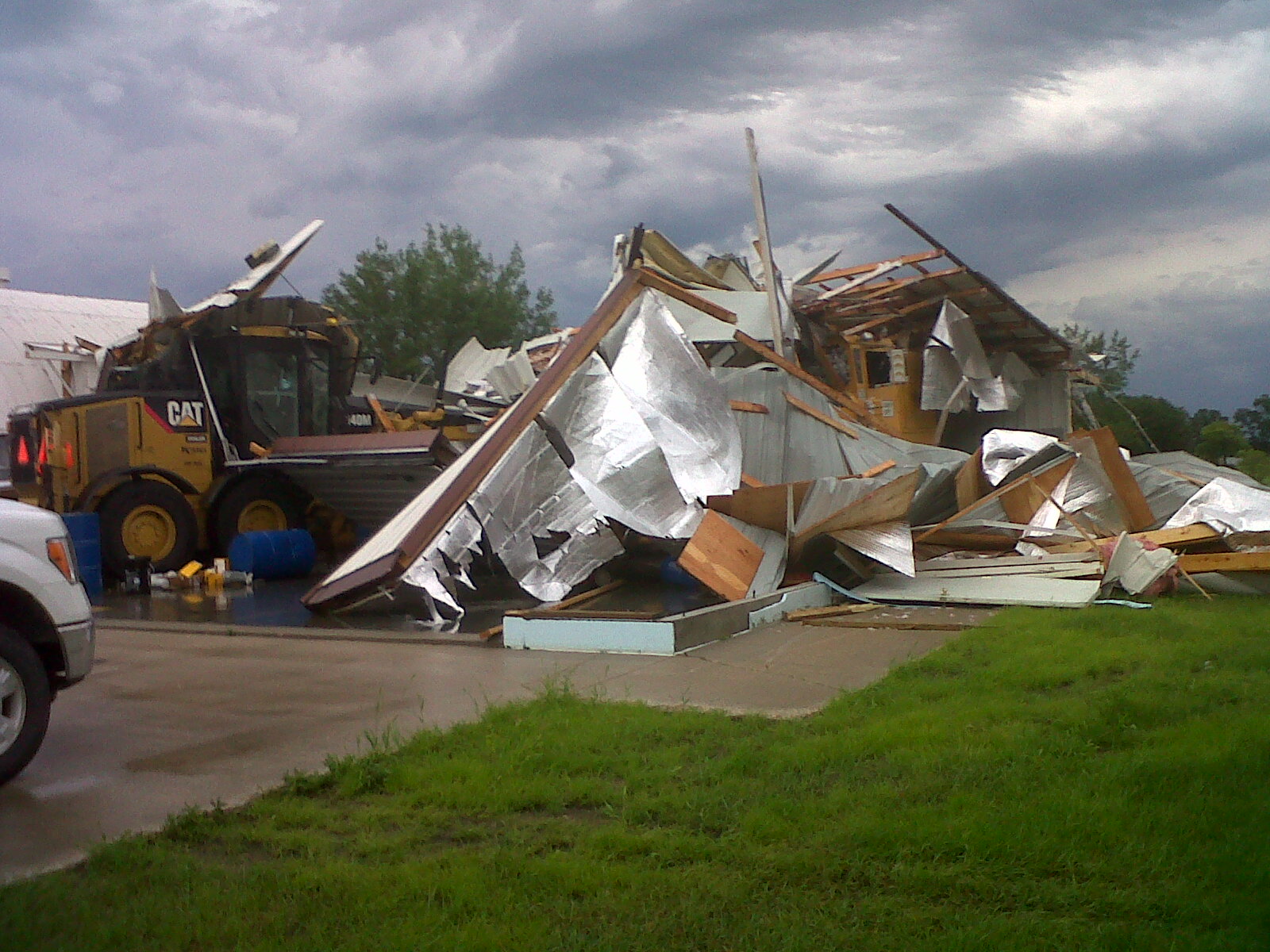
Kittson county shop mangled

Storm Reports

Environment
Upper ridge was in place with shortwave coming over the top of ridge.
 |
||
| Figure 1: 500 mb | F |
Near-storm environment summary. Very high cape values over 5000 J/kg and MUCAPE near 6,000 J/kg.
 |
||
 |
Media use of NWS Web News Stories is encouraged! Please acknowledge the NWS as the source of any news information accessed from this site. |
|

