Overview
A mid-level shortwave moved southeast through Minnesota in the evening, sparking convection near the front in the Red River Valley. Main threat was large hail, with rainfall over an inch in many locations affected.Hail:
Public Information Statement
National Weather Service Grand Forks ND
1241 PM CDT Fri Jul 15 2022

...HAIL REPORTS FROM OVERNIGHT...

Location                     Size      Time/Date       Provider
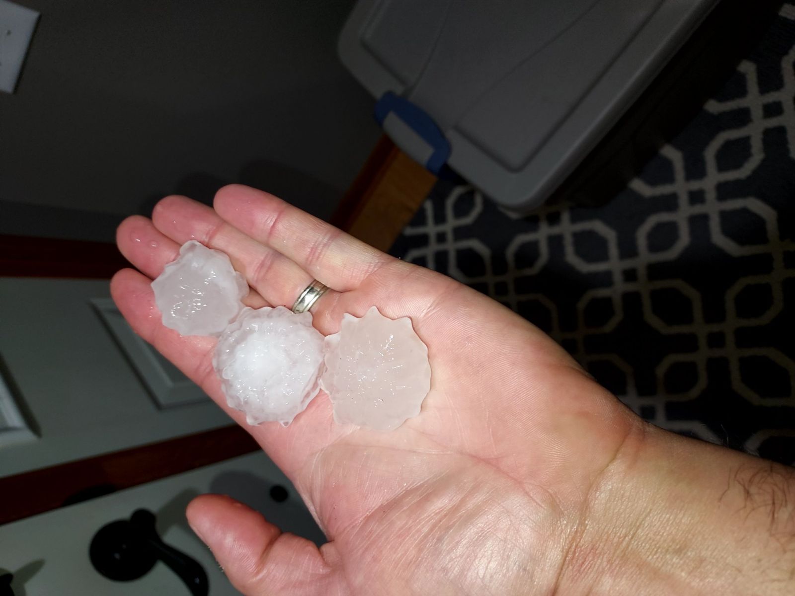
6 SE Blanchard               2.00 in   0118 AM 07/15   Trained Spotter
Lake Park                    2.00 in   0200 AM 07/15   Public
3 WSW Lake Park              2.00 in   0210 AM 07/15   Public
4 NNE Almora                 1.00 in   0300 AM 07/15   Public
5 E Lawndale                 1.00 in   0350 AM 07/15   Public
2 NNE Kindred                1.00 in   0405 AM 07/15   Public
Pelican Rapids               0.88 in   0315 AM 07/15   Public

Observations are collected from a variety of sources with varying
equipment and exposures. We thank all volunteer weather observers
for their dedication. Not all data listed are considered official.

$$
Photos & Video
 |
 |
 |
 |
| Large Hail in Lake Park, MN. (Brant Bigger) |
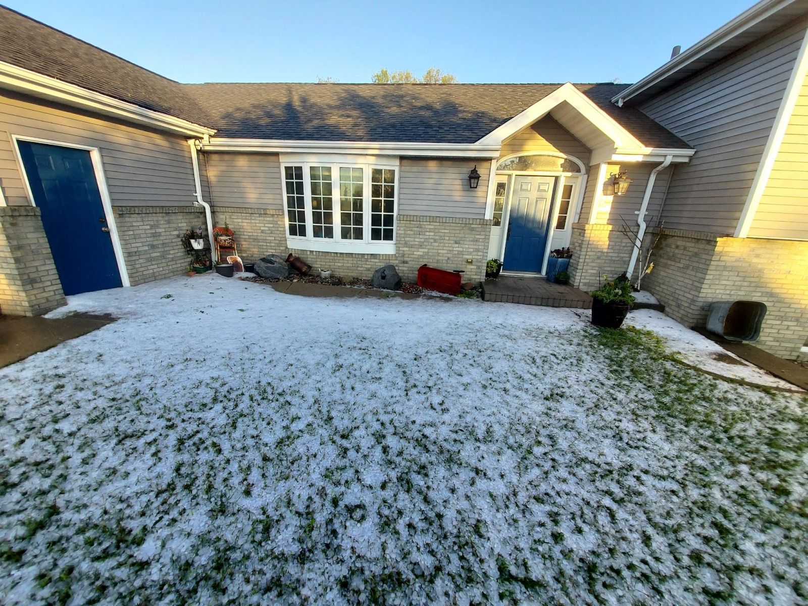
Hail covers the ground in Lake Park, MN (Brant Bigger) |
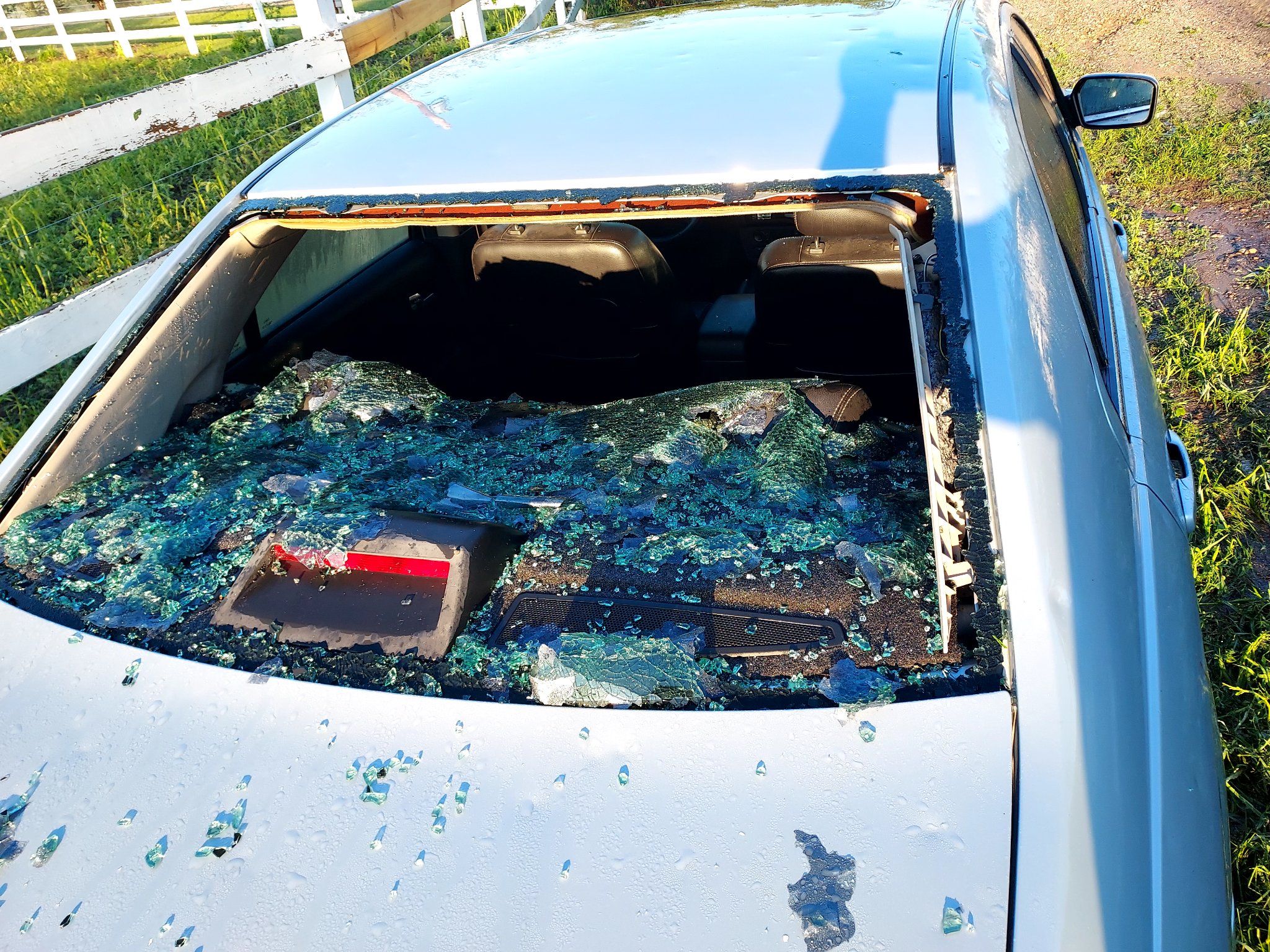
Car windshield damaged by the hail in Lake Park, MN (Brant Bigger) |
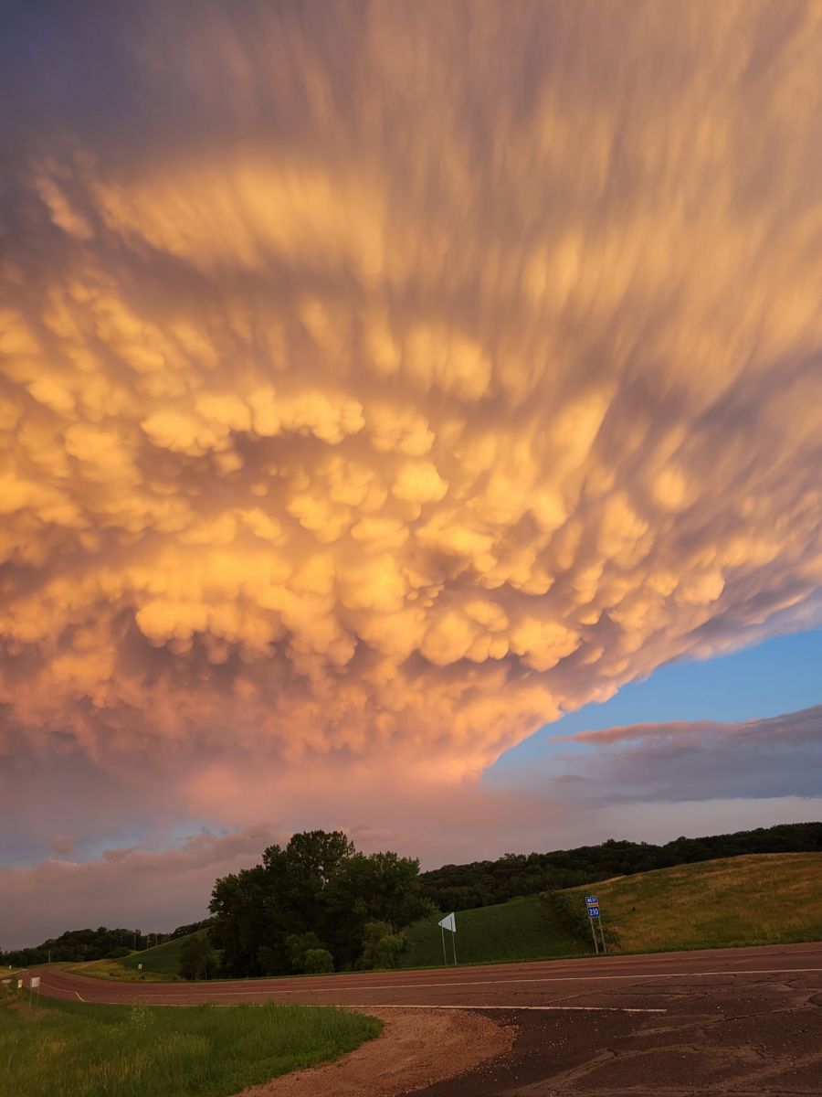
Mammatus clouds in Battle Lake, MN (Anita Quast) |
We've had some impressive rainfall amounts over the last 24 hours. More than 4 inches fell in several areas in southern Traill & northern Cass Counties. #VNLFirstAlert #ndwx #mnwx pic.twitter.com/GdFgrP1iKa
— Lisa Green (@LisaGreenVNL) July 15, 2022
Our largest hail stone so far this morning: TWO INCH diameter hail! This is from Lynette Dahl in Lake Park, MN. There was also a 2-inch hail report in Grandin, ND. The hail threat continues for those in the path of the storms in the southern valley! #VNLFirstAlert #ndwx #mnwx pic.twitter.com/jerLS1xEo9
— Lisa Green (@LisaGreenVNL) July 15, 2022
Radar
Here's a radar loop from 10 PM July 14th through 6 AM July 15th
Storm Reports
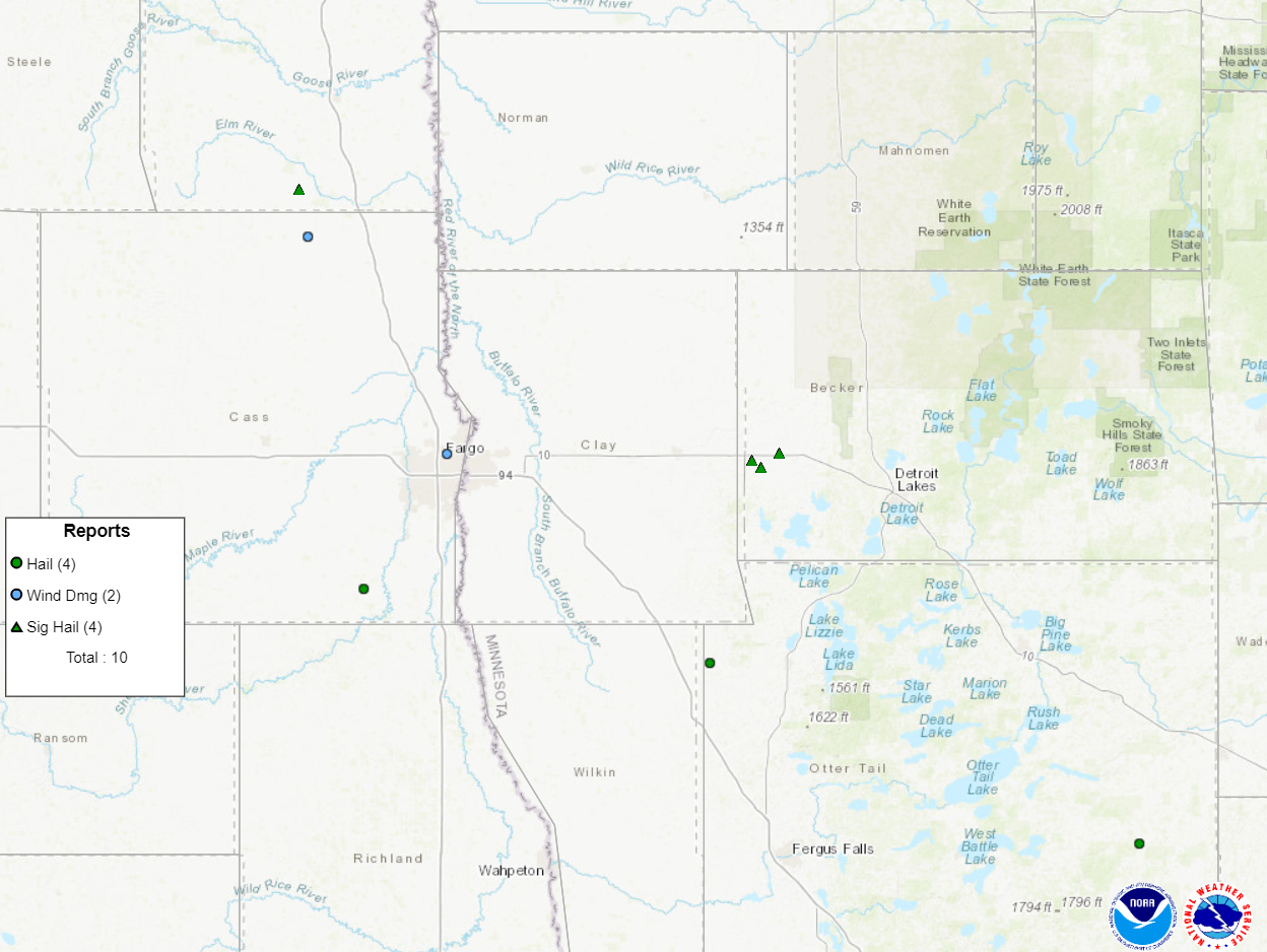 |
| Storm reports from the early morning storms, courtesy of SPC |
Rain Reports
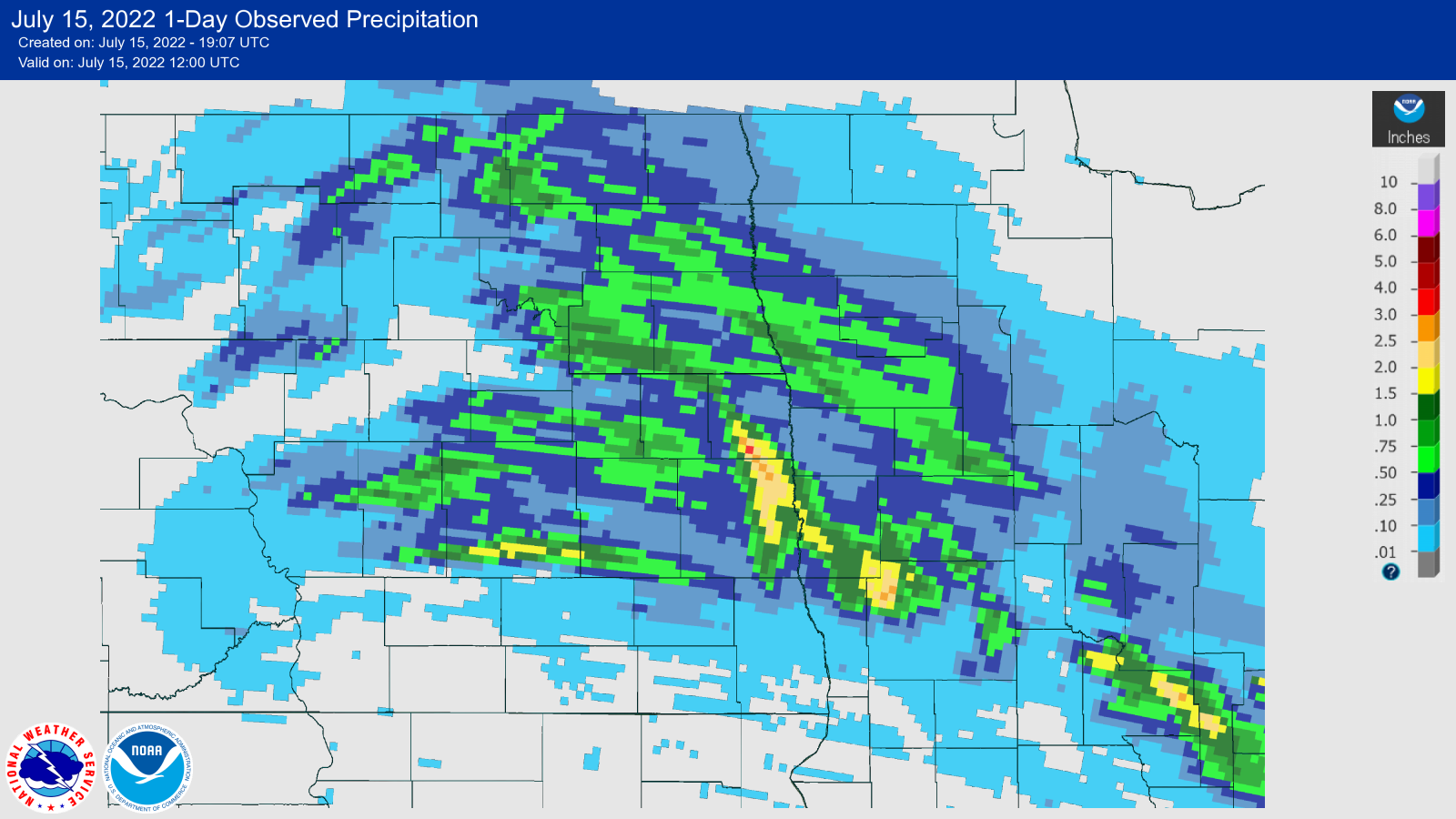 |
| 24 hour Rainfall map |
Public Information Statement
National Weather Service Grand Forks ND
1240 PM CDT Fri Jul 15 2022

...PRECIPITATION REPORTS FROM YESTERDAY AND OVERNIGHT...

Location                     Amount    Time/Date       Provider
6 NE Hunter                  4.45 in   0842 AM 07/15   CO-OP Observer
5 W Grandin                  4.42 in   0300 AM 07/15   Mesonet
5 W Grandin                  3.90 in   1205 PM 07/15   Mesonet
Gardner                      2.90 in   0300 AM 07/15   Public
Moorhead                     2.44 in   1210 PM 07/15   Mesonet
2 N Moorhead                 2.00 in   0700 AM 07/15   Cocorahs
2 N Fargo                    1.95 in   0800 AM 07/15   Cocorahs
4 NE Hunter                  1.95 in   1206 PM 07/15   Mesonet
2 NE Sabin                   1.78 in   1149 AM 07/15   Mesonet
1 S Reiles Acres             1.75 in   0653 AM 07/15   ASOS
Mayville                     1.75 in   1217 PM 07/15   Mesonet
2 E Gardner                  1.74 in   1207 PM 07/15   Mesonet
5 NNW Cormorant              1.73 in   0700 AM 07/15   Cocorahs
Moorhead                     1.70 in   0700 AM 07/15   Cocorahs
2 SSE North River            1.70 in   0700 AM 07/15   Cocorahs
4 SSW Kragnes                1.66 in   0800 AM 07/15   Cocorahs
6 W Dunvilla                 1.57 in   0543 AM 07/15   Cocorahs
4 WSW Hillsboro              1.55 in   1203 PM 07/15   Mesonet
2 NW Grandin                 1.55 in   1204 PM 07/15   Mesonet

Observations are collected from a variety of sources with varying
equipment and exposures. We thank all volunteer weather observers
for their dedication. Not all data listed are considered official.

$$
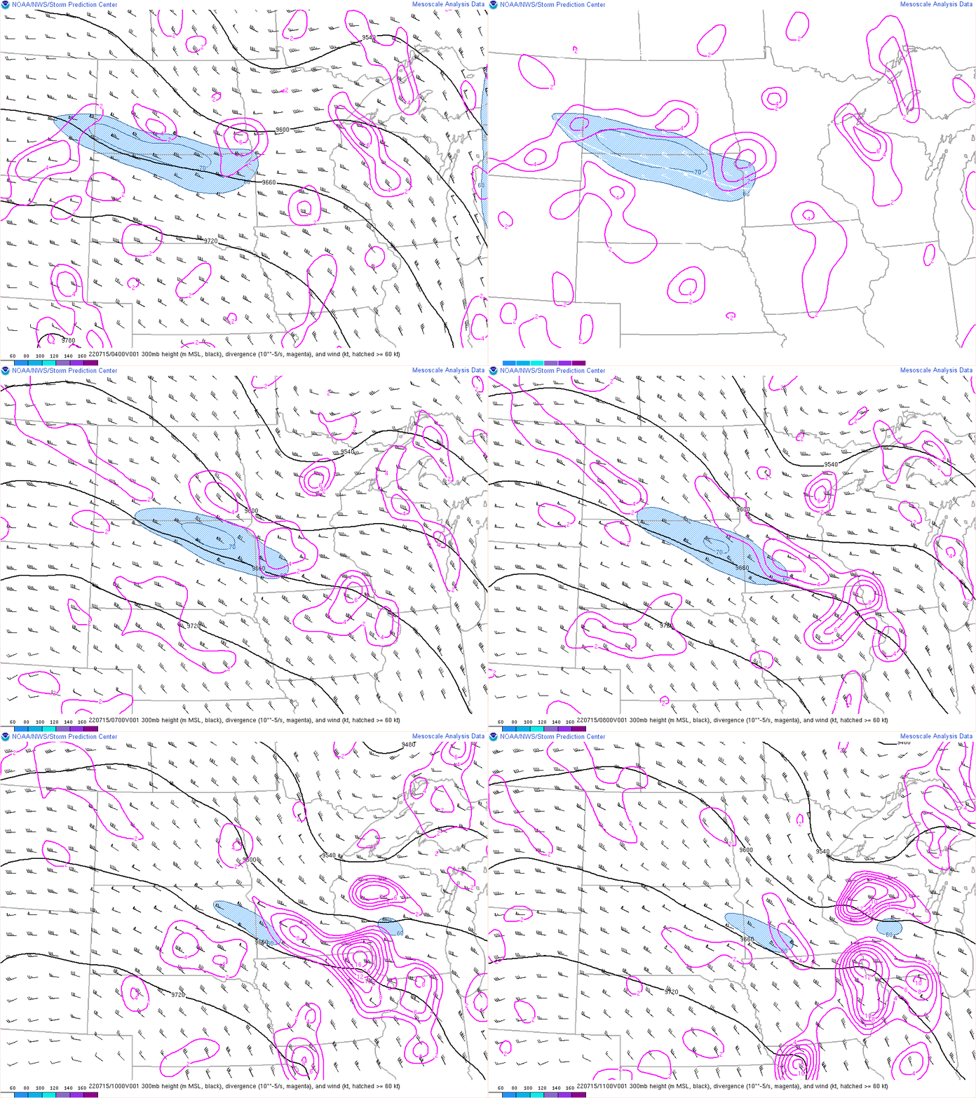
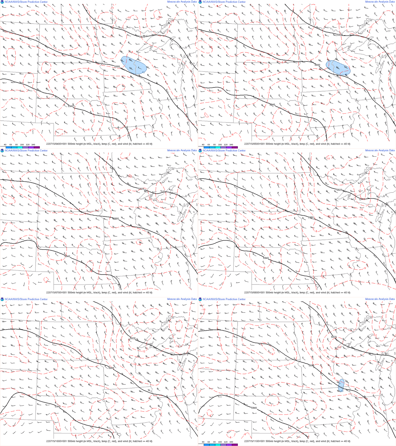
Environment
 |
 |
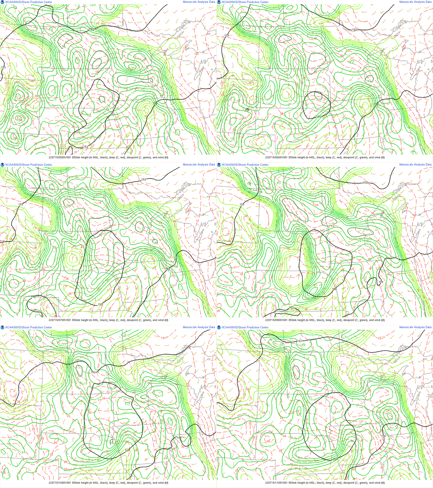 |
| Figure 1: 300mb | Figure 2: 500mb | Figure 3: 850mb |
 |
 |
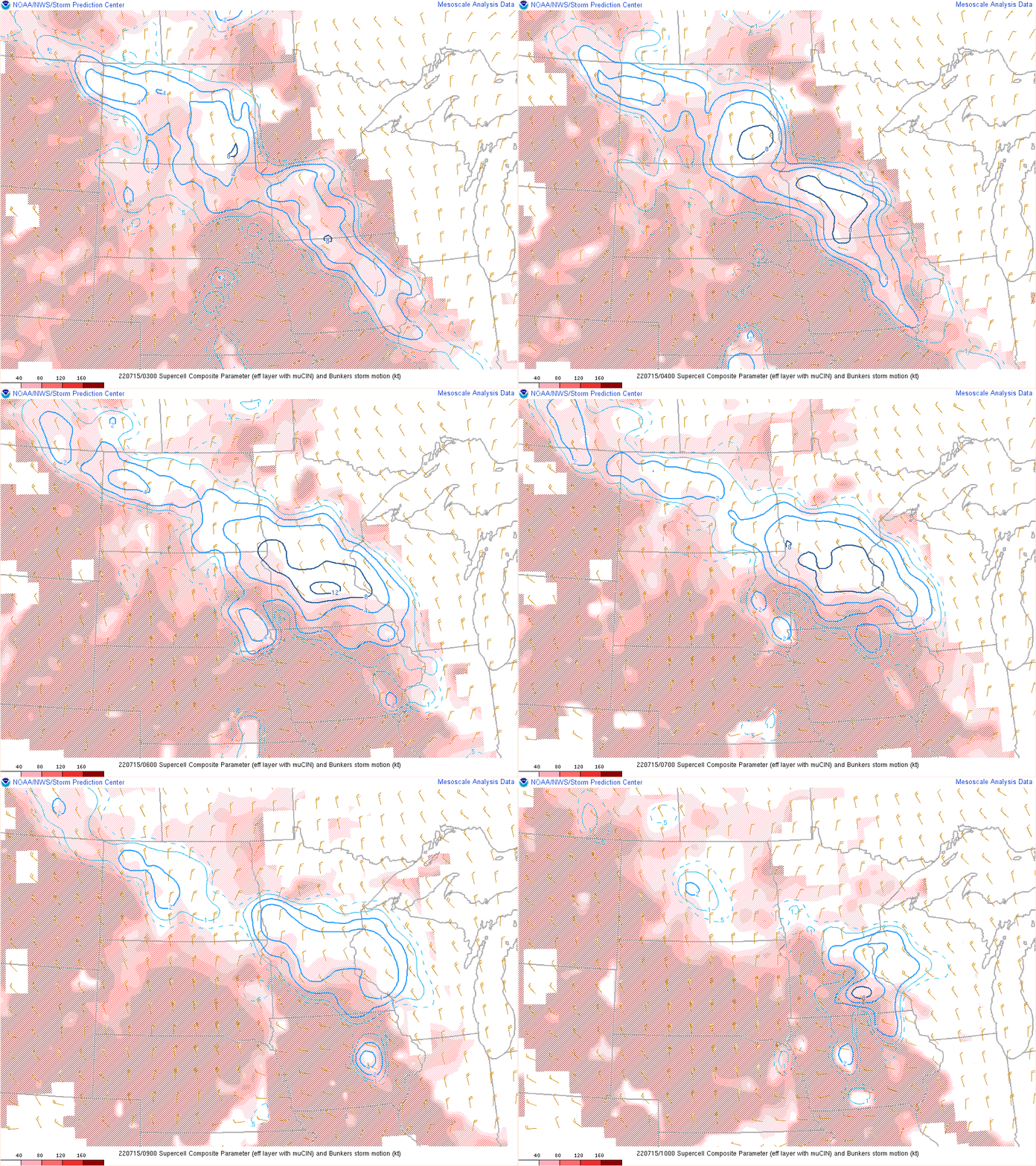 |
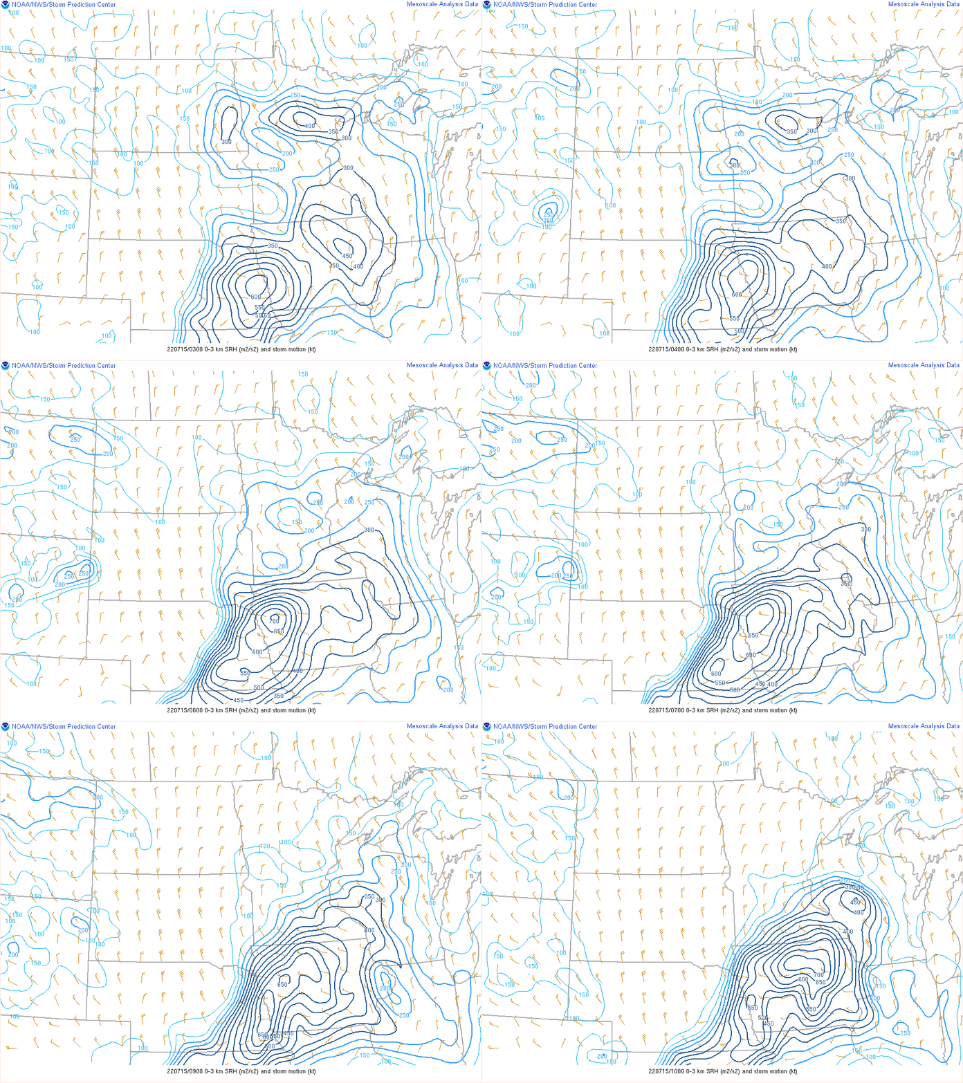
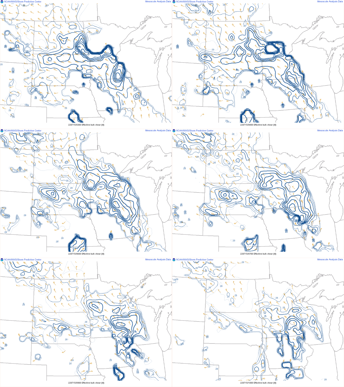
| Figure 4: 0-3km SRH | Figure 5: Effective Shear | Figure 6: Supercell Composite Parameter |
 |
 |
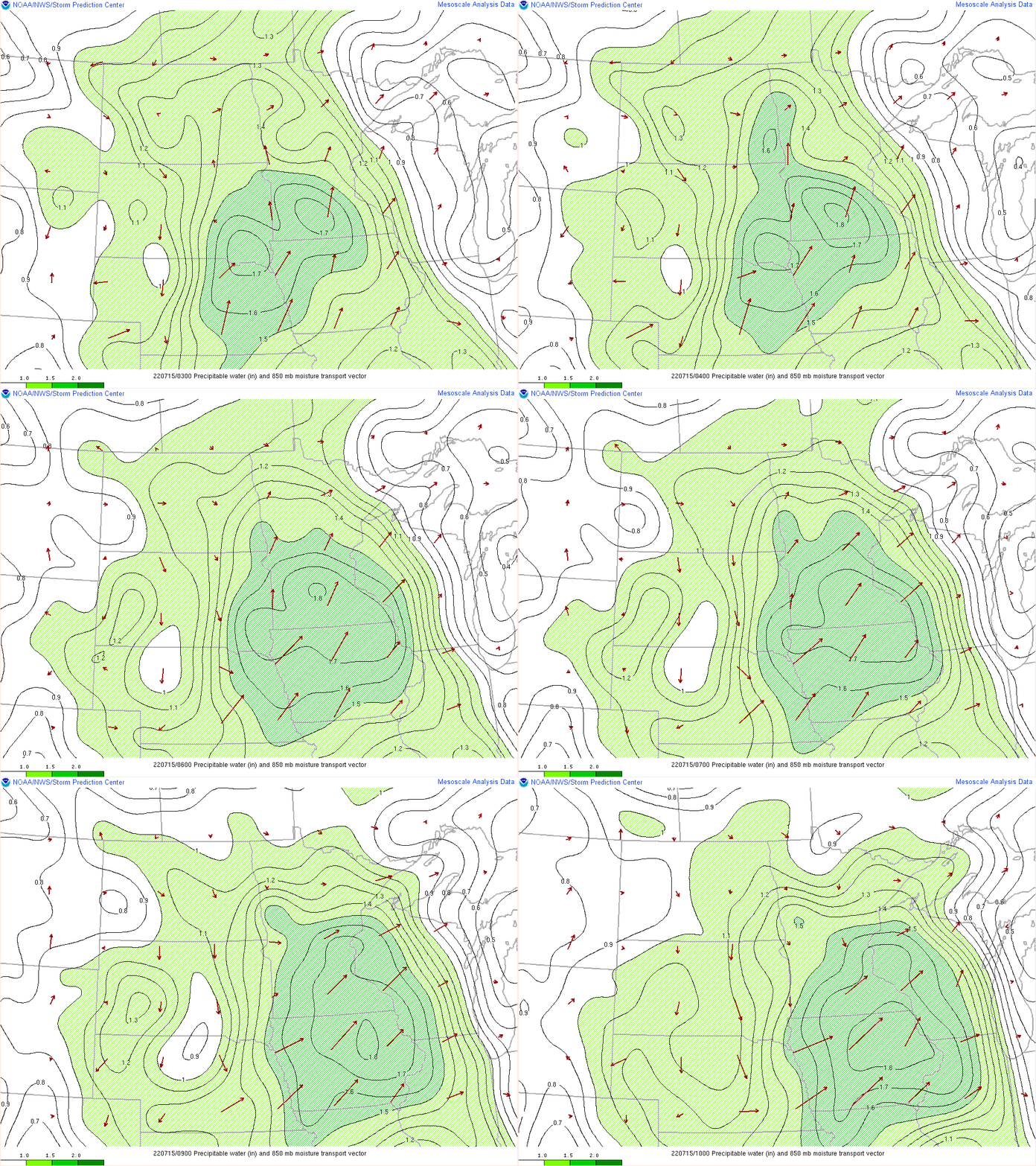 |
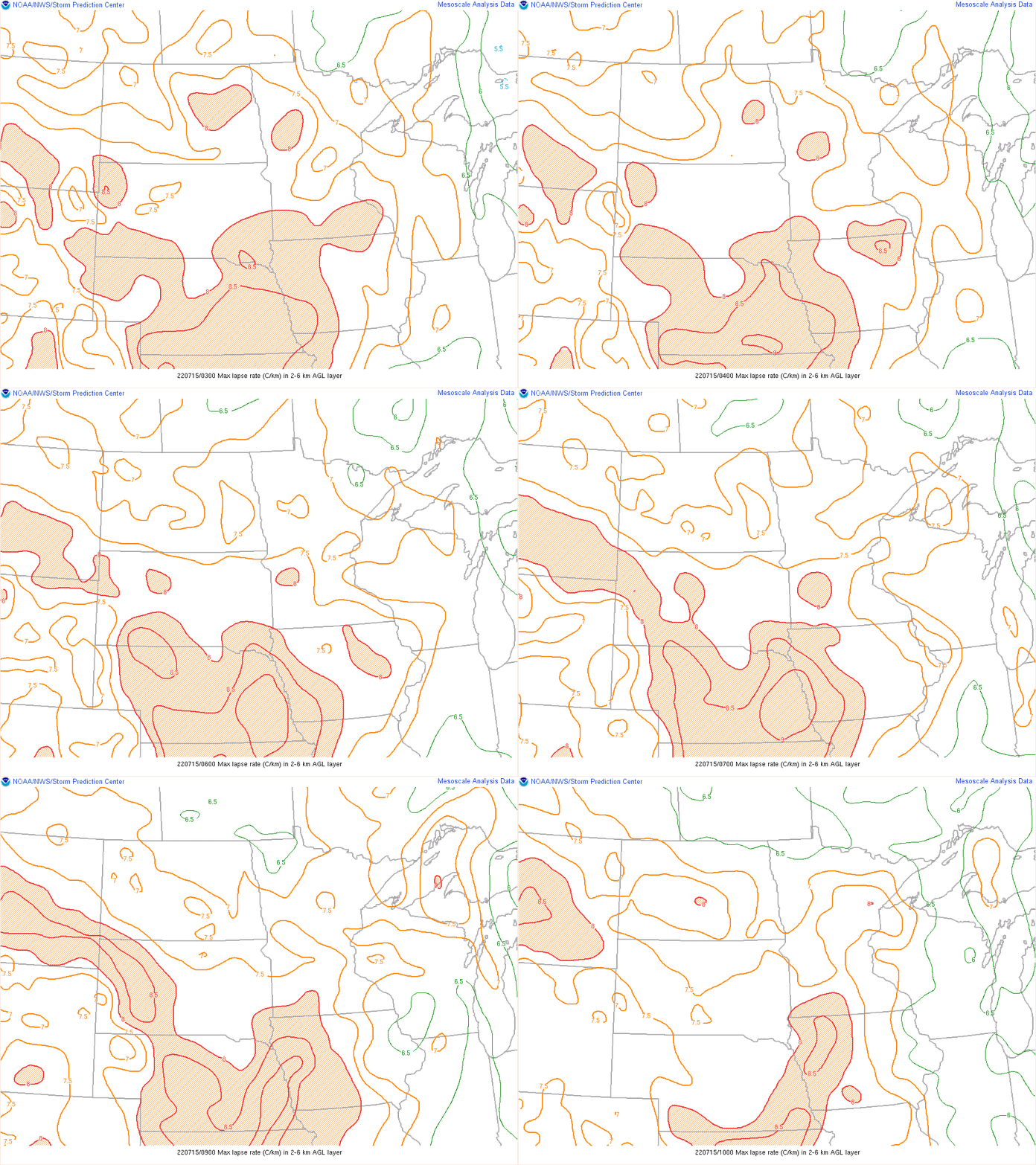
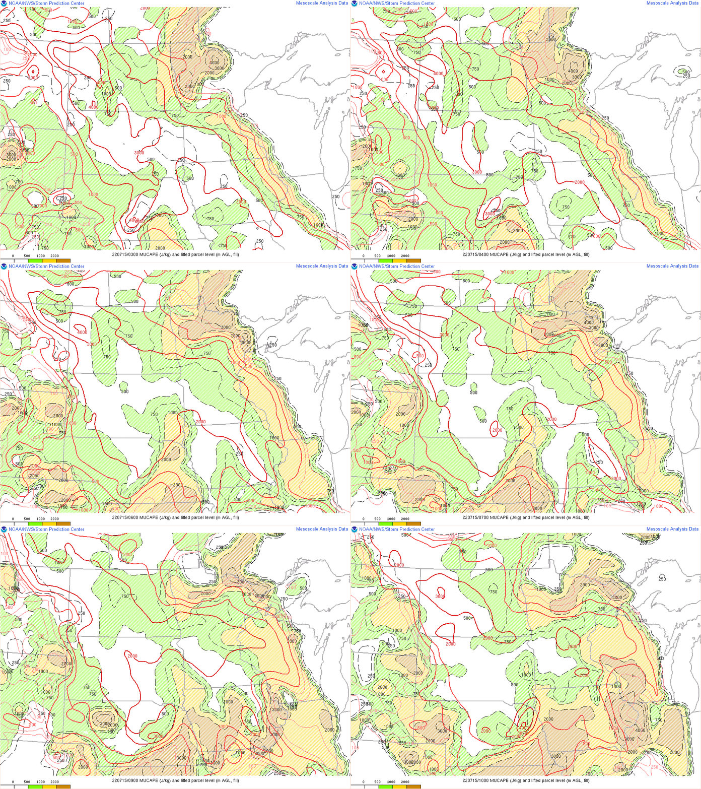
| Figure 7: Max Lapse Rates | Figure 8: MUCAPE | Figure 9: PWAT |
 |
Media use of NWS Web News Stories is encouraged! Please acknowledge the NWS as the source of any news information accessed from this site. |
 |