Overview
A cold front made its way into the area, sparking off convection into the night of August 5th, 2022Photos
Radar
Below is the Composite Reflectivity for the event
Storm Reports
073
NWUS53 KFGF 112155
LSRFGF

PRELIMINARY LOCAL STORM REPORT...SUMMARY
NATIONAL WEATHER SERVICE GRAND FORKS ND
452 PM CDT THU AUG 11 2022

..TIME...   ...EVENT...      ...CITY LOCATION...     ...LAT.LON...
..DATE...   ....MAG....      ..COUNTY LOCATION..ST.. ...SOURCE....
            ..REMARKS..

0715 PM     HAIL             1 ENE MOORHEAD          46.87N 96.74W
08/05/2022  E1.00 INCH       CLAY               MN   TRAINED SPOTTER

            HAIL NEAR HWY 10 AT EAST EDGE OF MOORHEAD.

0735 PM     TSTM WND GST     5 WNW HAWLEY            46.91N 96.41W
08/05/2022  E60.00 MPH       CLAY               MN   COCORAHS

            WIND GUSTS TO 60 MPH ALONG WITH HALF INCH HAIL. WINDS
            GUSTED UNTIL 738 PM CDT

0740 PM     HAIL             4 S FELTON              47.02N 96.50W
08/05/2022  E1.00 INCH       CLAY               MN   PUBLIC

            NICKEL TO QUARTER SIZE HAIL ON AND ON FOR 2 TO 3 MINUTES,
            UNTIL 743 PM CDT.

0755 PM     HAIL             8 W HITTERDAL           46.98N 96.43W
08/05/2022  E1.00 INCH       CLAY               MN   PUBLIC

            BRIEF BURST OF HAIL.

0815 PM     HAIL             5 S MAHNOMEN            47.24N 95.97W
08/05/2022  E1.00 INCH       MAHNOMEN           MN   PUBLIC

            A FEW QUARTER SIZED HAIL AND VERY STRONG WINDS.

0818 PM     HAIL             RED LAKE                47.88N 95.02W
08/05/2022  E1.00 INCH       BELTRAMI           MN   LAW ENFORCEMENT

            QUARTER SIZE HAIL COVERING THE GROUND. VERY HEAVY RAIN.

0825 PM     TSTM WND DMG     5 SE MAHNOMEN           47.26N 95.89W
08/05/2022                   MAHNOMEN           MN   PUBLIC

            A NUMBER OF 4 TO 6 INCH BRANCHES BROKEN DOWN. WIND GUSTED
            FOR ABOUT 5 MINUTES.

0858 PM     HAIL             3 S WASKISH             48.12N 94.51W
08/05/2022  E1.00 INCH       BELTRAMI           MN   DEPT OF HIGHWAYS

            HAIL COVERED HIGHWAY 72. TIME ESTIMATED BASED ON RADAR.

0903 PM     HAIL             5 S RED LAKE            47.80N 95.02W
08/05/2022  E1.00 INCH       BELTRAMI           MN   PUBLIC

            HAIL ACROSS HIGHWAY 89 JUST SOUTH OF THE CASINO.

0914 PM     HAIL             3 NNE CORMORANT         46.77N 96.04W
08/05/2022  E1.00 INCH       BECKER             MN   PUBLIC

            HAIL REPORTED ALONG THE EAST SHORE OF BIG COMORRANT LAKE.


0915 PM     TSTM WND GST     1 SE GWINNER            46.21N 97.64W
08/05/2022  M58.00 MPH       SARGENT            ND   AWOS

            PEAK WIND MEASURED AT THE GWINNER AIRPORT /KGWR/.

0932 PM     TSTM WND GST     5 SE MILNOR             46.21N 97.38W
08/05/2022  M54.00 MPH       SARGENT            ND   MESONET

            WINDS 48 GUSTING TO 54 MPH.

0955 PM     HAIL             2 S MCLEOD              46.36N 97.30W
08/05/2022  E1.25 INCH       RANSOM             ND   PUBLIC

            SHEETS OF HAIL IN PERIODS OF VERY HEAVY RAIN.

1035 PM     TSTM WND DMG     1 NNW HICKSON           46.68N 96.82W
08/05/2022                   CASS               ND   PUBLIC

            SEVERAL LARGE 4 TO 6 INCH DIAMETER BRANCHES BROKEN DOWN.


&&

$$
Environment
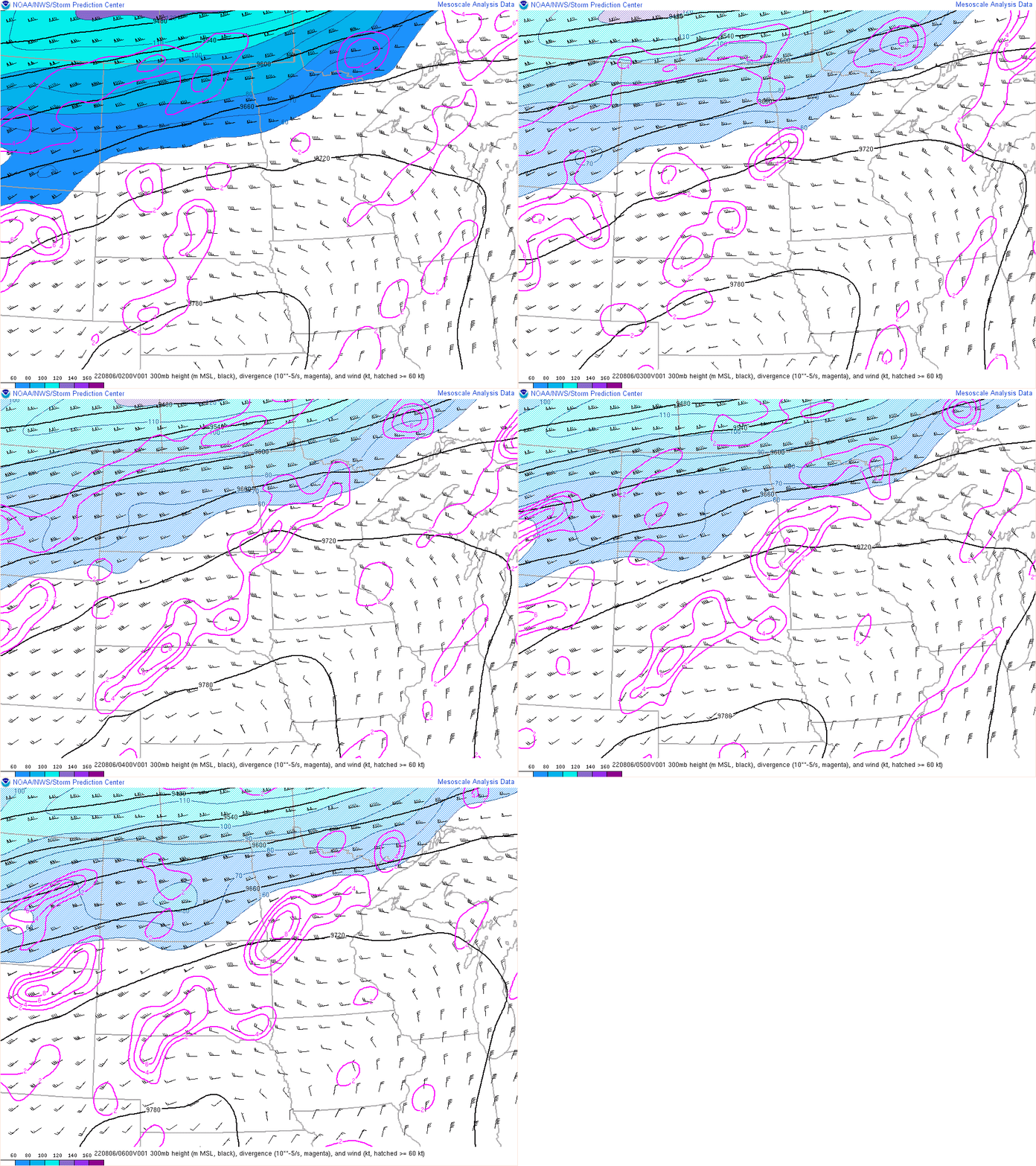 |
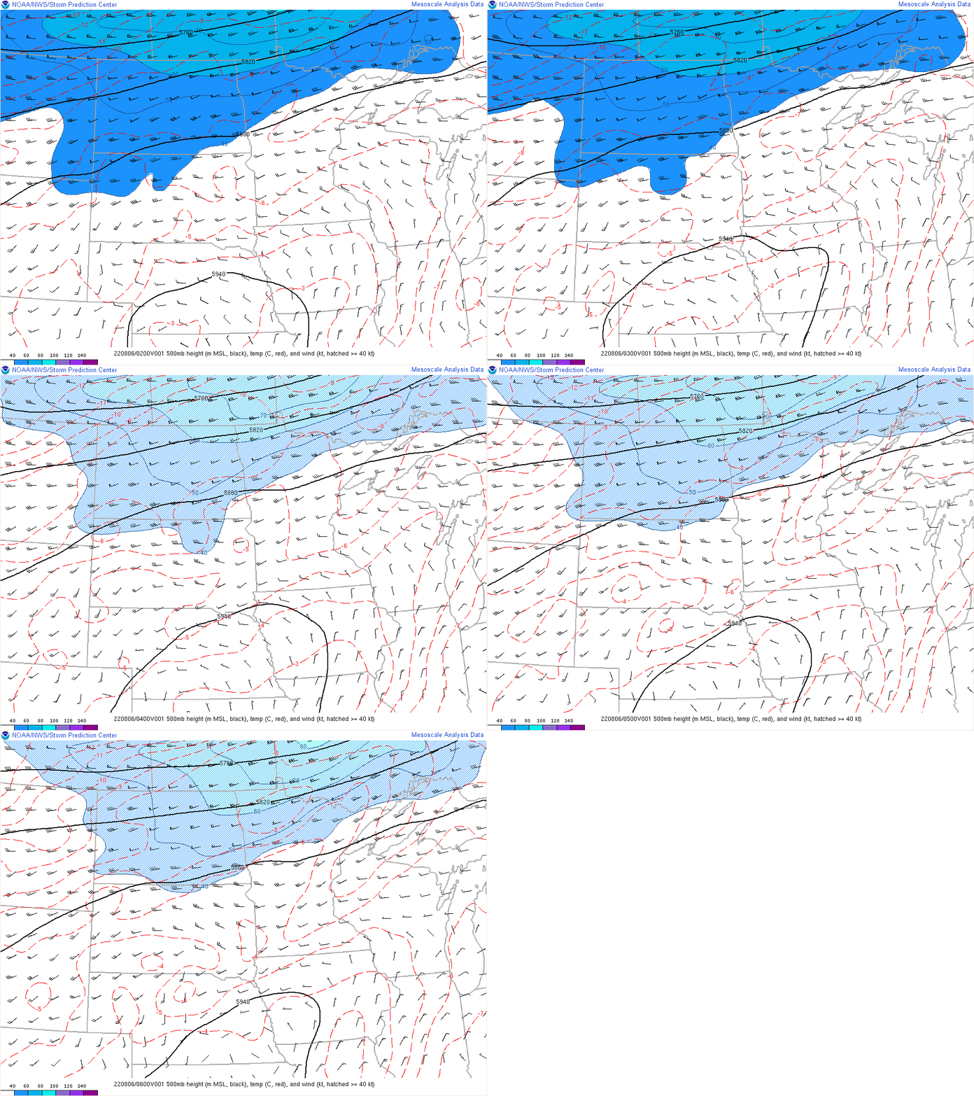 |
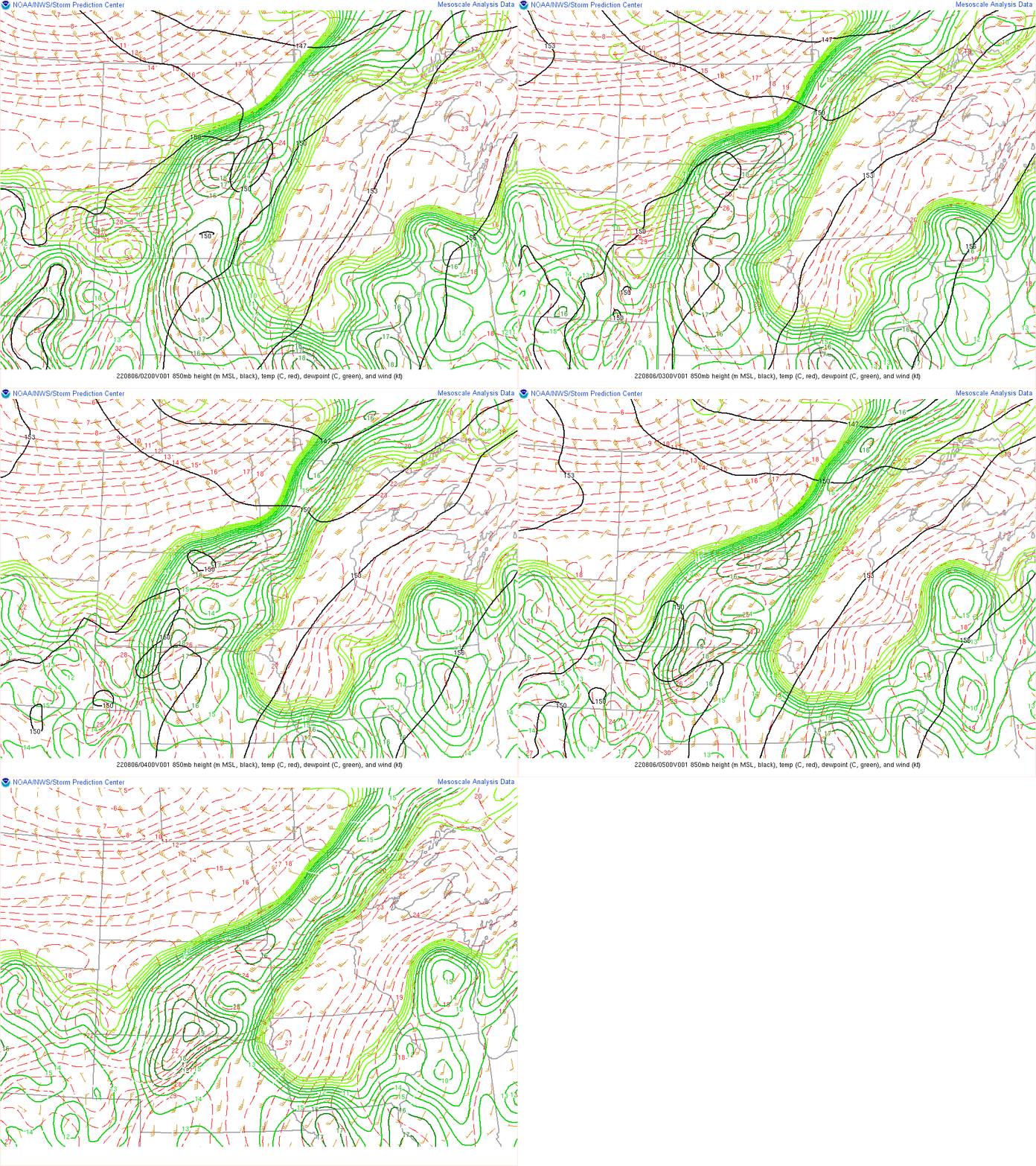 |
| Figure 1: A GIF of the 300mb level, showing a dip in the jet stream across the Red River Valley on August 6th, 2022 | Figure 2: GIF of the 500 millibar level showing a mid-level high just to the south of us, in Nebraska. | Figure 3: GIF of the 850 millibar level, showing ample moisture in the area of the severe storms, slowly shifting south as the evening goes on. |
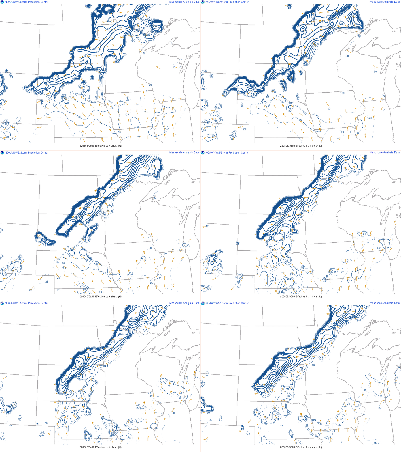 |
 |
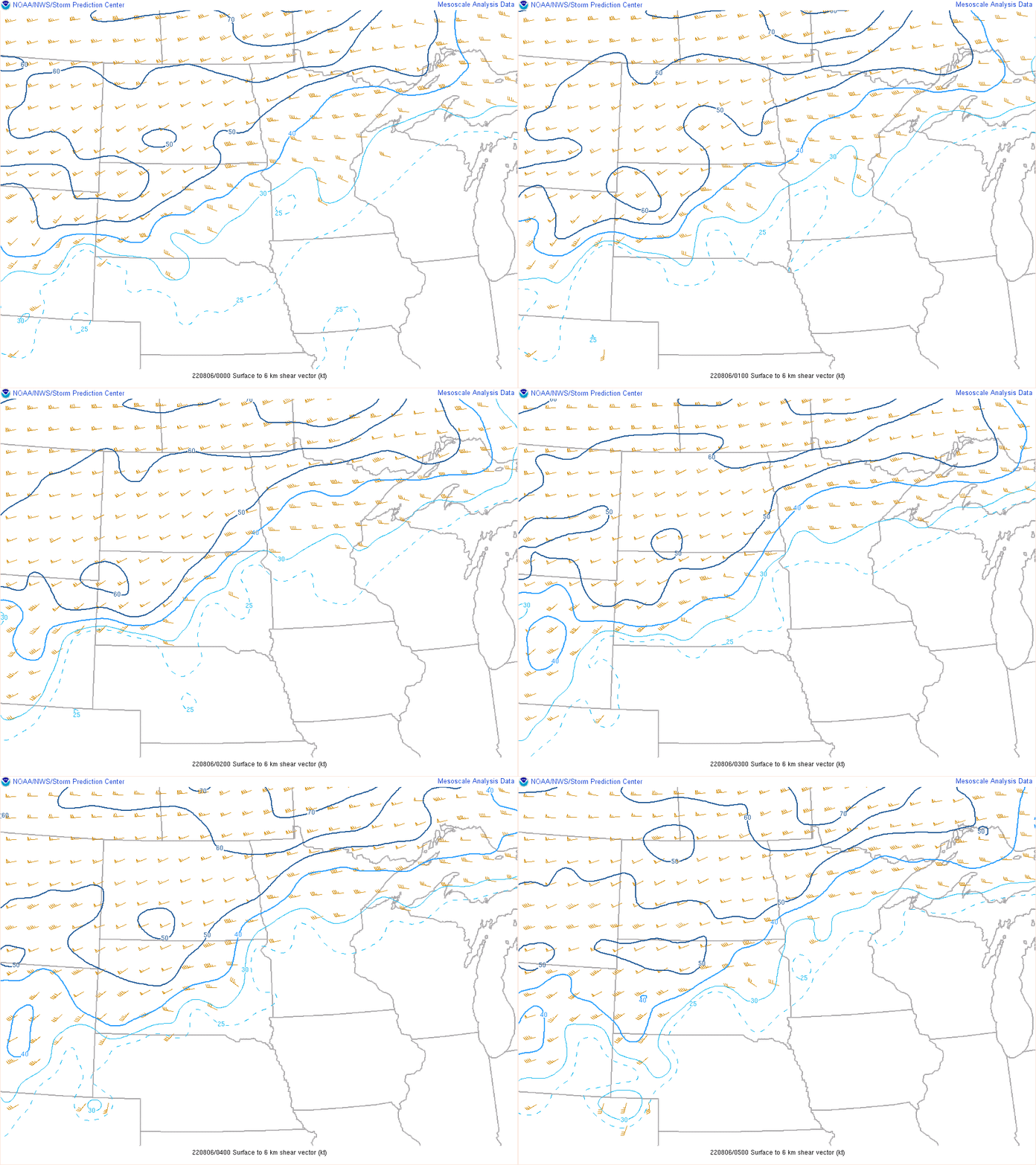 |
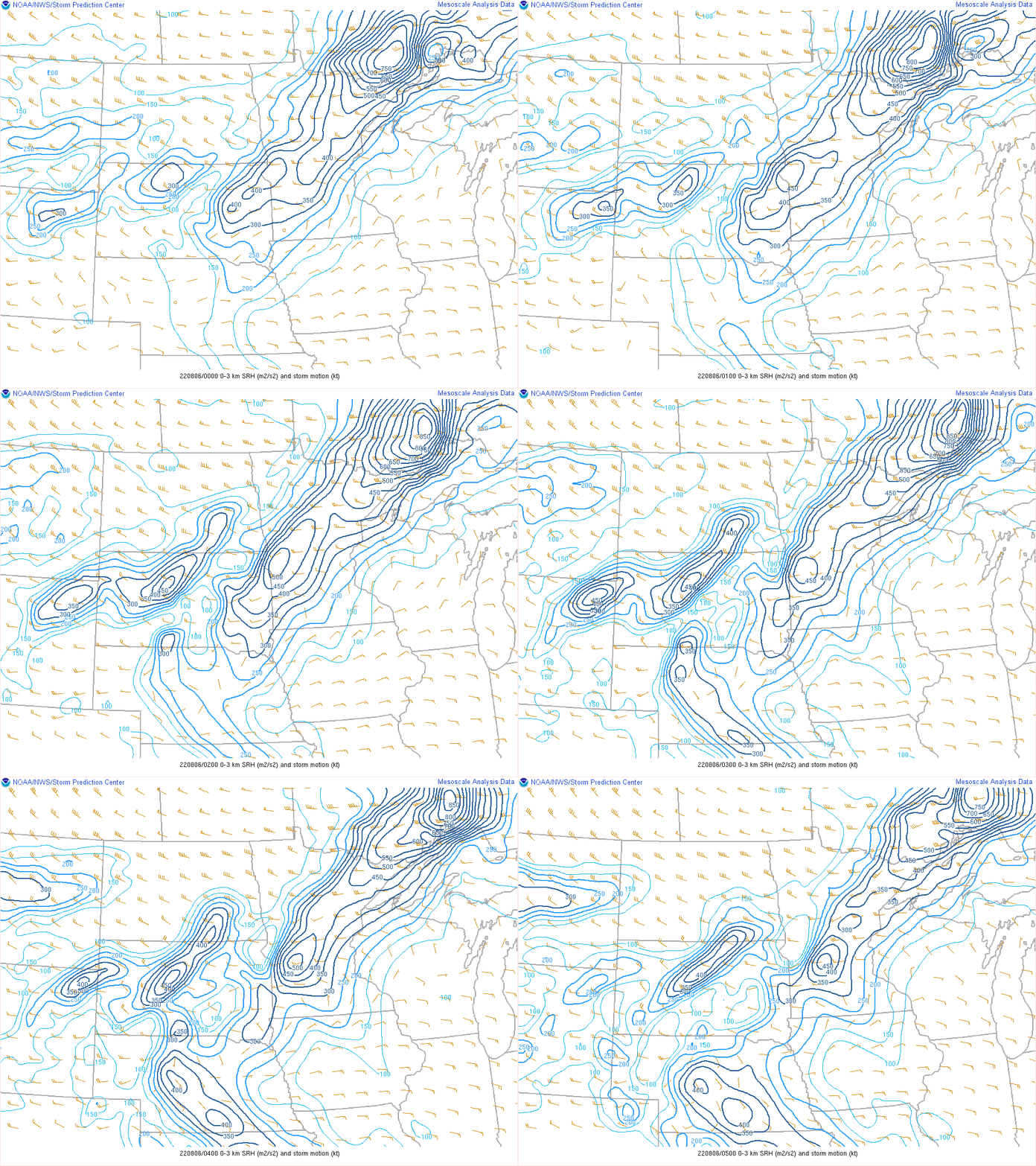
| Figure 4: GIF of effective bulk shear in the north Dakota and Minnesota area, showing between 40 and 55 knots present | Figure 5: GIF of Storm Relative Helicity in the 0 kilometer to 3 kilometer level. | Figure GIF of surface to 6km shear, showing around 50 knots out of the west over our area |
 |
 |
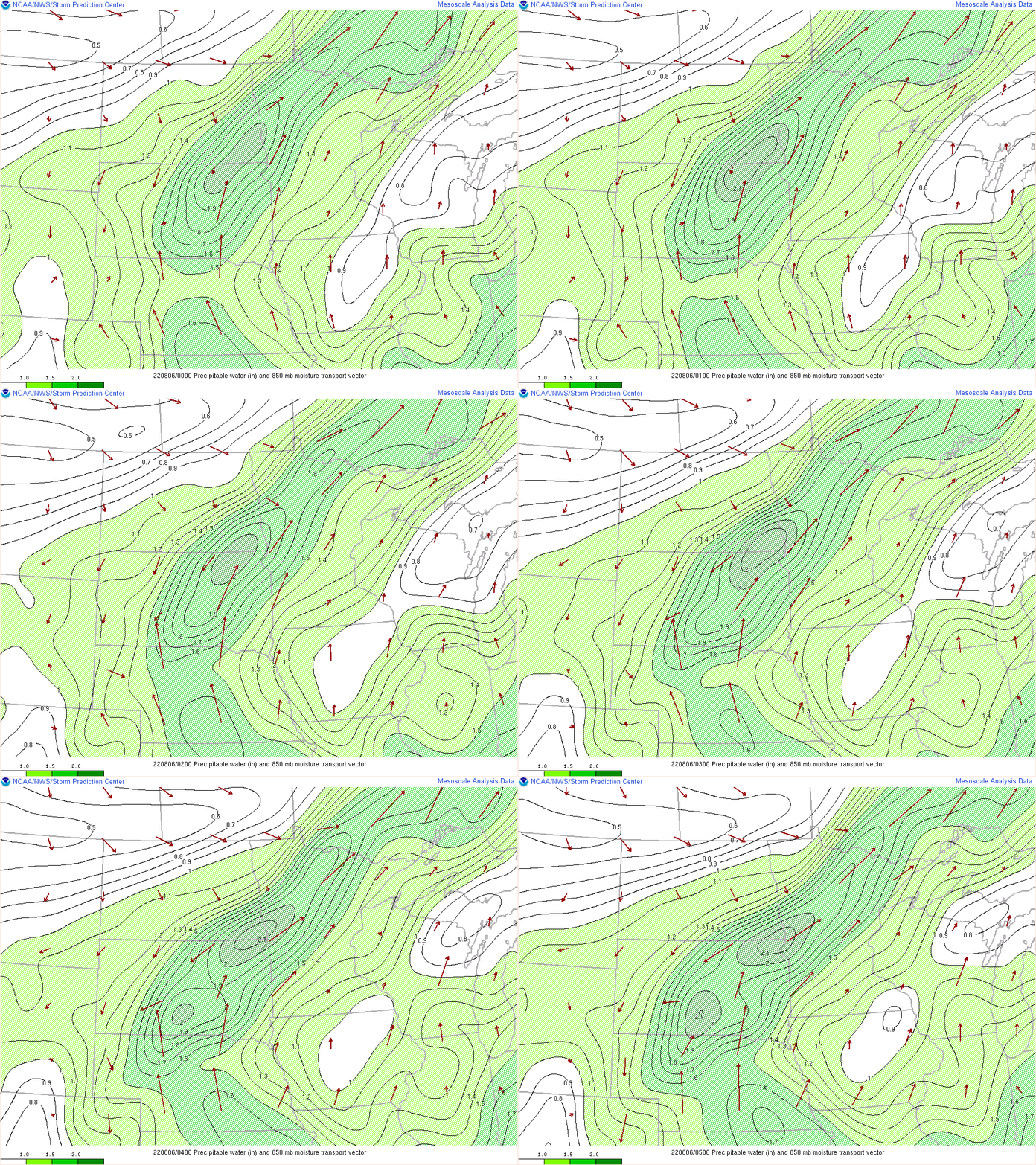 |
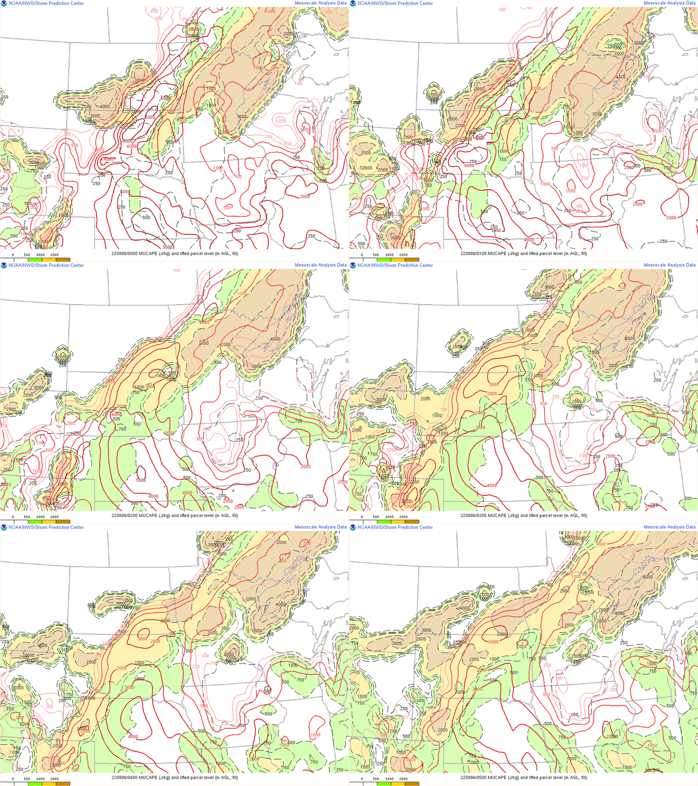
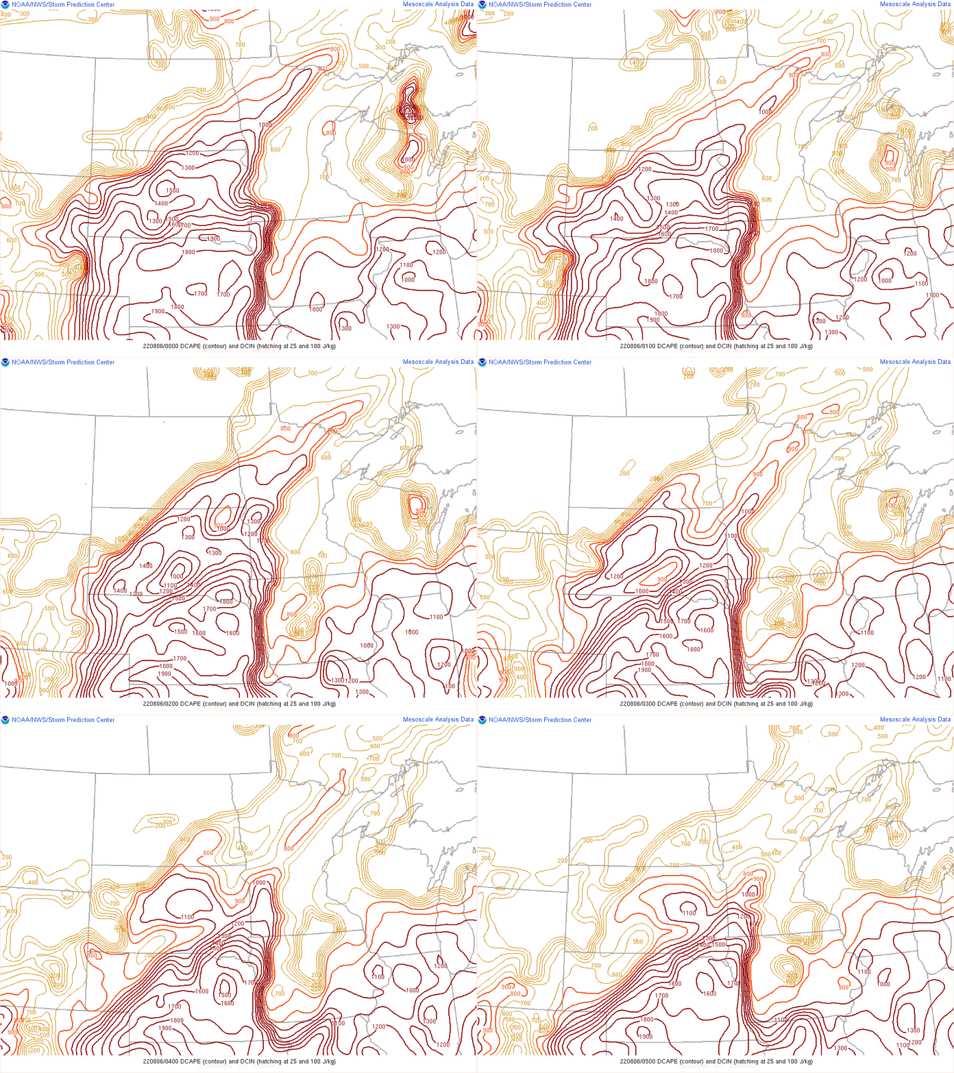
| Figure 7: GIF of Most Unstable convective available potential energy in eastern North Dakota and northwestern Minnesota. The GIF shows between 3000 to 4000 joules per kilogram in the area, slowly decreasing as the evening wears on | Figure 8: GIF of Downdraft Convective Available Potential Energy in the eastern North Dakota and northwestern Minnesota area. DCAPE starts out at 1100 Joules per kilogram at the beginning of the GIF, decreasing to non-severe levels (less than 1000 Joules per kilogram) | Figure 9: GIF of Precipitable Water in the area. Precipitable Water values of 2.1 inches are being advected into the area, making a potential flash flooding concern |
 |
Media use of NWS Web News Stories is encouraged! Please acknowledge the NWS as the source of any news information accessed from this site. |
 |