Overview
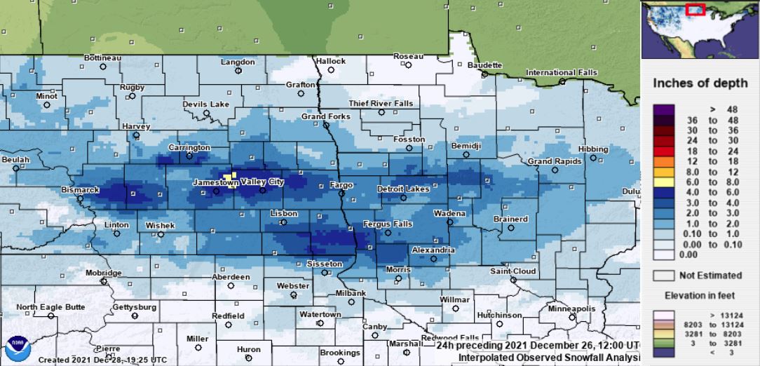
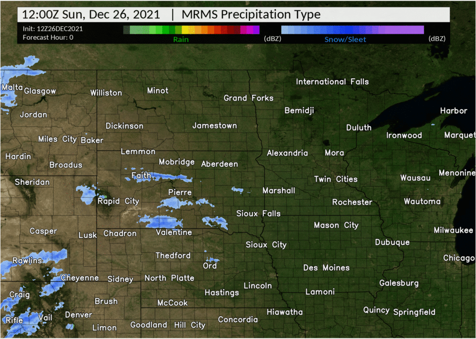
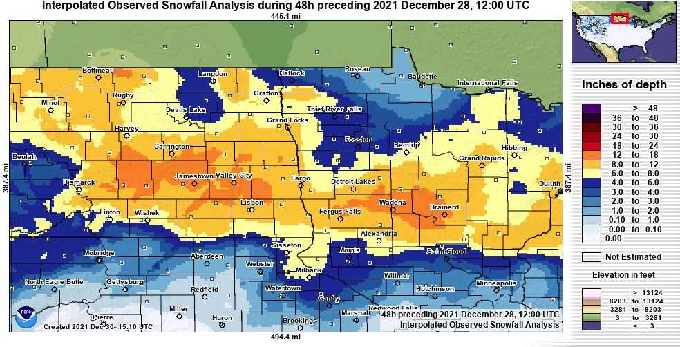
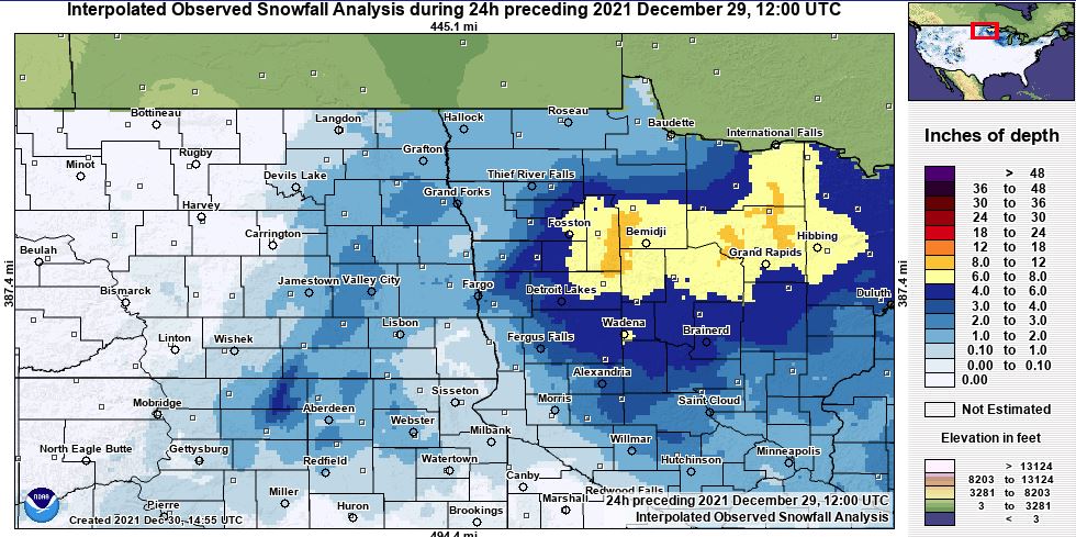
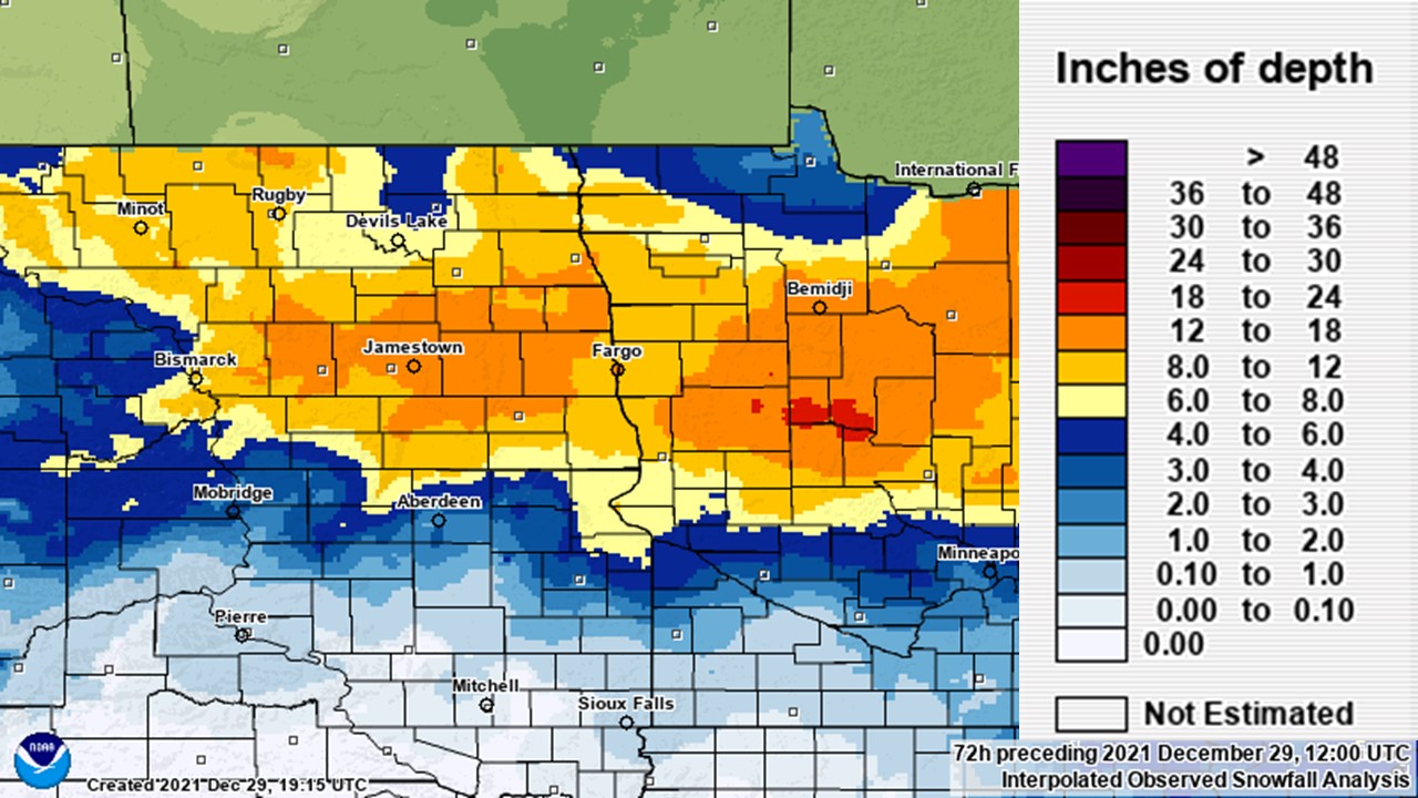
Three separate systems affected the region December 25th through the 28th. Each system brought varying amounts of snowfall, with the heaviest occurring on 26th-27th and the 28th. The system on the 26th through the 27th prompted a blizzard blizzard across southeast North Dakota into the southern Red River Valley, as winds gusted up to 55mph creating white out conditions.
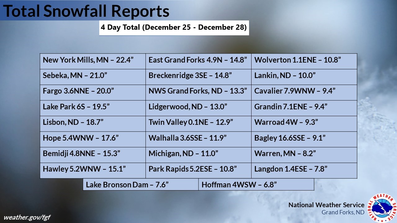
4 Day Total Snowfall
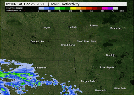
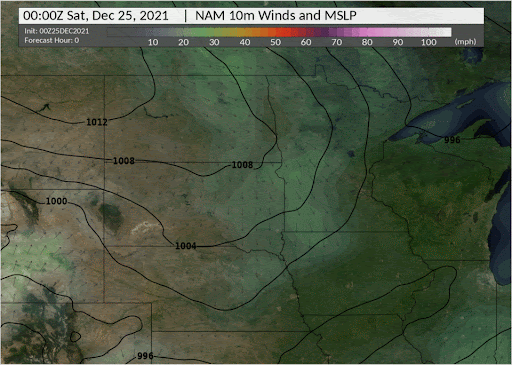
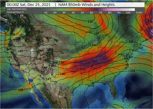
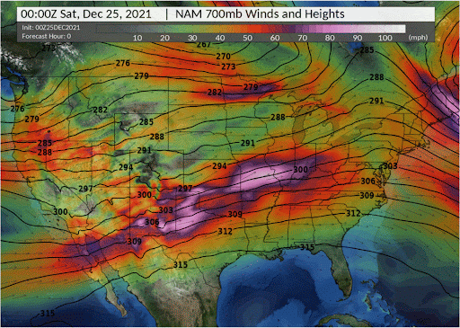
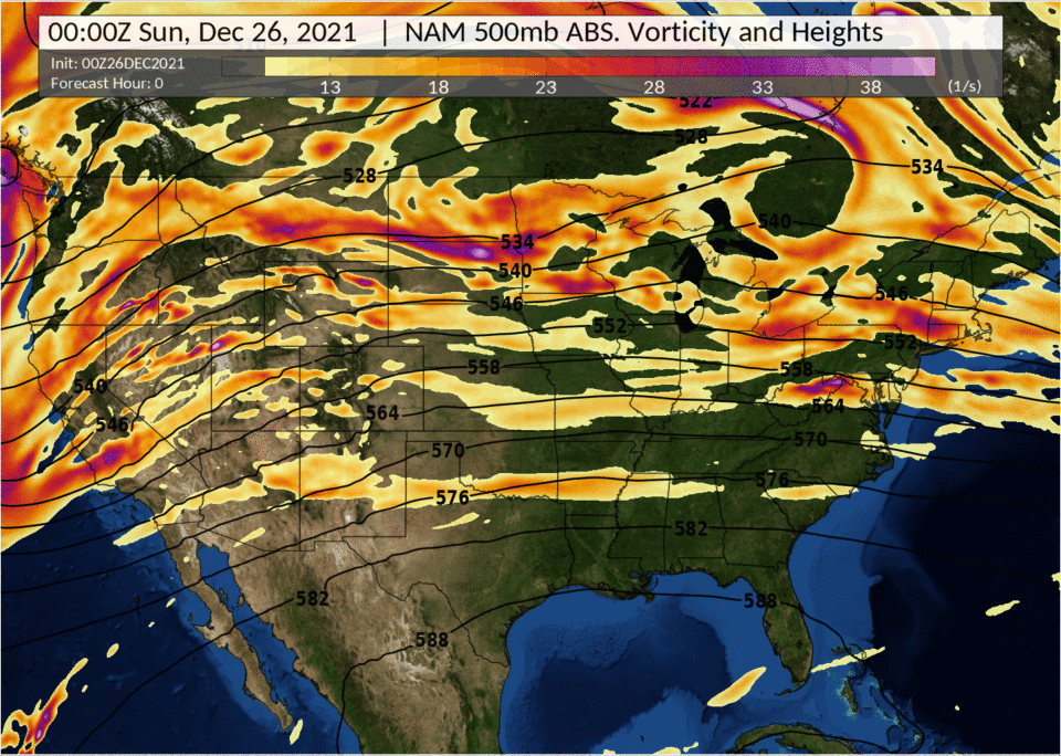
December 25, 2021
 |
 |
 |
| Radar Loop | December 25 Snowfall | Mean Sea Level Pressure |
 |
 |
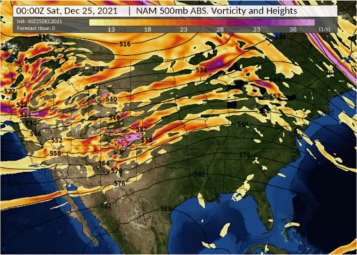 |
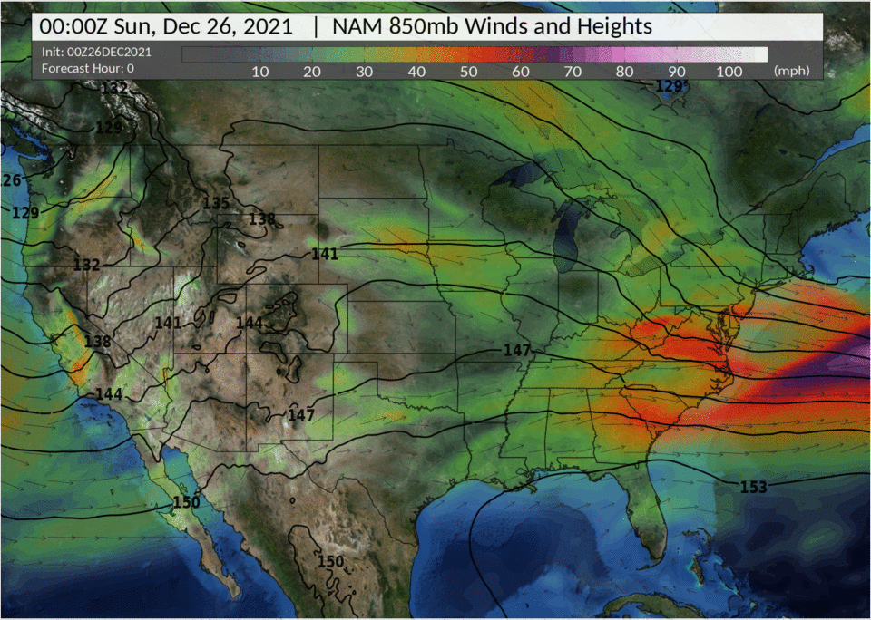
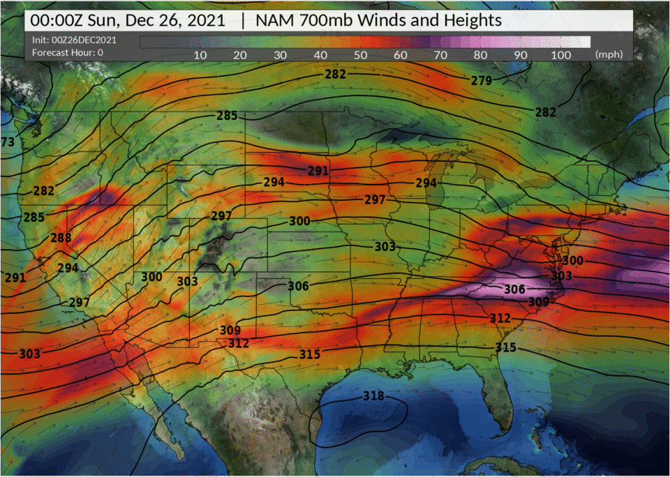
| 850mb | 700mb | 500mb |
December 26-27, 2021
 |
 |
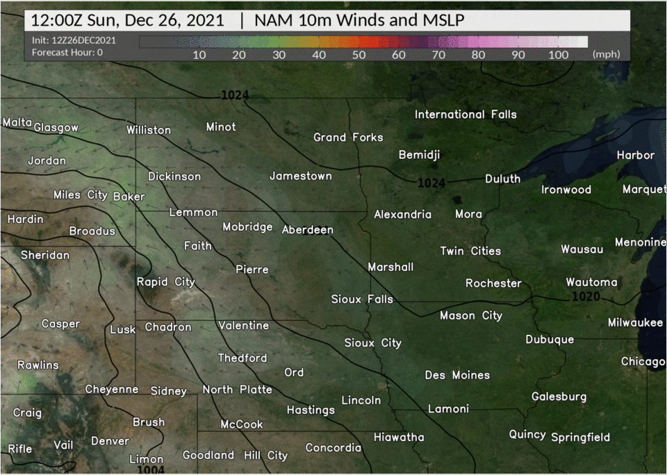 |
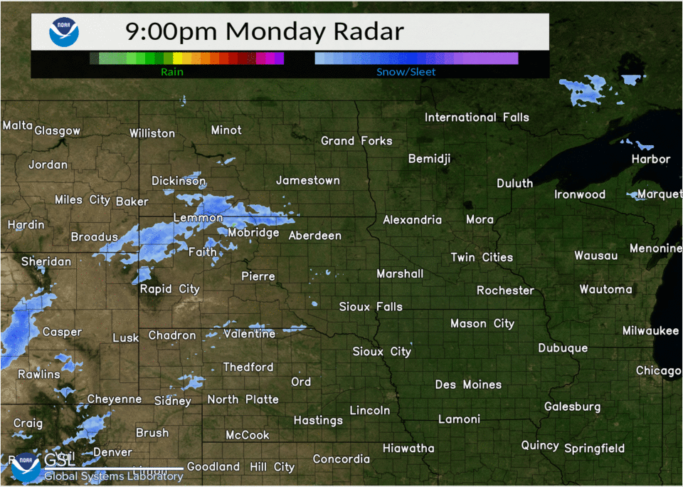
| Radar Loop | December 26-27 Snowfall | Mean Sea Level Pressure |
 |
 |
 |
| 850mb | 700mb | 500mb |
Location Highest Wind Gust
Valley City AP ND 54 MPH
Fargo AP ND 52 MPH
Moorhead AP MN 49 MPH
Cooperstown AP ND 48 MPH
Logan Center ND 2 E 47 MPH
Pillsbury ND 1 N 47 MPH
Prosper ND 5 NW 47 MPH
Wahpeton AP ND 47 MPH
Gwinner AP ND 47 MPH
Dilworth MN 2 S 47 MPH
Rothsay MN 0.5 NW 47 MPH
Elbow Lake AP MN 46 MPH
Dazey ND 2 E 45 MPH
Hillsboro ND 7 SE 45 MPH
Leonard ND 5 N 45 MPH
Hendrum MN 4 ENE 45 MPH
Mooreton ND 3 SW 44 MPH
Mahnomen AP MN 44 MPH
E Grand Forks MN 6 SE 44 MPH
Fingal ND 4 W 43 MPH
McHenry ND 8 N 43 MPH
Fergus Falls AP MN 43 MPH
Perley MN 6 E 42 MPH
Barrie ND 2 SW (Ekre) 42 MPH
Fargo ND 1 NNW 42 MPH
Galesburg ND 4 SSW 42 MPH
Sabin MN 2 NE 41 MPH
Hope ND 5 NE 41 MPH
Kempton ND 6 SE 41 MPH
Wahpeton ND 6 N 41 MPH
Mahnomen MN 3 SSE 41 MPH
Lake Park MN 0.5 W 41 MPH
Moorhead MN 41 MPH
Campbell MN 3 SE 40 MPH
Ulen MN 7 SSE 40 MPH
Cooperstown ND 3 W 40 MPH
Fergus Falls MN 40 MPH
Grand Forks AP ND 40 MPH
Park Rapids AP MN 40 MPH
Tenney MN 2 W 40 MPH
Brooks MN 3 S 40 MPH
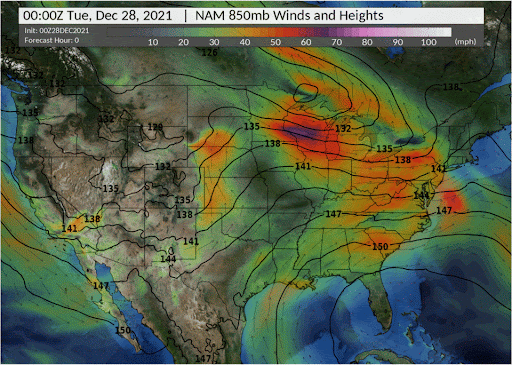
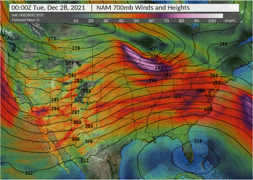
December 28, 2021
 |
 |
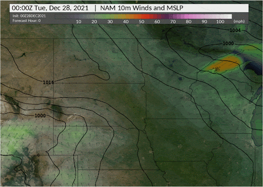 |
| Radar Loop | December 28 Snowfall | Mean Sea Level Pressure |
 |
 |
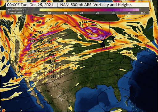 |
| 850mb | 700mb | 500mb |
 |
Media use of NWS Web News Stories is encouraged! Please acknowledge the NWS as the source of any news information accessed from this site. |
|

