Grand Forks, ND
Weather Forecast Office
Overview
Supercell thunderstorm formed in NW Beltrami county around 430pm intensifying as it worked its way over Lower Red Lake. Storm split into two storm cells as it neared the edge of the lake, and formed one or more tornadoes over the lake that tracked onshore. Damaging downburst winds and very large hail accompanied these two storm cells as they continued to track SE across SE Beltrami county through 615pm. Near the midnight hours redevelopment happened in Mahnomen county, with a cell tracking southeast producing small hail.
Tornadoes:
Zoomed out Image of Tornado tracks

Zoomed in Image of Lower Red Lake Tornado Tracks

Wind, Hail, & Tornado Reports:
Green H's are Hail reports, Blue W's are Wind reports, and Red T's are for Tornado reports.

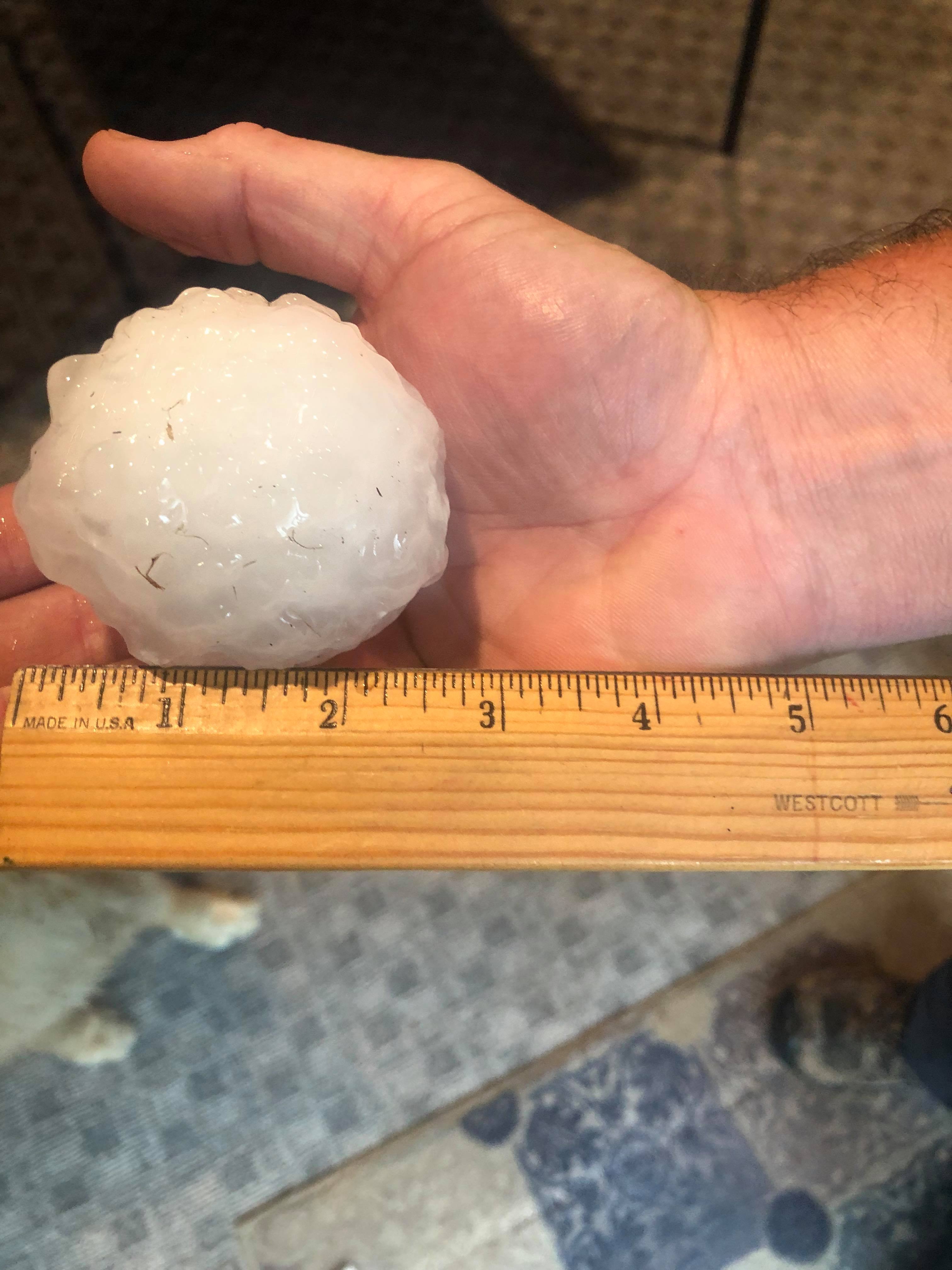
Photos
 |
 |
 |
 |
|
Pennington, MN Autumn Mahaffey |
Pennington, MN Autumn Mahaffey |
Pennington, MN Autumn Mahaffey |
Pennington, MN Autumn Mahaffey |
 |
 |
 |
 |
|
Hines, MN Jessica Machell Stormo |
Lake Pimushe, MN Darlene Eggebraaaten Czapiewski |
Lake Pimushe, MN Darlene Eggebraaaten Czapiewski |
Lake Pimushe, MN Darlene Eggebraaaten Czapiewski |
Radar
Storm Reports
PNS of Tornadoes.
https://mesonet.agron.iastate.edu/wx/afos/p.php?pil=PNSFGF&e=202107291737
LSR of reports
https://mesonet.agron.iastate.edu/wx/afos/p.php?pil=LSRFGF&e=202107291601
Environment
Synoptic Environment
 |
 |
 |
| 850 - 300 mb Mean Wind | 500 mb Analysis | Surface Observations |
Near-Storm Environment
 |
 |
 |
| ML CAPE 0 - 3 km | EHI Sfc - 3 km |
Bulk Shear 0 - 6km |
Additional Environmental Data
 |
 |
 |
| ABR 12z Sounding | BIS 12z Sounding | INL 12Z Sounding |
 |
Media use of NWS Web News Stories is encouraged! Please acknowledge the NWS as the source of any news information accessed from this site. |
|
US Dept of Commerce
National Oceanic and Atmospheric Administration
National Weather Service
Grand Forks, ND
4797 Technology Circle
Grand Forks, ND 58203-0600
701-772-0720
Comments? Questions? Please Contact Us.

