Overview
Just after 4 pm on Monday afternoon (June 7th), several high based storms formed northwest of Cooperstown, North Dakota. These storms formed north of a warm front, which was draped south of the Interstate 94 corridor. These storms intensified as they tracked to the east-northeast, prompting two severe thunderstorm warnings from Thompson toward Crookston, for large hail.
A break then occurred until mid-evening, when additional storms developed around the Jamestown area. These storms were extremely slow moving, holding over the Jamestown to Valley City corridor for hours at a time. Eventually the storms tracked east and east-southeast, affecting the Fargo-Moorhead to Lisbon corridor in the late evening time frame. Reports came in of Hail ranging from nickel toward Baseball size in Ransom, Cass, and Wahpeton counties. Damaging winds reports came in as well, with reports of 65-75mph gusts in southeastern ND. Isolated areas saw slightly higher reports of wind. These storms rolled into lakes country Minnesota close to midnight, prompting additional severe thunderstorm warnings for portions of Becker and Otter Tail counties. These storms continued to produce higher wind gusts in excess of 65mph across portions of west central Minnesota.
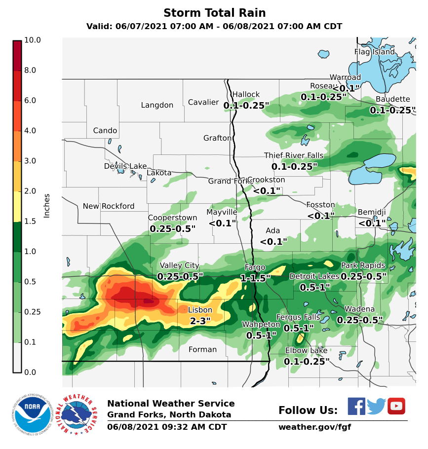
After midnight (on June 8th), storms redeveloped back in the Jamestown to Valley City corridor. Once again, these storms produced golf ball to baseball size hail, with some locations getting up to 5 rounds of the large hail. Rainfall reports were spotty, but some locations picked up 4 to 8 inches.
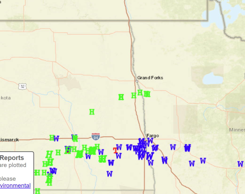
Wind & Hail:
Green H's are Hail reports, Blue W's are Wind reports, and Red T's are for Tornado reports.
Photos & Video
 |
 |
 |
 |
|
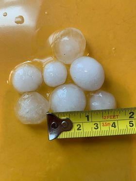
One inch Hail - Hatton, ND Michelle Bey |
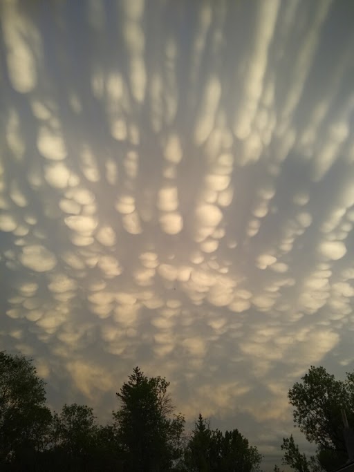
Mammatus Clouds - McVille, ND Tami Stein |
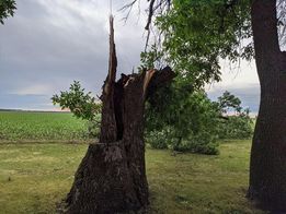
Snapped Tree - Wolverton, ND Christie Erickson |
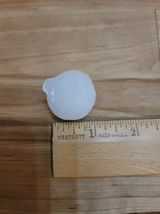
One Inch Hail - Litchville, ND Mark Kluvers |
Radar
Rain Reports
Estimated Storm Total Rainfall from June 7th through June 8th 2021.
 |
Media use of NWS Web News Stories is encouraged! Please acknowledge the NWS as the source of any news information accessed from this site. |
|

