Overview
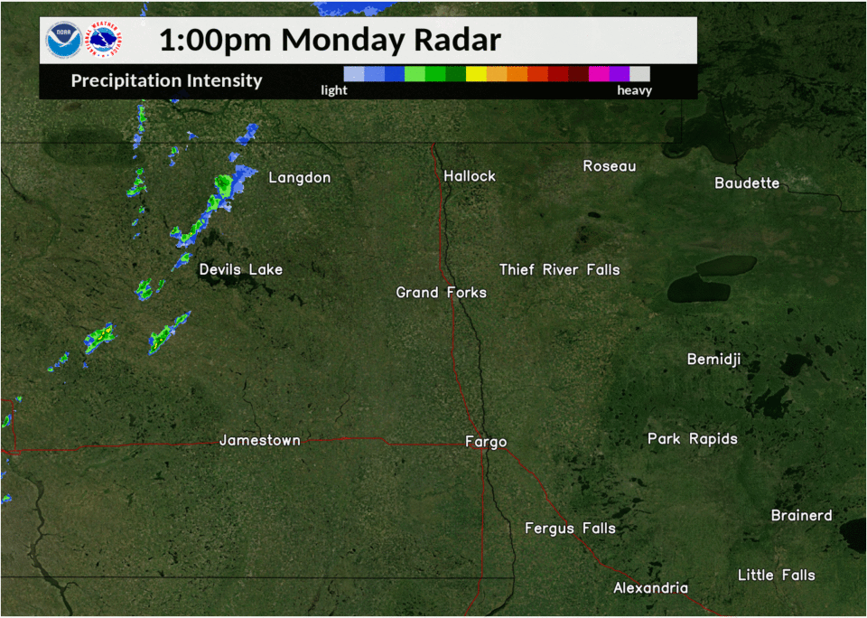
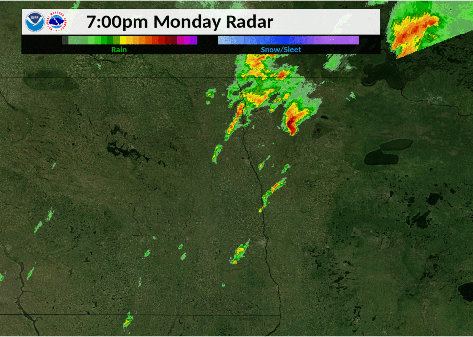
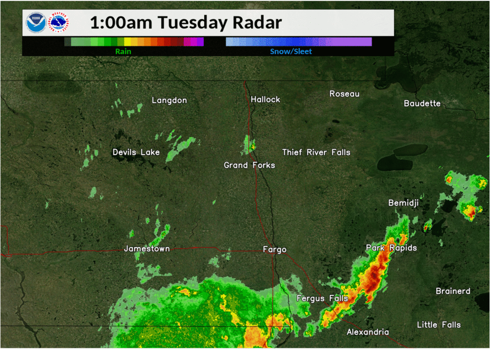
Several storms developed along a cold front pushing into the area on the afternoon of Monday, June 8th. Some of the thunderstorms became supercells, with rotation that helped produce hail up to 2 inches and damaging wind gusts, along with a few tornadoes. The storms moved from eastern North Dakota and into northwestern Minnesota. Additional thunderstorms moved up from South Dakota after dark and produced some damaging winds in the far southern Red River Valley into west central Minnesota.
Tornadoes:
|
Tornado #1 - North of Sharon, ND
Steele/Grand Forks Counties
| Date |
8 June 2020 |
| Time (Local) |
4:30 PM - 4:42 PM |
| EF Rating |
EF-1 |
| Est. Peak Winds |
95 mph |
| Path Length |
7.2 miles |
| Max Width |
250 yards |
| Injuries/Deaths |
None |
|
Summary:
Tornado tracked intermittently to the north-northeast for over 7 miles. It blew out the back wall of a pole shed and tore sheathing off the building. It also snapped or uprooted several cottonwood and pine trees in shelterbelts along its path. The tornado crossed through areas with similar scale downburst wind damage from the previous evening. Local residents assisted in identifying event damages in which trajectories were in a general north northeast direction compared to the northeast or east northeast trajectories from the previous evening.
|
|
Tornado #2 - South of Arvilla, ND
Grand Forks County
| Date |
8 June 2020 |
| Time (Local) |
5:09 PM - 5:15 PM |
| EF Rating |
EF-0 |
| Est. Peak Winds |
80 mph |
| Path Length |
3 miles |
| Max Width |
150 yards |
| Injuries/Deaths |
None |
|
Summary:
This tornado tracked intermittently to the north-northeast for about 3 miles. It snapped a number of poplar or cottonwood trees in the few shelter belts along its path. The tornado crossed through areas with similar scale downburst wind damage from the previous evening. Local residents assisted in identifying event damages in which trajectories were in a general north northeast direction compared to the northeast or east northeast trajectories from the previous evening.
|
|
|
Tornado #3 - Near Middle River MN
Marshall County
| Date |
8 June 2020 |
| Time (Local) |
7:17 PM - 7:32 PM |
| EF Rating |
EF-1 |
| Est. Peak Winds |
100 mph |
| Path Length |
9 miles |
| Max Width |
300 yards |
| Injuries/Deaths |
None |
|
Summary:
This tornado, though nearly rain wrapped was viewed and recorded by at least two chase teams as it tracked for around 9 miles, ending about 7 miles east of Middle River by 7:32 PM CDT. The tornado snapped numerous poplar and pine trees in groves along its path, spreading debris up to 300 yards wide across one roadway. Peak winds were estimated to 100 mph, maximum width to 300 yards.
|
|
Tornado #4 - Near Norris Camp DNR MN
Lake of the Woods County
| Date |
8 June 2020 |
| Time (Local) |
8:45 PM - 8:50 PM |
| EF Rating |
EF-1 |
| Est. Peak Winds |
107 mph |
| Path Length |
1.2 miles |
| Max Width |
100 yards |
| Injuries/Deaths |
None |
|
Summary:
This tornado tracked for about 1.2 miles and uprooted fir and pine trees, and snapped several large diameter ash and poplar trees along the Faunce-Butterfield Road SW roughly 4 miles southwest of the Norris Camp DNR station.
|
|
The Enhanced Fujita (EF) Scale classifies tornadoes into the following categories:
EF0
Weak
65-85 mph |
EF1
Moderate
86-110 mph |
EF2
Significant
111-135 mph |
EF3
Severe
136-165 mph |
EF4
Extreme
166-200 mph |
EF5
Catastrophic
200+ mph |
 |
Wind & Hail:
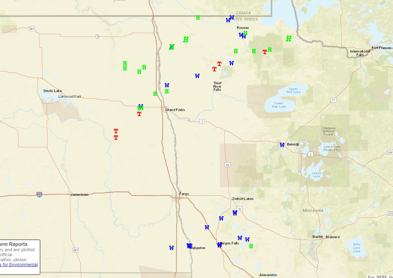
Storm reports across the area. Green H=Hail, Blue W=Damaging Wind, Red T=Tornado
Wind
 |
 |
 |
|
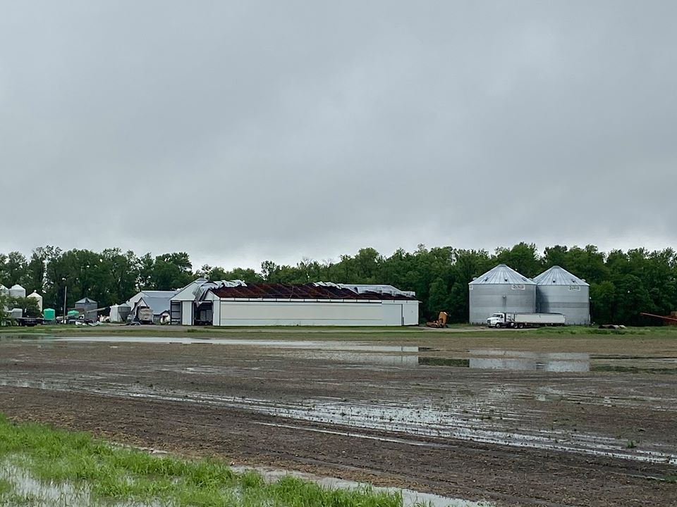
Salol MN
Justin Dernier
|
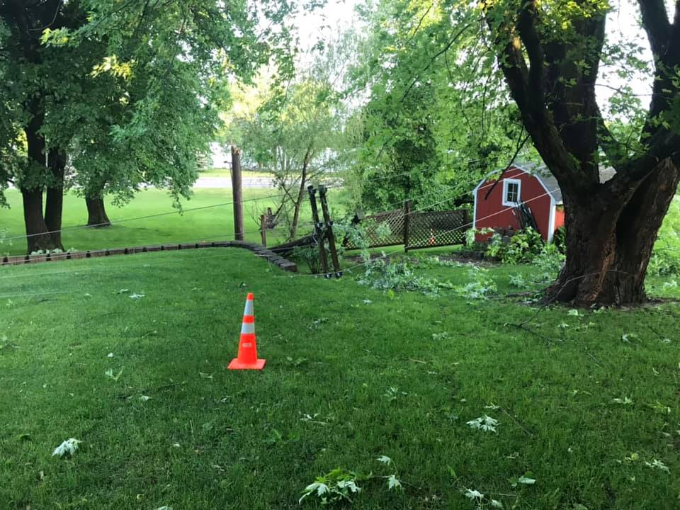
Underwood MN
Chris Rader
|
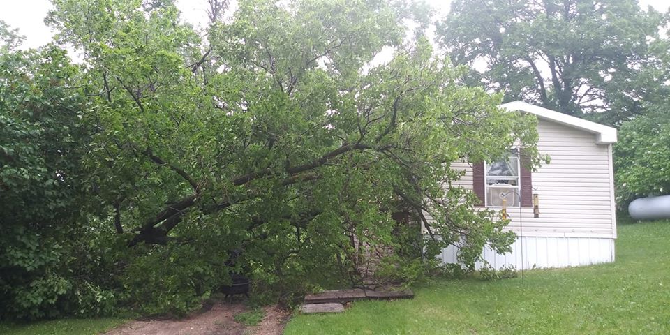
Wahpeton, ND
Dawn Gilles
|
 |
|
Fergus Falls MN
Jason Wolfe
|
Hail
 |
 |
|
Lake Bronson MN
Kathy Benson
|
Norris Camp DNR |
Radar
Header
 |
 |
 |
| 1pm to 7pm |
7pm to 1am |
1am to 7am |
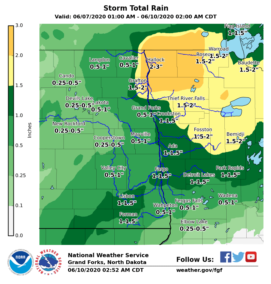
Rain Reports


