Overview
After a fairly long duration period of cooler than normal temperatures, a mid-September warm snap finally began on Sunday, September 15th. Along with the much warmer temperatures came increased humidity and periodic showers and thunderstorms. Several severe storms occurred over southeast ND during the early morning hours of Friday, September 20th. This was followed by additional storms along the Canadian border that morning and early afternoon. More storms then developed in the evening and continued into the early morning hours of Saturday, September 21st. During this time frame, thunderstorms stalled along the highway 2 corridor and dropped torrential rain. This resulted in flash flooding from Cooperstown to Grand Forks to Roseau. Finally, storms re-developed over the central Red River Valley late Saturday afternoon and tracked toward the Bemidji area that evening.Flooding
Various flood related products
 |
 |
 |
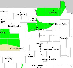 |
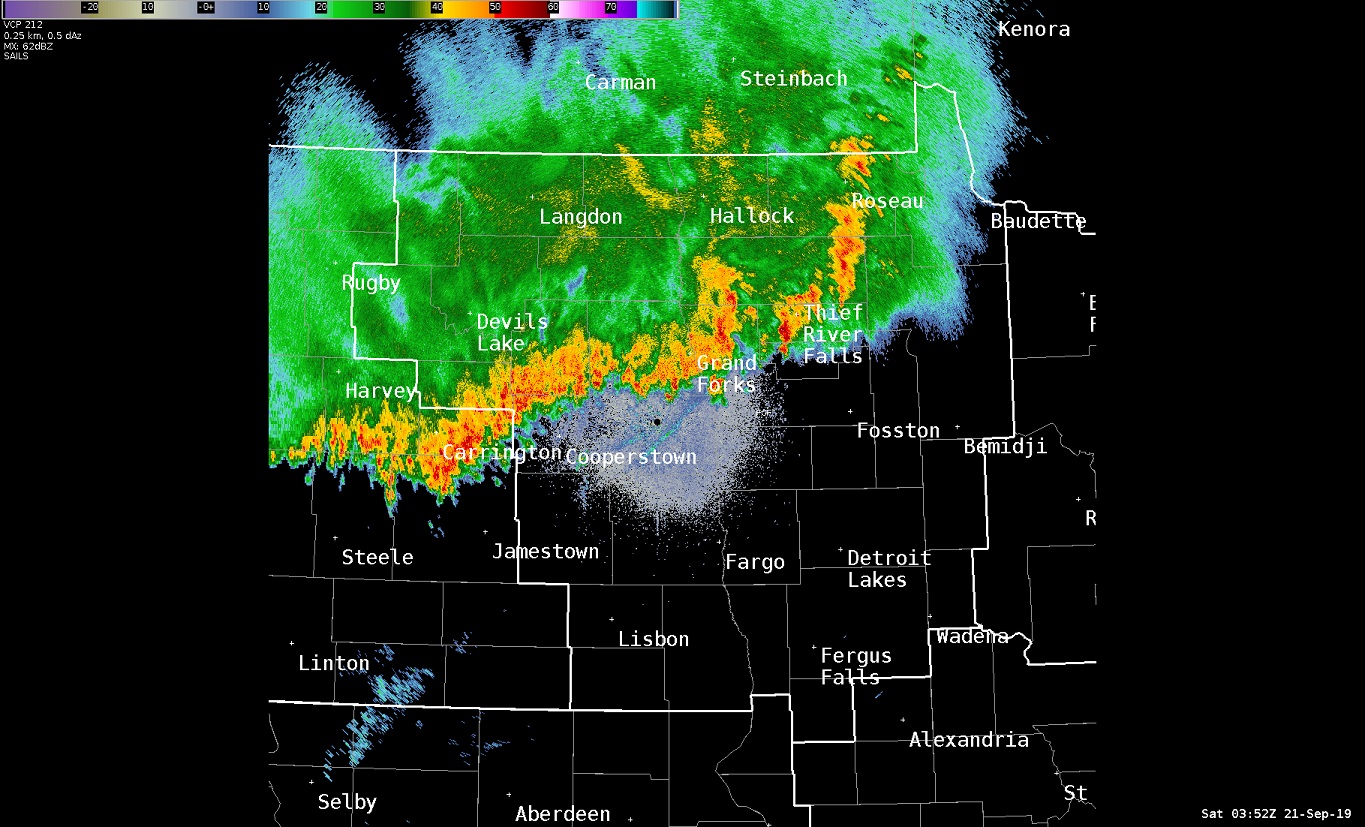
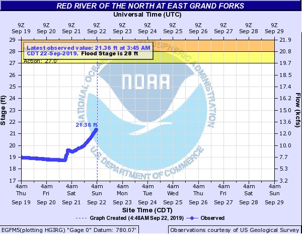
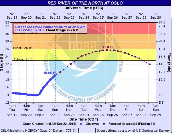
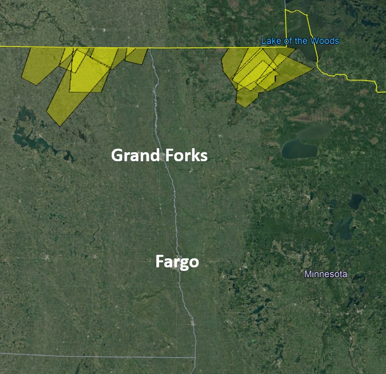
| Radar Image from ~11PM Fri | Initial 9/21 EGF Hydrograph | Initial 9/21 Oslo Hydrograph | Areal Flood Warnings still left at 5 AM Sunday 9/22 |
Watches & Warnings
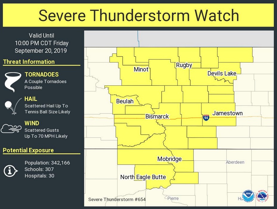
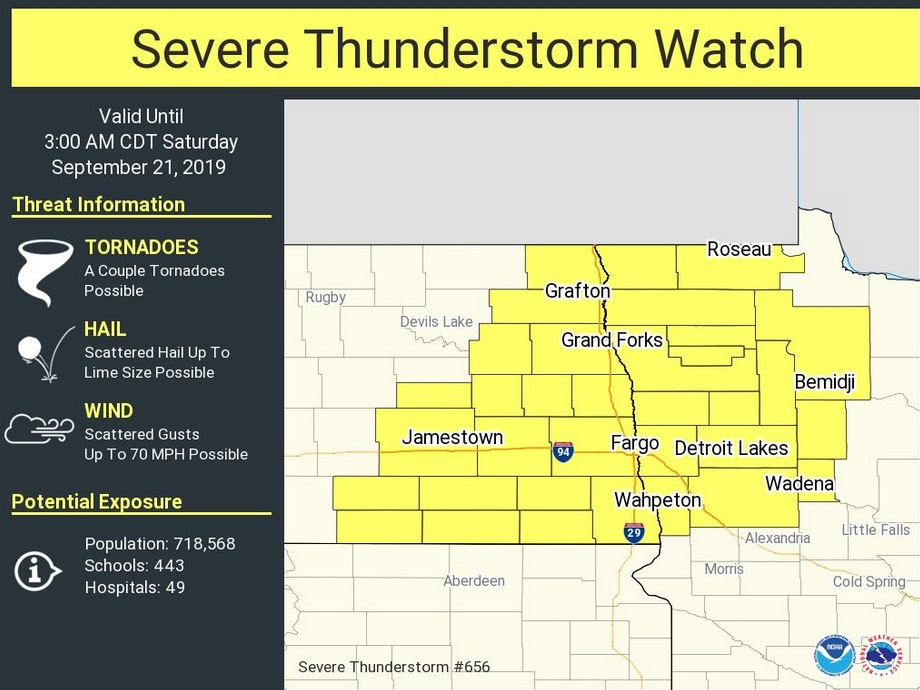
The initial Watches.
 |
 |
 |
|
Severe Thunderstorm Watch 1 Issued 150 PM Friday, September 20th |
Severe Thunderstorm Watch 2 Issued 710 PM Friday, September 20th |
Flash Flood Watch Issued 726 PM Friday, September 20th |
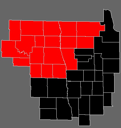
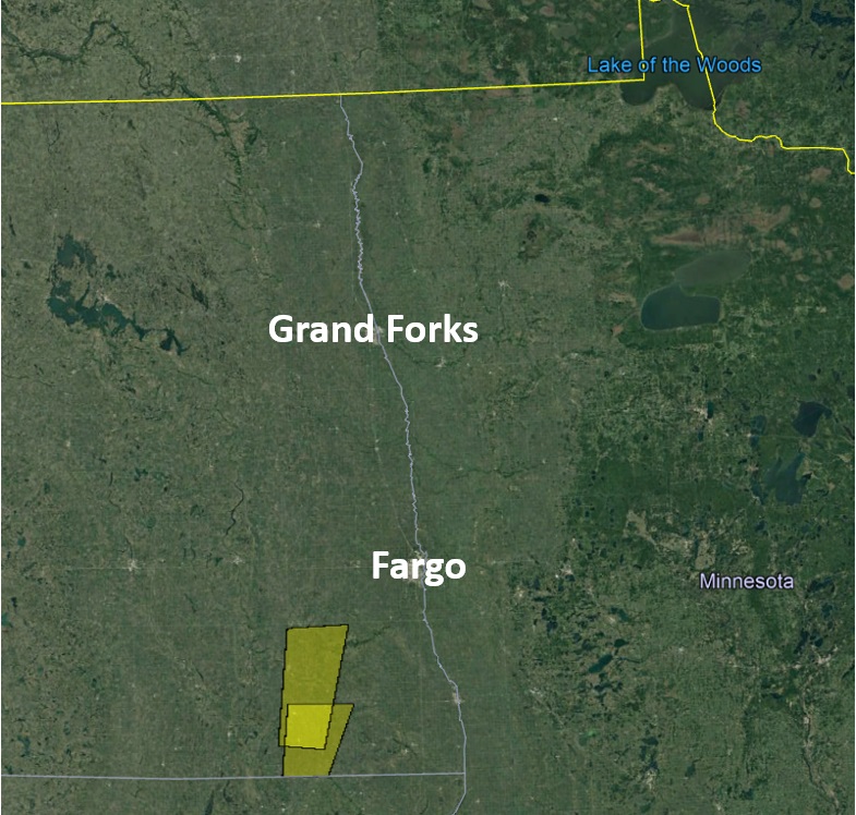
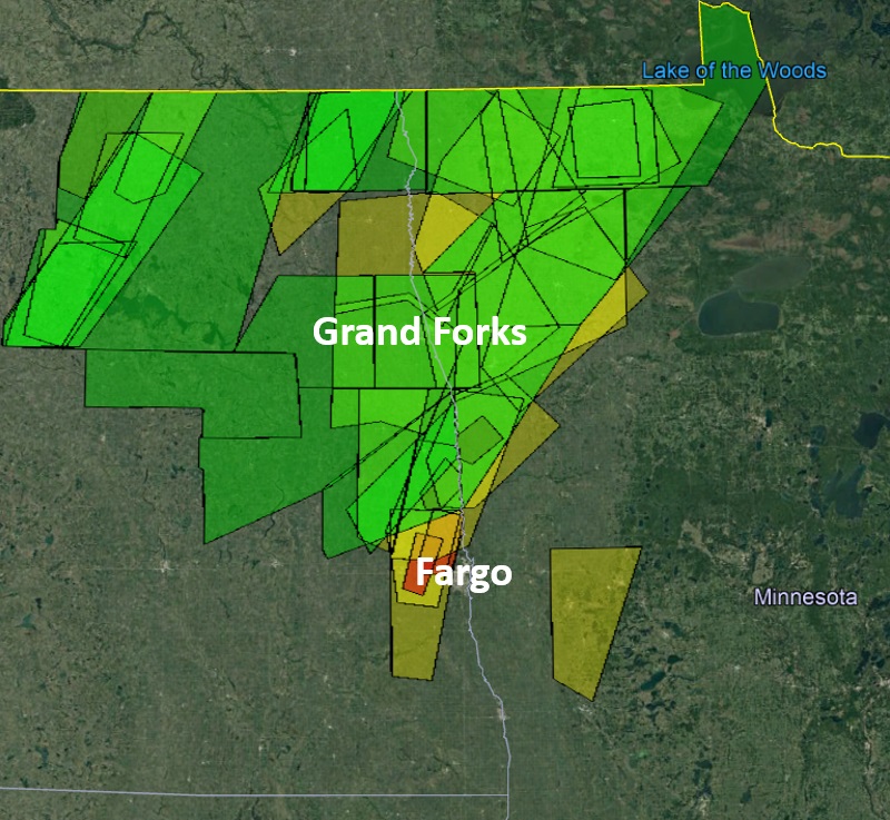
The Warnings
 |
 |
 |
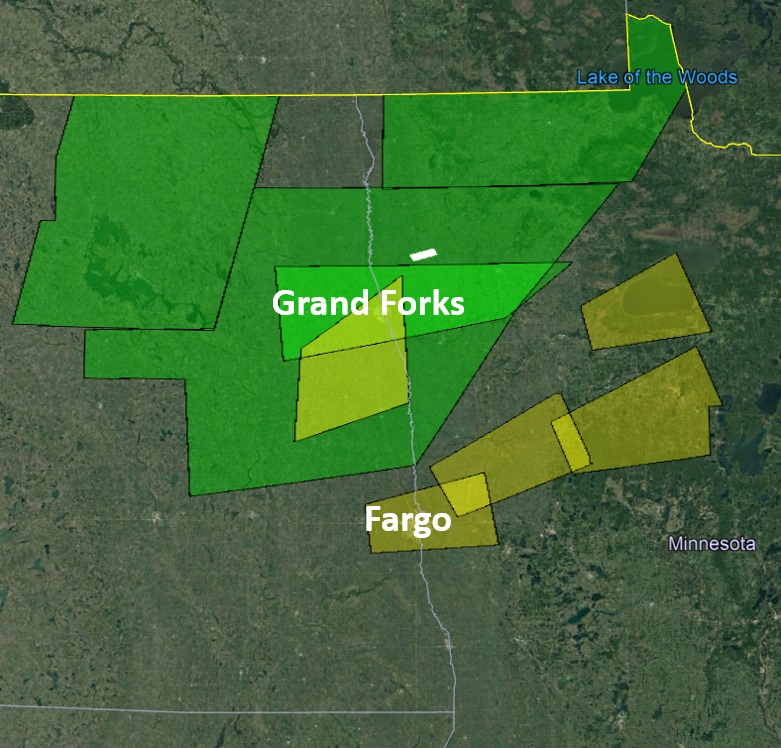 |
| Early Morning 9/20 Warnings | Morning/Afternoon 9/20 Warnings | Evening 9/20 - Overnight 9/21 Warnings | Afternoon/Evening 9/21 Warnings |
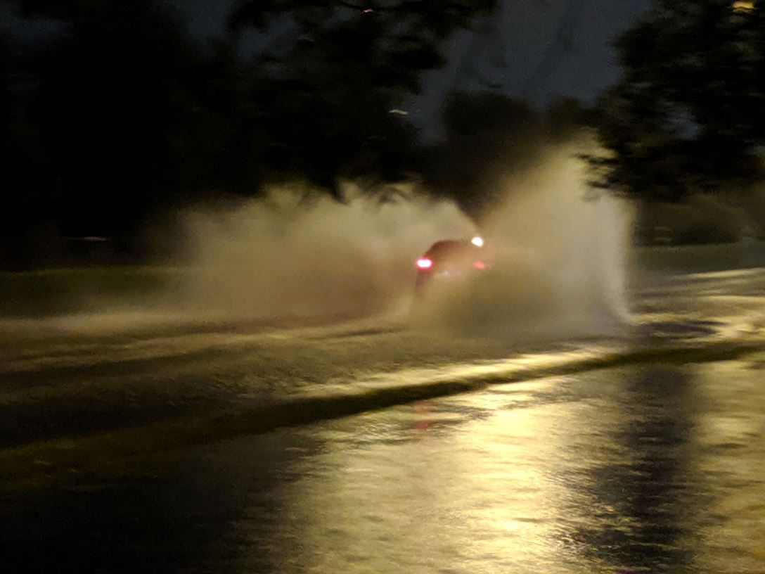
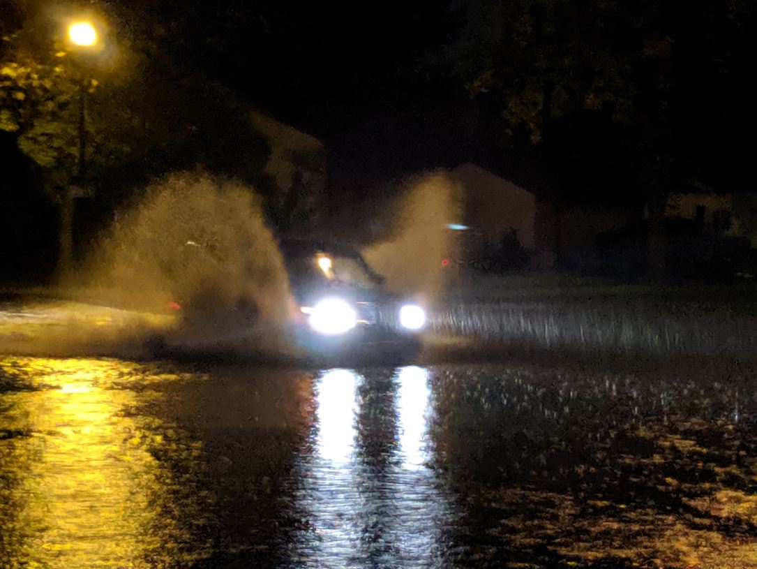
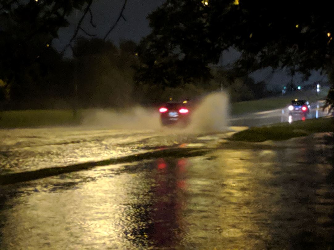
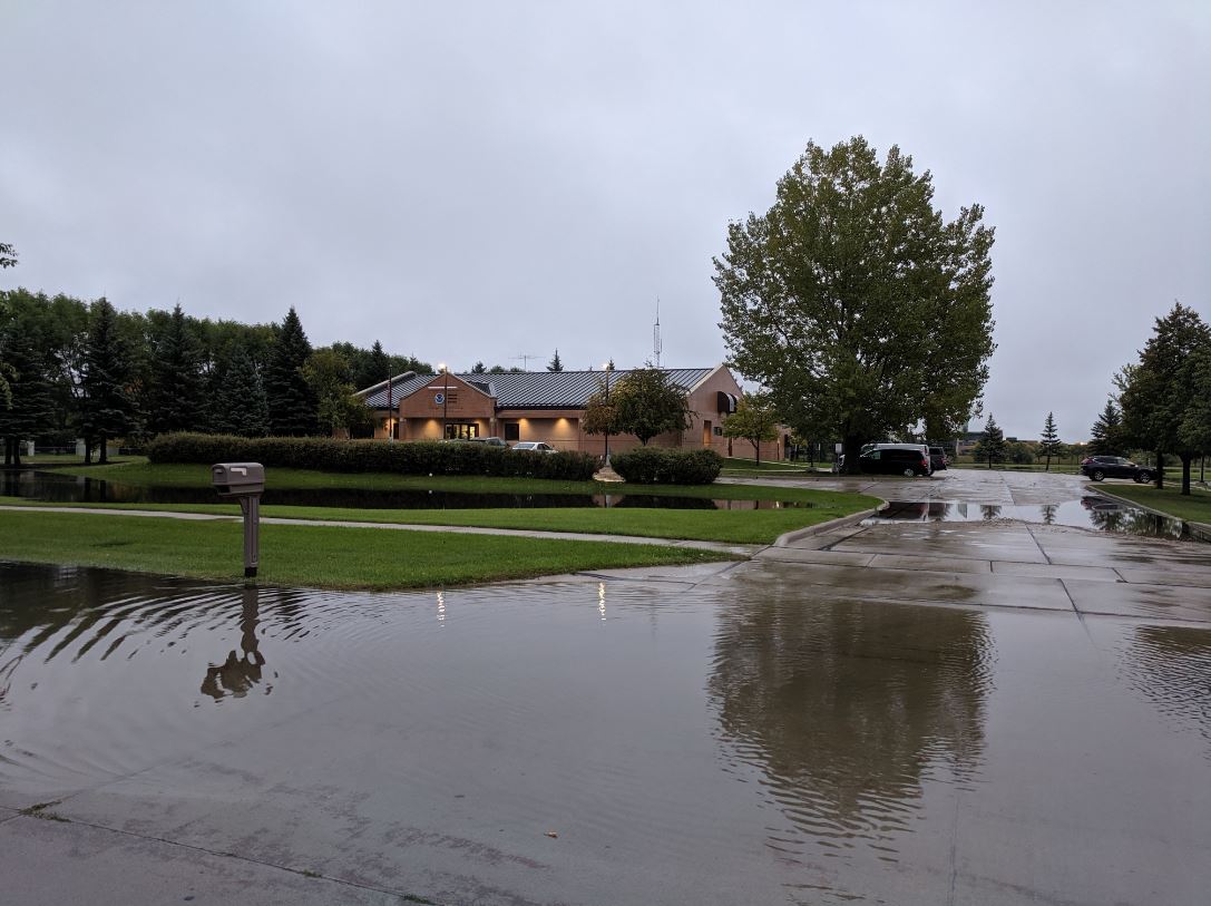
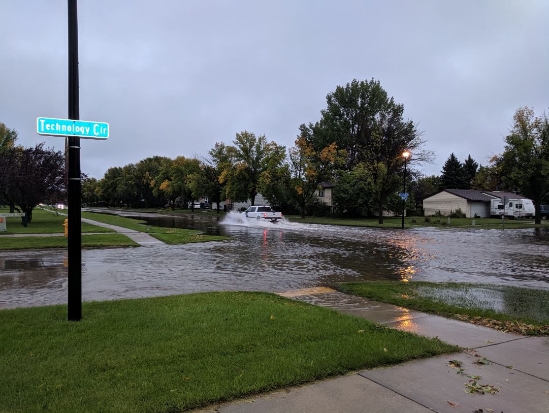
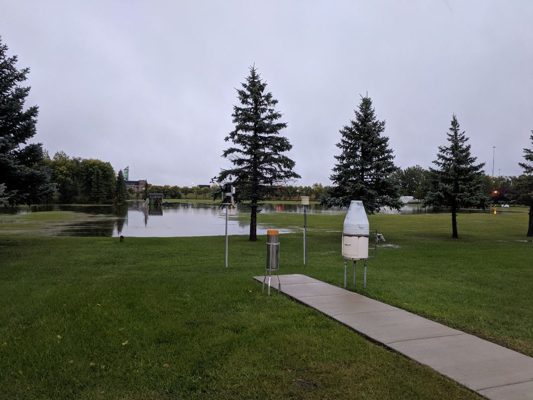
Photos & Video
These photographs are from around the NWS in Grand Forks ND.
 |
 |
 |
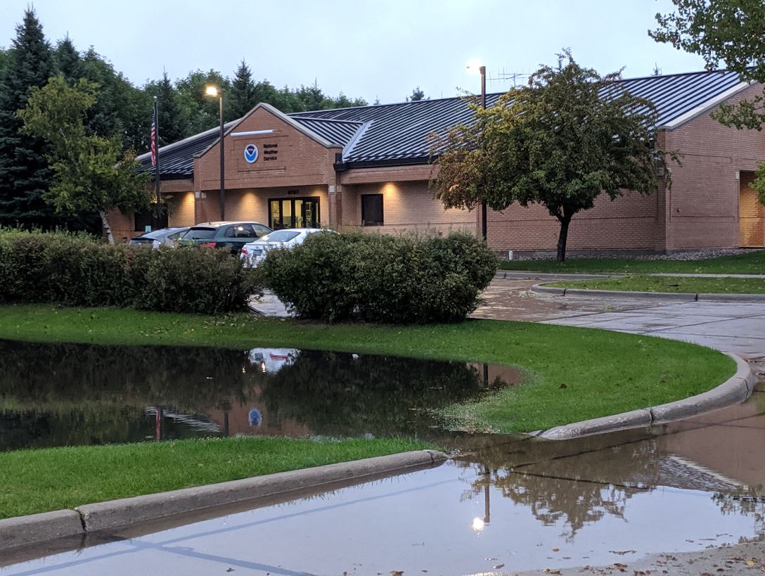 |
| University & Technology Circle | University & Technology Circle | University & Technology Circle | NWS Grand Forks |
 |
 |
 |
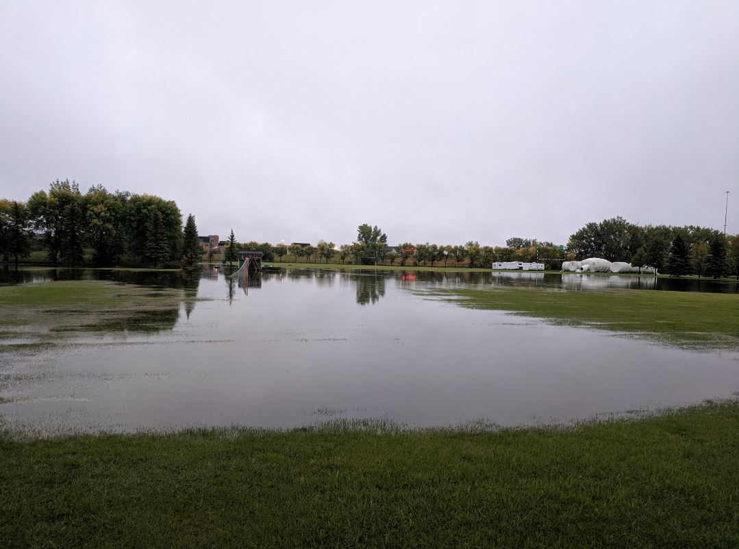 |
| NWS Grand Forks | University & Technology Circle | Looking toward I-29 | Looking toward I-29 |
Radar
Radar Loop from 4:00 a.m. to 10:00 a.m. on Friday, September 20th
Radar Loop from 10:00 a.m. to 4:00 p.m. on Friday, September 20th
Radar Loop from 4:00 p.m. to 10:00 p.m. on Friday, September 20th
Radar Loop from 10:00 p.m. Friday to 4:00 a.m. on Saturday
Radar Loop from 4:00 a.m. to 10:00 a.m. on Saturday, September 21st
Radar Loop from 1:00 p.m. to 7:00 p.m. on Saturday, September 21st
Rain Reports
This rainfall map covers the 24 hour period from 10 am Friday (9/20) to 10 am Saturday (9/21).

Public Information Statement
National Weather Service Grand Forks ND
146 PM CDT Sat Sep 21 2019

...PRECIPITATION ACCUMULATION REPORTS OVER THE PAST 24 HOURS...

Location                     Amount    Time/Date       Provider
Northwood                    8.73 in   1005 AM 09/21   Public
Norris Camp MN               7.10 in   0900 AM 09/21   COOP
3 NW Binford                 7.00 in   0905 AM 09/21   Public
10 W Faunce                  6.75 in   1130 AM 09/21   Mesonet
2 ESE Grand Forks            6.37 in   0334 AM 09/21   Public
Bathgate                     6.35 in   0102 PM 09/21   Public
Roseau MN 0.4 ENE            5.98 in   0700 AM 09/21   COCORAHS
Baudette                     5.70 in   1151 AM 09/21   Public
1 NNE Badger                 5.60 in   1232 PM 09/21   Public
Grand Forks ND 7 SW          5.52 in   1246 PM 09/21   CWOP
Clemenston MN                5.51 in   1200 PM 09/21   HADS
Roseau                       5.42 in   0800 AM 09/21   Cocorahs
1 WSW Grand Forks            5.32 in   0100 PM 09/21   Official NWS Obs
Roseau MN                    5.24 in   1145 AM 09/21   HADS
Grand Forks ND 2.5 SE        5.05 in   0700 AM 09/21   COCORAHS
9 SSW Gatzke                 5.03 in   1120 AM 09/21   Mesonet
Crookston                    5.00 in   0900 AM 09/21   Public
Thief River Falls            5.00 in   0830 AM 09/21   Public
1 WSW Caribou                4.99 in   0100 AM 09/21   Mesonet
3 SSE Grand Forks            4.90 in   0900 AM 09/21   Cocorahs
Grand Forks ND 3.4 SSE       4.90 in   0700 AM 09/21   COCORAHS
2 S Roseau                   4.90 in   0430 PM 09/20   Public
2 E Logan Center             4.79 in   1232 PM 09/21   Mesonet
1 W Grand Forks              4.73 in   0100 AM 09/21   Official NWS Obs
4 NE Fox                     4.70 in   1232 PM 09/21   Mesonet
4 SW Humboldt                4.55 in   1232 PM 09/21   Mesonet
1 E Warroad                  4.55 in   1230 PM 09/21   Mesonet
6 N Williams                 4.49 in   1232 PM 09/21   Mesonet
Baudette MN 12 S             4.43 in   1200 PM 09/21   HADS
5 WNW Grand Forks            4.39 in   1253 PM 09/21   ASOS
3 S Grand Forks              4.30 in   1232 PM 09/21   Mesonet
4 SSW Galesburg              4.13 in   1232 PM 09/21   Mesonet
1 NW Grand Forks Afb         4.12 in   1244 PM 09/21   ASOS
Larimore ND 4.9 SSE          4.10 in   0700 AM 09/21   COCORAHS
Grand Forks ND 3.7 SSE       4.07 in   0700 AM 09/21   COCORAHS
4 NW Crystal                 4.03 in   1232 PM 09/21   Mesonet
Warroad MN                   4.03 in   0130 AM 09/21   HADS
6 E Holt                     3.98 in   1145 AM 09/21   Mesonet
Northcote MN 2 ENE           3.94 in   1100 AM 09/21   HADS
Aneta                        3.90 in   1050 PM 09/20   Public
2 N Maddock                  3.87 in   1232 PM 09/21   Mesonet
2 ENE Backoo                 3.76 in   1232 PM 09/21   Mesonet
3 E Kelso                    3.74 in   1232 PM 09/21   Mesonet
Florian MN 1 S               3.73 in   1200 PM 09/21   HADS
Baudette MN 3 S              3.63 in   1206 PM 09/21   RAWS
Grand Forks Afb              3.63 in   0100 AM 09/21   Other Federal
3 S Grand Forks              3.59 in   1200 AM 09/21   Mesonet
3 NE Northwood               3.59 in   1232 PM 09/21   Mesonet
2 NNW Wannaska               3.59 in   1232 PM 09/21   Mesonet
5 WNW Saint Hilaire          3.58 in   0730 AM 09/21   Cocorahs
Sharon ND 7.9 ENE            3.53 in   0700 AM 09/21   COCORAHS
5 NE Viking                  3.50 in   1000 AM 09/21   Public
4 N Tabor                    3.38 in   1232 PM 09/21   Mesonet
2 NNW Wannaska               3.37 in   1200 AM 09/21   Mesonet
2 W Eldred                   3.31 in   1232 PM 09/21   Mesonet
2 ENE Backoo                 3.22 in   1200 AM 09/21   Mesonet
Hallock MN                   3.10 in   1145 AM 09/21   HADS
6 SW Leo                     2.99 in   1232 PM 09/21   Mesonet
Crookston MN 0.6 ENE         2.94 in   0630 AM 09/21   COCORAHS
Karlstad MN 0.2 SSW          2.88 in   0800 AM 09/21   COCORAHS
Lake Bronson MN              2.69 in   1115 AM 09/21   HADS
Alvarado MN 1 N              2.56 in   1145 AM 09/21   COOP
4 E Leeds                    2.53 in   1232 PM 09/21   Mesonet
Hatton ND 9.1 WSW            2.45 in   0600 AM 09/21   COCORAHS
3 WSW Mavie                  2.41 in   1232 PM 09/21   Mesonet
Hope ND 5.4 WNW              2.40 in   0700 AM 09/21   COCORAHS
5 NW Prosper                 2.24 in   1232 PM 09/21   Mesonet
Grandin ND 7.1 ENE           2.19 in   0700 AM 09/21   COCORAHS
2 E Mayville                 2.13 in   1232 PM 09/21   Mesonet
1 NE Stephen                 2.07 in   1232 PM 09/21   Mesonet
Grafton ND 6.8 N             2.05 in   0800 AM 09/21   COCORAHS
3 W Cooperstown              2.04 in   1232 PM 09/21   Mesonet
Colgate                      2.00 in   0700 AM 09/21   COOP
5 W Grand Forks              1.39 in   1053 PM 09/20   ASOS
2 SSW Casselton              1.35 in   0800 AM 09/21   CO-OP Observer
Devils Lake ND Airport       1.24 in   1256 PM 09/21   AWOS
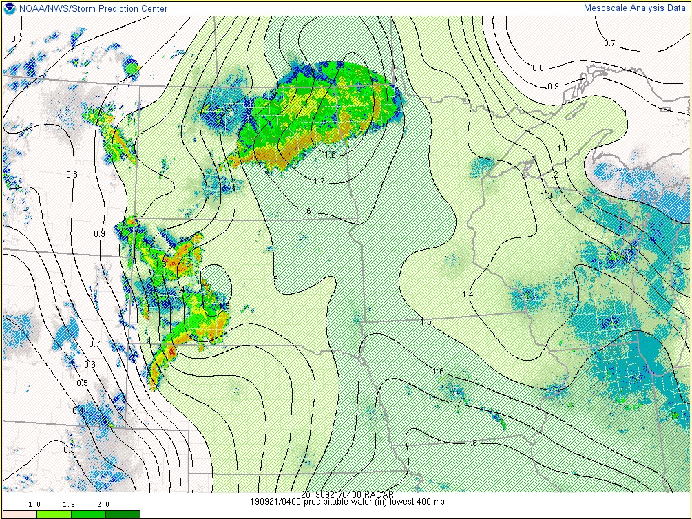
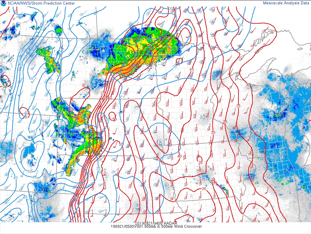
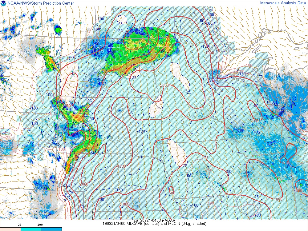
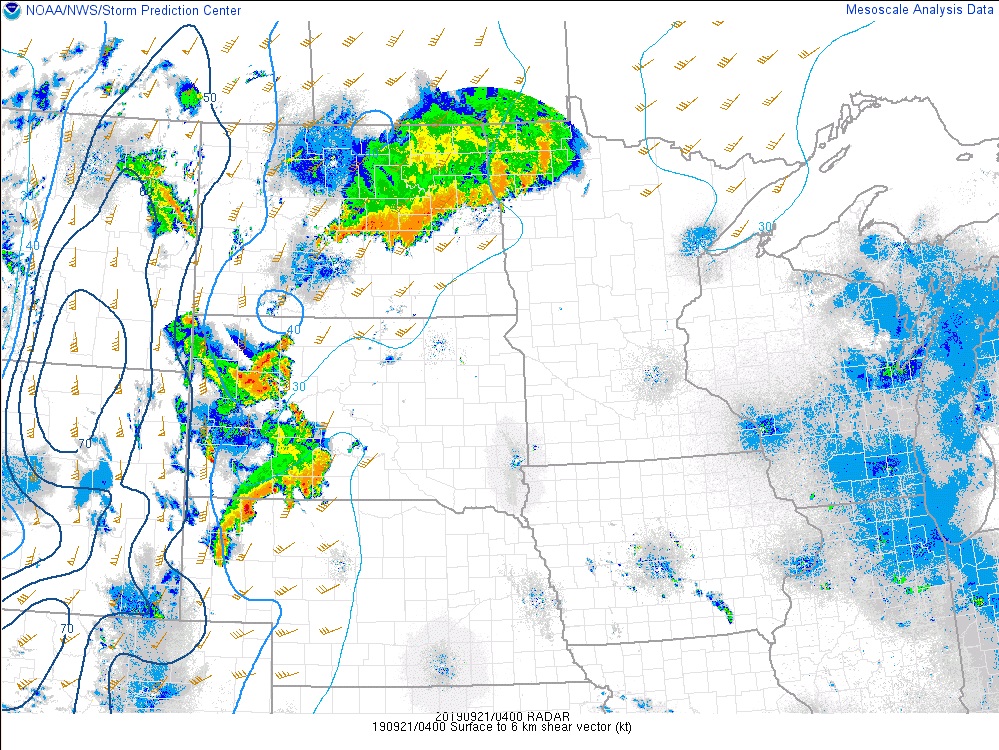
Environment
These charts are from the SPC mesoanalysis webpage.
 |
 |
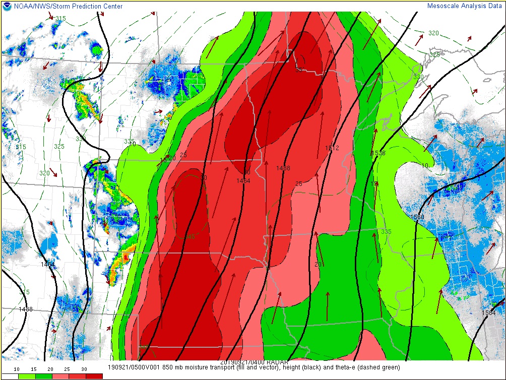 |
| 11 PM Fri Precipitable Water | 11 PM Fri 850mb Winds | 11 PM Fri 850mb Moisture Transport |
 |
 |
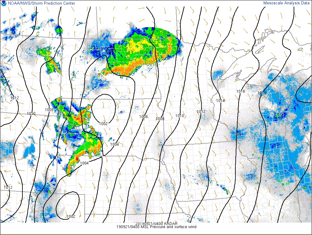 |
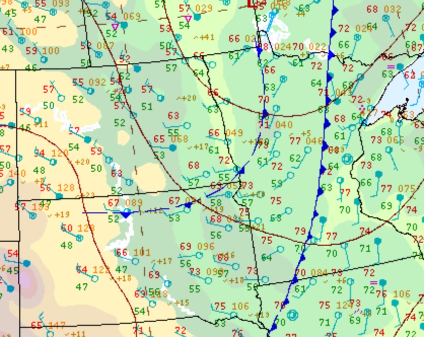
| 11 PM Fri MLCAPE | 11 PM Fri 0-6km Bulk Shear | 11 PM Fri Surface Map |
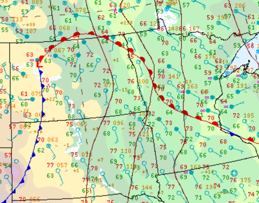
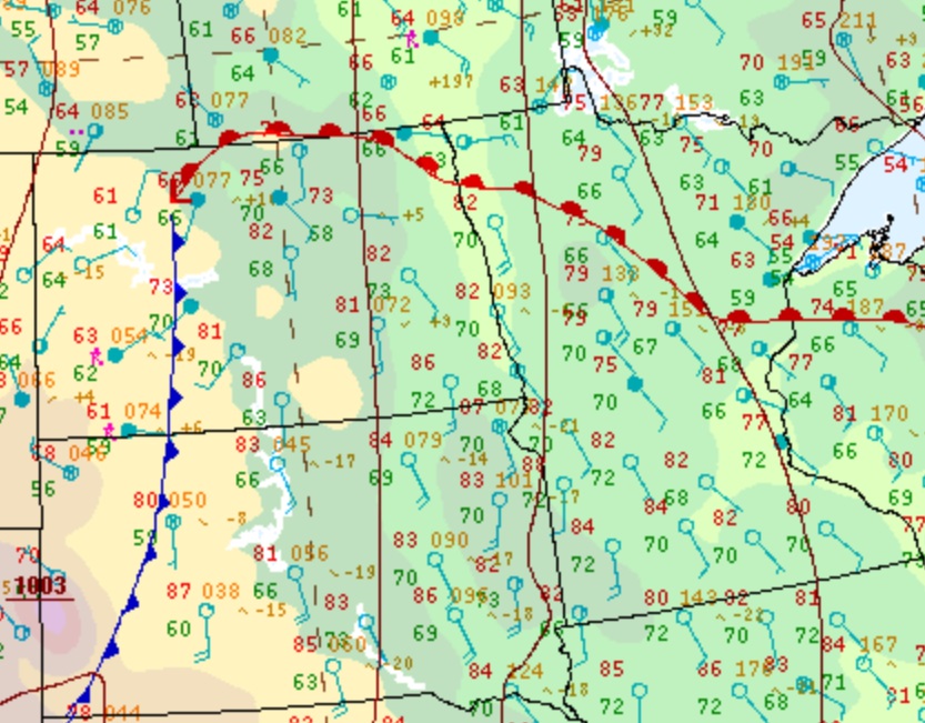
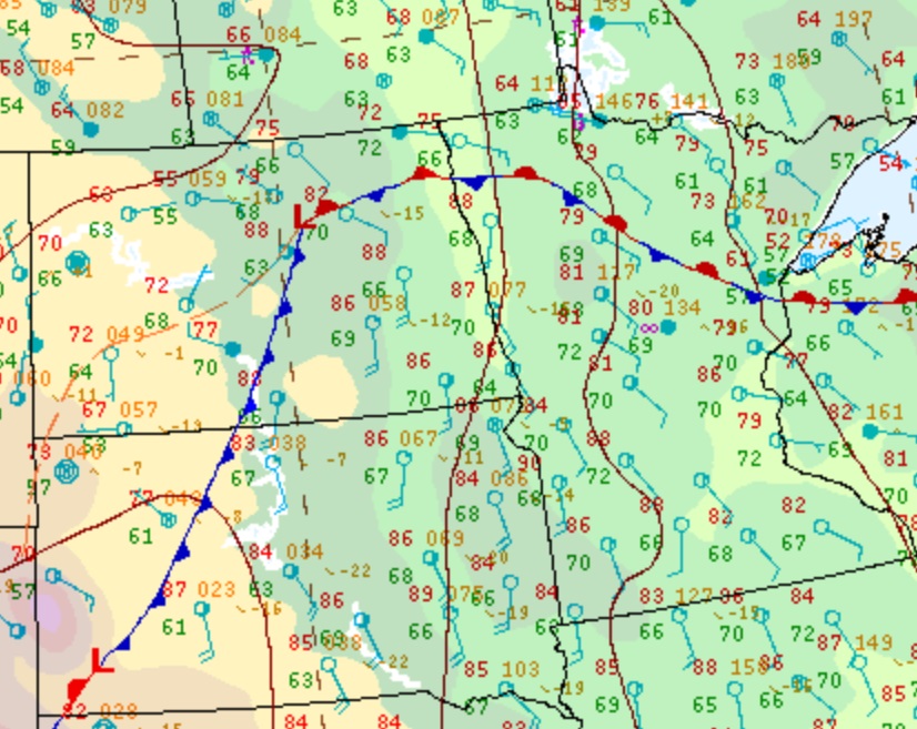
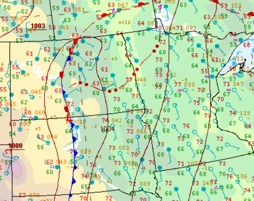
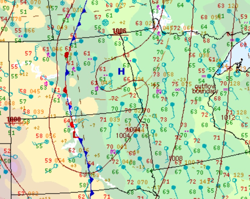
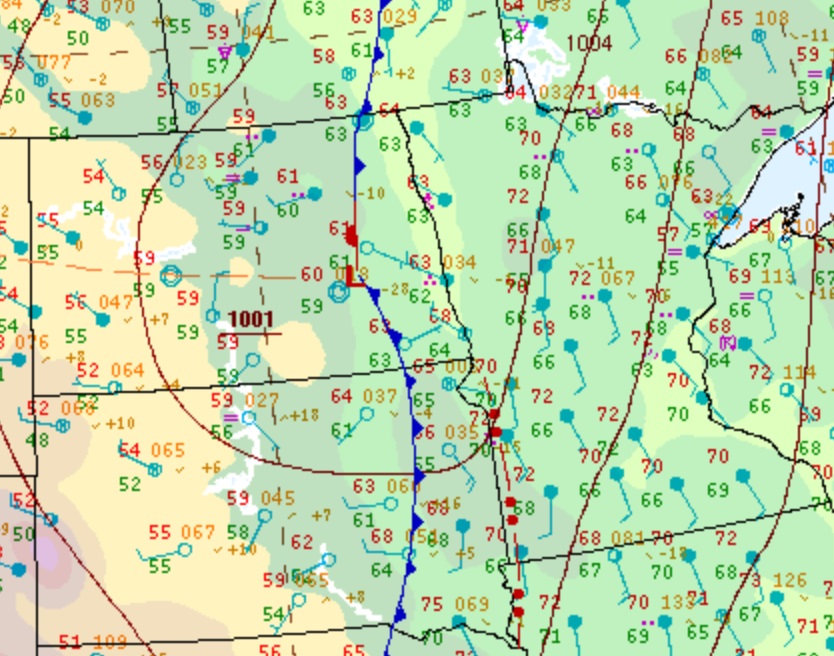
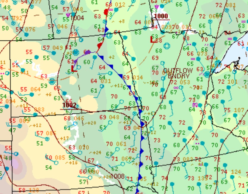
Additional Information
WPC Surface Maps
 |
 |
 |
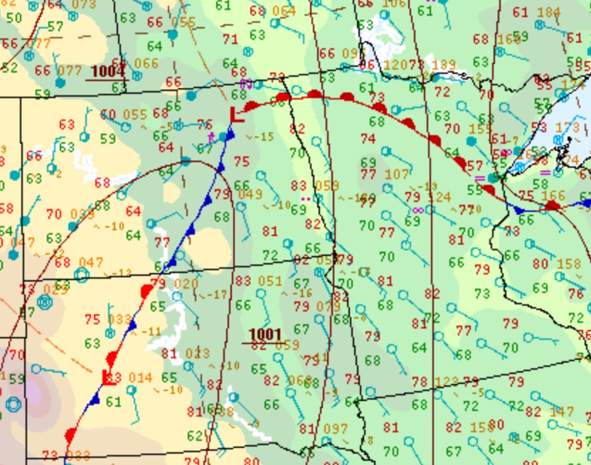 |
| 10 AM Fri 9/20 | 1 PM Fri 9/20 | 4 PM Fri 9/20 | 7 PM Fri 9/20 |
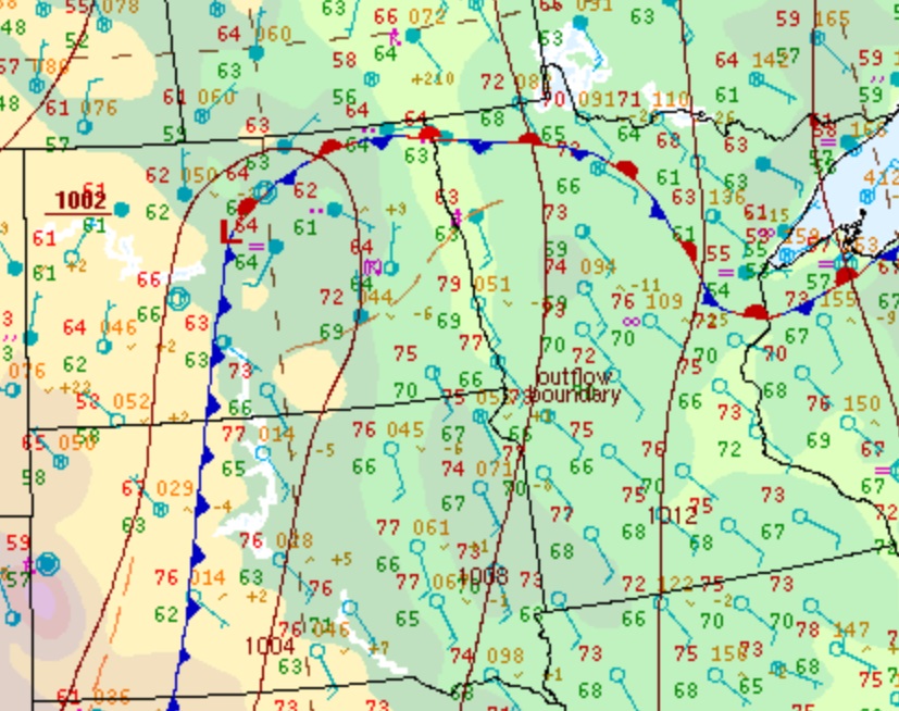 |
 |
 |
 |
| 10 PM Fri 9/20 | 1 AM Sat 9/21 | 4 AM Sat 9/21 | 7 AM Sat 9/21 |
 |
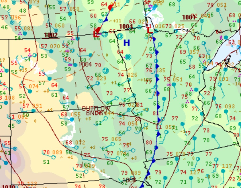 |
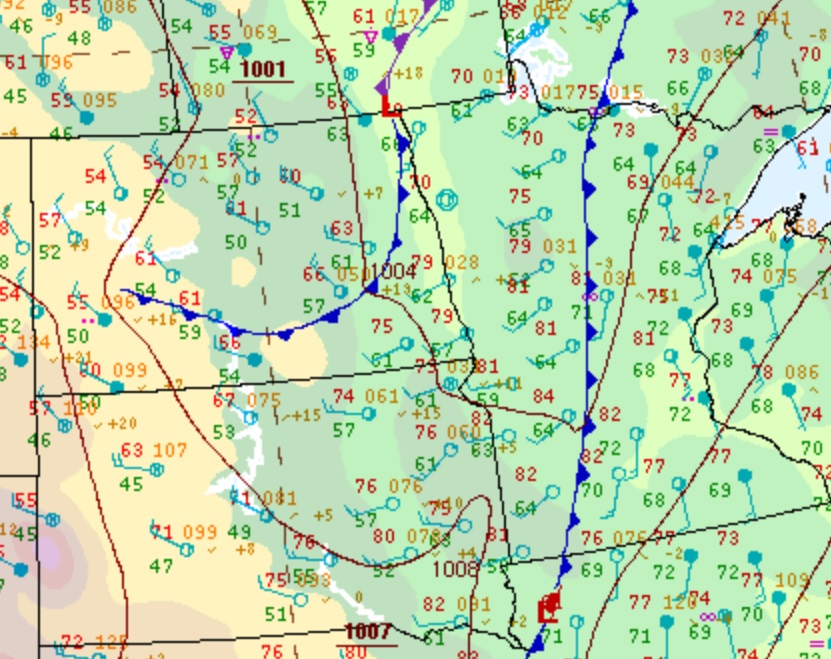 |
 |
| 10 AM Sat 9/21 | 1 PM Sat 9/21 | 4 PM Sat 9/21 | 7 PM Sat 9/21 |
 |
Media use of NWS Web News Stories is encouraged! Please acknowledge the NWS as the source of any news information accessed from this site. |
|

