Overview
On the evening of June 29, 2019 a region of showers and thunderstorms developed across northwest Minnesota near the international border. As storms became more widespread they began to organize into a southward propagating Mesoscale Convective System (MCS) that brought torrential rain, strong winds, and small hail overnight to portions of northwest and west central Minnesota. Outflow from this initial MCS promoted additional severe thunderstorms across west central MN early in the morning on Sunday, June 30th.Photos & Video
 |
 |
| Tree snapped north of Bemidji (Courtesy of Shirl Hofland) |
Additional trees down north of Bemidji (Courtesy of Shirl Hofland) |
Radar
Loop from 7:00 p.m. on June 29th to 1:00 a.m. on June 30th
Loop from 1:00 a.m. to 7:00 a.m. on June 30th
Loop from 7:00 a.m. to 11:00 a.m. on June 30th
Storm Reports
Did you see hail or wind damage from these storms? We want to hear about it!
Report severe weather by phone at 1-800-667-1218.

PRELIMINARY LOCAL STORM REPORT...SUMMARY
NATIONAL WEATHER SERVICE GRAND FORKS ND
525 PM CDT SUN JUN 30 2019

..TIME...   ...EVENT...      ...CITY LOCATION...     ...LAT.LON...
..DATE...   ....MAG....      ..COUNTY LOCATION..ST.. ...SOURCE....
            ..REMARKS..

0259 AM     HAIL             2 SE ROSBY              47.40N 94.78W
06/30/2019  E0.75 INCH       HUBBARD            MN   LAW ENFORCEMENT

            PEA TO DIME SIZE HAIL AND GUSTY SUB SEVERE
            WINDS.

0241 AM     HAIL             2 NE LAVINIA            47.54N 94.78W
06/30/2019  E0.75 INCH       BELTRAMI           MN   PUBLIC


0809 AM     HAIL             7 E SEBEKA              46.63N 94.94W
06/30/2019  E1.00 INCH       WADENA             MN   PUBLIC

            PHOTOGRAPH AND CONFIRMATION OF HAIL SIZE VIA
            SOCIAL MEDIA.

0156 AM     TSTM WND DMG     12 N BEMIDJI            47.66N 94.88W
06/30/2019                   BELTRAMI           MN   PUBLIC

            SOCIAL MEDIA IMAGE OF A MEDIUM SIZED TREE
            SNAPPED. TIME BASED ON RADAR.

1100 PM     HAIL             MIDDLE RIVER            48.44N 96.16W
06/29/2019  E0.88 INCH       MARSHALL           MN   PUBLIC
Environment
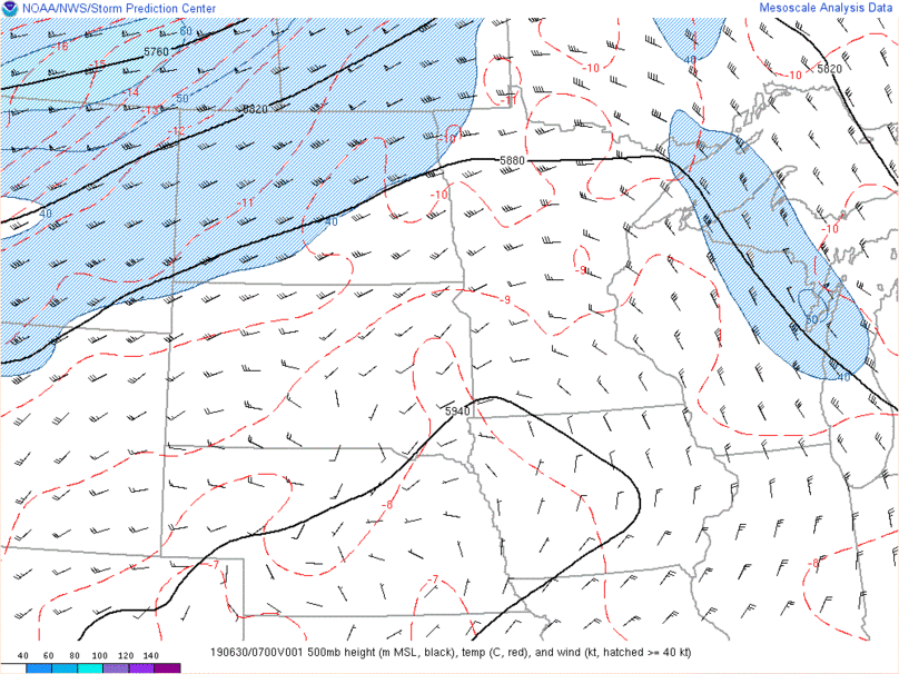
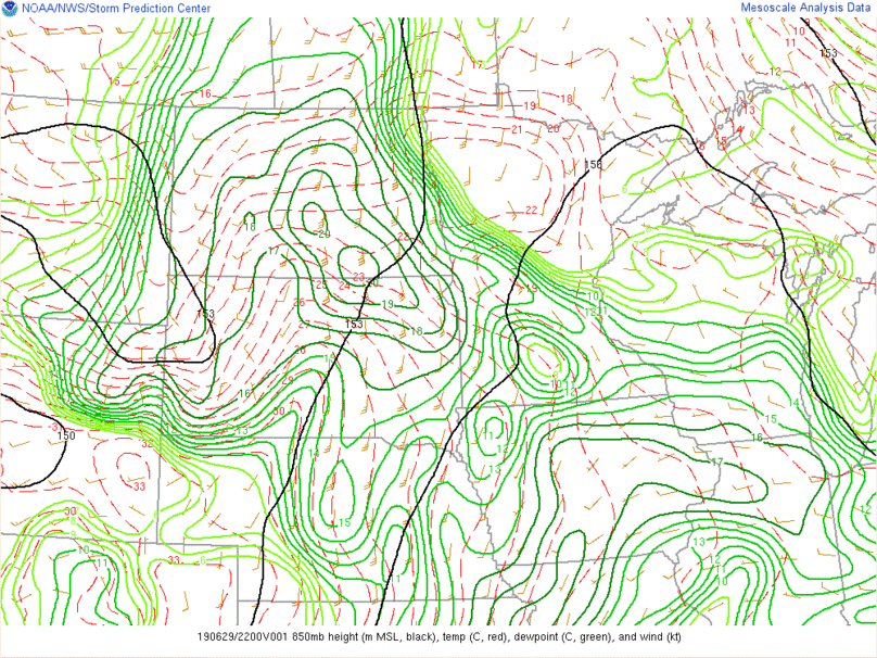
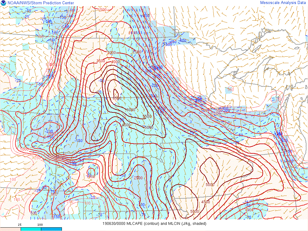
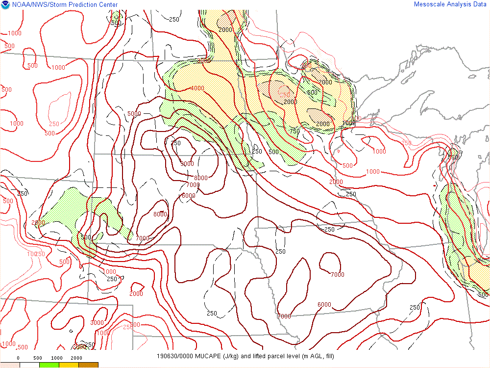
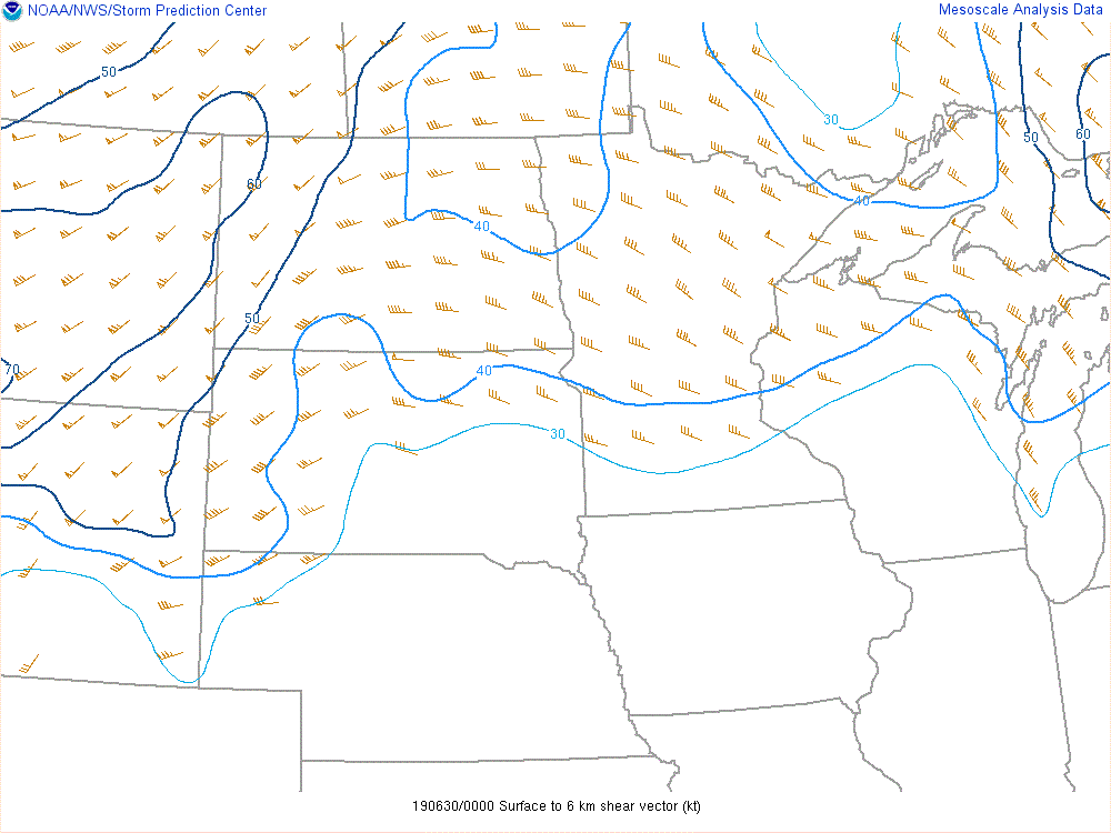
Although Saturday June 29th was forecast to be a very hot and muggy day, a morning storm system brought widespread rain and clouds to eastern North Dakota and northwest Minnesota. This lead to the atmosphere over the eastern half of North Dakota being much more stable in the lowest portion of the atmosphere than was expected (Figure 4 - notice the blue shading). Although the atmosphere was very unstable above the cooler layer near the ground (Figure 5), the cooler than expected surface temperatures along with a lack of forcing for ascent near a surface low in south central ND (Figure 3) kept thunderstorms from developing through the late afternoon. Later in the evening, winds in the middle of the atmosphere strengthened and began to act as a source of lift (Figure 2). (Note: if you look carefully, you can see thunderstorms beginning to develop across the international border in the visible satellite imagery (notice the rough looking clouds along the Red River into Canada)).
As the low level jet increased through the evening, scattered thunderstorms began to develop from far northeast North Dakota to northwest Minnesota. As these storms strengthened individual updrafts would quickly grow strong enough to support 0.5-1" hail before quickly diminishing in strength. This pop-up convection continued until the cold pools from the scattered storms began to consolidate. New thunderstorm updrafts began to develop along the edge of the consolidated cold pool as it spread outwards. This was most pronounced on the southern side of the cold pool where the southward moving cold pool was aided by a northward moving low level jet - creating a strong forcing for ascent. This allowed for the cluster of storms to begin shifting slowly to the south through northwest Minnesota.
Through the overnight hours the developing line of storms gradually organized into a mesoscale convective system (MCS) that eventually moved southward through central MN and into southeast MN by sunrise. In it's wake, a weak outflow boundary was draped from west to east across west central Minnesota. A second round of storms developed along this outflow boundary and brought morning severe storms to central Minnesota.
 |
 |
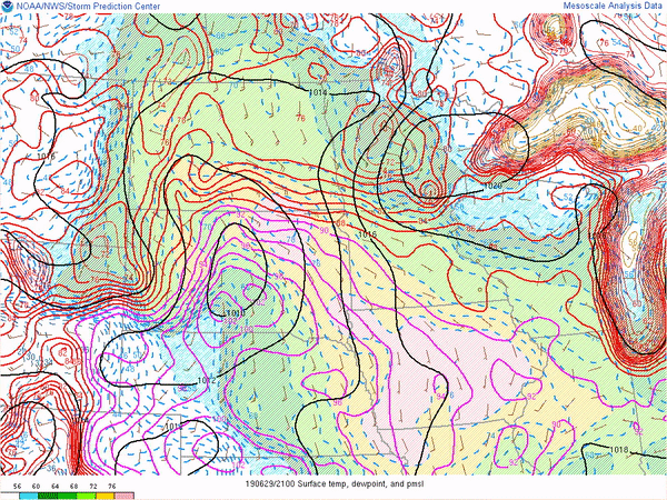 |
| Figure 1: 500 mb Heights, Winds, & Temperatures | Figure 2: 850 mb Heights, Winds, Temperatures, & Dewpoints | Figure 3: Mean Sea Level Pressure, Surface Temperature, Surface Dewpoint, Wind |
 |
 |
 |
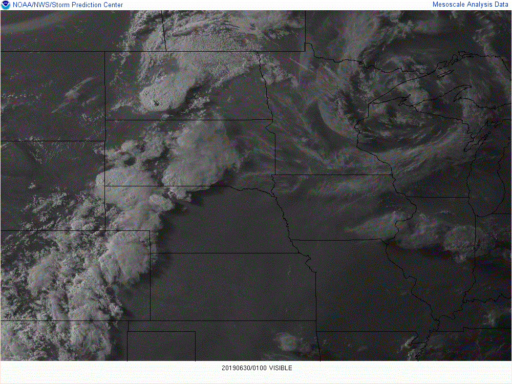 |
| Figure 4: Mixed Layer CAPE | Figure 5: Most Unstable CAPE | Figure 6: 0-6 km Bulk Shear | Figure 6: 8 PM Visible Satellite |
 |
Media use of NWS Web News Stories is encouraged! Please acknowledge the NWS as the source of any news information accessed from this site. |
|

