Overview
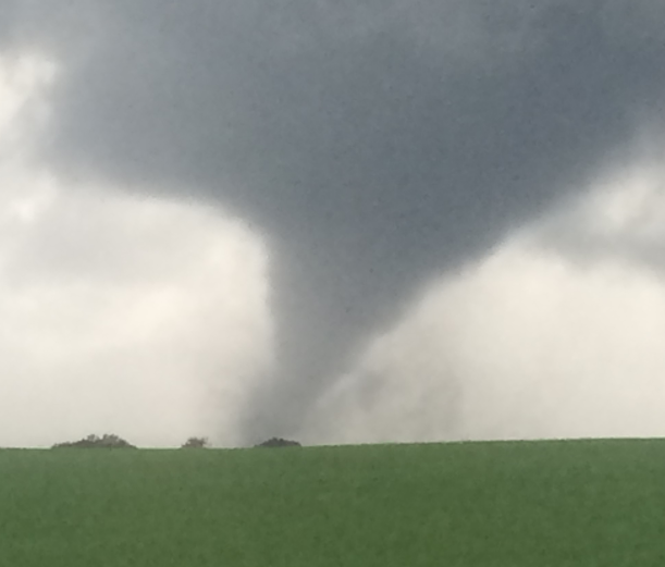
Severe thunderstorms formed during the afternoons and early evenings of June 7th and June 8th. These storms mainly produced damaging winds and large hail, but one tornado also occurred near Fertile, MN on Saturday June 8th. Total observed rainfall amounts from the 7th into the 8th were highly variable due to the scattered nature of the thunderstorms and locally heavy rainfall.Tornadoes
|
Tornado - 4 SE Fertile MN
|
||||||||||||||||
The Enhanced Fujita (EF) Scale classifies tornadoes into the following categories:
| EF0 Weak 65-85 mph |
EF1 Moderate 86-110 mph |
EF2 Significant 111-135 mph |
EF3 Severe 136-165 mph |
EF4 Extreme 166-200 mph |
EF5 Catastrophic 200+ mph |
 |
|||||
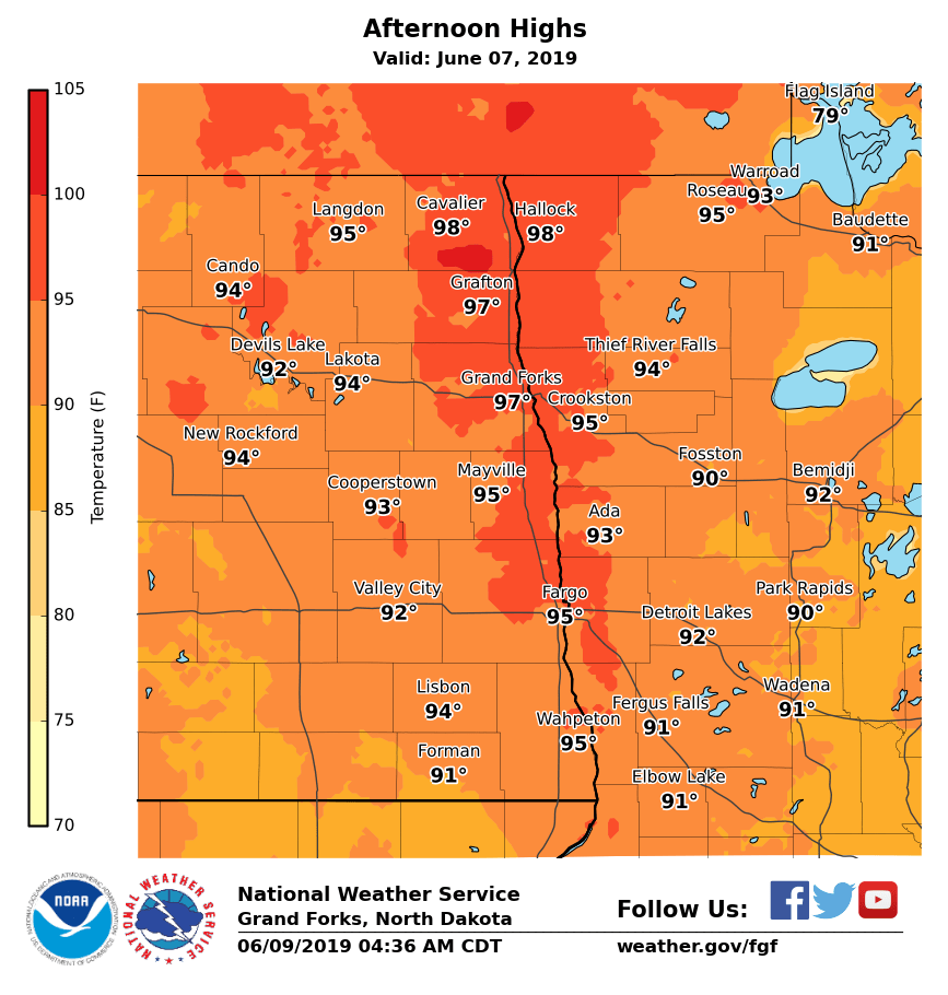
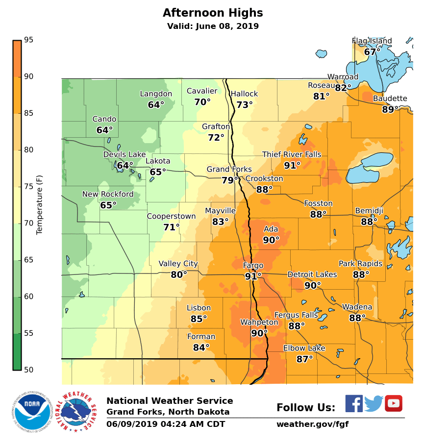
High Temperatures
Near record high temperatures occurred on Friday June 7th and Saturday June 8th, 2019. Friday June 7th was the hottest day for the summer so far across the area. On Friday, Fargo reach 96 degrees (near the record of 99 degrees set in 1941), Grand Forks (GFK) International Airport set a new record high of 96 degrees, and Grand Forks (Univ/NWS) reached 96 degrees (near record of 97 degrees set in 1988). On Saturday June 8th, Fargo set a new record high of 93 degrees.
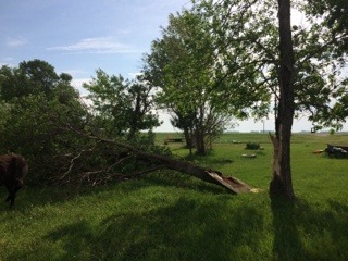
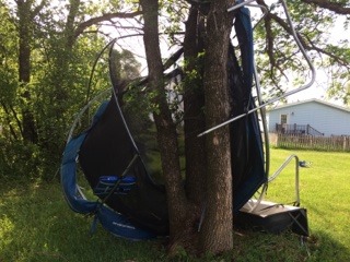
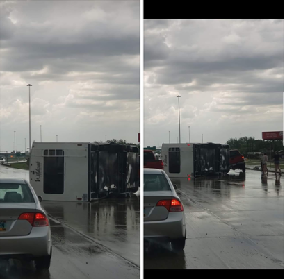
Photos & Video
June 7th photos
 |
 |
 |
 |
|
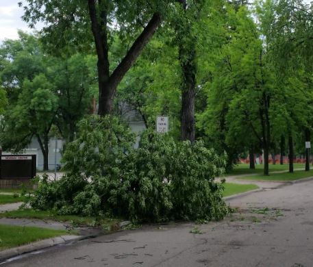
Near Alvarado, MN Lerry Pryzbyla |
Near Alvarado, MN Lerry Pryzbyla |
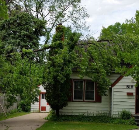
Grand Forks, ND Bob Filipy |
Grand Forks, ND Bob Filipy |
June 8th photos
 |
 |
 |
 |
|
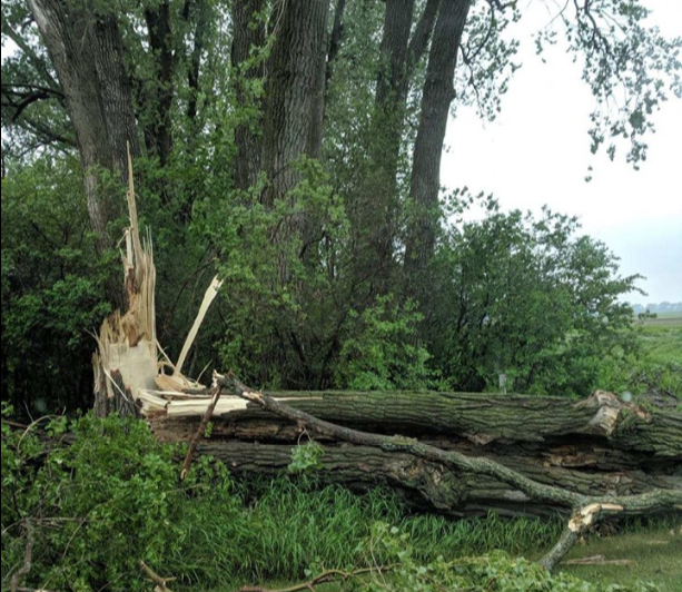
Near Leonard, ND Mitch Burdick |
Near Leonard, ND Mitch Burdick |
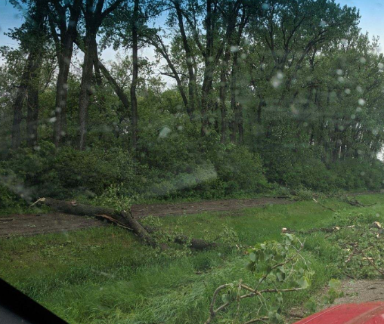
Fargo, ND | Near Fertile, MN |
Radar
--
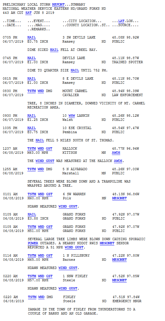
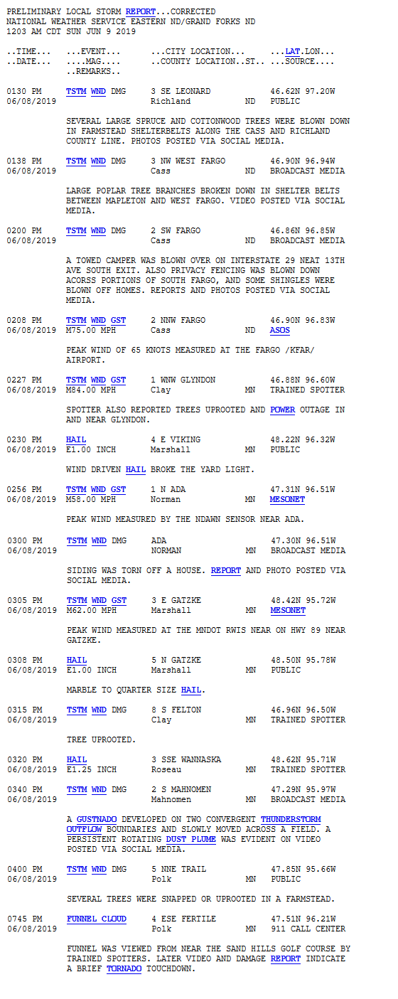
Storm Reports
Friday June 7th, 2019
Saturday June 8th, 2019
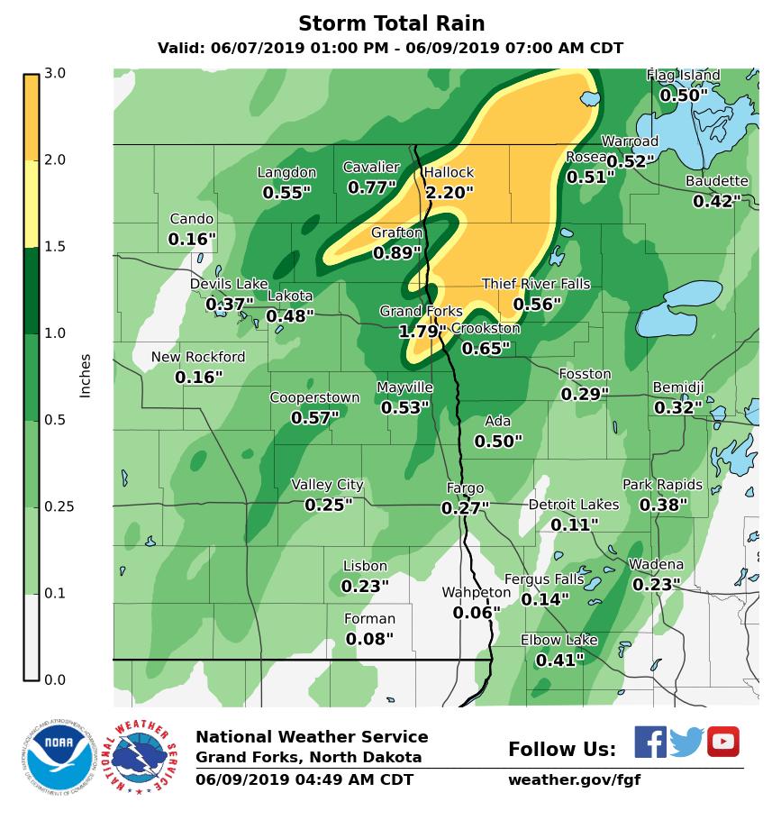
Rain Reports
This map shows the 2 day rainfall total, from 1 pm Friday June 7th to 7 am Sunday June 8th. The map may not depict every location accurately because the NWS does not receive rainfall reports in between a lot of the larger cities on this map. Between the larger cities, rainfall amounts are estimated for this map.
Additional Information
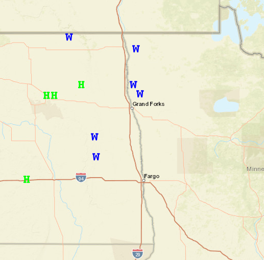
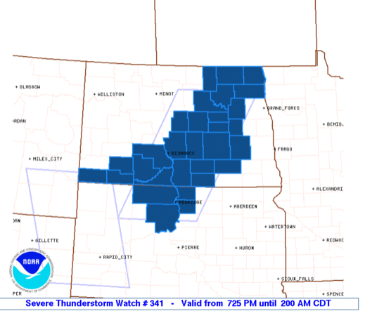
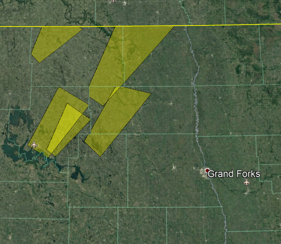
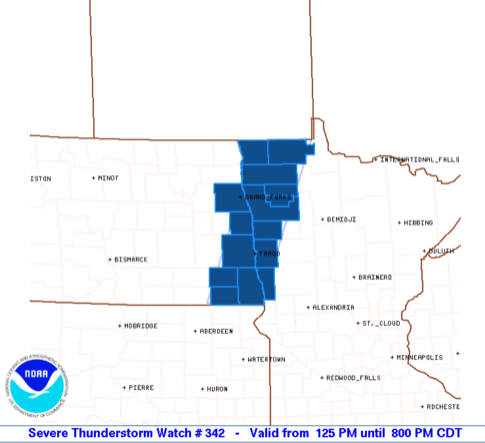
SPC Watches and NWS Grand Forks Warnings
 |
 |
 |
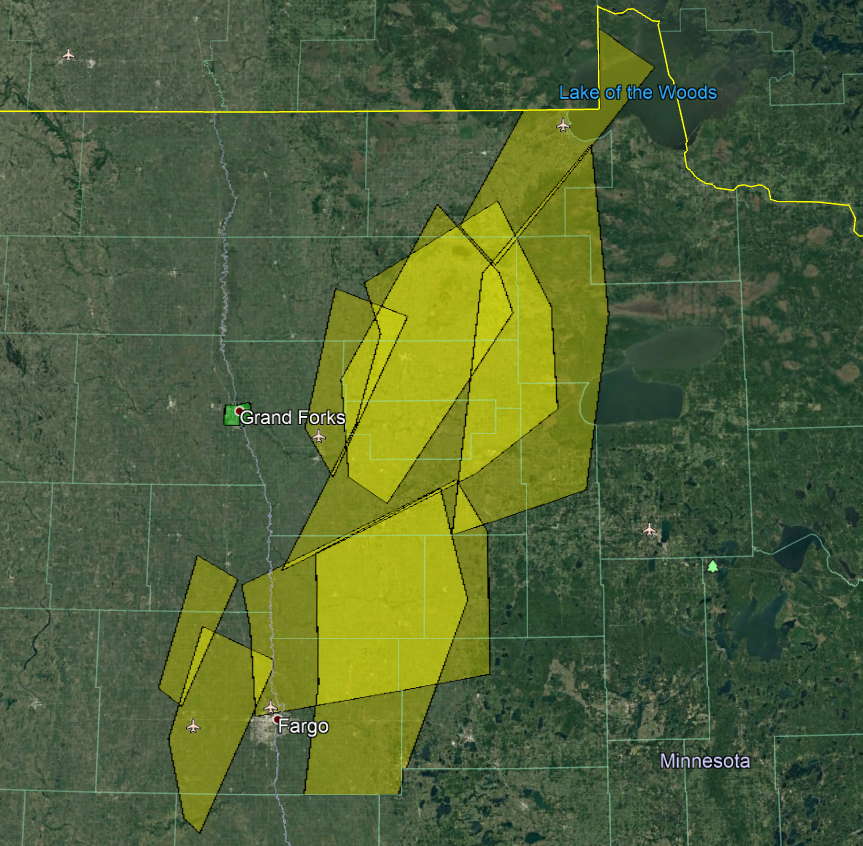 |
| SPC Watch June 7th | NWS Grand Forks June 7, 2019 Warnings | SPC Watch June 8th | NWS Grand Forks June 8, 2019 Warnings |
 |
Media use of NWS Web News Stories is encouraged! Please acknowledge the NWS as the source of any news information accessed from this site. |
|

