Overview
A strong Colorado Low storm system moved through from the afternoon of Sunday March 4th through late in the evening on Monday March 5th. Initially, thunderstorms developed, producing cloud to ground lightning, heavy rain, and occasionally pea sized hail. Rain transitioned to sleet and freezing rain, then eventually to snow. Snow continued from late Sunday night through Monday night, producing widely varying amounts across the area from less than an inch to 14 inches.Hail:
Pea sized hail was reported with thunderstorms on the afternoon of Sunday March 4th.
 |
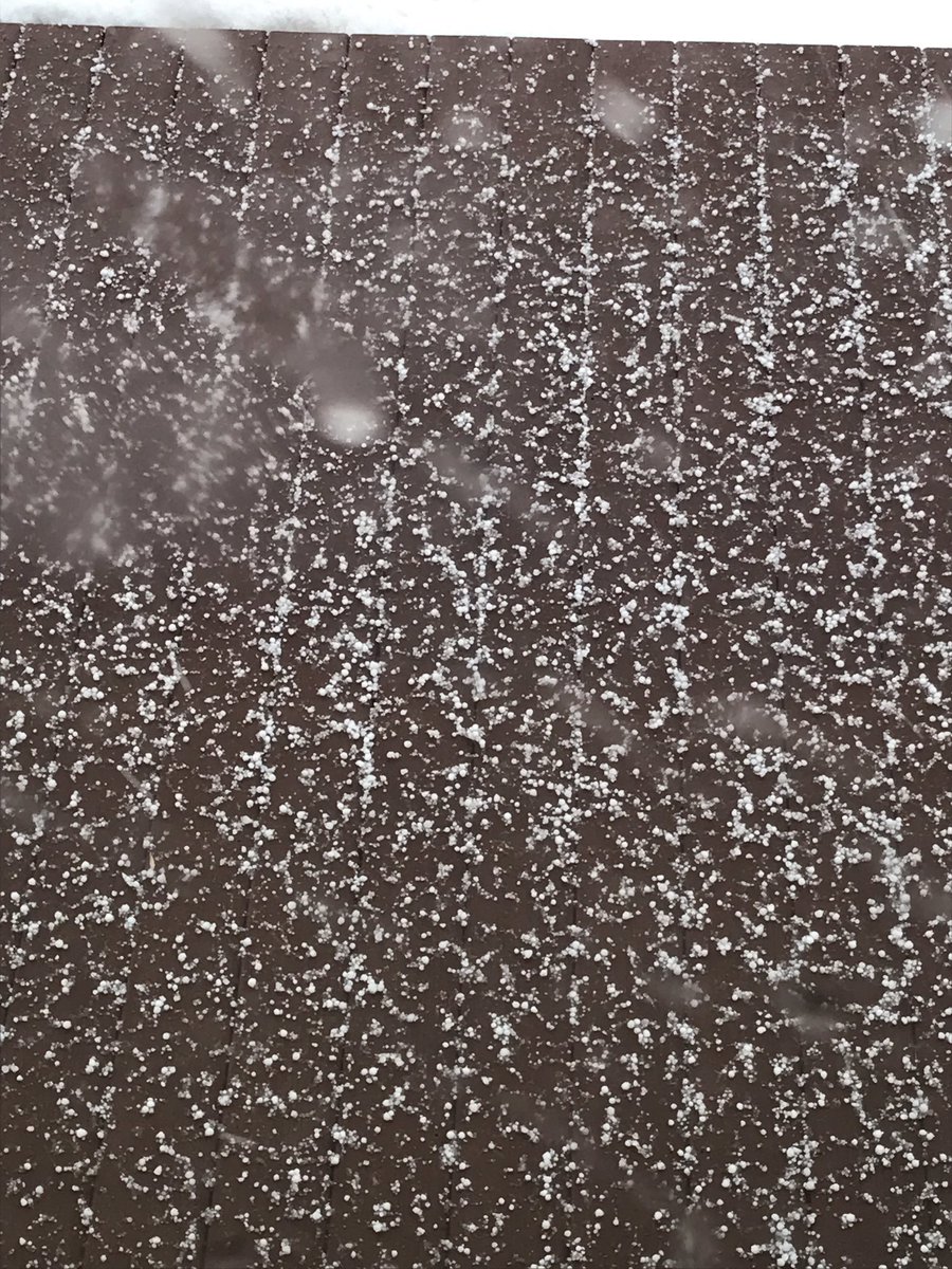 |
| Small hail near Casselton, ND. | Small hail near Valley City, ND. |
Precipitation - Snow/Liquid 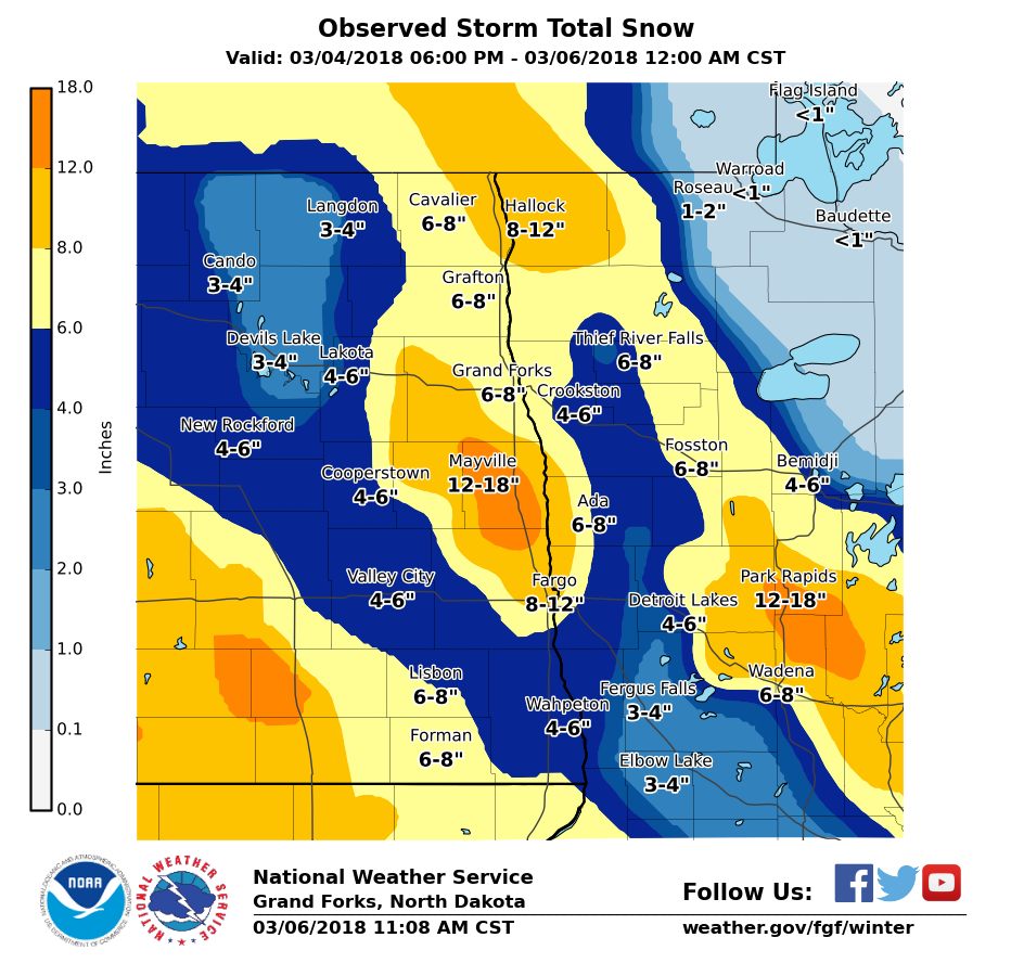
Snowfall Totals from March 4-5, 2018 ...PUBLIC INFORMATION STATEMENT... Location Amount Kelso ND 14.0 Oylen MN 14.0 Nimrod MN 13.5 Sharon ND 11.0 Hatton ND 10.0 Karlstad MN 10.0 4N Park Rapids MN 9.3 New York Mills MN 9.0 Buxton ND 9.0 Sebeka MN 9.0 Argyle MN 8.7 5N Detroit Lakes MN 8.0 7NW Warren MN 7.1 2N Moorhead MN 7.0 Pembina ND 6.8 Forman ND 6.5 Fargo ND 6.3 Grand Forks NWS 6.2 Abercrombie ND 6.2 Lisbon ND 6.1 6E Lankin ND 6.0Warren MN 5.9 Michigan ND 5.8 5WNW Hope ND 5.7 Bagley MN 5.5 Lidgerwood ND 5.5 5WNW Durbin ND 5.5 Detroit Lakes MN 5.3 New Rockford ND 5.0 Crookston MN 5.0 Enderlin ND 5.0 Leeds ND 5.0 Breckenridge 4.8 McLeod ND 4.2 Cando ND 4.0 Devils Lake ND 3.0 Thief River Falls MN 3.0 Holt MN 3.0 2NW Ottertail 2.7 Starkweather ND 2.5 8NNW Bemidji 1.2 4E Turtle River MN 0.8
Photos & Video:
 |
 |
 |
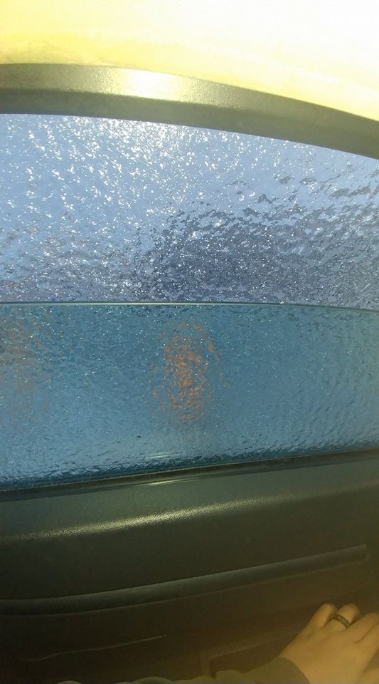
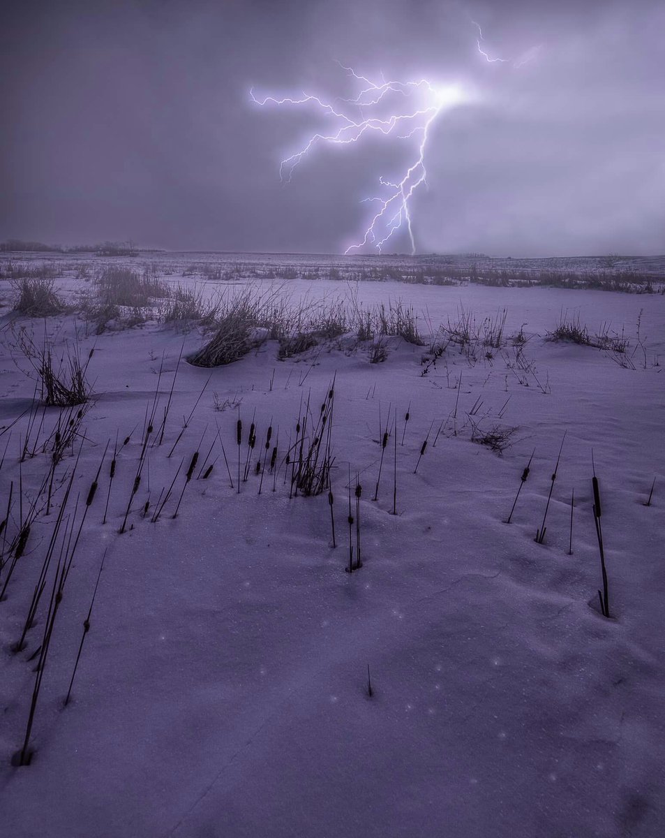
| Ice adhering to car window near Detroit Lakes by Kent Freeman | Lightning illuminates snowy field in the Grand Forks area by Mike Lawrence | A mixture of graupel and small hail by Vince Godon |
 |
 |
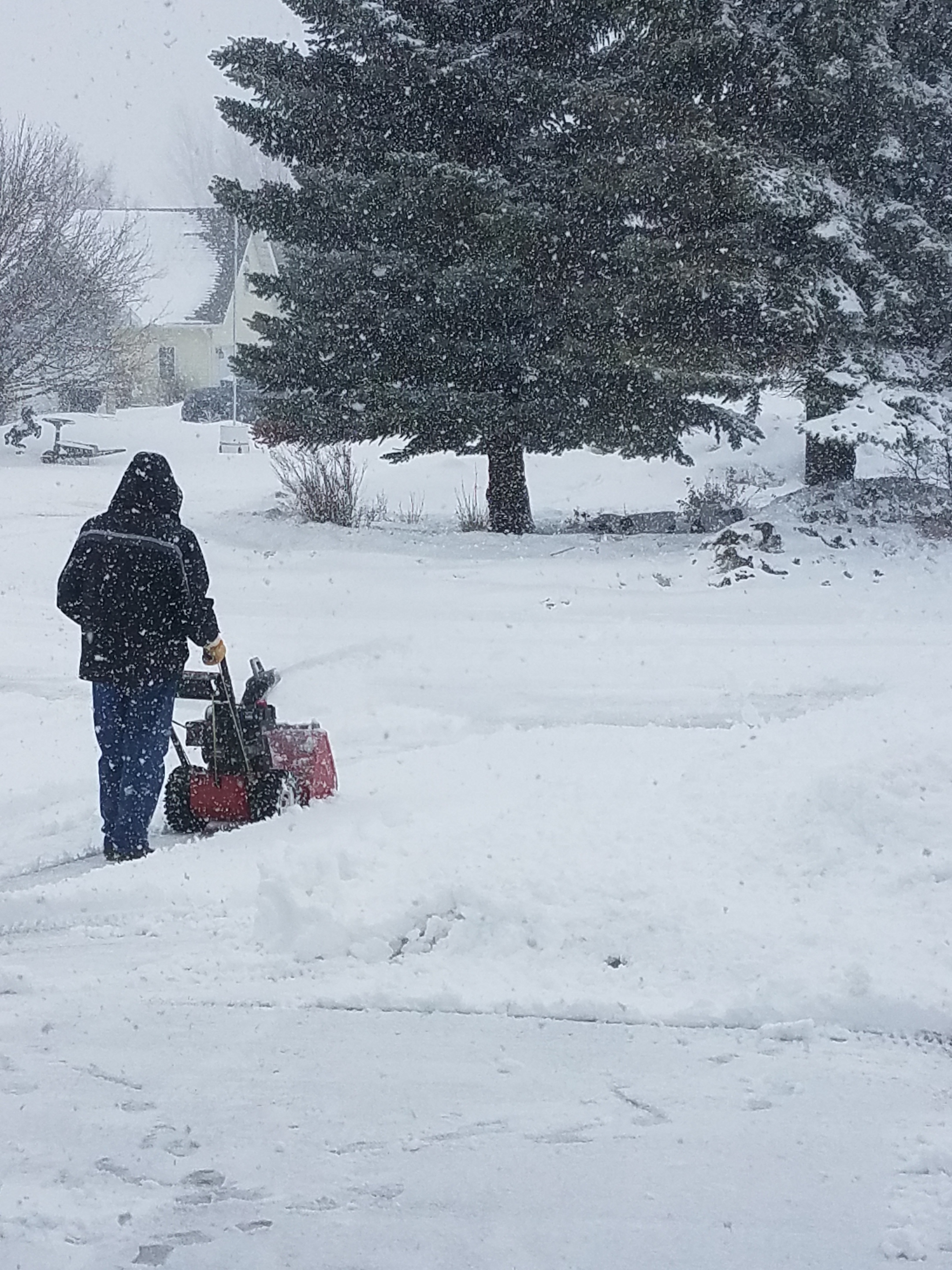
| Snow blowing heavy snow in south Grand Forks by Nancy Godon | Snow drifts in south Grand Forks by Vince Godon |
Radar:
3pm to 9 pm Sunday March 4th Radar Loop with Estimated Precipitation Type
9pm Sunday March 4th to 3am Monday March 5th Radar Loop with Estimated Precipitation Type
3am to 9am Monday March 5th Radar Loop with Estimated Precipitation Type
9am to 3pm Monday March 5th Radar Loop with Estimated Precipitation Type
3pm to 9pm Monday March 5th Radar Loop with Estimated Precipitation Type
9pm Monday March 5th to 3am Tuesday March 6th Radar Loop with Estimated Precipitation Type
Additional Information
 |
Media use of NWS Web News Stories is encouraged! Please acknowledge the NWS as the source of any news information accessed from this site. |
|

