Overview
The first major winter storm of the season hit the region on December 4th. Surface low pressure tracked from the central Rockies into southern Minnesota, and then northward toward the Great Lakes region. This track is ideal for heavy snow and blizzard conditions across the northern plains, which placed the region in cold sector of the storm. The precipitation started off as rain and/or freezing rain Monday morning across much of the area, which placed a layer of ice below the snowfall and increased the hazardous nature of the storm. Increasing winds brought blizzard conditions to portions of the Red River Valley during the afternoon and early evening hours before the winds and snowfall finally ended by Tuesday morning.Snow/Ice
...December 4th Storm Total Snowfall Reports...

Location                     Amount
Roosevelt                    11.0 in
2 N Wannaska                 10.0 in
10 E Hayes Lake State Park   10.0 in
1 N Warroad                  9.0 in
4 SW Mavie                   8.5 in
Baudette                     8.0 in
Crookston                    7.0 in
Greenbush                    6.0 in
Argyle                       6.0 in
4 SSW Blabon                 5.9 in
8 SSE Logan Center           5.6 in
Grand Forks                  5.3 in
4 N Argyle                   5.0 in
5 N March                    4.5 in
4 E Turtle River             4.1 in
Mayville                     4.0 in
Cooperstown                  4.0 in
Pillsbury                    4.0 in
Halstad                      4.0 in
Grafton                      3.5 in
Lancaster                    3.2 in
Ada                          3.0 in
8 W Stephen                  3.0 in
4 SSE Puposky                3.0 in
Valley City                  3.0 in
Pembina                      2.6 in
3 SSW Mentor                 2.5 in
5 SSW Casselton              2.1 in
6 SW Nash                    2.0 in
Gary                         2.0 in
Cavalier                     2.0 in
Alida                        2.0 in
Michigan                     1.9 in
1 W Prairie Rose             1.8 in
Mcleod                       1.7 in
Fargo                        1.4 in
5 NNW Cormorant              1.3 in
Kindred                      1.1 in
2 N Moorhead                 1.1 in
Lidgerwood                   1.0 in
Starkweather                 1.0 in
Wind Gusts
...December 4th Blizzard Highest Wind Gusts...

Location                     Speed     Time/Date
Tenney MN (DOT)              57 MPH    0620 PM 12/04
Wahpeton ND (DOT)            57 MPH    0540 PM 12/04
Fergus Falls MN (APT)        56 MPH    0714 PM 12/04
Lake Park MN (DOT)           55 MPH    0545 PM 12/04
Grand Forks ND (DOT)         55 MPH    0325 PM 12/04
Detroit Lakes MN (APT)       54 MPH    0714 PM 12/04
Fargo ND (APT)               53 MPH    0500 PM 12/04
Donaldson MN (DOT)           51 MPH    1100 PM 12/04
Thief R Falls MN (APT)       51 MPH    1202 AM 12/05
Cooperstown ND (APT)         51 MPH    0515 PM 12/04
Devils Lake ND (DOT)         51 MPH    0140 PM 12/04
Wahpeton ND (APT)            51 MPH    0615 PM 12/04
E Grand Forks MN (DOT)       50 MPH    1015 PM 12/04
Rothsay MN (DOT)             50 MPH    0820 PM 12/04
St Vincent MN (DOT)          50 MPH    0505 PM 12/04
Buxton ND 4 S (DOT)          50 MPH    0510 PM 12/04
Buffalo ND 7 N (DOT)         50 MPH    0640 PM 12/04
Frazee MN 2 E                49 MPH    0634 PM 12/04
Grand Forks ND (APT)         49 MPH    0445 PM 12/04
Gwinner ND (APT)             48 MPH    0815 PM 12/04
Elbow Lake MN (APT)          47 MPH    0818 PM 12/04
Mahnomen MN (DOT)            47 MPH    1245 AM 12/05
Dilworth MN (DOT)            47 MPH    0715 PM 12/04
Verndale MN (DOT)            46 MPH    1145 PM 12/04
Mahnomen MN (APT)            46 MPH    0710 PM 12/04
Hallock MN (APT)             46 MPH    0814 PM 12/04
Moorhead MN (APT)            46 MPH    0734 PM 12/04
Park Rapids MN (APT)         46 MPH    0223 AM 12/05
Flag Island MN               45 MPH    0334 AM 12/05
Grafton ND (APT)             45 MPH    0255 PM 12/04
Brooks MN (DOT)              45 MPH    1245 AM 12/05
Warroad MN (APT)             44 MPH    1154 PM 12/04
Baudette MN (APT)            44 MPH    1211 AM 12/05
Cavalier ND (APT)            44 MPH    0635 PM 12/04
Wadena MN (APT)              44 MPH    0753 PM 12/04
Hendrum MN (DOT)             44 MPH    0204 PM 12/04
Walhalla ND (APT)            44 MPH    0455 PM 12/04
Langdon ND (APT)             44 MPH    0235 PM 12/04
Devils Lake ND (APT)         43 MPH    1257 PM 12/04
Charlesville MN 3 NNE        43 MPH    0700 PM 12/04
Leeds ND (DOT)               43 MPH    1225 PM 12/04
Cando ND (APT)               43 MPH    0135 PM 12/04
Badger MN (DOT)              43 MPH    0600 PM 12/04
Bemidji MN (APT)             43 MPH    0912 PM 12/04
Fargo ND (DOT)               42 MPH    0910 PM 12/04
Ottertail MN (DOT)           42 MPH    0725 AM 12/05
Mentor MN 2 WNW              42 MPH    1132 PM 12/04
Moorhead MN (DOT)            42 MPH    0335 PM 12/04
Gatzke MN 2 ENE              41 MPH    1115 PM 12/04
Fosston MN (APT)             41 MPH    1215 AM 12/05
Crookston MN (APT)           41 MPH    0414 PM 12/04
Grand Forks ND (AFB)         41 MPH    0546 PM 12/04
Emerado ND (DOT)             40 MPH    0910 PM 12/04
Staples MN (APT)             39 MPH    1132 PM 12/04
Ponsford MN 10 N             39 MPH    0503 AM 12/05
Roseau MN (APT)              36 MPH    0814 PM 12/04
Fergus Falls MN (PWLC)       35 MPH    0704 PM 12/04
Radar:
Additional Information
Images and Meteorology
 |
 |
 |
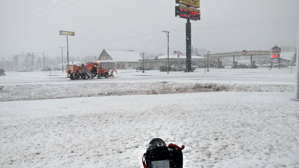
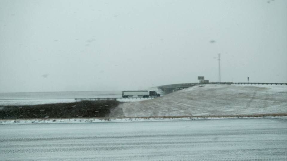
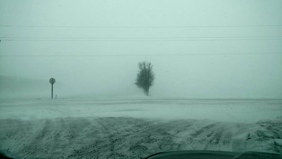
| Monday Afternoon in Hillsboro (Credit Kevin Mahoney) | Monday Afternoon I-29 near Hillsboro (Credit Kevin Mahoney) | Monday Afternoon 5 miles south of Grand Forks (Credit Kevin Mahoney) |
| Surface Low Pressure Loop |
 |
Media use of NWS Web News Stories is encouraged! Please acknowledge the NWS as the source of any news information accessed from this site. |
 |