Overview
There were two different focus areas on Wednesday, June 7th, 2017. First, a cold front would exit into central Minnesota during the afternoon, spawning a few thunderstorms. Then, behind this front, an upper level disturbance would move into the Red River Valley during the late morning and early afternoon. The upper level disturbance proved to be the main weather producer for the day. Many factors came into play, helping to make this an ideal day for cold core tornadoes. Along with the upper level disturbance, there was abundant sunshine and good heating through the morning, which resulted in a frontal boundary and an area of surface low pressure setting up along the western edge of the Red River Valley. Between roughly noon and 2 pm, 8 tornado warnings and 1 severe thunderstorm warning were issued over the central and northern Red River Valley.Tornadoes:
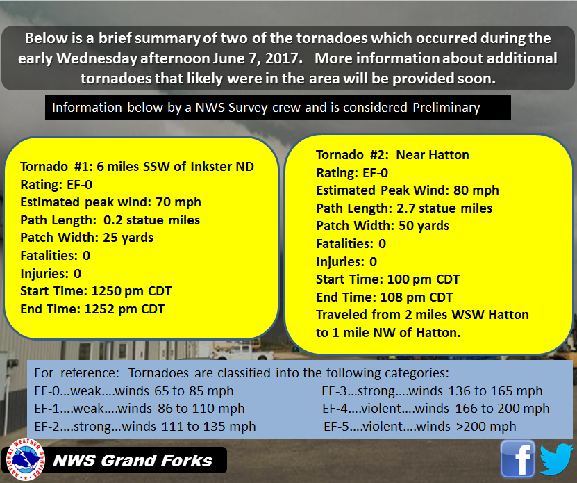
The Enhanced Fujita (EF) Scale classifies tornadoes into the following categories:
| EF0 Weak 65-85 mph |
EF1 Moderate 86-110 mph |
EF2 Significant 111-135 mph |
EF3 Severe 136-165 mph |
EF4 Extreme 166-200 mph |
EF5 Catastrophic 200+ mph |
 |
|||||
Surface Maps
These are the Weather Prediction Center's official surface maps for several hours on June 7th.
Satellite:
Here are loops of Water Vapor and Infrared Imagery.
| Water Vapor |
Infrared |
Radar:
This is a radar loop that covers the event.
| Radar Imagery |
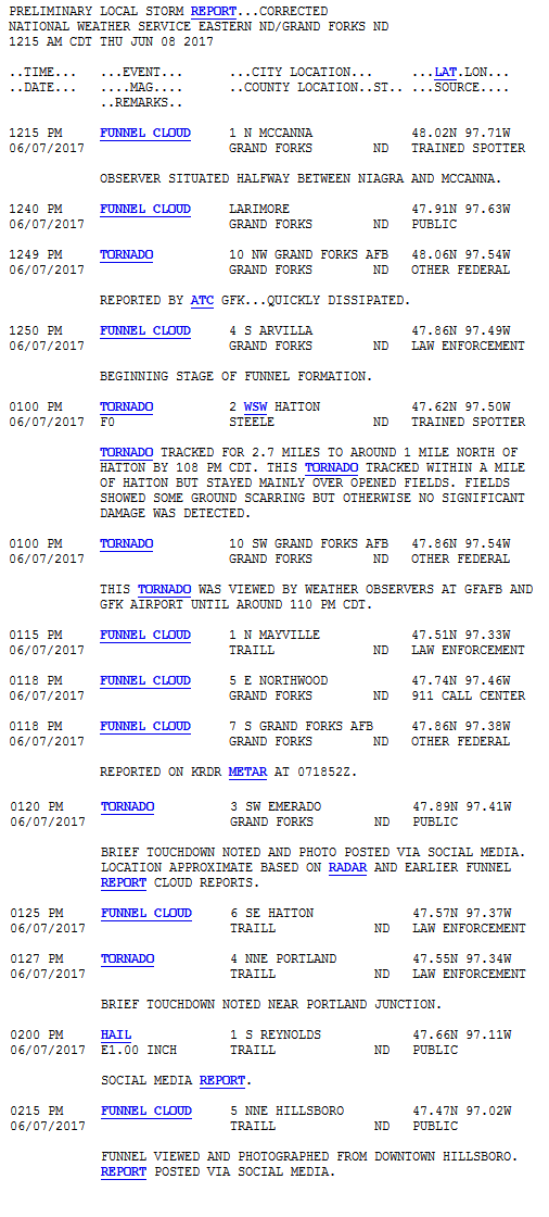
Storm Reports
This map shows the preliminary storm reports that were received June 7th, 2017.
 |
Here are the actual reports.
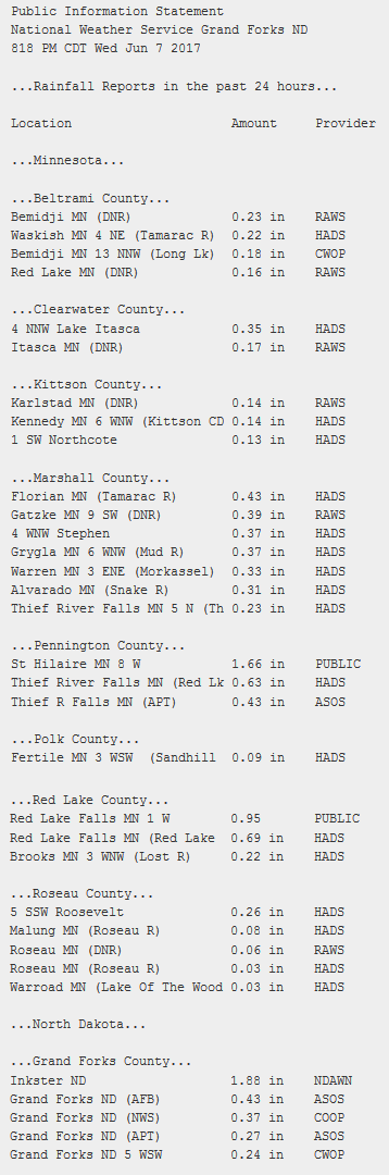
Rain Reports
Here is a map of the rainfall amounts from yesterday. It may not capture all areas exactly, but does show the areas well.
 |
Here are some of the rainfall reports we received.
Environment
Here are some of the various weather parameters at 1 pm on June 7th, as warnings began.
 |
 |
 |
| Water Vapor showing the spin | Temperatures | Winds |
 |
 |
 |
| Fronts | Dew point |
500mb Temperatures |
 |
 |
 |
| NST (A tornado parameter) | Radar | Raw Water Vapor |
The tornado watch and warnings issued
 |
|
| SPC Tornado Watch | NWS Grand Forks Warnings |
 |
Media use of NWS Web News Stories is encouraged! Please acknowledge the NWS as the source of any news information accessed from this site. |
|

