Overview
|
A powerful winter storm moved through the region over the holidays, affecting the region Christmas day and into Monday. Freezing drizzle on the morning of the 25th led to icy roads. Heavier precipitation moved into the region during the afternoon hours of the 25th and continued into the evening and overnight hours. This precipitation started as freezing rain across southeast North Dakota and west central Minnesota, with some locations receiving significant ice accumulation which led to sporadic power outages. Temperatures across this area eventually rose above freezing for a brief period of time which led to rain and limited ice impacts. This precipitation transitioned to sleet and snow further to the north. The heavy snow across northeast North Dakota and adjacent portions of Minnesota occurred with strong winds, leading to blizzard conditions. As the system moved off to the east Monday morning, winds switched to the north/northwest and gusts up to 50 mph lead to blizzard conditions across much of eastern North Dakota and adjacent portions of Minnesota into Monday afternoon. Most major roadways were closed from late Sunday night through much of Monday afternoon. |
Water Vapor Imagery |
Wind:
...Highest Wind Reports During December 25-26, 2016 Winter Storm...

Location                     Speed     Time/Date
Wadena MN (APT)              58 MPH    0214 AM 12/26
Rothsay MN (DOT)             53 MPH    1035 PM 12/25
Tenney MN (DOT)              50 MPH    0905 AM 12/26
Wahpeton ND (APT)            48 MPH    0935 AM 12/26
Devils Lake DOT Hwy 20       48 MPH    0538 AM 12/26
Cando ND (APT)               46 MPH    0535 AM 12/26
Grafton ND (APT)             46 MPH    0715 AM 12/26
Grand Forks ND (APT)         46 MPH    0830 AM 12/26
Hallock MN (APT)             46 MPH    1154 PM 12/25
Devils Lake ND (APT)         45 MPH    0633 AM 12/26
Fergus Falls MN (APT)        45 MPH    1054 PM 12/25
Lake Park MN (DOT)           45 MPH    0950 PM 12/25
Verndale MN (DOT)            45 MPH    0215 AM 12/26
4 W Churchs Ferry            45 MPH    0538 AM 12/26
Staples MN (APT)             45 MPH    0232 AM 12/26
Elbow Lake MN (APT)          45 MPH    1220 PM 12/25
Hendrum MN (DOT)             44 MPH    1202 AM 12/26
Bowesmont ND (DOT)           44 MPH    0908 AM 12/26
Wahpeton ND (DOT)            44 MPH    0838 AM 12/26
Crookston MN (APT)           43 MPH    1135 AM 12/26
Langdon ND (APT)             43 MPH    1055 AM 12/26
Fargo ND (APT)               43 MPH    1256 PM 12/26
Donaldson MN (DOT)           43 MPH    1240 PM 12/26
Mahnomen MN (DOT)            43 MPH    1251 AM 12/26
St Vincent MN (DOT)          43 MPH    1230 PM 12/26
Buxton ND 4 S (DOT)          43 MPH    0938 AM 12/26
Buffalo ND 7 N (DOT)         43 MPH    0938 AM 12/26
Grand Forks ND (DOT)         43 MPH    1138 AM 12/26
Mcleod ND 3 N                43 MPH    1149 AM 12/26
Dilworth MN (DOT)            42 MPH    0120 PM 12/26
Park Rapids MN (APT)         41 MPH    0142 PM 12/26
Cavalier ND (APT)            40 MPH    1115 AM 12/26
Mahnomen MN (APT)            40 MPH    1255 AM 12/26
Walhalla ND (APT)            40 MPH    1055 AM 12/26
Moorhead MN (APT)            40 MPH    0933 AM 12/26
Emerado ND (DOT)             40 MPH    1223 PM 12/26
Grand Forks ND (AFB)         40 MPH    0855 AM 12/26
Roseau MN (DNR)              40 MPH    0108 AM 12/26
Chamberlain MN (DOT)         39 MPH    0135 PM 12/26
E Grand Forks MN (DOT)       39 MPH    0828 AM 12/26
Thief R Falls MN (APT)       39 MPH    1213 PM 12/26
Baudette MN (APT)            38 MPH    0833 PM 12/25
Bemidji MN (APT)             38 MPH    0152 PM 12/26
Detroit Lakes MN (DNR)       38 MPH    0120 PM 12/26
Detroit Lakes MN (APT)       38 MPH    1014 AM 12/26
Kelliher MN (DNR)            38 MPH    0107 AM 12/26
Karlstad MN (DNR)            38 MPH    0206 PM 12/26
Roseau MN (APT)              38 MPH    1234 AM 12/26
Cooperstown ND (APT)         38 MPH    0715 AM 12/25
Frontier ND (S Fargo)        37 MPH    0101 PM 12/26
Badger MN (DOT)              37 MPH    1210 AM 12/26
Ottertail MN (DOT)           37 MPH    0100 PM 12/26
Badoura MN (DNR)             36 MPH    0206 PM 12/26
Bemidji MN (DNR)             36 MPH    0306 PM 12/26
Fosston MN (APT)             36 MPH    1234 PM 12/26
Brooks MN (DOT)              36 MPH    1205 PM 12/26
Moorhead MN (DOT)            36 MPH    1120 AM 12/26
7 N Salol                    35 MPH    1130 PM 12/25
Bagley MN                    35 MPH    1240 AM 12/26
Shooks MN (DOT)              35 MPH    0410 PM 12/26
Gatzke MN 2 ENE              35 MPH    1205 PM 12/26

Observations are collected from a variety of sources with varying
equipment and exposures. Not all data listed are considered official.
Snow:

...STORM TOTAL SNOWFALL REPORTS FROM AROUND THE AREA...

HEAVY SNOW REPORTS

LOCATION                  SNOW FALL     TIME/DATE
                           (INCHES)   OF OBSERVATION    LAT    LON
MINNESOTA

...LAKE OF THE WOODS COUNTY...
  FLAG ISLAND                  4.5 E   830 AM 12/26   49.32N  94.89W

LOCATION                  SNOW FALL     TIME/DATE
                           (INCHES)   OF OBSERVATION    LAT    LON
NORTH DAKOTA

...BENSON COUNTY...
  9 NNW ESMOND                17.8 M   830 PM 12/26   48.15N  99.84W

...CAVALIER COUNTY...
  LANGDON                     13.0 E   600 PM 12/26   48.76N  98.37W

...GRAND FORKS COUNTY...
  NORTHWOOD                    8.0 E   600 PM 12/26   47.74N  97.57W
  NIAGARA                     10.0 E   600 PM 12/26   48.00N  97.87W

...PEMBINA COUNTY...
  NECHE                       10.0 E   734 AM 12/26   48.98N  97.55W
  CAVALIER                    11.9 M   236 PM 12/26   48.80N  97.62W

...RAMSEY COUNTY...
  DEVILS LAKE                 10.0 E   714 AM 12/26   48.11N  98.87W
  6 SE PENN                   13.5 M  1000 AM 12/26   48.16N  99.00W

...STEELE COUNTY...
  5 NW HOPE                    7.2 M   600 AM 12/27   47.38N  97.80W

...TOWNER COUNTY...
  CANDO                       13.0 E   714 AM 12/26   48.49N  99.20W
  CANDO                       16.0 E   700 PM 12/26   48.49N  99.20W

SNOW REPORTS

LOCATION                  SNOW FALL     TIME/DATE
                           (INCHES)   OF OBSERVATION    LAT    LON
MINNESOTA

...BECKER COUNTY...
  6 S LAKE PARK                1.4 M   600 AM 12/27   46.80N  96.10W
  6 N DETROIT LAKES            1.7 M   830 PM 12/26   46.90N  95.84W

...BELTRAMI COUNTY...
  4 E TURTLE RIVER             1.7 M   830 PM 12/26   47.59N  94.67W
  1 S THORHULT                 4.2 M   830 PM 12/26   48.22N  95.25W

...CLAY COUNTY...
  SABIN                        0.3 M   830 PM 12/26   46.78N  96.65W

...KITTSON COUNTY...
  KARLSTAD                     3.4 M   600 AM 12/27   48.58N  96.52W

...NORMAN COUNTY...
  ADA                          1.0 M   830 PM 12/26   47.30N  96.51W

...OTTER TAIL COUNTY...
  2 S BATTLE LAKE              1.3 M   600 AM 12/27   46.26N  95.72W
  2 SE OTTERTAIL               2.0 M   830 PM 12/26   46.41N  95.53W

...ROSEAU COUNTY...
  4 W WARROAD                  4.5 M   830 PM 12/26   48.91N  95.41W
  ROSEAU                       4.5 E   734 AM 12/26   48.85N  95.76W

...WADENA COUNTY...
  2 WSW MENAHGA                1.1 M   600 AM 12/27   46.74N  95.14W

...WILKIN COUNTY...
  3 E BRECKENRIDGE             0.2 M   830 PM 12/26   46.26N  96.53W

LOCATION                  SNOW FALL     TIME/DATE
                           (INCHES)   OF OBSERVATION    LAT    LON
NORTH DAKOTA

...BARNES COUNTY...
  LITCHVILLE                   3.0 M   100 PM 12/26   46.66N  98.19W

...CASS COUNTY...
  3 NE FARGO                   0.3 M   600 AM 12/27   46.91N  96.77W
  3 S FARGO                    0.6 M   830 PM 12/26   46.83N  96.82W

...GRAND FORKS COUNTY...
  GRAND FORKS                  3.5 M   600 AM 12/27   47.92N  97.07W
  4 W GRAND FORKS              3.6 M   830 PM 12/26   47.92N  97.16W

...RICHLAND COUNTY...
  LIDGERWOOD                   0.3 M   830 PM 12/26   46.07N  97.15W

...TRAILL COUNTY...
  1 W MAYVILLE                 4.2 M   830 PM 12/26   47.50N  97.35W
Christmas Blizzard History
Since 1975 (over the past 41 years). there have been 4 blizzards that affected Christmas day.
2016 - A powerful winter storm moved through the region over the holidays, affecting the region Christmas day and into Monday. Freezing drizzle on the morning of the 25th led to icy roads. Heavier precipitation moved into the region during the afternoon hours of the 25th and continued into the evening and overnight hours. This precipitation started as freezing rain across southeast North Dakota and west central Minnesota, with some locations receiving significant ice accumulation which led to sporadic power outages. Temperatures across this area eventually rose above freezing for a brief period of time which led to rain and limited ice impacts. This precipitation transitioned to sleet and snow further to the north. The heavy snow across northeast North Dakota and adjacent portions of Minnesota occurred with strong winds, leading to blizzard conditions. As the system moved off to the east Monday morning, winds switched to the north/northwest and gusts up to 50 mph lead to blizzard conditions across much of eastern North Dakota and adjacent portions of Minnesota into Monday afternoon. Most major roadways were closed from late Sunday night through much of Monday afternoon.
2009 - As the area of low pressure stagnated over Iowa, it deepened and brought stronger north to northeast winds to eastern North Dakota. The combination of snow and strong winds brought whiteout conditions to eastern North Dakota. One rarity of the blizzard was the relatively warm temperatures (20s) that held throughout the event. Conditions finally improved on the morning of the 26th, but it took a long time to dig out from all the snow. Interstates 29 and 94 were both closed for an extended period of time, with travel and all other activities essentially shut down. Many of the larger cities spent thousands of dollars on employee salaries, fuel, and maintenance costs for plowing snow. The 25.5 inch storm total snowfall measured at the Grand Forks National Weather Service office was one of its highest storm total amounts ever.
1992 - An arctic front swept through the region producing strong winds and a brief period of ground blizzard conditions early Christmas morning.
1983 - Pressure gradient between arctic high pressure and a departing low pressure system produced a trace of snow, very strong winds, and ground blizzard conditions early Christmas morning. Dangerous wind chills followed this event.
Photos:
 |
 |
.jpg) |
 |
| Ice on Power Lines in Cass County (Cass County Electric) |
Downed Power Lines (Cass County Electric) |
Web Cam Images at 4am Dec 26 (NDDOT and MNDOT) |
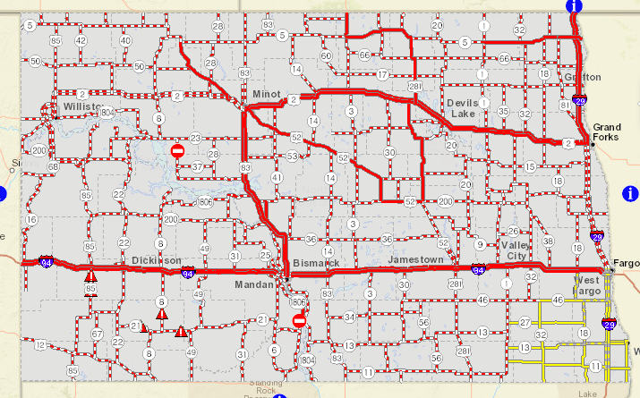
Road Closures in North Dakota at Noon Dec 26 (NDDOT) |
Radar and Weather Map Loops:
|
6am Dec 25 through 6pm Dec 25 |
6pm Dec 25 through 6am Dec 26 |
6am Dec 26 through 6pm Dec 26 |
|
Surface Pressure and Winds |
Observations |
500mb Pattern |
Liquid Equivalent Reports
...Christmas Storm 2016 Liquid Equivalent Reports...

Location                     Amount
Litchville ND                1.59 in
Hope ND 5 NW                 1.11 in
Lisbon ND                    0.96 in
Pembina ND                   0.94 in
Durbin ND                    0.92 in
Campbell MN 4 W (Rabbitt R)  0.89 in
Menahga MN 1 W               0.87 in
Ada MN                       0.85 in
Mayville ND                  0.85 in
Warroad MN 4 W               0.85 in
Mcleod ND 3 N                0.83 in
Casselton ND                 0.83 in
Pelican Rapids MN            0.81 in
Argyle MN                    0.75 in
Karlstad                     0.74 in
Fargo ND                     0.73 in
Oxbow ND  1 SSE              0.73 in
Mcleod ND 3 E                0.72 in
Sebeka MN                    0.72 in
Breckenridge MN 3 SE         0.71 in
Lidgerwood ND                0.69 in
Breckenridge MN (Ottertail R 0.68 in
Abercrombie ND               0.67 in
Sarles ND                    0.65 in
Sabin MN                     0.65 in
Crookston MN                 0.64 in
North River ND 2 ESE         0.64 in
Glyndon MN 2 Ww (SB Buffalo  0.64 in
March MN 4 NNE               0.63 in
Westbury MN 3 ESE            0.62 in
Grand Forks ND (NWS)         0.61 in
Glyndon MN 2 N (Buffalo R)   0.59 in
Wadena MN 13 E (Leaf R)      0.59 in
Cormorant MN 5 NW            0.59 in
Campbell MN (Rabitt R)       0.57 in
Havana ND                    0.57 in
Michigan ND                  0.57 in
Fergus Falls MN 3 W (Pelican 0.56 in
Greenbush MN                 0.56 in
Esmond ND 9 NNW              0.52 in
Grand Forks ND (APT)         0.52 in
3 E Turtle River             0.52 in
Ada MN (Wild Rice R)         0.51 in
Park Rapids MN (APT)         0.51 in


Observations are collected from a variety of sources with varying
equipment and exposures. Not all data listed are considered official.
 |
Media use of NWS Web News Stories is encouraged! Please acknowledge the NWS as the source of any news information accessed from this site. |
|

