Grand Forks, ND
Weather Forecast Office
Overview
|
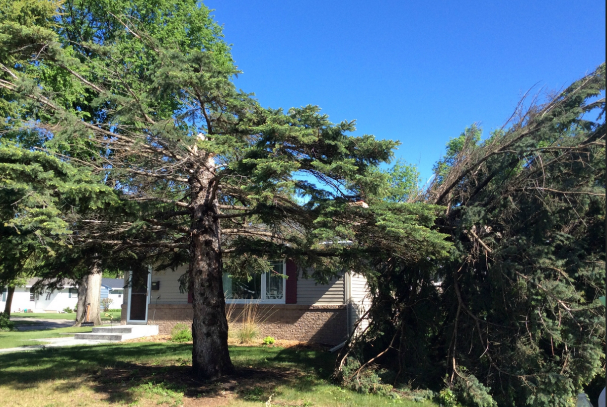
Thunderstorms formed across central and eastern North Dakota during the evening of May 22 and organized into a line of storms by late evening across eastern North Dakota. Rainfall amounts between 0.75 and 2.00 inches occurred from Valley City northeastward to Pembina. Gusty winds in the 40 to 50 mph range were common along the leading edge of the line of storms. A localized region of enhanced straight line wind damage from a microburst occurred across eastern sections of Grand Forks into East Grand Forks, with estimated wind speeds up to 100-110 mph. |
.PNG) Damage Area |
 |
 |
Media use of NWS Web News Stories is encouraged! Please acknowledge the NWS as the source of any news information accessed from this site. |
|
US Dept of Commerce
National Oceanic and Atmospheric Administration
National Weather Service
Grand Forks, ND
4797 Technology Circle
Grand Forks, ND 58203-0600
701-772-0720
Comments? Questions? Please Contact Us.


