Overview
The most severe blizzard of the season affected the region this past Sunday, January 26th. A couple clipper systems moved through the region which made conditions perfect for this event to occur. The first clipper system brought 2 to 4 inches of fluffy snow to the region Saturday evening, which would easily blow around. The second clipper system brought a strong cold front, which moved through the region during the late morning and early afternoon hours. As this strong cold front moved through the region, winds would increase into the 30 to 40 mph range, with gusts to over 50 mph. The combination of new fluffy snow and strong winds caused blowing snow and ground blizzard conditions across much of the region. Visibilities were reported to be as low as zero (near whiteout) in open country, and even below a quarter mile at times within the more sheltered urban areas. Interstate 29 and Interstate 94 closed, as well as many highways across the region.Photos & Video
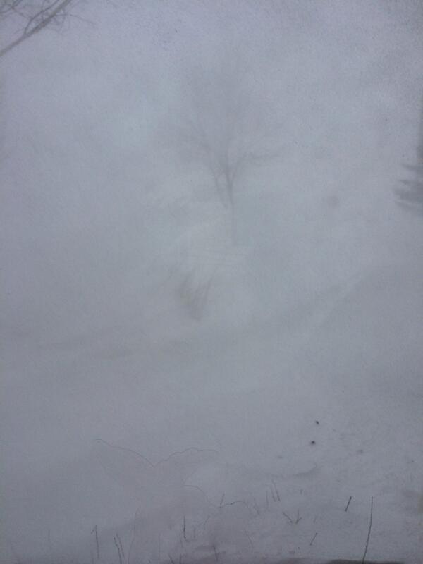 |
 |
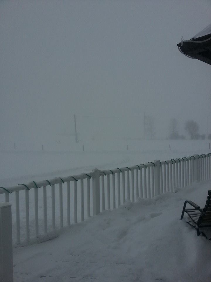 |
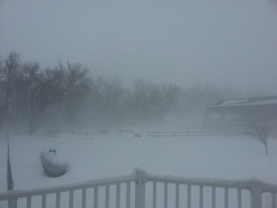 |
| Pembina, ND 1:00 p.m. |
Walhalla, ND Main Street 1:00 p.m. |
Near Gilby, ND Early Afternoon |
Near Gilby, ND Early Afternoon |
 |
|||
|
I-29 Near Grand Forks Early Afternoon (Courtesy NDDOT) |
Storm Reports
Highest Reported Wind Gusts:
LOCATION SPEED TIME/DATE
COOPERSTOWN ARPT 60 1155 AM 01/26
GRAFTON AIRPORT 58 0235 PM 01/26
DONALDSON 57 0330 PM 01/26
FERGUS FALLS AIRPORT 56 0613 PM 01/26
2 W TENNEY 55 0110 PM 01/26
GWINNER ARPT i 54 0235 PM 01/26
BUXTON-MAYVILLE BRIDGE 54 0132 PM 01/26
VALLEY CITY AIRPORT i 53 1255 PM 01/26
CANDO AIRPORT 53 0115 PM 01/26
5 SE EAST GRAND FORKS 53 0245 PM 01/26
LANGDON AIRPORT 52 0915 AM 01/26
GRAND FORKS INTL ARPT 52 0216 PM 01/26
5 NNW GRAND FORKS 52 0305 PM 01/26
ROTHSAY 51 0305 PM 01/26
CROOKSTON AIRPORT 51 0355 PM 01/26
HAMPDEN 51 0158 PM 01/26
SAINT VINCENT i 50 0550 PM 01/26
4 ENE HENDRUM 50 0250 PM 01/26
DILWORTH 50 0230 PM 01/26
WAHPETON AIRPORT 49 0235 PM 01/26
ELBOW LAKE AIRPORT 49 0553 PM 01/26
FARGO-HECTOR INTL ARPT 49 0412 PM 01/26
CAVALIER AIRPORT 49 0115 PM 01/26
DEVILS LAKE AIRPORT 49 1115 AM 01/26
MOORHEAD AIRPORT 48 0335 PM 01/26
WADENA AIRPORT 48 1114 AM 01/26
WALHALLA AIRPORT 47 1155 AM 01/26
DETROIT LAKES AIRPORT 47 0315 PM 01/26
GRAND FORKS AFB 47 0923 AM 01/26
3 ENE GATZKE 46 0420 PM 01/26
DETROIT LAKES DNR 46 0420 PM 01/26
3 WSW OTTERTAIL 46 0155 PM 01/26
DRESDEN 46 0950 AM 01/26
HALLOCK AIRPORT 46 1213 PM 01/26
2 WNW VERNDALE 45 1105 AM 01/26
3 S BROOKS 45 0729 AM 01/26
BINFORD 45 0231 PM 01/26
AGASSIZ NWR 44 0420 PM 01/26
FOSSTON AIRPORT 44 0835 AM 01/26
PARK RAPIDS AIRPORT 43 0351 PM 01/26
SHEYENNE NATL GRASSLANDS 42 1249 PM 01/26
STAPLES AIRPORT 41 1013 AM 01/26
THIEF RIVER FALLS ARPT 40 0455 PM 01/26
1 ENE KARLSTAD 40 0532 PM 01/26
BAUDETTE AIRPORT 39 0504 PM 01/26
WARROAD AIRPORT 38 0441 PM 01/26
FLAG ISLAND 38 0613 PM 01/26
BEMIDJI DNR 38 0306 PM 01/26
BADGER 37 0327 PM 01/26
ROSEAU AIRPORT 37 0454 PM 01/26
FORT TOTTEN 36 1051 AM 01/26
BEMIDJI AIRPORT 35 0810 PM 01/26
OBSERVATIONS ARE COLLECTED FROM A VARIETY OF SOURCES WITH VARYING
EQUIPMENT AND EXPOSURE. NOT ALL DATA LISTED ARE CONSIDERED OFFICIAL.
Lowest Reported Visibilities:
LOCATION                       VISIBILITY (MILES)

...MINNESOTA...

...BECKER...
DETROIT LAKES AIRPORT          0.25

...CLAY...
DILWORTH                       0.05
MOORHEAD AIRPORT               0.00

...GRANT...
ELBOW LAKE AIRPORT             0.00

...KITTSON...
SAINT VINCENT                  0.13
DONALDSON                      0.08
HALLOCK AIRPORT                0.00

...MARSHALL...
3 ENE GATZKE                   0.02

...NORMAN...
4 ENE HENDRUM                  0.08

...OTTER TAIL...
FERGUS FALLS AIRPORT           0.25
WADENA AIRPORT                 0.25
3 WSW OTTERTAIL                0.00

...PENNINGTON...
THIEF RIVER FALLS ARPT         0.25

...POLK...
FOSSTON AIRPORT                0.25
5 SE EAST GRAND FORKS          0.11
CROOKSTON AIRPORT              0.00

...RED LAKE...
3 S BROOKS                     0.17

...ROSEAU...
WARROAD AIRPORT                0.25
ROSEAU AIRPORT                 0.25
BADGER                         0.20

...WILKIN...
2 W TENNEY                     0.04
ROTHSAY                        0.00

...NORTH DAKOTA...

...BARNES...
VALLEY CITY AIRPORT            0.25

...CASS...
FARGO (RED RIVER BRIDGE)       0.13
FARGO-HECTOR INTL ARPT         0.00

...CAVALIER...
LANGDON AIRPORT                0.00

...GRAND FORKS...
EMERADO                        0.23
GRAND FORKS INTL ARPT          0.13
GRAND FORKS AFB                0.00

...GRIGGS...
COOPERSTOWN ARPT               0.00

...PEMBINA...
WALHALLA AIRPORT               0.25
CAVALIER AIRPORT               0.00

...RAMSEY...
DEVILS LAKE AIRPORT            0.00

...RICHLAND...
WAHPETON AIRPORT               0.00
5 W WAHPETON                   0.00

...SARGENT...
GWINNER ARPT                   0.25

...TOWNER...
CANDO AIRPORT                  0.25

...WALSH...
GRAFTON AIRPORT                0.00

OBSERVATIONS ARE COLLECTED FROM A VARIETY OF SOURCES WITH VARYING
EQUIPMENT AND EXPOSURE. NOT ALL DATA LISTED ARE CONSIDERED OFFICIAL.
Environment
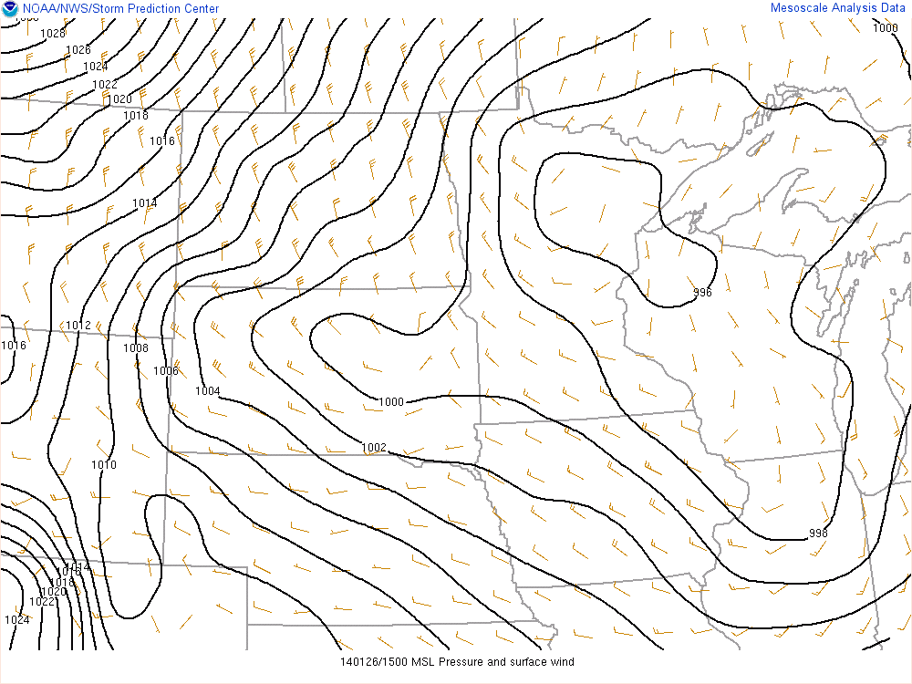
Mean sea-level pressure and surface winds maps are shown below. Throughout the day, the low pressure center, which was located to the south and east of the area, progressed towards the Great Lakes. The progression shifted the winds to be northerly by the afternoon. As the progression continued, a tightening of the pressure gradient intensified the winds, which caused a great deal of strong winds from snow that was already covering the ground.
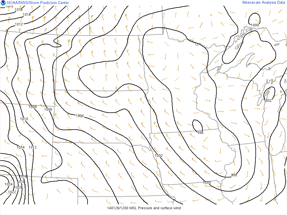 |
 |
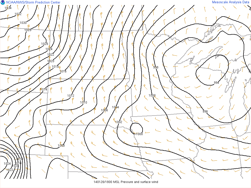 |
| Figure 1: 6:00 a.m. | Figure 2: 9:00 a.m. | Figure 3: 12:00 p.m. |
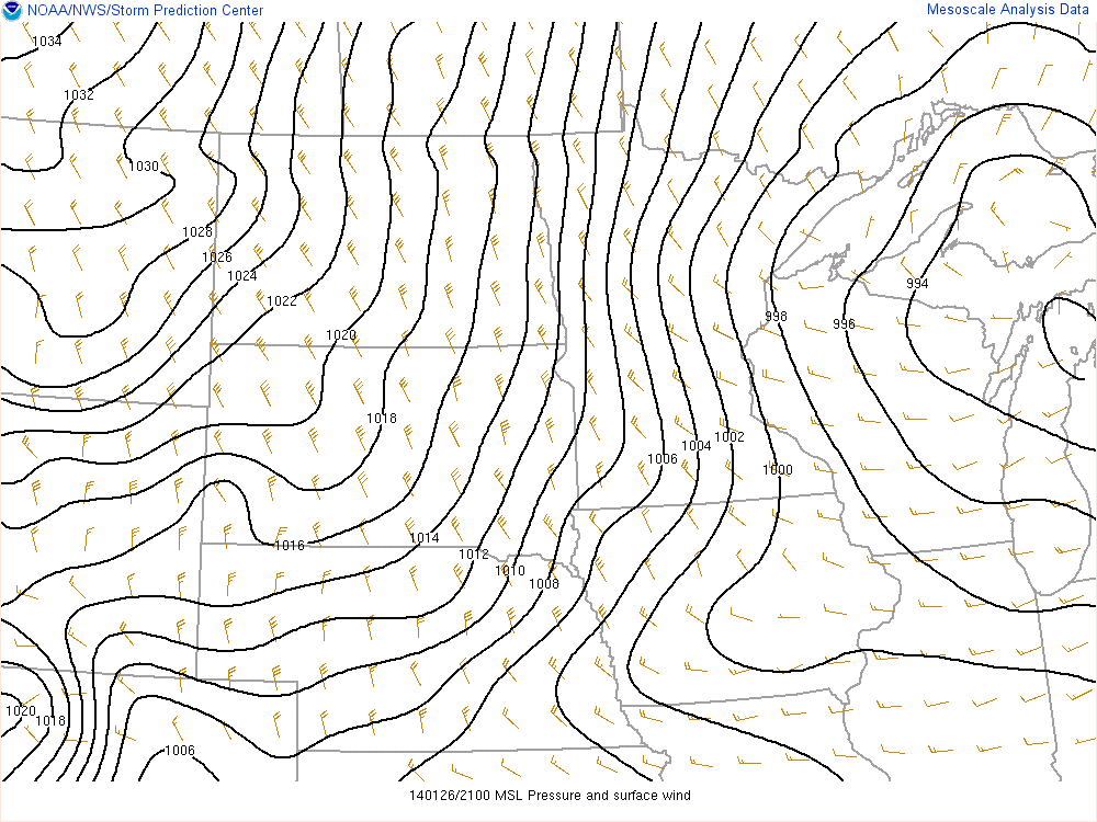 |
| Figure 4: 3:00 p.m. |
 |
Media use of NWS Web News Stories is encouraged! Please acknowledge the NWS as the source of any news information accessed from this site. |
 |