Grand Forks, ND
Weather Forecast Office
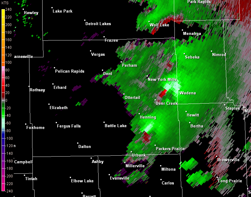
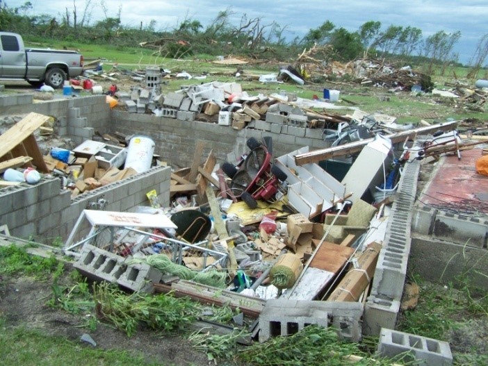
The Almora-Bluffton, Minnesota tornado was rated as an EF4, with peak winds estimated to 175 mph. This tornado made its initial touchdown about 3 miles north-northeast of Leaf Valley, MN around 345 pm CDT. The damage path continued to about 2 miles west of Parkers Prairie, passing just south of Almora, MN, just east of Deer Creek and just west of Bluffton, before lifting about 10 miles north of Bluffton around 445 pm. Damage with this tornado complex extended out as much as 1.3 miles wide at times along the 39 mile path. The most extreme damage was located along Ottertail County road 143, west and southwest of Bluffton, where several homes and farmsteads were completely destroyed. In addition, several vehicles were propelled hundreds of feet through the air while numerous trees were shredded and debarked. This tornado also produced one fatality just south of Almora, shortly before 4 pm.
The Wadena, MN tornado was rated as an EF4, with peak winds estimated to 170 mph. This tornado made its initial touchdown about 3 miles south-southwest of Wadena, MN around 5 pm CDT, and produced a continuous damage path through Wadena before lifting about 7 miles north-northeast of town by 518 pm CDT. Damage with this tornado extended as much as 1.1 miles wide at times along the 10 mile north-northeast directed path. The most extreme damage was located from the southwest Wadena residential area into the industrial area located between the high school and the Highway 10 corridor. Several homes were completely destroyed, as were several industrial or warehouse structures. In addition, several school buses and other vehicles were propelled through the air up to a few hundred feet. This was also a multi-vortex tornado, with multiple tornado tubes rotating around a common center. This multi-vortex tornado consisted of multiple tornado tubes pivoting around a common center, each tube acting singulartly or in concert to produce areas of EF1 to EF4 damage, in a path that varied from 0.1 to 1.3 miles in width. For most of this tornadoes 39 mile path, the team was able to find consistent core with EF2 or greater damage, with smaller areas of embedded EF3 to EF4 damage.
Radar Base Reflectivity and Velocity at 4:29 PM showing lead Almora-Bluffton and trailing Wadena tornadic circulations


Damage survey photo of devastation from east Ottertail County into Wadena County

US Dept of Commerce
National Oceanic and Atmospheric Administration
National Weather Service
Grand Forks, ND
4797 Technology Circle
Grand Forks, ND 58203-0600
701-772-0720
Comments? Questions? Please Contact Us.

