Grand Forks, ND
Weather Forecast Office
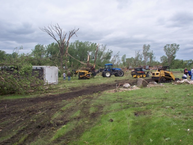
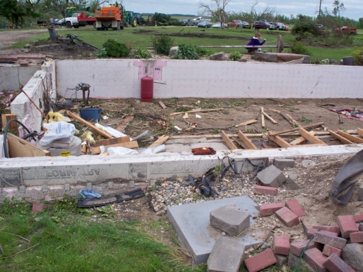
The Holmes, ND tornado was rated as an EF4, with peak winds estimated to 185 mph. This tornado made its initial touchdown roughly 1 mile north of Mayville, ND around 349 pm, and produced a near continuous damage path through rural north-central Traill county into rural south-central Grand Forks county before lifting about 10 miles west of Thompson, ND around 410 pm. The damage path was nearly 17 miles long and reached a maximum width of 150 yards at times. Damage was most extreme at a farmstead near ND Highway 15, where a home was completely swept from its foundation and destroyed.
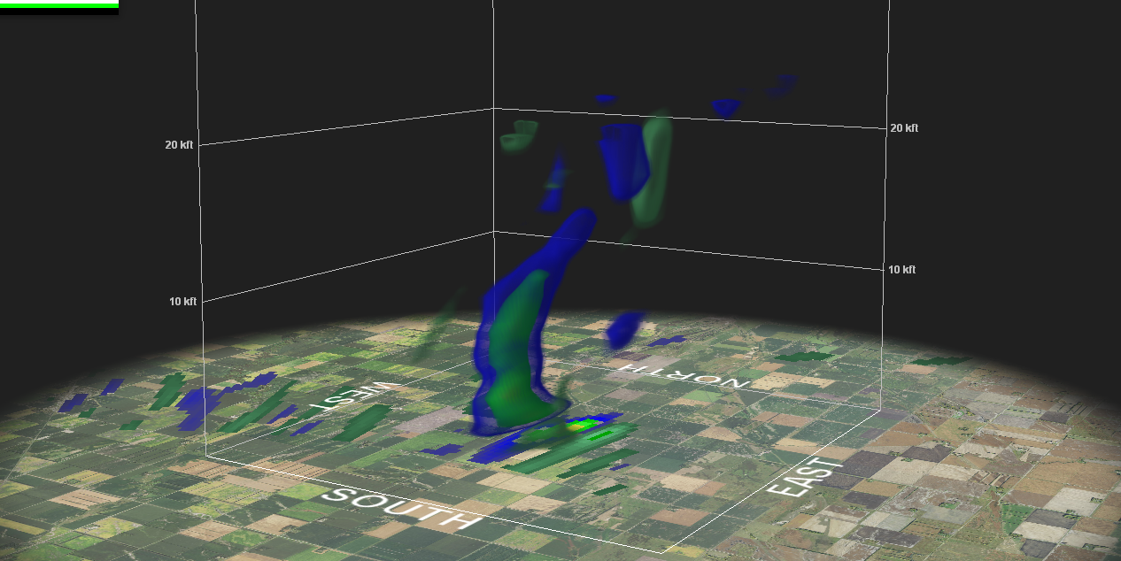
A pronounced debris ball was seen in radar reflectivity imagery (shown below), similar to the Northwood EF4 tornado in August of 2007. This debris ball showed up just north of the KMVX WSR 88D, and became a very strong signature around the time EF4 damage was inflicted.
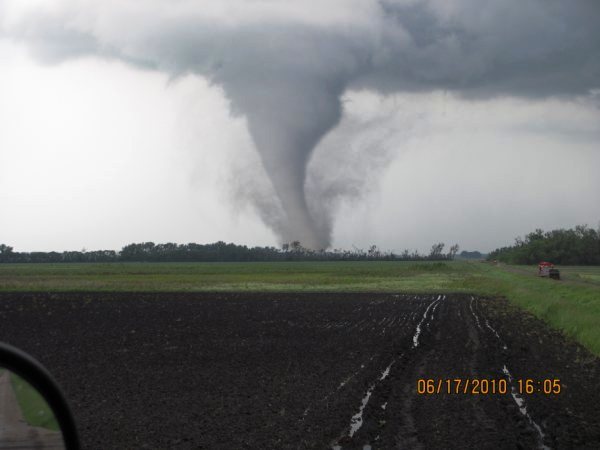
4:05 PM Mayville-Holmes tornado churning dirt west of Reynolds, ND.
Tornado damage from survey photos taken at homestead near ND Hwy 15
US Dept of Commerce
National Oceanic and Atmospheric Administration
National Weather Service
Grand Forks, ND
4797 Technology Circle
Grand Forks, ND 58203-0600
701-772-0720
Comments? Questions? Please Contact Us.

