
Dangerous heat will expand from the Gulf Coast into the Southern Plains and Desert Southwest through week's end. Additional extreme heat impacting the Pacific Northwest will shift to the northern Plains by the weekend. Tropical Storm Bertha is expected to continue to impact portions of the northern Gulf Coast from the western Florida Panhandle to southeastern Louisiana through tonight. Read More >

Figure 1
Upper air observations are taken twice a day around the world at 1200 hours and 0000 hours GMT (5 am and 5 pm MST). See Fig. 1 for U.S. locations. The observation system consists of an instrument (radiosonde), and a gas-filled balloon. This radiosonde contains various sensors that will gather temperature, humidity, and pressure data while the instrument ascends. Winds are also derived by using a GPS system that tracks the balloon location to calculate a wind speed and direction. Balloons are usually filled with hydrogen but helium is sometimes also used. The balloon is rather large, inflating to about 6 feet in diameter at the release site and increasing to as much as 20 feet in diameter before bursting at high altitude.
Balloons typically reach a height of 100,000-110,000 feet above sea level before bursting, and these flights usually last about 100 minutes. Parachutes are used with the balloons to slow the descent after burst, thereby protecting people and property from potential harm. Distance traveled by the balloons vary greatly, depending on the winds aloft over the area. It is not unusual here at Santa Teresa to see balloons/radiosondes land in Culberson County or near Carlsbad, NM with strong west winds aloft.
Data from the radiosonde are sent via radio signal to our office where computers analyze and store the data; these data are then transmitted to the National Center for Environmental Prediction (NCEP). NCEP runs a quality control check on the data and then assimilates it with other data from satellites, aircraft, radar, and surface observations, to be used in initializing numerous forecast models. These models forecast the development and movement of weather systems, and are used by the NWS and private companies around the country to issue various forecasts. For more information on radiosondes and the NWS Upper Air network, visit the NWS Upper Air page.
In September 2022, WFO El Paso/Santa Teresa began using the GRAW DFM-17 radiosonde (Fig. 2) along with new software to receive the data. The GRAW radiosonde replaces the Vaisala RS92-NG radiosonde (Fig. 3). This new radiosonde is lighter (styrofoam covering to protect electronics and battery from the elements) and more durable than the previous instrument.
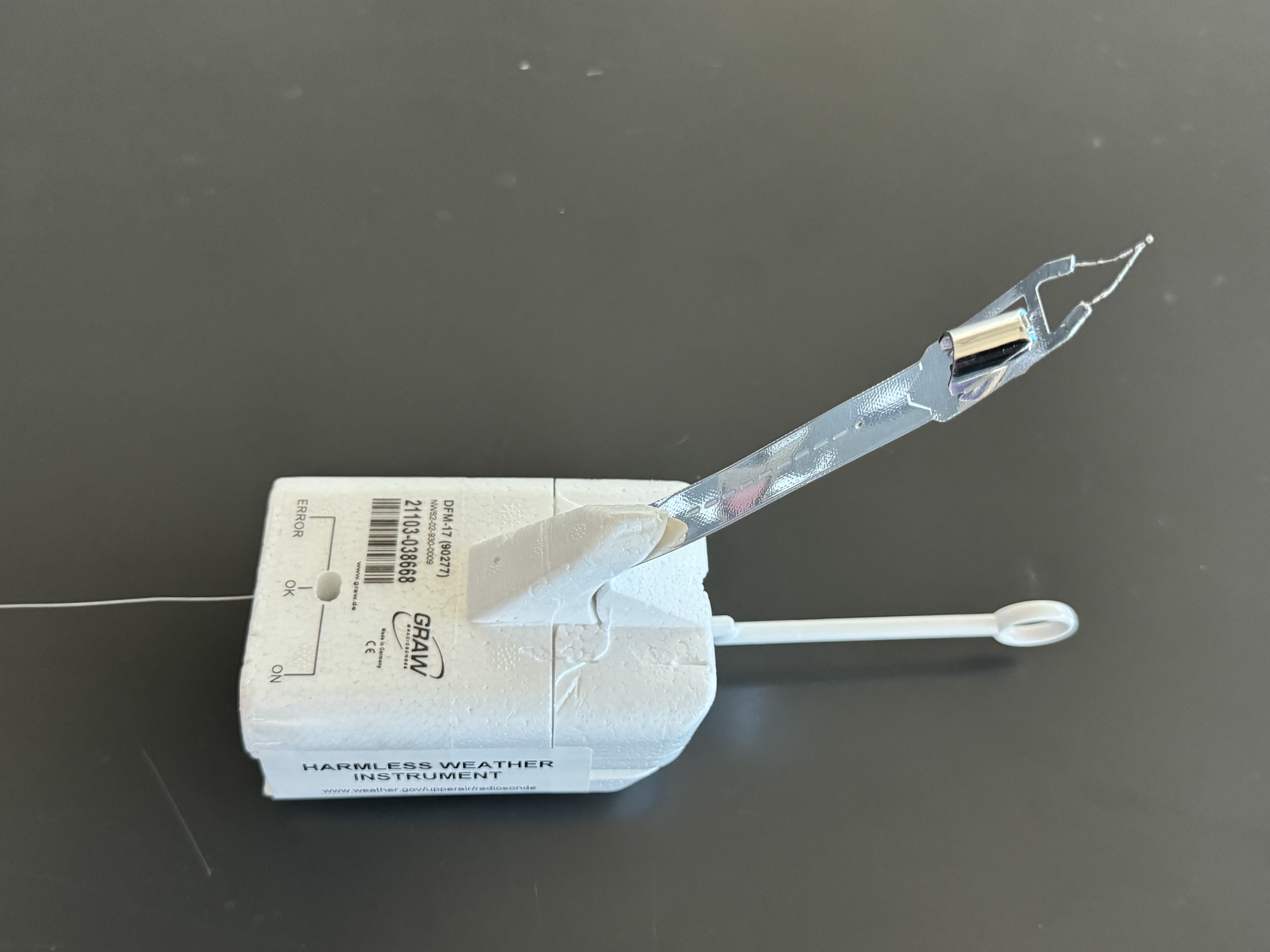
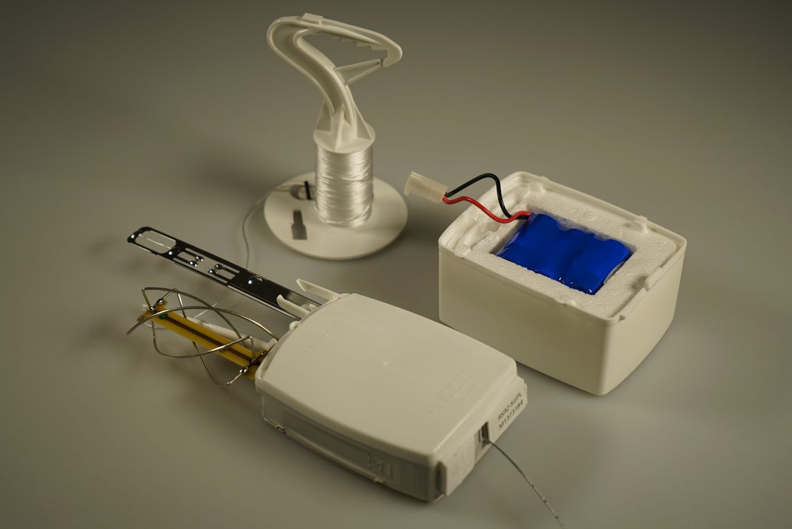
Figure 2 Figure 3
If you find a weather balloon/radiosonde, it is safe to handle ("Harmless Weather Instrument" is printed on at least three sides). For more information, click here.
**Last updated 12/10/24

