
Thunderstorms, some severe, may produce heavy to excessive rainfall and isolated flooding over portions of the Southern Plains today and Saturday. Dry conditions, combined with gusty winds and low relative humidities will continue to support an elevated to critical fire weather threat in the Desert Southwest into to early next week. Read More >
NWS El Paso will reconfigure some of its zones starting on Sept 19, 2023
This is the current configuration of our public weather zone NM402 "Southern Gila Highlands/Black Range
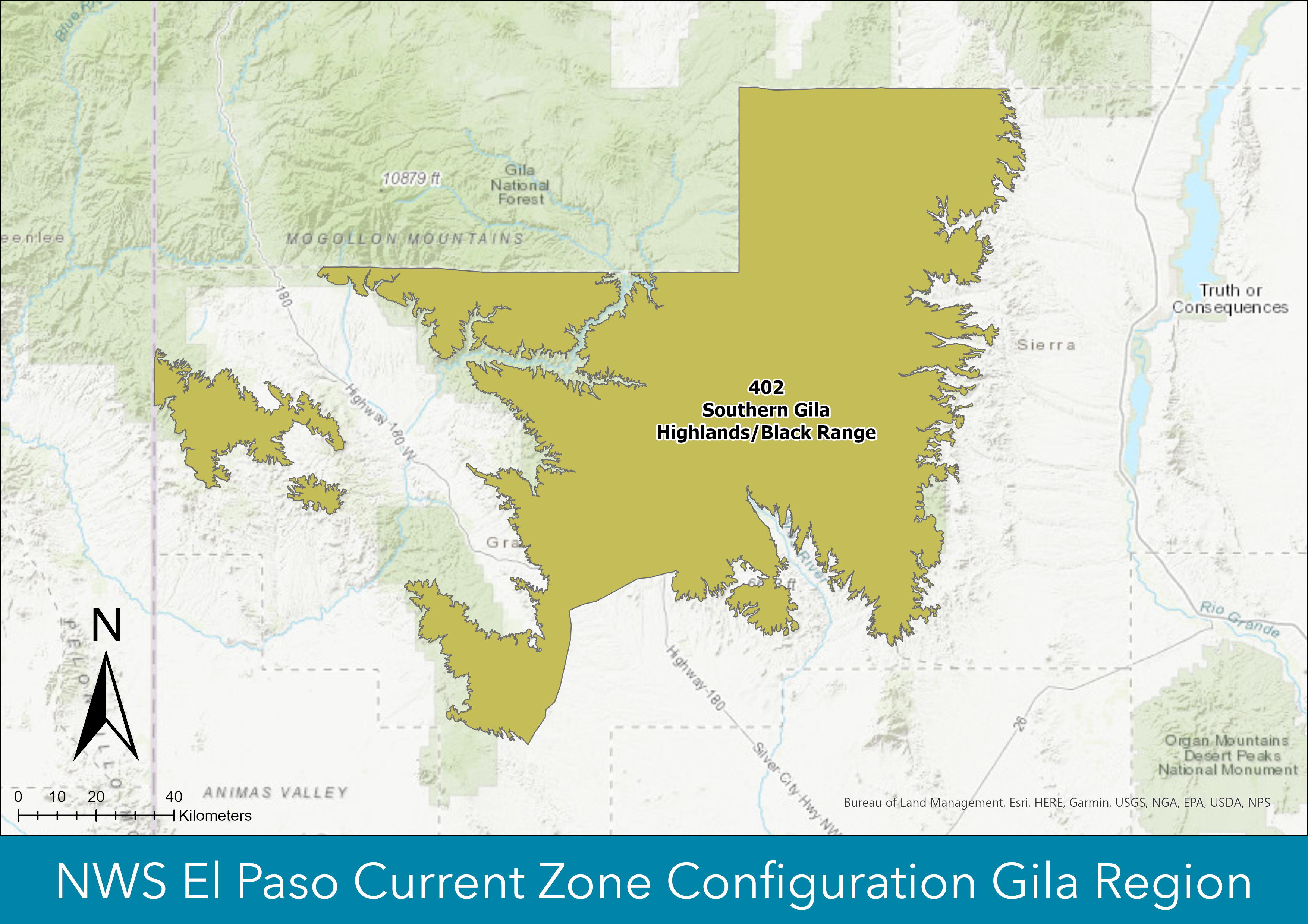
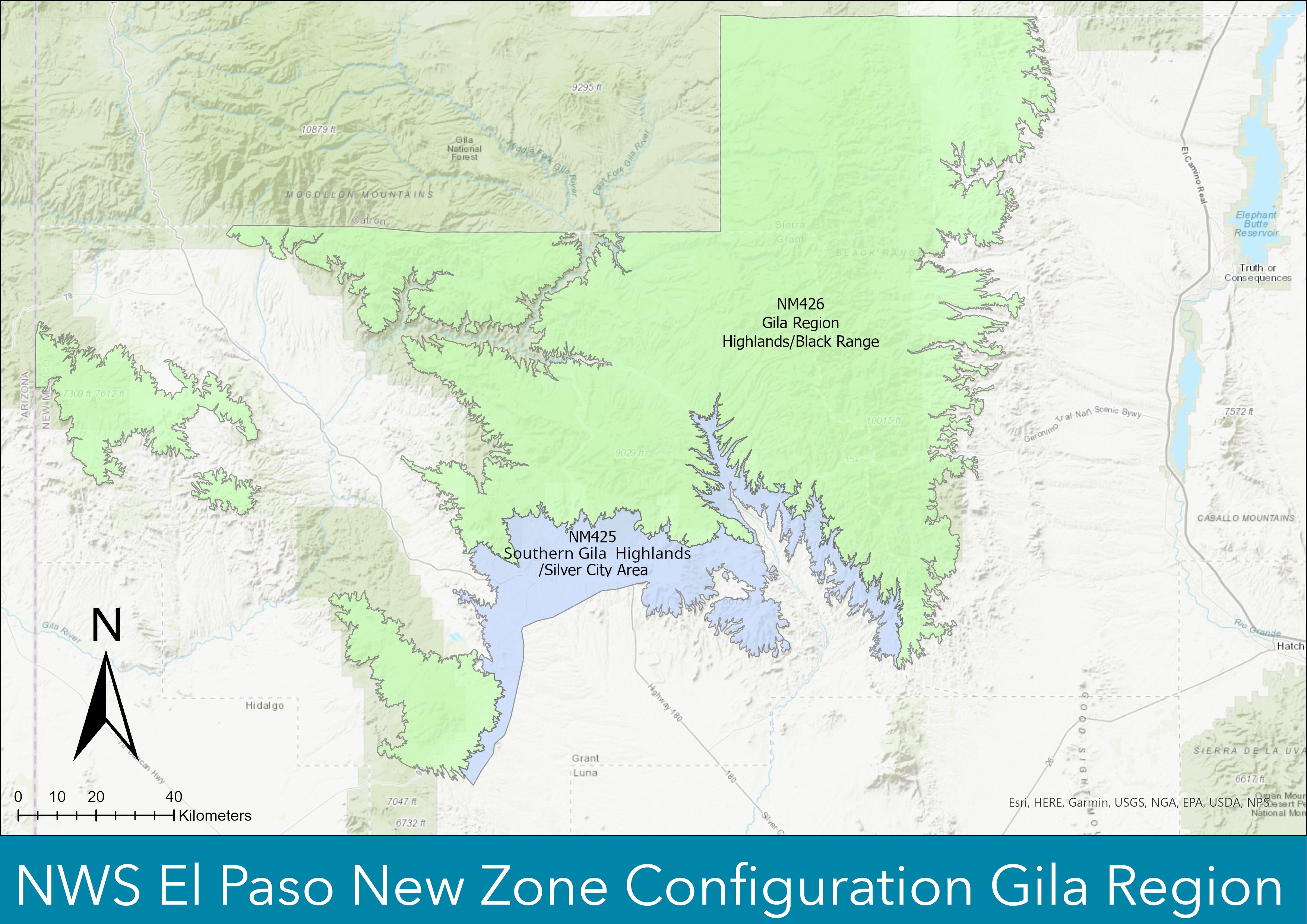
We plan to break a small section of the zone out to include Silver City. The new zone number will be NM425 and it will be called "Central Grant County/Silver City Area". We will also renumber and rename the rest of NM402. The new zone number will be NM426 and it will be named "Gila Region Highlands/Black Range".
We will also be reconfigure a couple of our Tularosa Basin zones. We will be reconfiguring NM412 "Central Tularosa Basin" and NM413 "Southern Tularosa Basin".
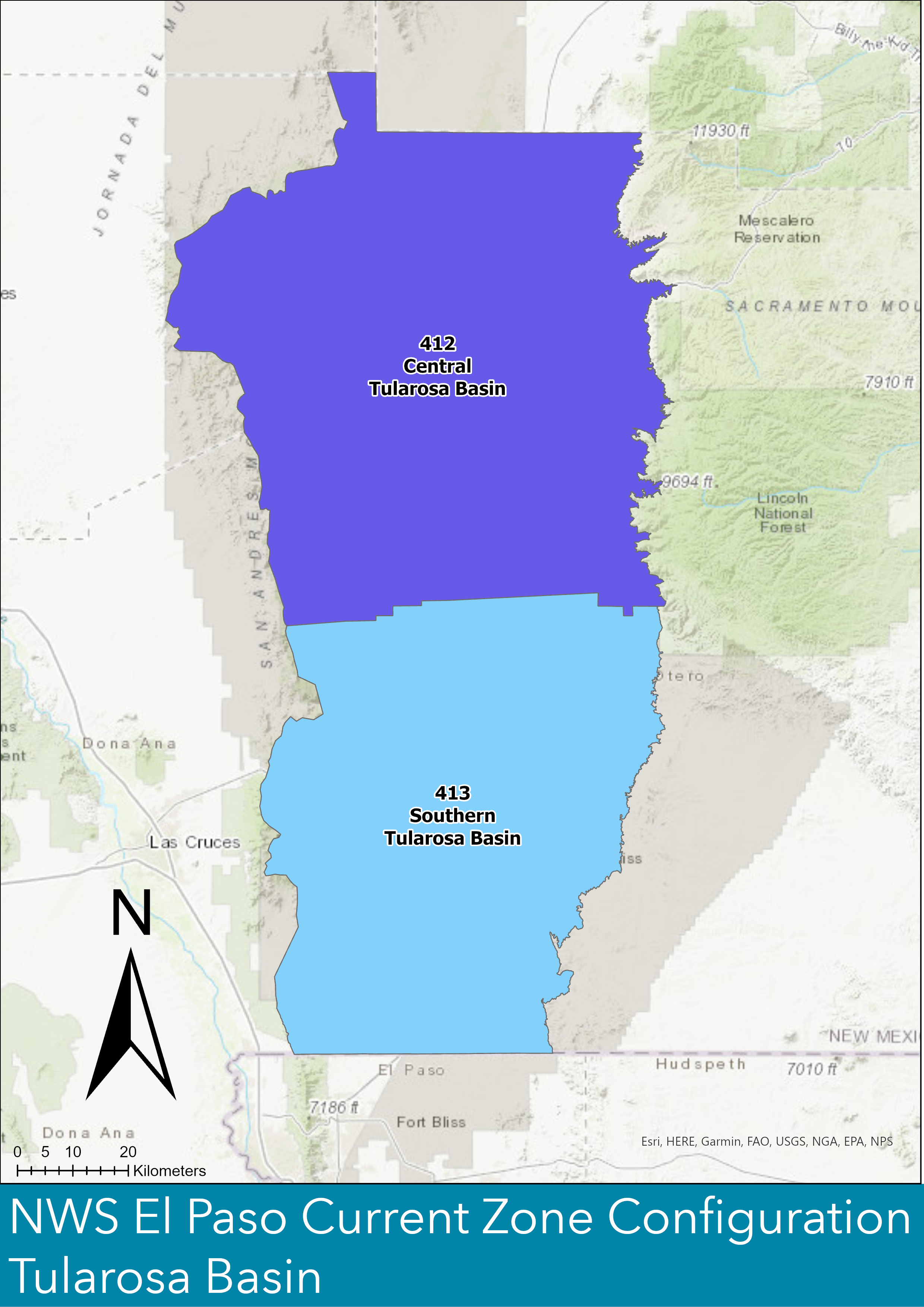
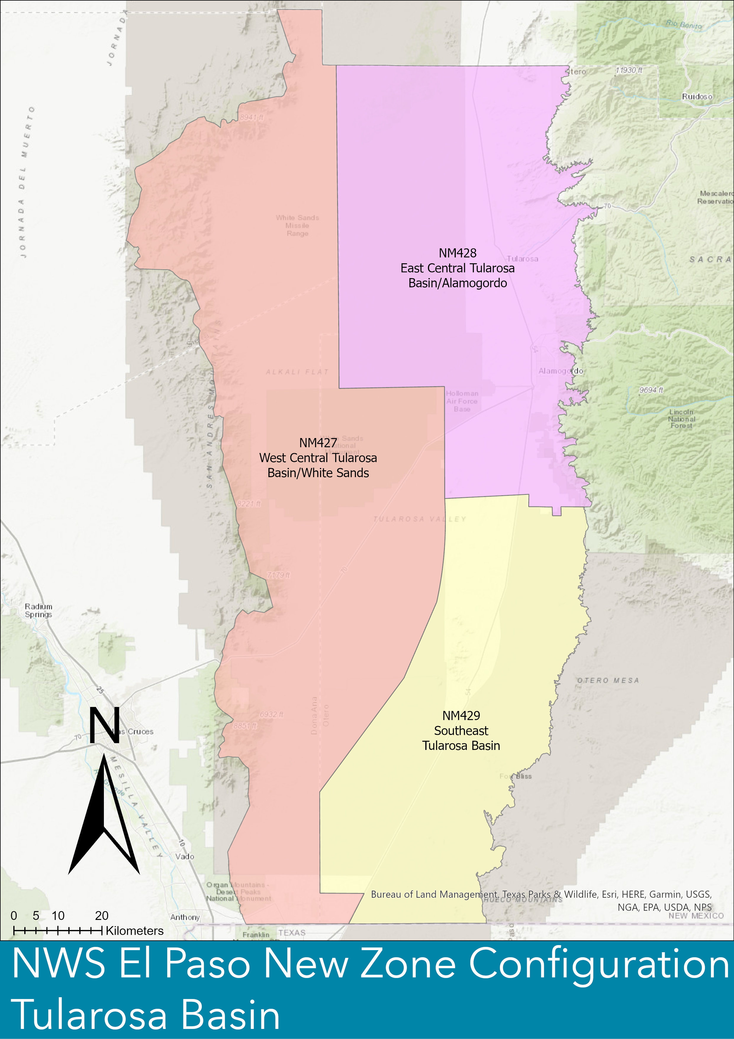
We will be splitting the zone in half and creating a new zone on the western side of the Tularosa Basin. The new zone will be numbered NM427 and will be called "West Central Tularosa Basin/White Sands". The rest of the zones will be renumbered and renamed to; NM428 "East Central Tularosa Basin/Alamogordo" and NM429 "Southeast Tularosa Basin".
These changes will result in improved warning products and forecast services for the general public. Grant, Sierra, Otero, and Dona Ana county emergency managers were consulted as part of the process and are supportive of the proposed zone reconfiguration. These are the counties affected by these zone changes.
If you have any questions about the new public weather zone configurations, please contact:
Jason Laney - NWS El Paso Warning Coordination Meteorologist - jason.laney@noaa.gov or by calling 575-589-4088 ext 223

