
June 2026 Climate Summary. Northeastern and central Nevada was on average warmer and drier than normal. No snowfall was received at any of our climate sites in June, which was normal.
(Averages and departures derived from the 1991-2020 climatological normal data base period.)
Elko: June 2026 was warmer than normal with an average temperature of 65.5 degrees, which was 2.3 degrees above normal. Elko received 0.33” of rain and 0.0” of snowfall in June, which was below average for rainfall, and normal for snowfall. The averages for rain and snow in June are 0.57” and 0.0” respectively. The period of record for the Elko area began in 1890.
Ely: June 2026 was warmer than normal with an average temperature of 64.6 degrees, which was 3.3 degrees above normal, making June 2026 tied for the 5th warmest on record. Ely received 0.04” of rain and 0.0” of snowfall in April, which was below average for rainfall, and normal for snowfall. The averages for rain and snow in June are 0.56” and 0.0” respectively. The period of record for the Ely area began in 1893.
Eureka: June 2026 was warmer than normal with an average temperature of 64.4 degrees, which was 2.7 degrees above normal, making June 2026 the 8th warmest on record. Eureka received 0.02” of rainfall in June, which was below average, making June 2026 the 5th driest on record. The average rainfall for June is 0.63”. The period of record for the Eureka airport began in 1997.
Tonopah: June 2026 was warmer than normal with an average temperature of 72.1 degrees which was 3.0 degrees above normal, making June 2026 tied for the 9th warmest on record. Tonopah received 0.00” of rainfall in June, which was below average, making June 2026 tied for the 1st driest on record. The average rainfall for June is 0.23”. The period of record for the Tonopah area began in 1954.
Winnemucca: June 2026 was warmer than normal with an average temperature of 67.7 degrees, which was 2.3 degrees above normal. Winnemucca received 0.49” of rain and 0.0” of snowfall in June, which was below average for rainfall, and normal for snowfall. The averages for rain and snow in June are 0.50” and 0.0” respectively. The period of record for the Winnemucca area began in 1877.


 Social Media - Click to view more
 Elko Radar
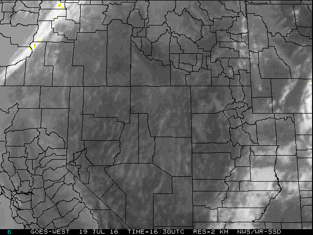 Regional Infrared Satellite Image
 National Weather Map - Click to enlarge
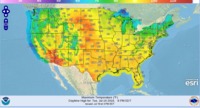 Gridded Forecast Image
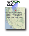 Forecast Weather Tables
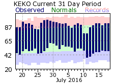 Recent LKN Temperatures
 Satellite-GOES
 Winter Weather
 Weather Stats