November 17-18, 2013
Severe Weather & High Wind Events
| Overview | Radar | SPC Products | Additional Resources |
A powerful low pressure system strengthened and tracked northeast from the western Great Lakes towards James Bay during the afternoon of November 17th through the overnight hours. This intense system brought severe weather to many parts of Illinois, Indiana, Ohio, and Michigan. Above normal temperatures and strong winds in both the upper and lower levels of the atmosphere help in creating just the right environment for severe storms and tornadoes. Southerly winds out ahead of the cold front allowed temperatures to soar into the lower to middle 60s during the afternoon hours across southeast Michigan. A line of thunderstorms developed with the cold front that swept through the area during the evening hours. Several of these storms produced severe wind gusts and wind damage as they moved through the area. Behind the cold front, gradient winds gusted to 50 to 60 mph during the overnight hours, producing additional damage across southeast Michigan. Below is a map of the severe weather warnings and reports collected during the evening hours, along with a radar loop from 3:00 pm to 8:00 pm EST. Additional resources are also available from various National Weather Service offices that were affected with this strong storm system.
Back to top
|
|
| Radar loop courtesy of Iowa Environmental Mesonet (IEM). Larger red boxes are tornadao watches, storm-based tornado warnings shown with smaller red boxes, yellow boxes are severe thunderstorm warnings, and green boxes are special marine warnings. |
|
PRELIMINARY LOCAL STORM REPORT...SUMMARY
NATIONAL WEATHER SERVICE DETROIT/PONTIAC MI
903 PM EST SUN NOV 17 2013
..TIME... ...EVENT... ...CITY LOCATION... ...LAT.LON...
..DATE... ....MAG.... ..COUNTY LOCATION..ST.. ...SOURCE....
..REMARKS..
0430 PM TSTM WND DMG MIDLAND 43.62N 84.23W
11/17/2013 MIDLAND MI 911 CALL CENTER
DISPATCH REPORTS MULTIPLE TREES DOWN THROUGHOUT MIDLAND
COUNTY. TIME ESTIMATED FROM RADAR
0455 PM TSTM WND GST 1 NNE PERRY 42.84N 84.22W
11/17/2013 E65.00 MPH SHIAWASSEE MI TRAINED SPOTTER
SPOTTER ALSO ESTIMATED PENNY-SIZE HAIL
0459 PM TSTM WND DMG 3 ENE PERRY 42.85N 84.17W
11/17/2013 SHIAWASSEE MI TRAINED SPOTTER
NUMEROUS DOWNED TREES TO 18-INCH DIAMETER AT LANSING RD
AND CHURCH
0505 PM TSTM WND GST 1 W SAGINAW 43.42N 83.97W
11/17/2013 E65.00 MPH SAGINAW MI TRAINED SPOTTER
POWER POLE DOWN ON WEST SIDE OF SAGINAW
0512 PM TSTM WND DMG SSW FOWLERVILLE 42.66N 84.07W
11/17/2013 LIVINGSTON MI 911 CALL CENTER
MULTIPLE TREES DOWN
0520 PM TSTM WND DMG TECUMSEH 42.01N 83.94W
11/17/2013 LENAWEE MI TRAINED SPOTTER
4 INCH DIAMETER TREE DOWN. TIME ESTIMATED FROM RADAR.
0521 PM TSTM WND DMG 4 NW FLINT 43.06N 83.75W
11/17/2013 GENESEE MI AMATEUR RADIO
FRONT AND BACK WALLS BLOWN DOWN ALONG WITH SEVERAL DOWNED
TREES.
0525 PM TSTM WND DMG 2 S WHITMORE LAKE 42.40N 83.75W
11/17/2013 WASHTENAW MI AMATEUR RADIO
REPORT OF 6 INCH DIAMETER TREE DOWN ALONG WITH MULTIPLE
POWER OUTAGES.
0530 PM TSTM WND DMG 3 NE YPSILANTI 42.28N 83.59W
11/17/2013 WASHTENAW MI TRAINED SPOTTER
4 TO 5 INCH DOWNED TREES
0538 PM TSTM WND GST 5 SSW CANTON 42.24N 83.52W
11/17/2013 M70.00 MPH WAYNE MI ASOS
MEASURED AT WILLOW RUN AIRPORT
0542 PM TSTM WND DMG 5 NNE COLUMBIAVILLE 43.22N 83.37W
11/17/2013 LAPEER MI TRAINED SPOTTER
TREE FELL ON HOUSE
0544 PM TSTM WND DMG 3 NNW FLUSHING 43.10N 83.87W
11/17/2013 GENESEE MI TRAINED SPOTTER
A TREE OF 30 FEET HIGH AND 5 FEET IN DIAMETER WAS DOWNED
0545 PM TSTM WND GST IDA 41.91N 83.57W
11/17/2013 M64.00 MPH MONROE MI PUBLIC
REPORT RELAYED THROUGH FACEBOOK
0550 PM TSTM WND DMG LA SALLE 41.87N 83.45W
11/17/2013 MONROE MI 911 CALL CENTER
WIRES DOWN IN THE LA SALLE AND ERIE VICINITIES. TIME
ESTIMATED FROM RADAR.
0551 PM TSTM WND DMG 4 ENE ROMULUS 42.25N 83.29W
11/17/2013 WAYNE MI TRAINED SPOTTER
10 INCH DIAMETER TREE DOWN
0622 PM TSTM WND GST 3 NE HIGHLAND 42.67N 83.58W
11/17/2013 E60.00 MPH OAKLAND MI NWS EMPLOYEE
0800 PM HEAVY RAIN 3 NNW MILAN 42.13N 83.71W
11/17/2013 M1.27 INCH WASHTENAW MI TRAINED SPOTTER
24 HOUR RAINFALL TOTAL
|
|
|
Damage reports collected during the overnight hours from the synoptic winds. Image courtesy of Iowa Environmental Mesonet (IEM) |
|
PUBLIC INFORMATION STATEMENT |
Note: Generally, winds that occurred before 7 pm were associated with the line of thunderstorms, and those that occurred after 7 pm were gradient winds in the wake of the cold front. |
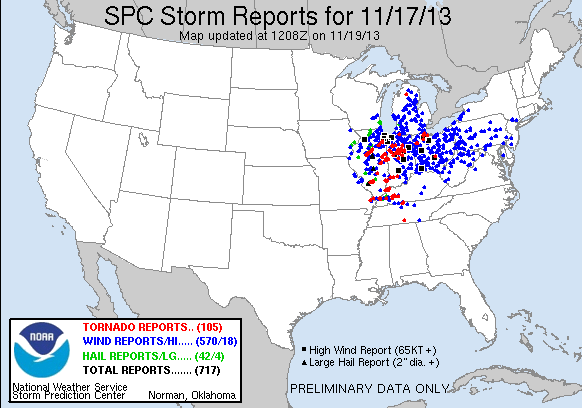 |
| More local storm report details can be found here or by clicking on the above image. |
Back to top
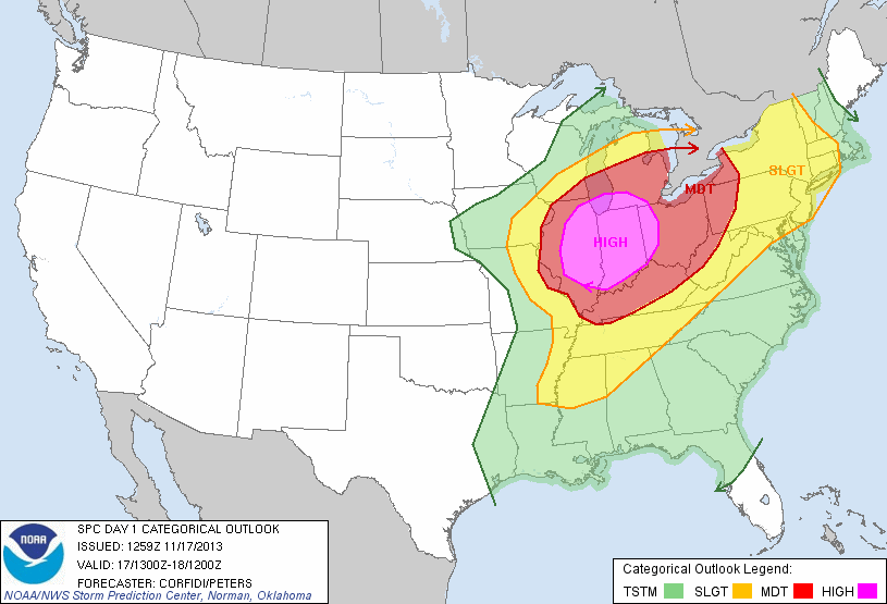
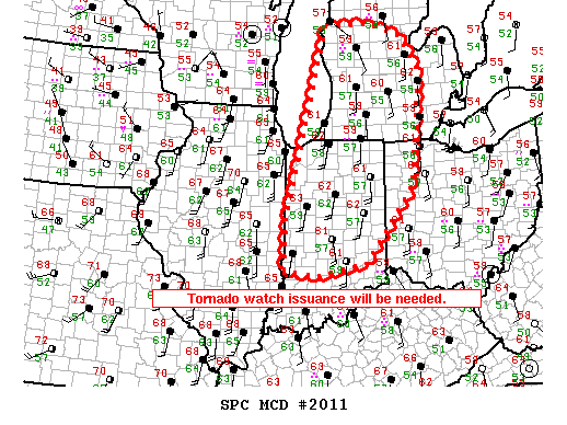
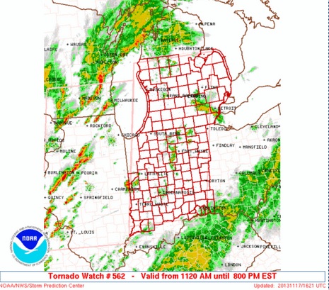
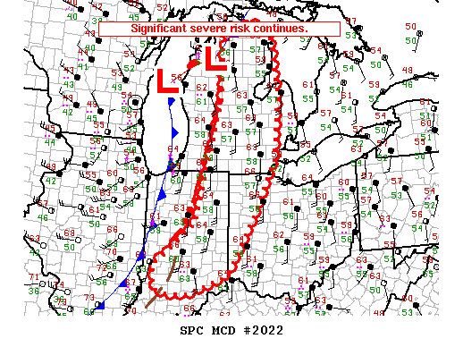
SPC Products (More details can be found by clicking on the images)
Storm Prediction Center (SPC) products include watches that were issued and mesoscale discussions (MCDs).
 |
 |
 |
 |
Other states were also affected by the severe weather, inlcuding several tornadoes, that occurred
on this day. Below are links to other summaries done by various NWS offices.