Detroit/Pontiac, MI
Weather Forecast Office
Overview
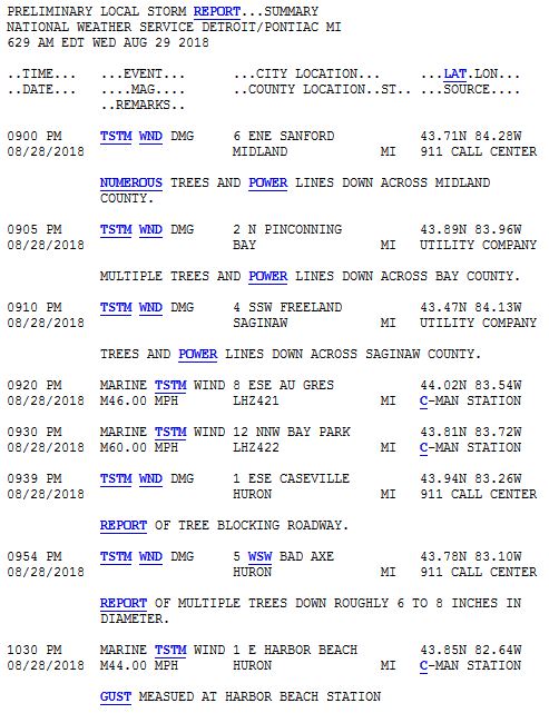
On the evening of August 28th, severe storms rolled across lower Michigan bringing heavy rains and damaging winds to portions of the area. A thunderstorm complex moved over Wisconsin in the afternoon and traveled across Lake Michigan before traveling across lower Michigan. The severe weather over Southeast Michigan was focused over the Tri-Cities and Thumb areas. Damaging winds brought down trees and power lines, leaving many homes without power.Radar:
Header
 |
| Radar Loop from 8:30pm to 3:00am on August 28, 2018 Courtesy Iowa Environmental Mesonet (IEM) |
Storm Reports
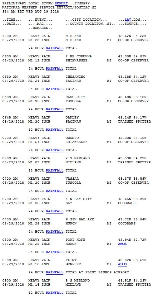
Rain Reports
 |
Media use of NWS Web News Stories is encouraged! Please acknowledge the NWS as the source of any news information accessed from this site. |
 |
Weather Forecasts
Fire Weather
Snowfall Forecast
Marine Forecast
Beach Forecast
Aviation
Digital Forecast Graphics
Current Weather Conditions
Local Observations
Today's Weather History
Observed Snowfall
Regional Radar Mosaic
Past Weather Records
Climate records by month
Additional Daily Climate Data
Top 20 Lists
Breakdown by Decade
Largest Snowstorms
Season Snowfall Maps
Year To Date Plots
Severe Weather
Daily Plots
Annual Plots
Event Summaries
US Dept of Commerce
National Oceanic and Atmospheric Administration
National Weather Service
Detroit/Pontiac, MI
9200 White Lake Road
White Lake, MI 48386
248-620-9804
Comments? Questions? Please Contact Us.


