Detroit/Pontiac, MI
Weather Forecast Office
| Overview | Radar |
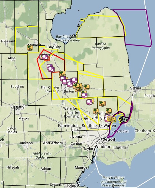
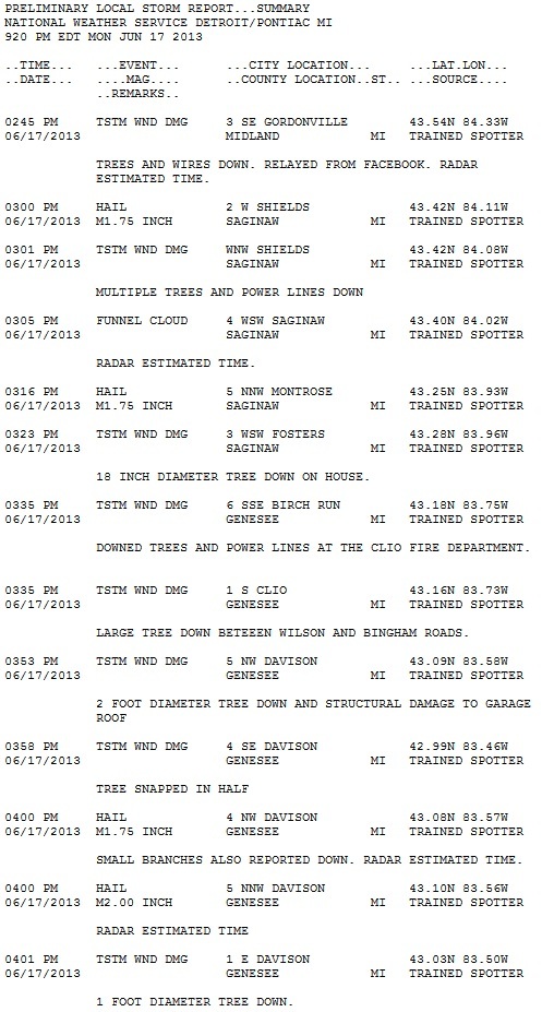
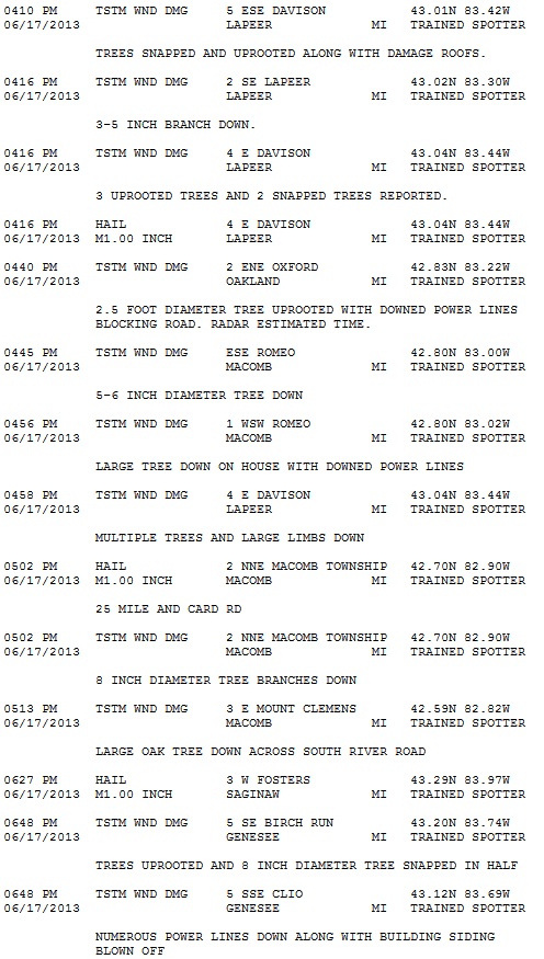
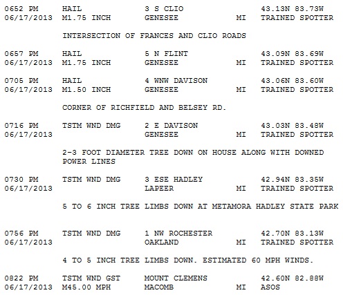
A cold front moving through Michigan produced severe storms during the afternoon and evening on Monday, June 17, 2013. The first storm tracked through Midland County around 2pm and continued to moved off to the southeast over Lake St. Clair. A second storm formed just before 6pm and followed a similar path as the first storm. These storms resulted in multiple hail and wind damage reports, with numerous trees and power lines down.
Radar

Radar loop courtesy of Iowa Environmental Mesonet (IEM)
|
|
|
|
|
Image courtesy of Iowa Environmental Mesonet (IEM). Yellow boxes are severe thunderstorm warnings, red box is a tornado warning, and purple boxes are special marine warnings. Local Storm Reports (LSR) are also shown plotted on the map. |
Weather Forecasts
Fire Weather
Snowfall Forecast
Marine Forecast
Beach Forecast
Aviation
Digital Forecast Graphics
Current Weather Conditions
Local Observations
Today's Weather History
Observed Snowfall
Regional Radar Mosaic
Past Weather Records
Climate records by month
Additional Daily Climate Data
Top 20 Lists
Breakdown by Decade
Largest Snowstorms
Season Snowfall Maps
Year To Date Plots
Severe Weather
Daily Plots
Annual Plots
Event Summaries
US Dept of Commerce
National Oceanic and Atmospheric Administration
National Weather Service
Detroit/Pontiac, MI
9200 White Lake Road
White Lake, MI 48386
248-620-9804
Comments? Questions? Please Contact Us.