Detroit/Pontiac, MI
Weather Forecast Office
| Overview | Radar | SPC Products | Additional Resources |
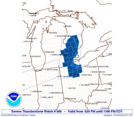
On the early evening of September 20, 2014, strong to severe thunderstorms formed ahead of a cold front crossing central lower Michigan. These storms raced eastward at 45 mph causing areas of damage across parts of the area.
Back to top
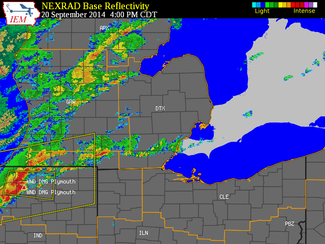 |
| Radar loop courtesy of Iowa Environmental Mesonet (IEM). Larger yellow boxes are severe thunderstorm watches, smaller (storm-based) yellow boxes are severe thunderstorm warnings, and blue boxes are special marine warnings. NOTE: Time is in CDT! |
|
|
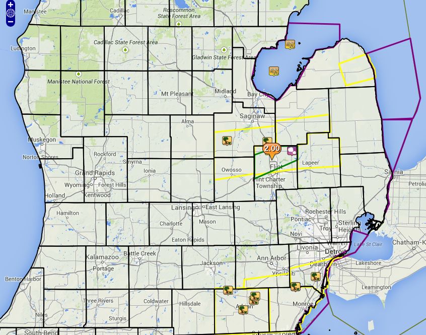
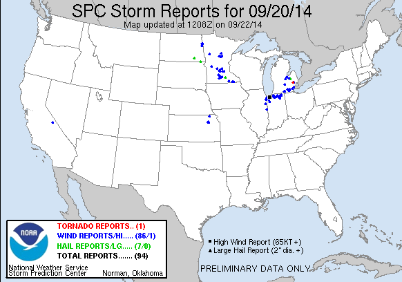
| Image courtesy of Iowa Environmental Mesonet (IEM). Yellow boxes are severe thunderstorm warnings, green box is an urban and small stream flood advisory and purple boxes are special marine warnings. Local Storm Reports (LSR) are also shown plotted on the map. |
|
|
Text Summary of Local Storm Reports (LSRs)
Back to top
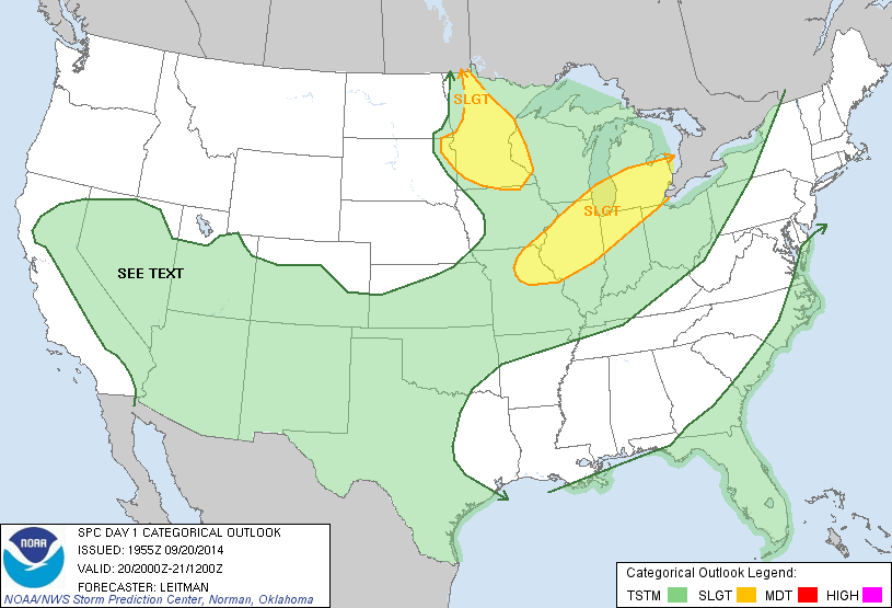
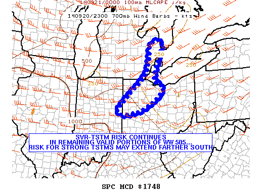
SPC Products (More details can be found by clicking on the images)
 |
 |
 |
 |
Area event summaries:
Weather Forecasts
Fire Weather
Snowfall Forecast
Marine Forecast
Beach Forecast
Aviation
Digital Forecast Graphics
Current Weather Conditions
Local Observations
Today's Weather History
Observed Snowfall
Regional Radar Mosaic
Past Weather Records
Climate records by month
Additional Daily Climate Data
Top 20 Lists
Breakdown by Decade
Largest Snowstorms
Season Snowfall Maps
Year To Date Plots
Severe Weather
Daily Plots
Annual Plots
Event Summaries
US Dept of Commerce
National Oceanic and Atmospheric Administration
National Weather Service
Detroit/Pontiac, MI
9200 White Lake Road
White Lake, MI 48386
248-620-9804
Comments? Questions? Please Contact Us.