Overview
A strong low pressure system brought all kinds of weather conditions to the Great Lakes region and to Michigan on Tuesday, February 12th. Snow started to work in across the area from the Ohio border around midnight and continued to move north into the morning hours. Warmer air aloft also moved in from south to north and led to the development of a mix of precipitation across the region. Easterly winds gusting to around 25 mph during the morning fed plenty of cold Canadian air to the surface, allowing for freezing rain to dominate south of Detroit where tens of thousands of residents lost power. Sleet was more prevalent to the north. Eventually temperatures rose above freezing by the late morning, leading to a changeover to liquid rain. Precipitation tapered off across the region by early afternoon as the system's dry slot moved in.
Snowfall Totals
 |
* This map includes snowfall totals through the late morning/early afternoon on Tuesday the 12th. Ice accumulations are not included here - see the list of Storm Reports for these. Additional snow showers moved across the region later in the evening and overnight, but are also not included here.
Radar
 |
|
|
Radar loop from 11 PM Monday through 11 AM Tuesday (Loop courtesy of Iowa Environmental Mesonet) |
Storm Reports
PRELIMINARY LOCAL STORM REPORT...SUMMARY
NATIONAL WEATHER SERVICE DETROIT/PONTIAC MI
738 PM EST TUE FEB 12 2019

..TIME...   ...EVENT...      ...CITY LOCATION...     ...LAT.LON...
..DATE...   ....MAG....      ..COUNTY LOCATION..ST.. ...SOURCE....
            ..REMARKS..

0700 AM     SNOW             2 NNE WIXOM             42.55N 83.52W
02/12/2019  M1.5 INCH        OAKLAND            MI   TRAINED SPOTTER

            5 HOUR SNOWFALL

0700 AM     SNOW             4 E WHITE LAKE          42.65N 83.43W
02/12/2019  M1.7 INCH        OAKLAND            MI   OFFICIAL NWS OBS

            5 HOUR SNOWFALL AT THE NWS WHITE LAKE OFFICE

0700 AM     SNOW             ANN ARBOR               42.28N 83.73W
02/12/2019  M1.0 INCH        WASHTENAW          MI   CO-OP OBSERVER

            6.5 HOUR SNOWFALL

0830 AM     ICE STORM        TEMPERANCE              41.77N 83.57W
02/12/2019                   MONROE             MI   NWS EMPLOYEE

            0.3 INCHES OF ICE ACCUMULATION WITH SCATTERED POWER
            OUTAGES ACROSS THE COUNTY

0930 AM     SNOW             MARLETTE                43.33N 83.08W
02/12/2019  M4.1 INCH        SANILAC            MI   TRAINED SPOTTER

            5 HOUR SNOWFALL

0950 AM     SNOW             PORT HURON              42.99N 82.43W
02/12/2019  M1.4 INCH        ST. CLAIR          MI   PUBLIC

            5.5 HOUR SNOWFALL

1030 AM     SNOW             OAKLEY                  43.14N 84.17W
02/12/2019  M4.5 INCH        SAGINAW            MI   TRAINED SPOTTER

            7.5 HOUR SNOWFALL

1130 AM     SNOW             3 E OIL CITY            43.61N 84.53W
02/12/2019  M4.9 INCH        MIDLAND            MI   TRAINED SPOTTER

            7.5 HOUR SNOWFALL TOTAL

1135 AM     ICE STORM        2 SE IDA                41.89N 83.55W
02/12/2019                   MONROE             MI   AMATEUR RADIO

            0.3 INCHES OF ICE ACCULATION WITH MULTIPLE POWER OUTAGES
            ACROSS THE COUNTY

1200 PM     FREEZING RAIN    SALINE                  42.18N 83.78W
02/12/2019  E0.20 INCH       WASHTENAW          MI   PUBLIC

            9 HOUR ICE ACCUMULATION TOTAL

1200 PM     SNOW             BAY CITY                43.59N 83.89W
02/12/2019  M5.3 INCH        BAY                MI   BROADCAST MEDIA

            7 HOUR SNOWFALL

1200 PM     SNOW             BURT                    43.24N 83.91W
02/12/2019  M4.3 INCH        SAGINAW            MI   BROADCAST MEDIA

            7 HOUR SNOWFALL

1200 PM     SNOW             CARO                    43.49N 83.40W
02/12/2019  M3.5 INCH        TUSCOLA            MI   BROADCAST MEDIA

            7 HOUR SNOWFALL

1200 PM     FREEZING RAIN    WYANDOTTE               42.21N 83.16W
02/12/2019  E0.20 INCH       WAYNE              MI   PUBLIC

            9 HOUR ICE ACCUMULATION TOTAL

1200 PM     SNOW             SHELBY TOWNSHIP         42.67N 83.03W
02/12/2019  M2.0 INCH        MACOMB             MI   PUBLIC

            10 HOUR SNOW/SLEET/PELLET TOTAL

0100 PM     SNOW             MIDLAND                 43.62N 84.23W
02/12/2019  M5.0 INCH        MIDLAND            MI   PUBLIC

            8 HOUR SNOWFALL

0100 PM     SNOW             2 W PECK                43.26N 82.86W
02/12/2019  M4.0 INCH        SANILAC            MI   TRAINED SPOTTER

            9 HOUR SNOWFALL

0100 PM     SNOW             FLINT                   43.02N 83.69W
02/12/2019  M3.0 INCH        GENESEE            MI   OFFICIAL NWS OBS

            10 HOUR SNOWFALL AT BISHOP INTERNATIONAL AIRPORT

0200 PM     SNOW             2 NW SAGINAW            43.45N 83.97W
02/12/2019  M5.6 INCH        SAGINAW            MI   TRAINED SPOTTER

            9 HOUR SNOWFALL
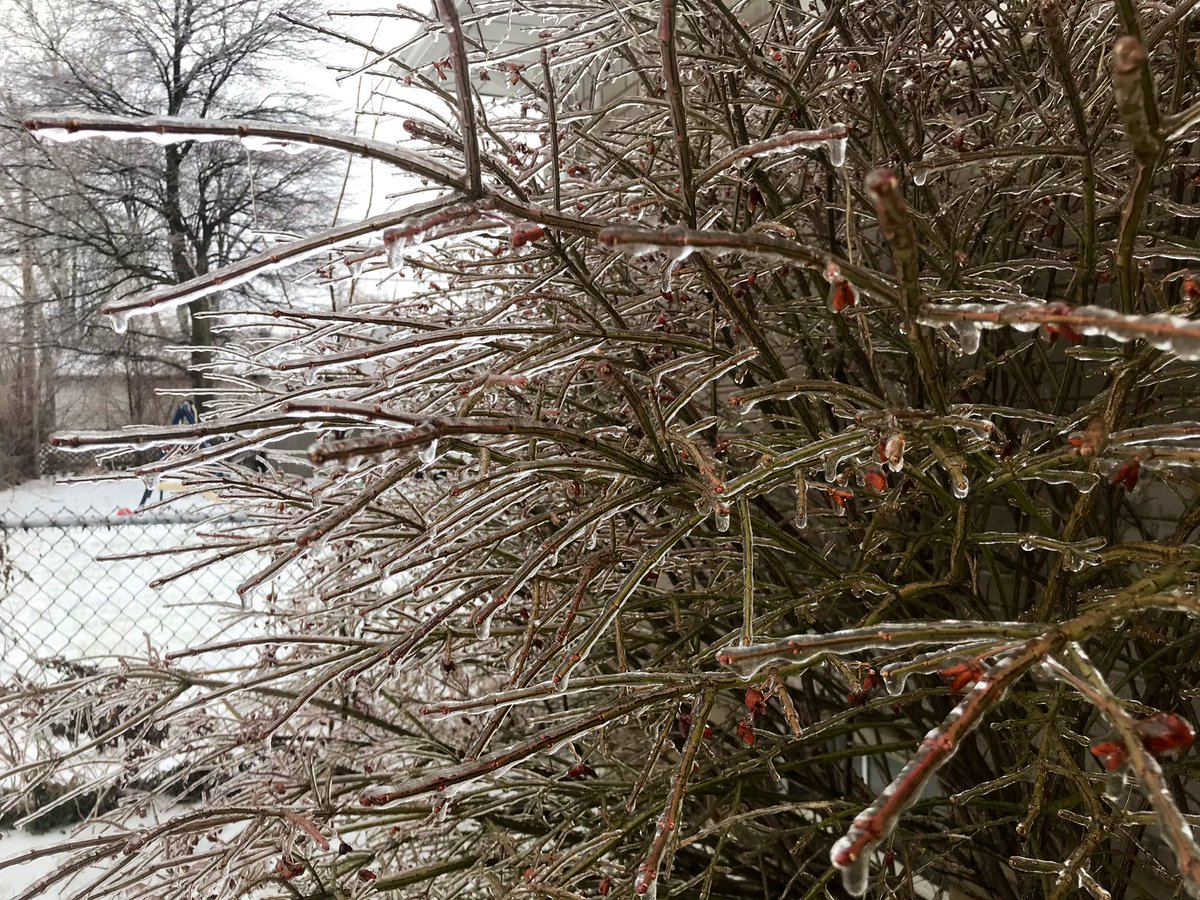
Photos
|
|
|
| Garden City, courtesy Thomas Iwinski | Monroe, courtesy Tom Hawley at Monroe News |
 |
Media use of NWS Web News Stories is encouraged! Please acknowledge the NWS as the source of any news information accessed from this site. |
|