Detroit/Pontiac, MI
Weather Forecast Office
| Overview | Radar | SPC Products | Additional Resources |
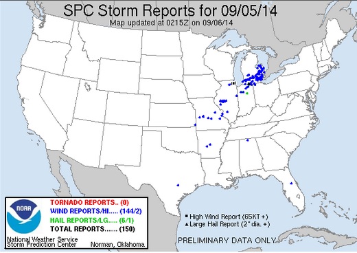
Multiple rounds of severe storms rolled across Southern Michigan on Friday, September 5, bringing damaging winds and numerous reports of damage. Winds up to 74 mph were reported as the storms raced east ahead of a cold front. The environment was primed for severe weather with temperatures reaching into the upper 80s and lower 90s, along with dewpoints reaching up into the 70s.
Back to top
 |
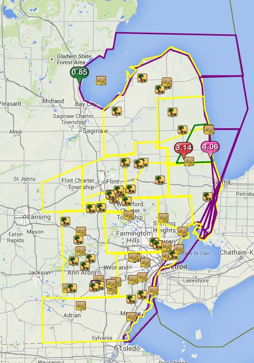
| Radar loop courtesy of Iowa Environmental Mesonet (IEM). Larger yellow box is a severe thunderstorm watch, smaller yellow boxes are severe thunderstorm warnings, and blue boxes are special marine warnings. Local storm reports are also plotted on the map. |
|
|
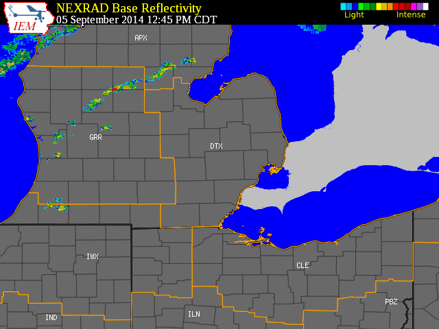
| Image courtesy of Iowa Environmental Mesonet (IEM). Yellow boxes are severe thunderstorm warnings, green box is a flood advisory and purple boxes are special marine warnings. Local Storm Reports (LSR) are also shown plotted on the map. |
|
|
Text Summary of Local Storm Reports (LSRs)
Back to top
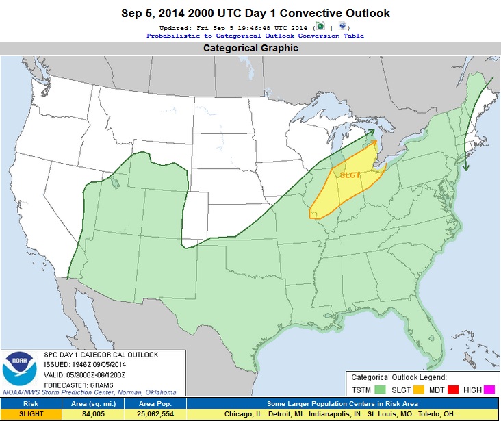
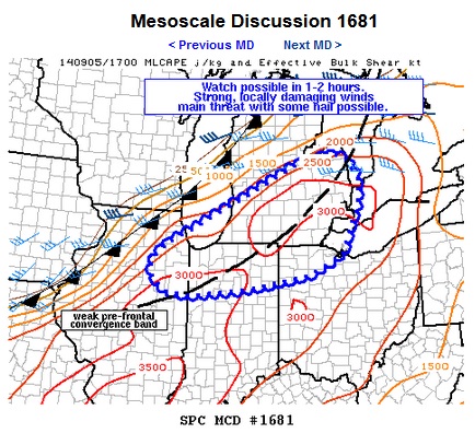
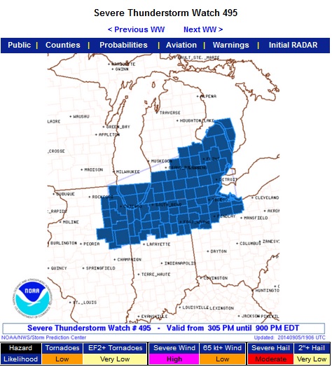
SPC Products (More details can be found by clicking on the images)
 |
 |
 |
Event Summaries from local NWS offices
Weather Forecasts
Fire Weather
Snowfall Forecast
Marine Forecast
Beach Forecast
Aviation
Digital Forecast Graphics
Current Weather Conditions
Local Observations
Today's Weather History
Observed Snowfall
Regional Radar Mosaic
Past Weather Records
Climate records by month
Additional Daily Climate Data
Top 20 Lists
Breakdown by Decade
Largest Snowstorms
Season Snowfall Maps
Year To Date Plots
Severe Weather
Daily Plots
Annual Plots
Event Summaries
US Dept of Commerce
National Oceanic and Atmospheric Administration
National Weather Service
Detroit/Pontiac, MI
9200 White Lake Road
White Lake, MI 48386
248-620-9804
Comments? Questions? Please Contact Us.