Overview
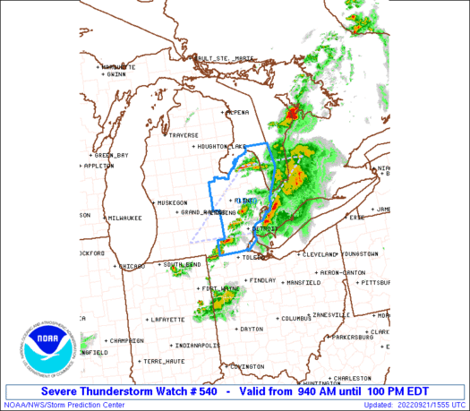
Strong to severe thunderstorms impacted southeast Michigan during the morning hours of September 21st. Storms initiated over northern lower Michigan along residual outflow from the previous evening's storms over Wisconsin, reinvigorating in a region of elevated instability over northern lower Michigan. Individual cells organized into a broken line prior to reaching the Tri Cities and Saginaw Bay, around 800 AM EDT. A Severe Thunderstorm Watch was issued for southeast Michigan at 940 AM given the persistence of these storms and associated hail/wind threat. Thunderstorms maintained their organization as they tracked southeast, producing isolated hail up to 1 inch in diameter, marine thunderstorm wind gusts exceeding 34 knots (40 mph), and localized tree/power line damage per local storm reports, before exiting the CWA by 100 PM EDT.
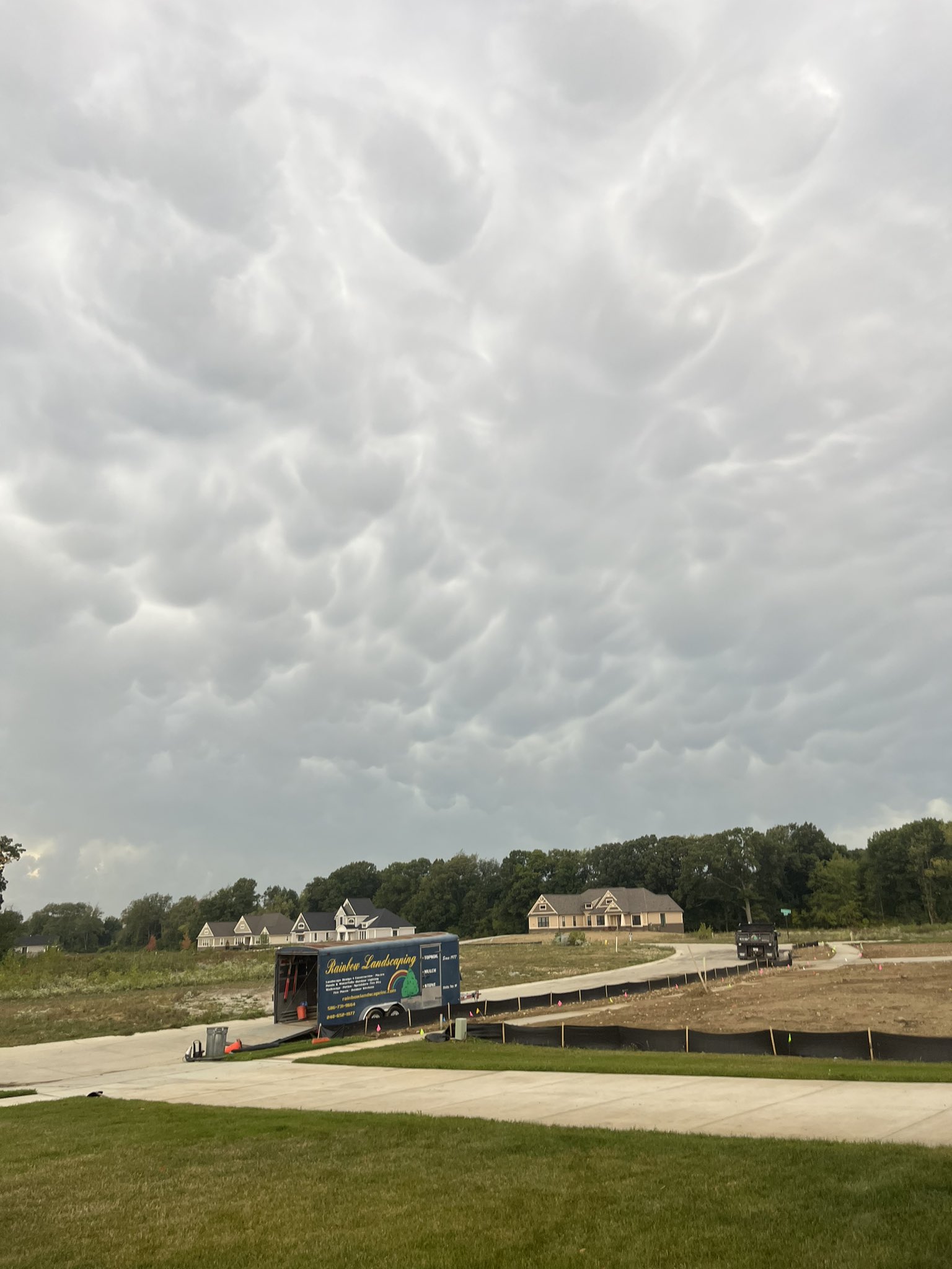
Photos
 |
 |
 |
|
Lapeer, MI Credit: Ryan Jake Jakubowski |
Lapeer, MI Credit: Ryan Jake Jakubowski |
Lapeer, MI Credit: Ryan Jake Jakubowski |
 |
 |
 |
|
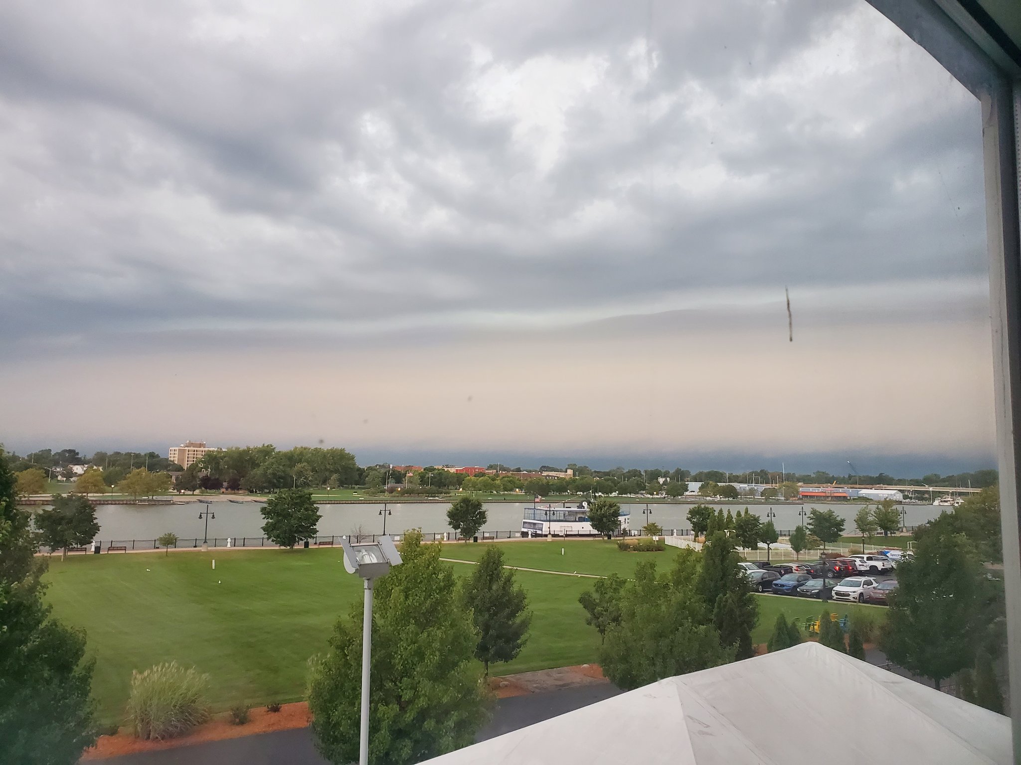
Bay City, MI Credit: Songlover99 |
Madison Heights, MI Credit: Daniel Mueller |
Oakland Township, MI Credit: Anthony @miwxanthony |
 |
 |
 |
|
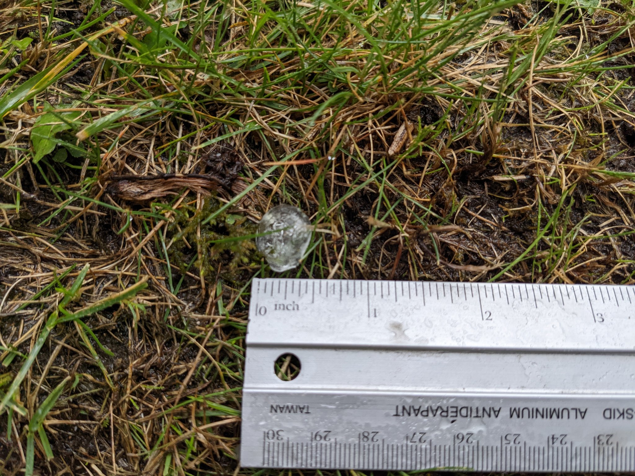
Shelby Township, MI Credit: Josh Palazzolo |
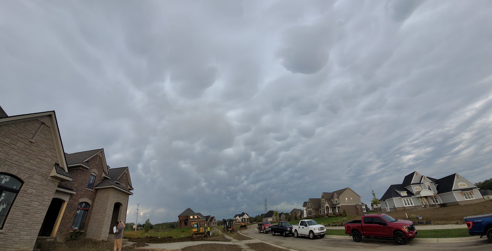
Highland Township, MI Credit: James Brennan |
Howell, MI Credit: Robert Forry |
 |
||
|
Detroit, MI Credit: Adrienne |
Radar
  |
|
Click to Enlarge Radar loop courtesy of Iowa Environmental Mesonet (IEM) |
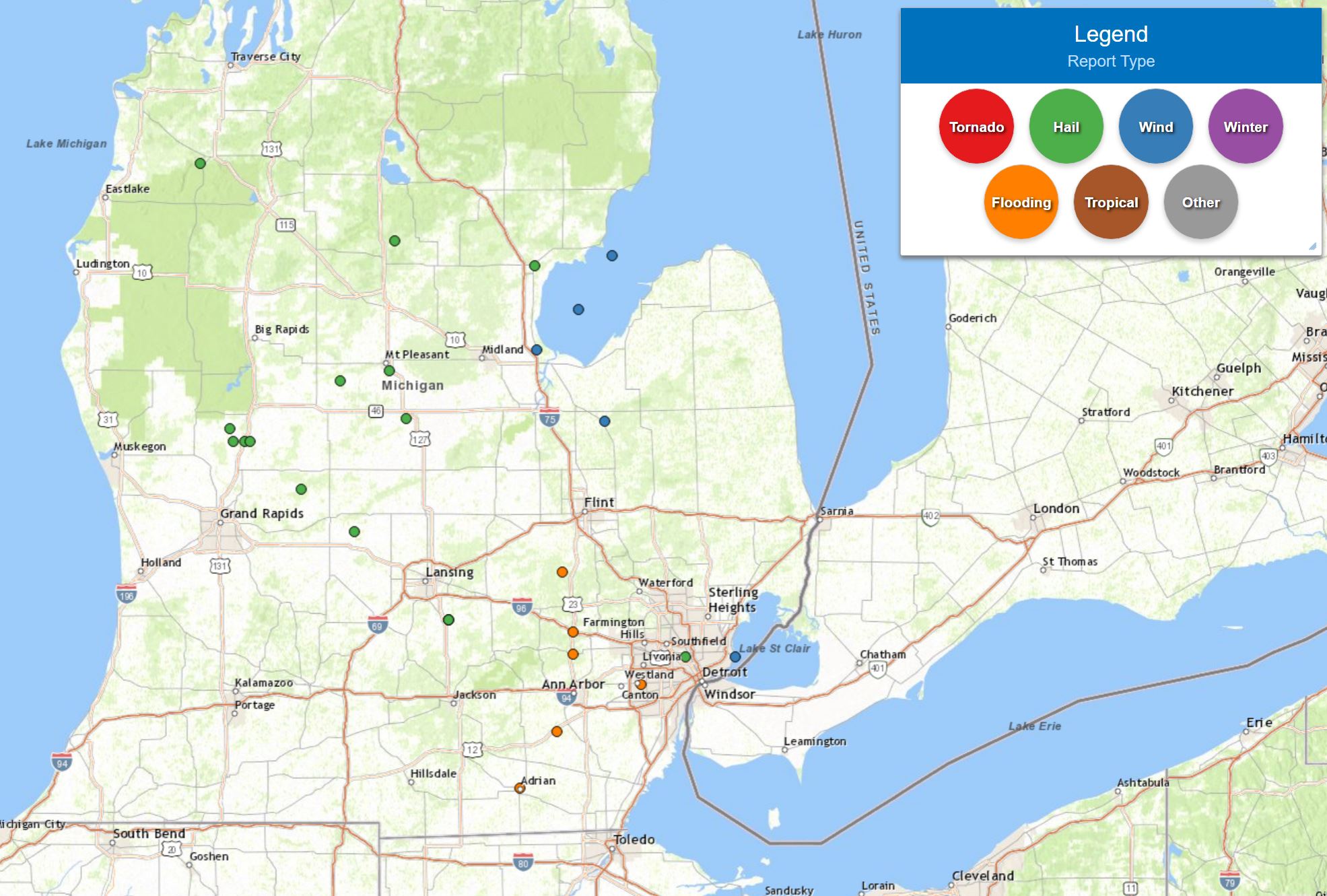
Storm Reports
|
|
|
Map of Local Storm Reports |
Severe Weather Local Storm Reports:
PRELIMINARY LOCAL STORM REPORT...SUMMARY
NATIONAL WEATHER SERVICE DETROIT/PONTIAC MI
101 PM EDT WED SEP 21 2022

..TIME...   ...EVENT...      ...CITY LOCATION...     ...LAT.LON...
..DATE...   ....MAG....      ..COUNTY LOCATION..ST.. ...SOURCE....
            ..REMARKS..

0910 AM     MARINE TSTM WIND 8 ESE AU GRES           44.02N 83.54W
09/21/2022  E40.20 MPH       LHZ421             MI   BUOY

            AT GRAVELLY SHOAL LIGHT.

0920 AM     MARINE TSTM WIND 12 NNW BAY PARK         43.81N 83.72W
09/21/2022  E58.80 MPH       LHZ422             MI   BUOY

            AT SAGINAW BAY LIGHT 1.

0926 AM     TSTM WND DMG     KAWKAWLIN               43.65N 83.95W
09/21/2022                   BAY                MI   911 CALL CENTER

            MULTPLE TREE LIMBS AND POWER LINES DOWN ACROSS THE
            COUNTY.

0959 AM     TSTM WND DMG     VASSAR                  43.37N 83.58W
09/21/2022                   TUSCOLA            MI   911 CALL CENTER

            NUMEROUS TREES AND POWER LINES DOWN.

1123 AM     HAIL             4 NNW DETROIT           42.43N 83.14W
09/21/2022  M1.00 INCH       WAYNE              MI   PUBLIC

1142 AM     MARINE TSTM WIND 4 NNE GROSSE POINTE     42.43N 82.87W
09/21/2022  M40.00 MPH       LCZ460             MI   C-MAN STATION

            MEASURED AT DETROIT YACHT CLUB.
.gif) |
|
National Storm Reports for September 21, 2022 |
 |
|
Severe Thunderstorm Watch for September 21, 2022 |
Environment
Thermodynamically, mid-level lapse rates of 7 to 8 C developed as cooler mid-level temperatures (around -12 C) associated with an approaching trough flowed atop a seasonably warm thermal ridge below. This allowed MUCAPE values to approach 1000 J/kg by the time convection developed near daybreak, with mid-level lapse rates of 7 to 8 C/km. Instability during this event was maximized above 700 MB, with the majority of this instability above the freezing level (around 13kft per 21.12z DTX RAOB). Low level thermal profiles were characterized by a robust inversion, which limited surface-based instability (MLCIN hovered around 200 J/kg) and kept the majority of storms elevated. Kinematics were governed by the trough as well, as a mid-level speed max rounded the base of the aforementioned trough. The strengthened westerly flow atop lighter southwest surface winds offered sufficient deep layer shear, with 0-6 km bulk shear of 35-40 knots over the northern tier of the CWA. Day 1 SPC Outlook extended the Marginal Risk northward to include the Tri Cities and Thumb, with all of southeast Michigan at risk for isolated large hail and isolated damaging winds.
Storms began over northern lower Michigan as a decayed convective complex which had moved through Wisconsin overnight reinvigorated around daybreak. Initially isolated cells merged into a broken line by the time they entered the CWA around 800 AM EDT. Tapping into the aforementioned instability and shear profiles, storms quickly became strong to severe over the Tri Cities area and persisted as they tracked southeast at 40 to 50 MPH. This prompted the issuance of Severe Thunderstorm Watch #540 at 940 AM EDT. A prominent feature with these storms was the presence of strong reflectivity cores, with 60 dBZ extending to 20 kft or greater in the strongest storms. Despite convincing velocity signatures at times per KDTX radar, wind damage was relatively isolated as storms remained elevated. Overall, reports of hail and damaging winds were isolated across the CWA by the time storms moved out of the area around 100 PM EDT.
Click on the images below to see them expanded.
 |
 |
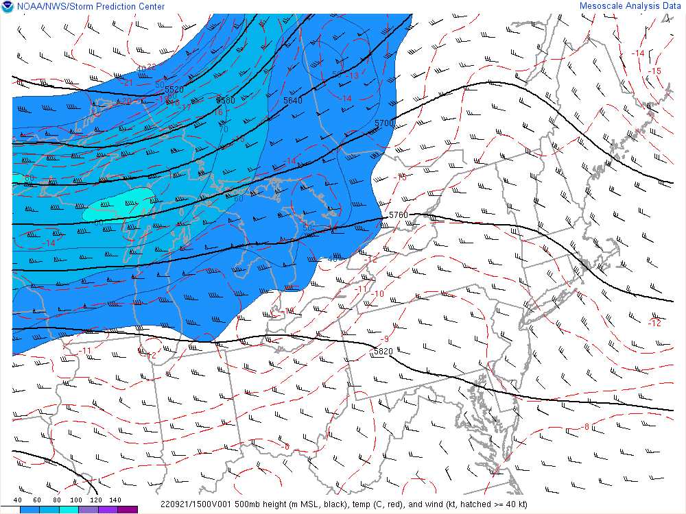 |
| Figure 1: Surface Analysis, valid 1500 UTC 21 September 2022 | Figure 2: KDTX observed sounding, valid 1200 UTC 21 September 2022 | Figure 3: 500mb Analysis, valid 1500 UTC 21 September 2022 |
 |
 |
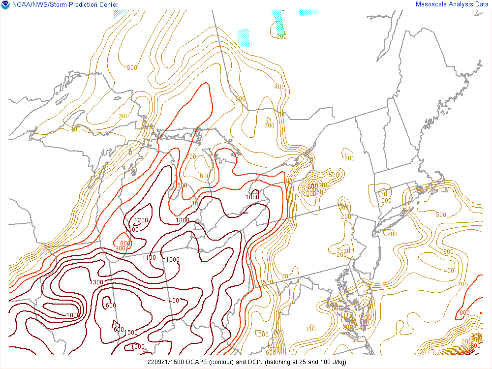 |
| Figure 4: Precipitable Water, valid 1600 UTC 21 September 2022 | Figure 5: Mixed Layer CAPE, valid 1500 UTC 21 September 2022 | Figure 6: Downdraft CAPE, valid 1400 UTC 21 September 2022 |
 |
 |
 |
| Figure 7: Surface-based CAPE, valid 1400 UTC 21 September 2022 | Figure 8: 0-6km Bulk Wind Shear, valid 1500 UTC 21 September 2022 | Figure 9: 0-1km Bulk Wind Shear, valid 1500 UTC 21 September 2022 |
 |
||
| Figure 10: Midlevel Lapse Rates, valid 1300 UTC 21 September 2022 | ||
 |
Media use of NWS Web News Stories is encouraged! Please acknowledge the NWS as the source of any news information accessed from this site. |
|