| Damage Survey | Radar | Photos |
On the early morning of September 21, 2014, a small storm cell developed along and ahead of a cold front tracking through southeast Michigan. Although no severe weather had been reported as the broader storm system crossed lower Michigan – this particular storm appeared to have encountered an area of localized shear and was able to form a brief, small tornado just west-northwest of Rochester. Unfortunately, the event occurred suddenly and without warning and was on the ground for 1 ½ to 2 minutes. There are several reasons why these can occasionally happen without a warning. Doppler radars are designed to most effectively detect strong tornadoes – that is, those most likely to cause injury and fatalities. In fact, 95% of all strong tornadoes (EF3 or larger) are warned in advance. However, for smaller tornadoes (EF0-1), 67% receive advance warning. This is because smaller tornadoes tend to develop and dissipate very quickly, making them harder to anticipate and respond to with warnings and/or siren activations.
All of the available radar velocity images below are from 552 am to 602 am EDT. The tornado was on the ground from 557 am to 559 am EDT. There is clear evidence of a low level circulation for the time the tornado was on the ground, but limited evidence of tornado rotation before or after. This is a good example illustrating that small tornadoes can develop quickly and then dissipate just as fast with little or no advance evidence from radar or other observational data.
Also of interest are the Correlation Coefficient (CC) images, which show debris lifted right about the time the tornado dissipated and shortly thereafter.
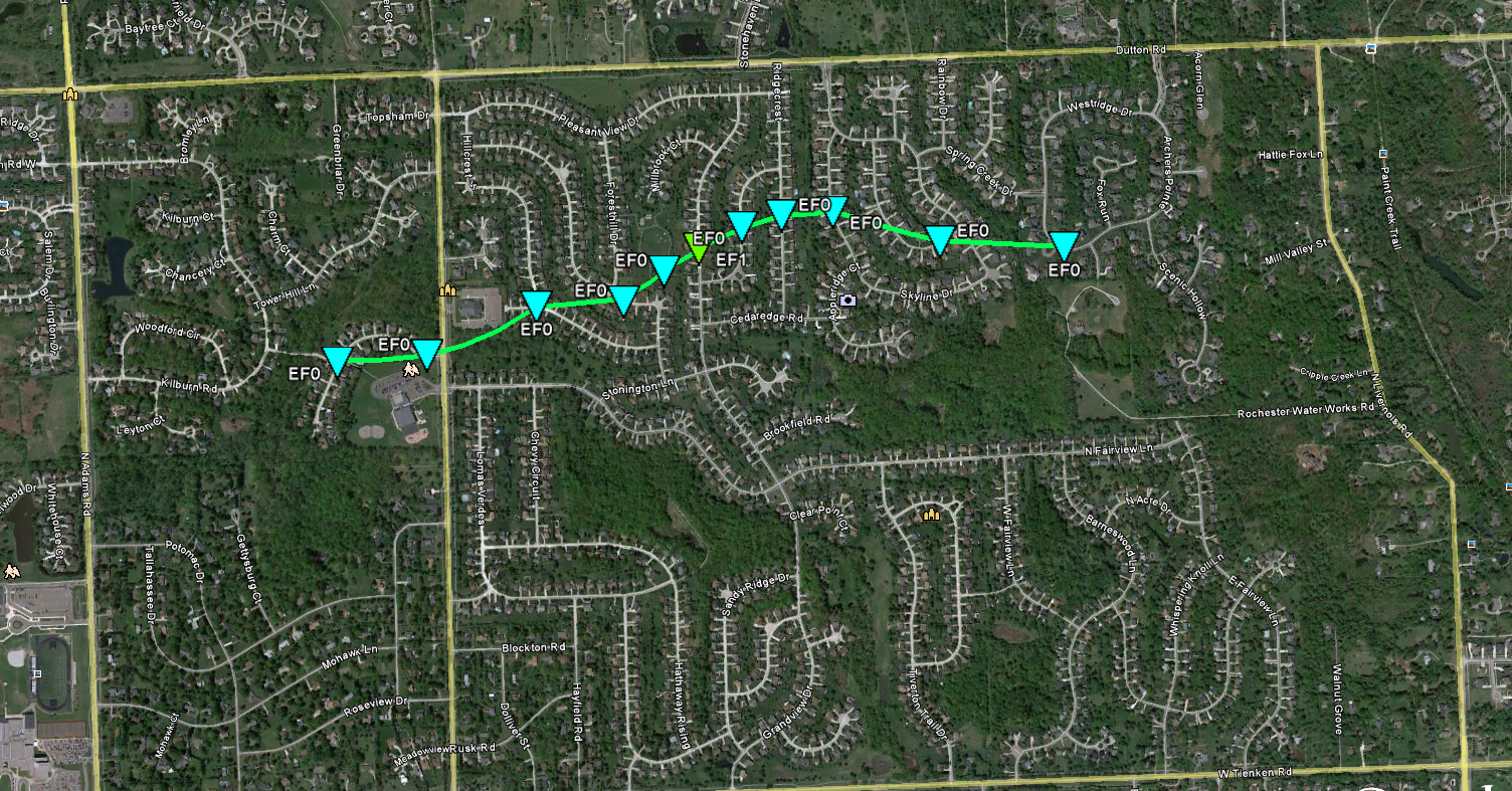
...NWS DAMAGE SURVEY FOR 09/21/14 TORNADO...
.ROCHESTER TORNADO...
RATING: EF-1
ESTIMATED PEAK WIND: 90 MPH
PATCH LENGTH/STATUTE/: 1.25 MILES
PATH WIDTH /MAXIMUM/: 150 YARDS
FATALITIES: 0
INJURIES: 0
START DATE: SEPTEMBER 21 2014
START TIME: 5:57 AM EDT
START LOCATION: 3 WNW ROCHESTER / OAKLAND COUNTY / MI
START LAT/LON: 42.70 / -83.19
END DATE: SEPTEMBER 21 2014
END TIME: 5:59 AM EDT
END LOCATION: 3 WNW ROCHESTER / OAKLAND COUNTY / MI
END LAT/LON: 42.71 / -83.17
SURVEY SUMMARY: THE TORNADO STARTED NEAR LAMBETH PARK AND NEW KENT
ROAD AND TRACKED EAST-NORTHEAST...ENDING NEAR WEST RIDGE DRIVE AND
SPRING CREEK ROAD. THE TORNADO IS RATED EF-1 WITH MAXIMUM WIND
GUSTS OF 90 MPH. MAXIMUM PATH WIDTH WAS 150 YARDS AND PATH LENGTH
WAS 1 1/4 MILES. STRONGEST DAMAGE WAS ALONG GRANDVIEW AND FAIRLANE
DRIVES WITH PARTIAL ROOF TORN OFF OF HOUSE...SEVERAL HOMES HAD
MINOR ROOF AND SIDING DAMAGE. NUMEROUS TREES WERE DOWNED ALONG THE
PATH. THE TORNADO LIFTED AT 559 AM.
(Click image for larger version)
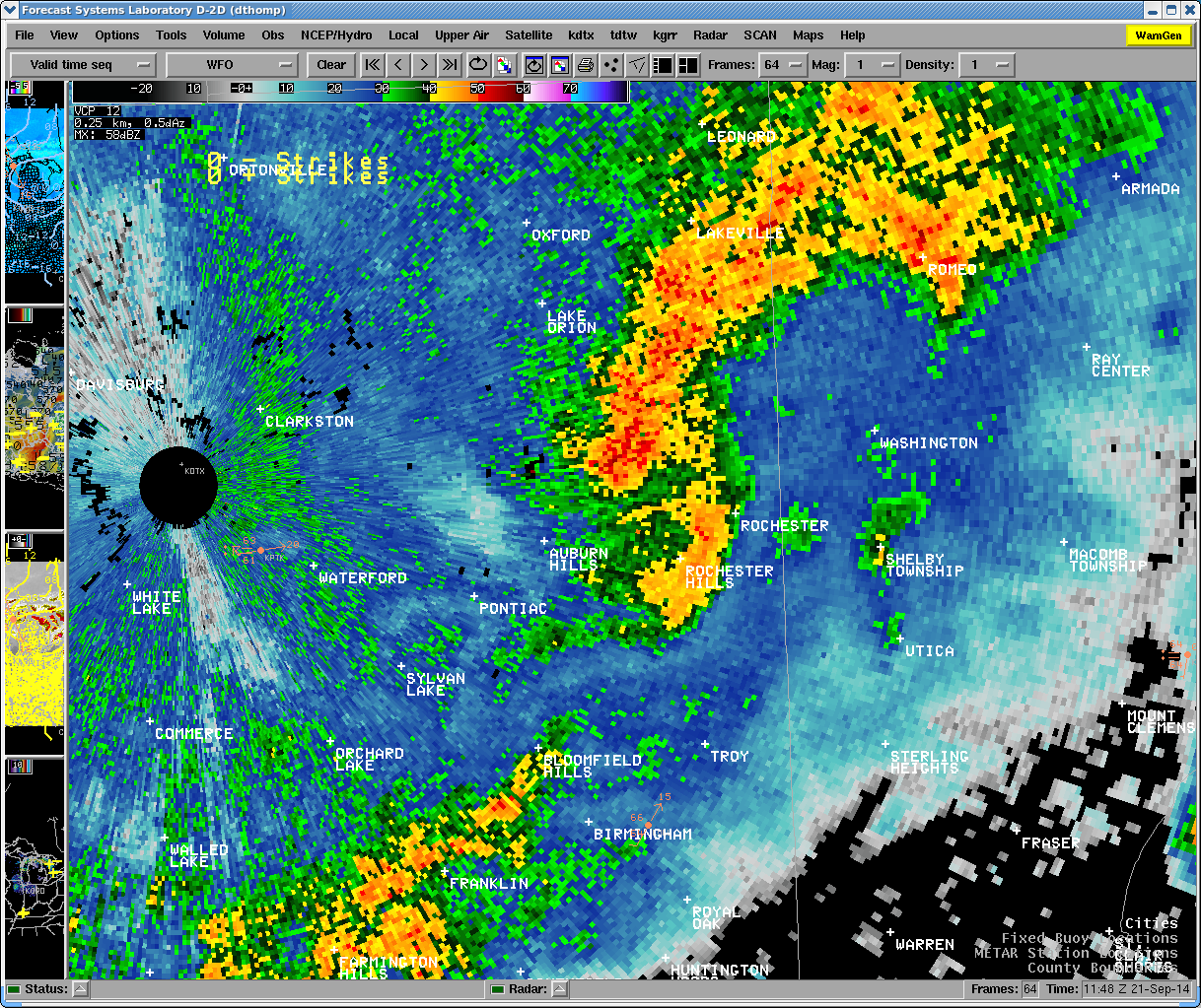 |
| 0957Z (557 a.m. EDT) Reflectivity |
 |
 |
 |
 |
 |
| 0952Z (5:52 am EDT) Storm Relative Motion/Velocity (SRM) | 0955Z (5:55 am EDT) Storm Relative Motion/Velocity (SRM) | 0957Z (5:57 am EDT) Storm Relative Motion/Velocity (SRM) | 1000Z (6:00 am EDT) Storm Relative Motion/Velocity (SRM) | 1002Z (6:02 am EDT) Storm Relative Motion/Velocity (SRM) |
 |
 |
| 1000Z (6:00 am EDT) Correlation Coefficient (CC) | 1002Z (6:02 am EDT) (Correlation Coefficient (CC) |
 |
| Radar loop courtesy of Iowa Environmental Mesonet (IEM). NOTE: Time is in CDT! |
Photos (Click on thumbnail for bigger image)
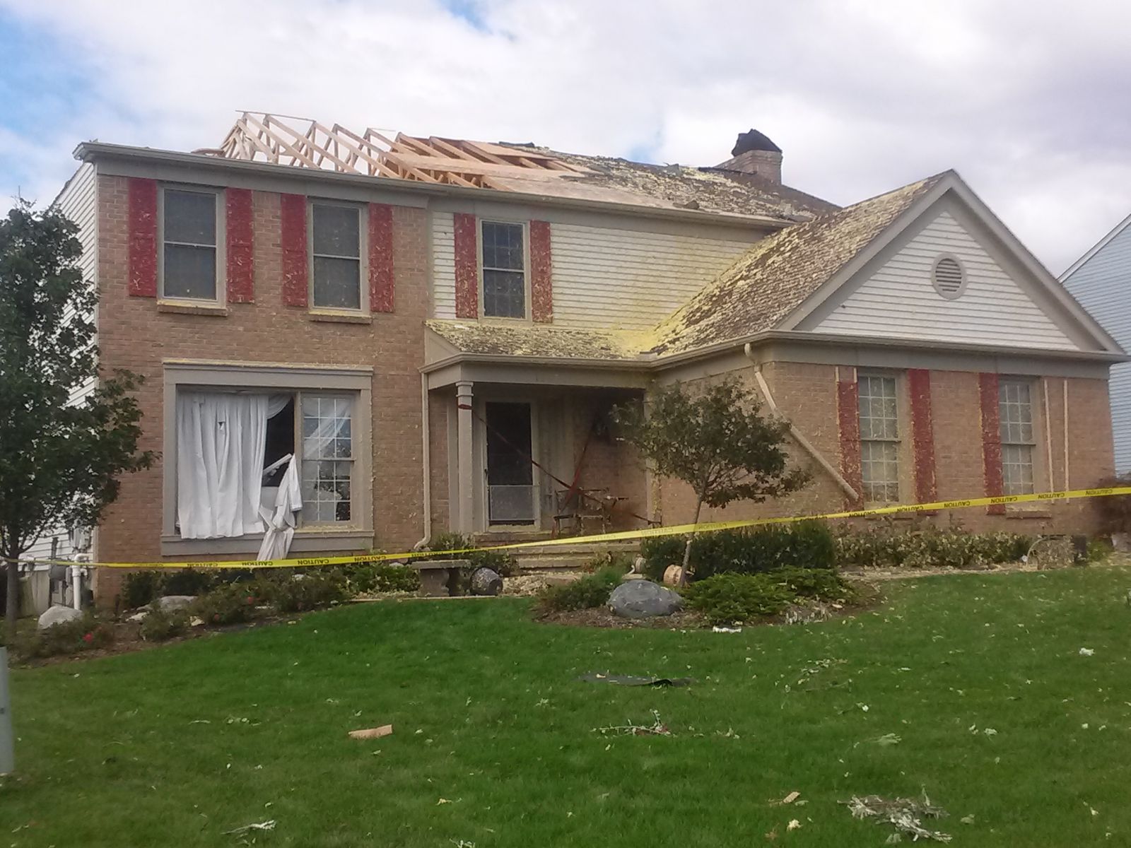 |
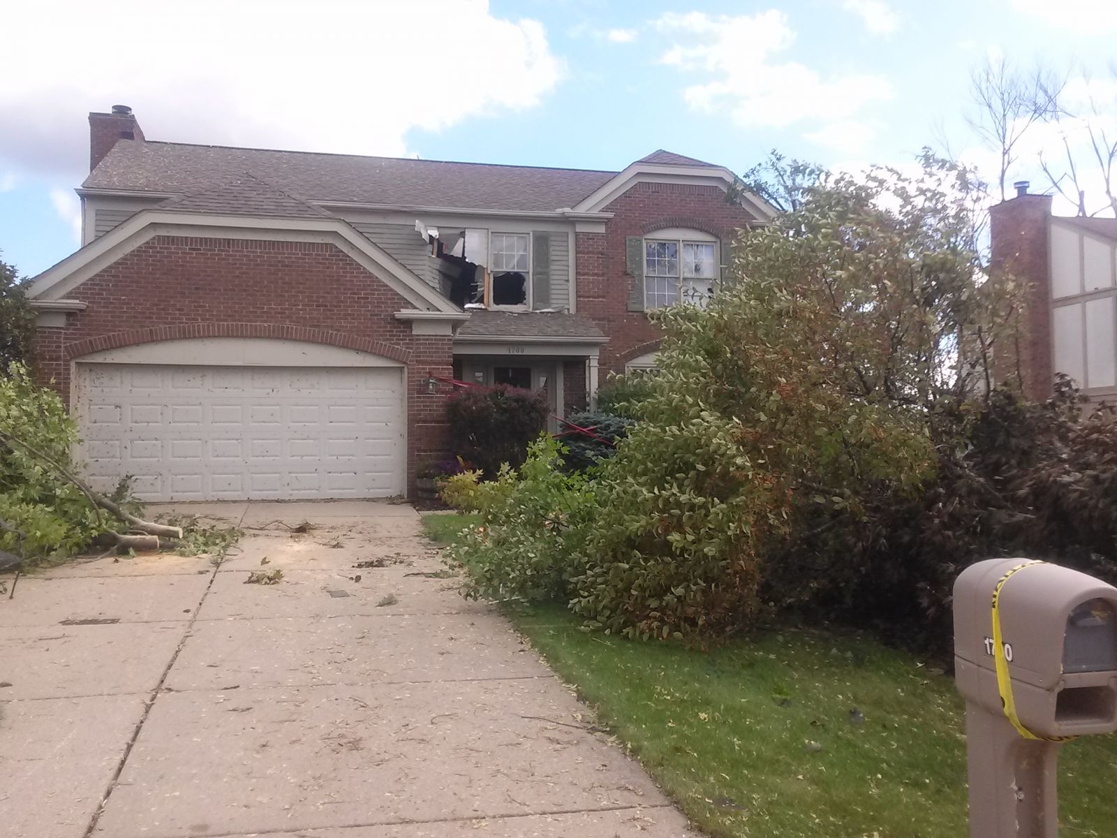 |
 |
| Courtesy of NWS Detroit/Pontiac, MI | Courtesy of NWS Detroit/Pontiac, MI | Courtesy of NWS Detroit/Pontiac, MI |

