Detroit/Pontiac, MI
Weather Forecast Office
| Overview | Radar | Winds | SPC Products | Additional Resources |
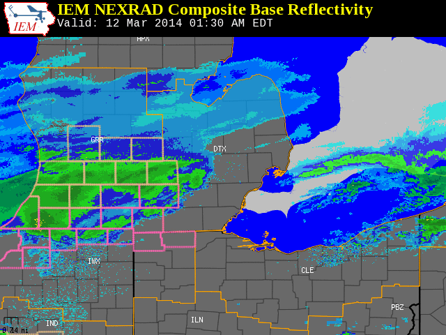
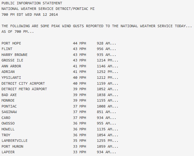
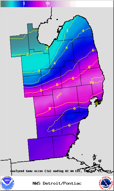
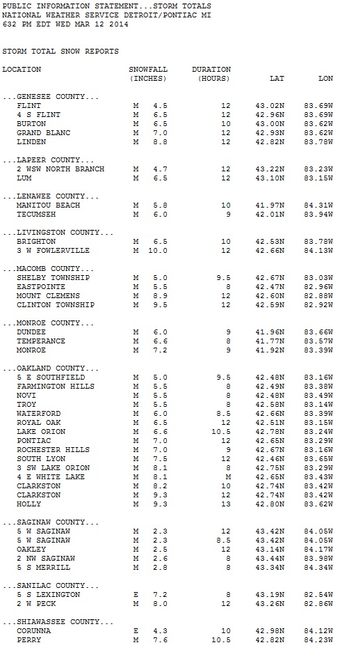
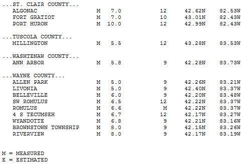
A low pressure system tracked across the Ohio Valley on March 12th. A tremendous amount of moisture lifted north of the low track and into southern Michigan. This moisture combined with arctic air plunging into the Great Lakes quickly turned light rain into all snow. Intensification of this storm system during the morning of the 12th lead to the development of heavy wet snow. The strength of the storm system and instability in the atmosphere also triggered some thunder snow. During the course of the morning, northerly winds intensified which caused a significant amount of blowing and drifting of the snow. These northerly winds also caused temperatures to plummet during the course of the afternoon. The rapid freezing of the heavy wet snow and blowing and drifting led to extremely poor road conditions throughout most of Southeast Michigan. The significant blowing and drifting of the snow made measuring very difficult. The link below is an estimate of spotter reports across southeast Michigan.
|
|
| Radar loop courtesy of Iowa Environmental Mesonet (IEM). Winter Storm Warnings are outlined in pick and Winter Weather Advisories are outlined in peach. |
Back to top
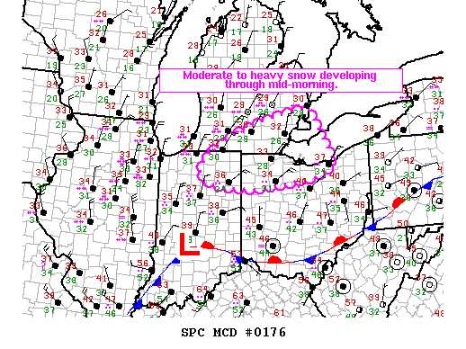
SPC Products (More details can be found by clicking on the images)
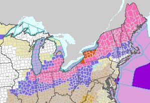 |
| Watch, Warning and Advisory Map at 7am (03/12) |
 |
Event Summaries from local NWS offices:
Weather Forecasts
Fire Weather
Snowfall Forecast
Marine Forecast
Beach Forecast
Aviation
Digital Forecast Graphics
Current Weather Conditions
Local Observations
Today's Weather History
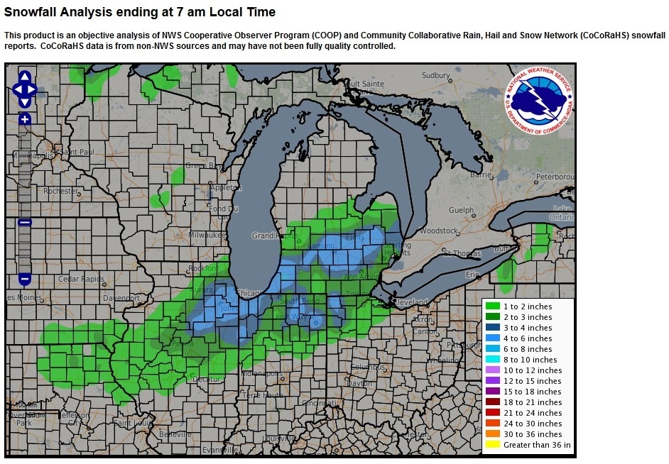
Observed Snowfall
Regional Radar Mosaic
Past Weather Records
Climate records by month
Additional Daily Climate Data
Top 20 Lists
Breakdown by Decade
Largest Snowstorms
Season Snowfall Maps
Year To Date Plots
Severe Weather
Daily Plots
Annual Plots
Event Summaries
US Dept of Commerce
National Oceanic and Atmospheric Administration
National Weather Service
Detroit/Pontiac, MI
9200 White Lake Road
White Lake, MI 48386
248-620-9804
Comments? Questions? Please Contact Us.