Overview
A cold front associated with a strong low pressure system swept across the state on Friday, May 4th. This system brought both a quick round of severe thunderstorms along the east side of the state during the early afternoon, along with high winds not associated with thunderstorms that led to a High Wind Warning for much of the day. Strong winds in excess of 50 mph were seen across southern portions of lower Michigan. As a result, numerous reports of downed trees, power lines, and minor structure damage were received from throughout the region. Power outages across SE Michigan impacted an estimated 300,000+ customers. Winds quickly subsided behind the cold frontal passage in the early evening.
Radar
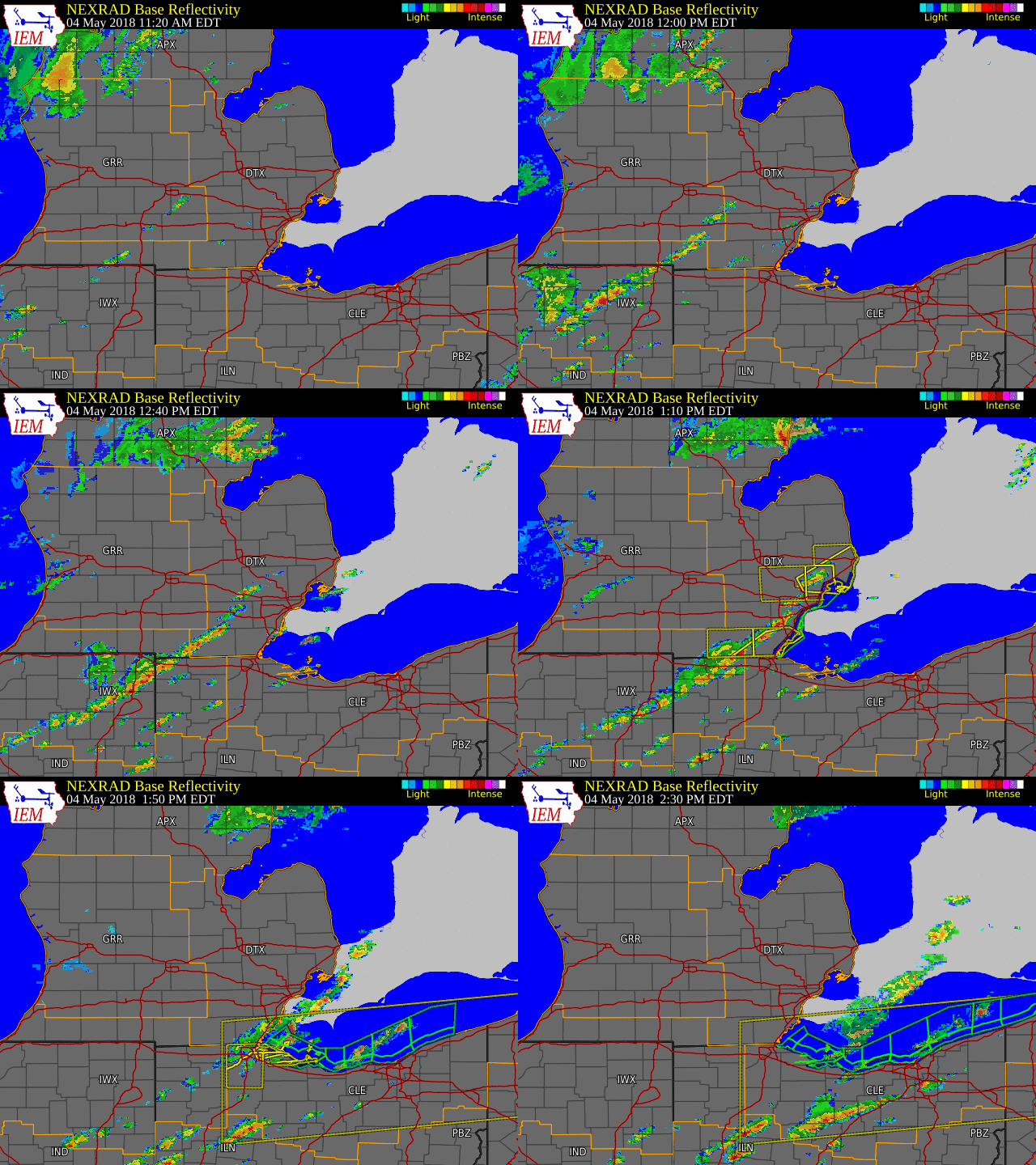 |
| Radar Loop from 11:20am to 2:30pm on May 4, 2018 Courtesy Iowa Environmental Mesonet (IEM) |
Wind Reports
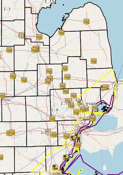 |
| Map of Severe Thunderstorm Warnings (yellow), Special Marine Warnings (purple), associated wind gust and thunderstorm wind damage reports, and 24 hour rainfall reports (number values). |
 |
 |
| Peak Wind Gusts | Damage Reports for both High Wind Warning and Severe Thunderstorm Warning |
Photos
 |
 |
 |
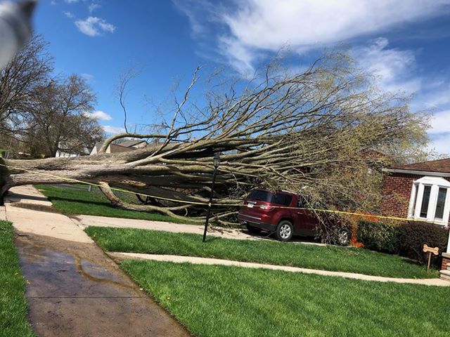
| Unionville: Uprooted Tree Photo Credit: Phill Wilson |
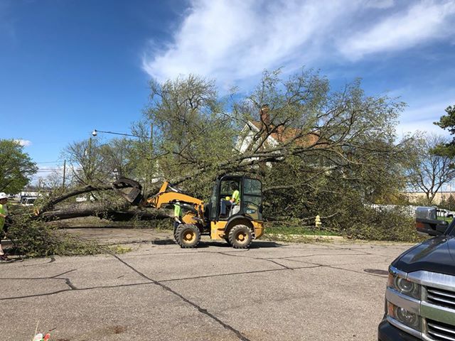
Wyandotte: Uprooted Tree Photo Credit: Nicholas Janeski |
Wyandotte: Uprooted Tree Photo Credit: Nicholas Janeski |
 |
 |
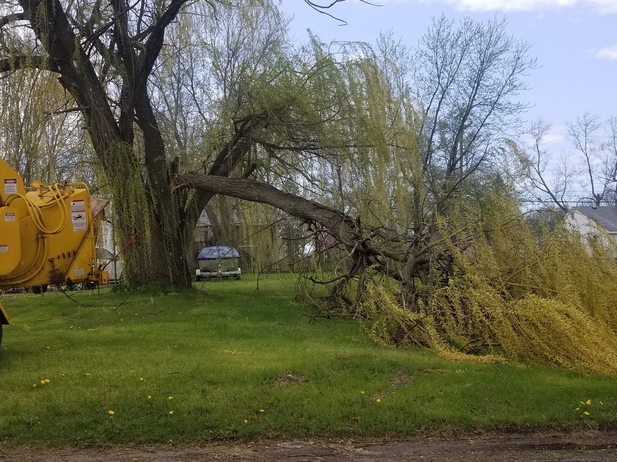 |
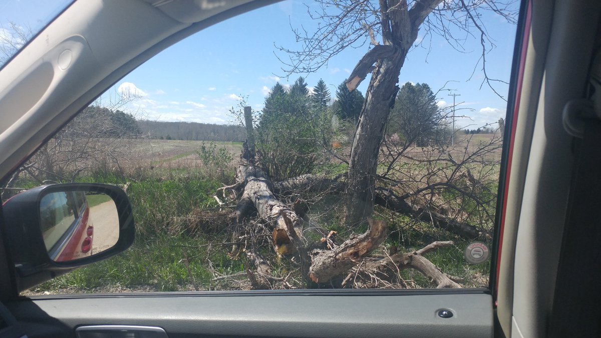
| Peck: Fence Damage Photo Credit: Tanner McCanham |
Peck: Uprooted Tree Photo Credit: Tanner McCanham |
Monroe: Tree Damage Photo Credit: Matthew Evans |
 |
 |
|
| Whiteford Township: Overturned Semi Truck Photo Credit: Micheal Miller |
Goodrich: Tree Damage Photo Credit: Dmitry Smirnov |
Environment
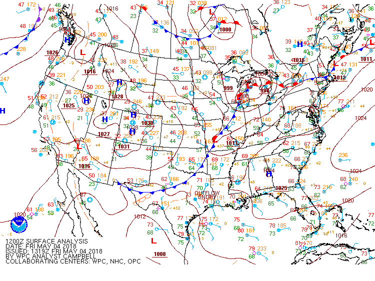
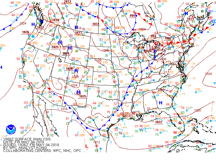
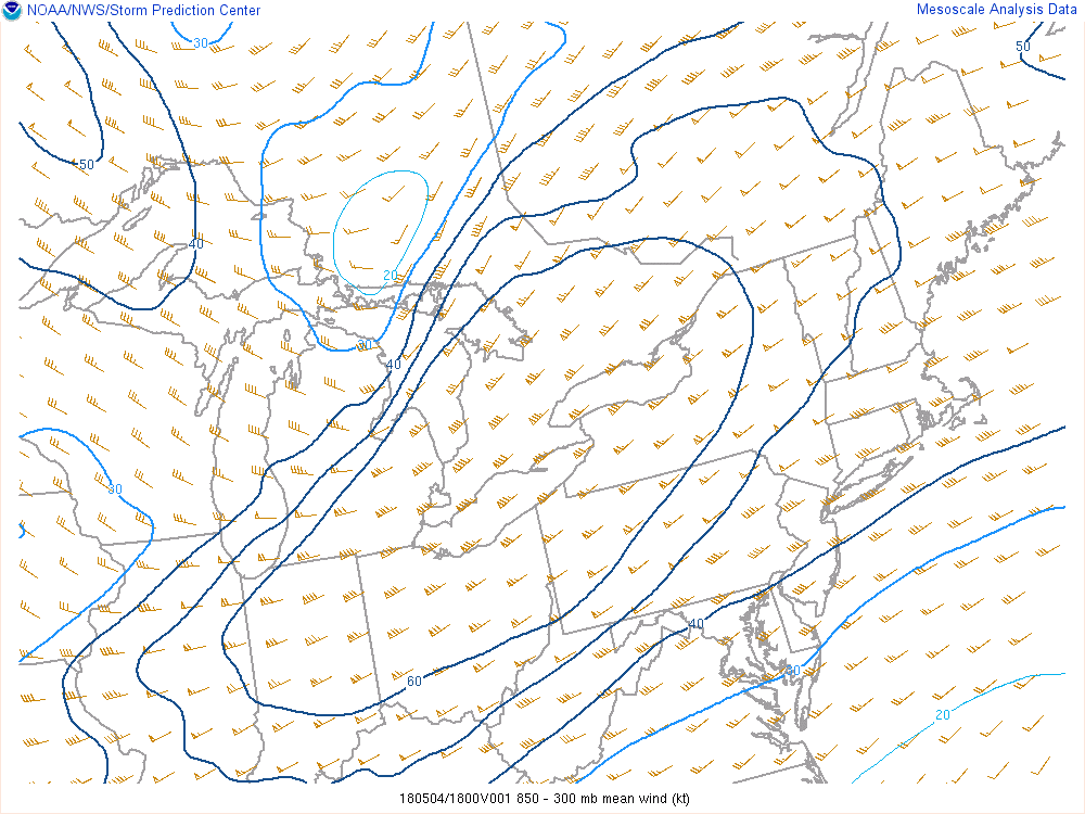
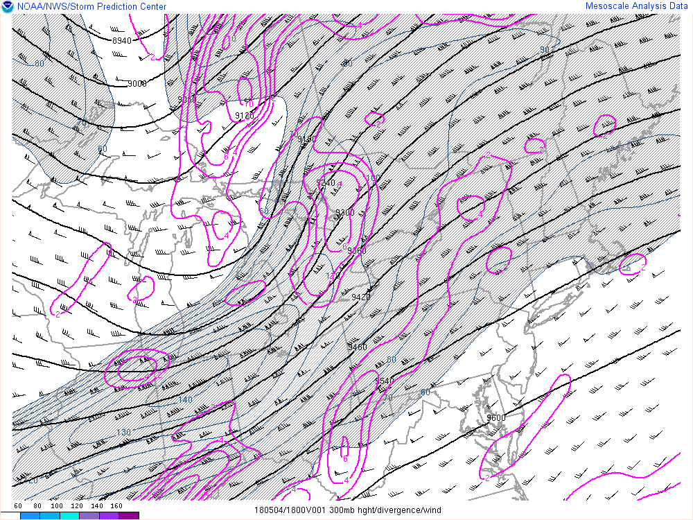
A dynamic upper level system moved from the central Plains into the Great Lakes and strengthened through the day on May 4. A strong jet streak and divergence of air aloft allowed the surface low pressure center to deepen, resulting in a deep layer of strong winds through the troposphere. Daytime heating mixed these winds down to the surface through the afternoon. Enough destabilization occurred ahead of the cold front in the southeastern portion of SE Michigan for a line of storms to develop in the early afternoon and bring additional damaging gusts, toppling numerous trees and power lines.
 |
 |
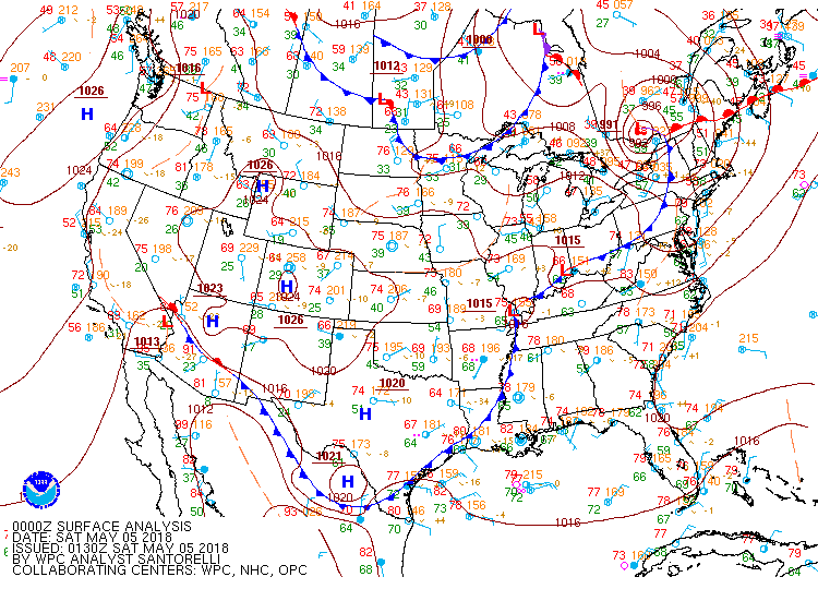 |
| Figure 1: Surface Map at 12z (8am) | Figure 2: Surface Map at 18z (2pm) | Figure 3: Surface Map at 00z (8pm) |
 |
 |
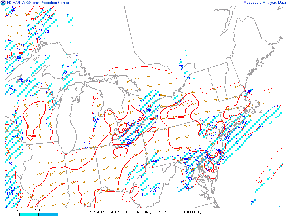 |
| Figure 4: SPC Mesoanalysis of 850-300mb Mean Wind at 18z (2pm) | Figure 5: SPC Mesoanalysis of 300mb Heights, Wind Speed, and Divergence at 18z (2pm) | Figure 6: SPC Mesoanalysis of Most Unstable CAPE and CIN, and Effective Bulk Shear at 16z (12pm) |
 |
Media use of NWS Web News Stories is encouraged! Please acknowledge the NWS as the source of any news information accessed from this site. |
 |