Detroit/Pontiac, MI
Weather Forecast Office
Overview
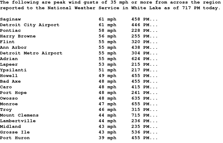
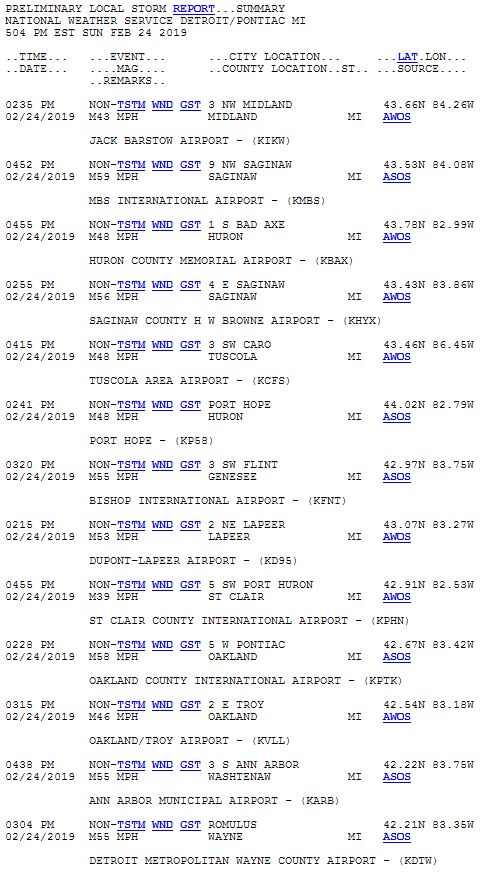
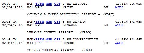
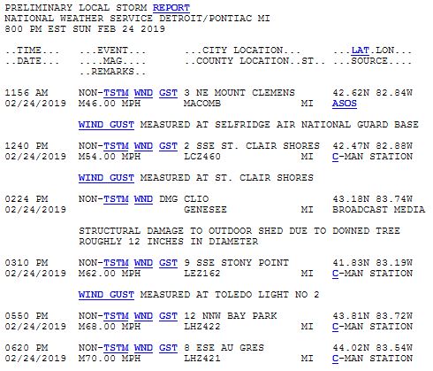
A low pressure system quickly intensified over the weekend of February 23-24th, as it crossed the Great Lakes region. This system brought blizzard warnings to western portions of the Great Lakes to high wind warnings across the rest of the region. The increased pressure gradient associated with the storm, along with a well-mixed boundary layer led to high winds over the region, with gusts in 60 mph range. The strong winds ramped up on Sunday morning across Southeast Michigan with the highest gusts occurring in the afternoon and evening. Downed power lines led to numerous power outages across the state on Sunday with issues lasting into Monday, as well as a few locations with structural damage.Wind Reports:
 |
| Reported wind gusts across Southeast Michigan on Sunday, February 24, 2019 |
Photos & Video
 |
| Roof damage from wind at Adrian College (Photo courtesy of Saralyn Tapp) |
Storm Reports
 |
Media use of NWS Web News Stories is encouraged! Please acknowledge the NWS as the source of any news information accessed from this site. |
 |
Weather Forecasts
Fire Weather
Snowfall Forecast
Marine Forecast
Beach Forecast
Aviation
Digital Forecast Graphics
Current Weather Conditions
Local Observations
Today's Weather History
Observed Snowfall
Regional Radar Mosaic
Past Weather Records
Climate records by month
Additional Daily Climate Data
Top 20 Lists
Breakdown by Decade
Largest Snowstorms
Season Snowfall Maps
Year To Date Plots
Severe Weather
Daily Plots
Annual Plots
Event Summaries
US Dept of Commerce
National Oceanic and Atmospheric Administration
National Weather Service
Detroit/Pontiac, MI
9200 White Lake Road
White Lake, MI 48386
248-620-9804
Comments? Questions? Please Contact Us.


