Detroit/Pontiac, MI
Weather Forecast Office
| Overview | Radar | Additional Resources |
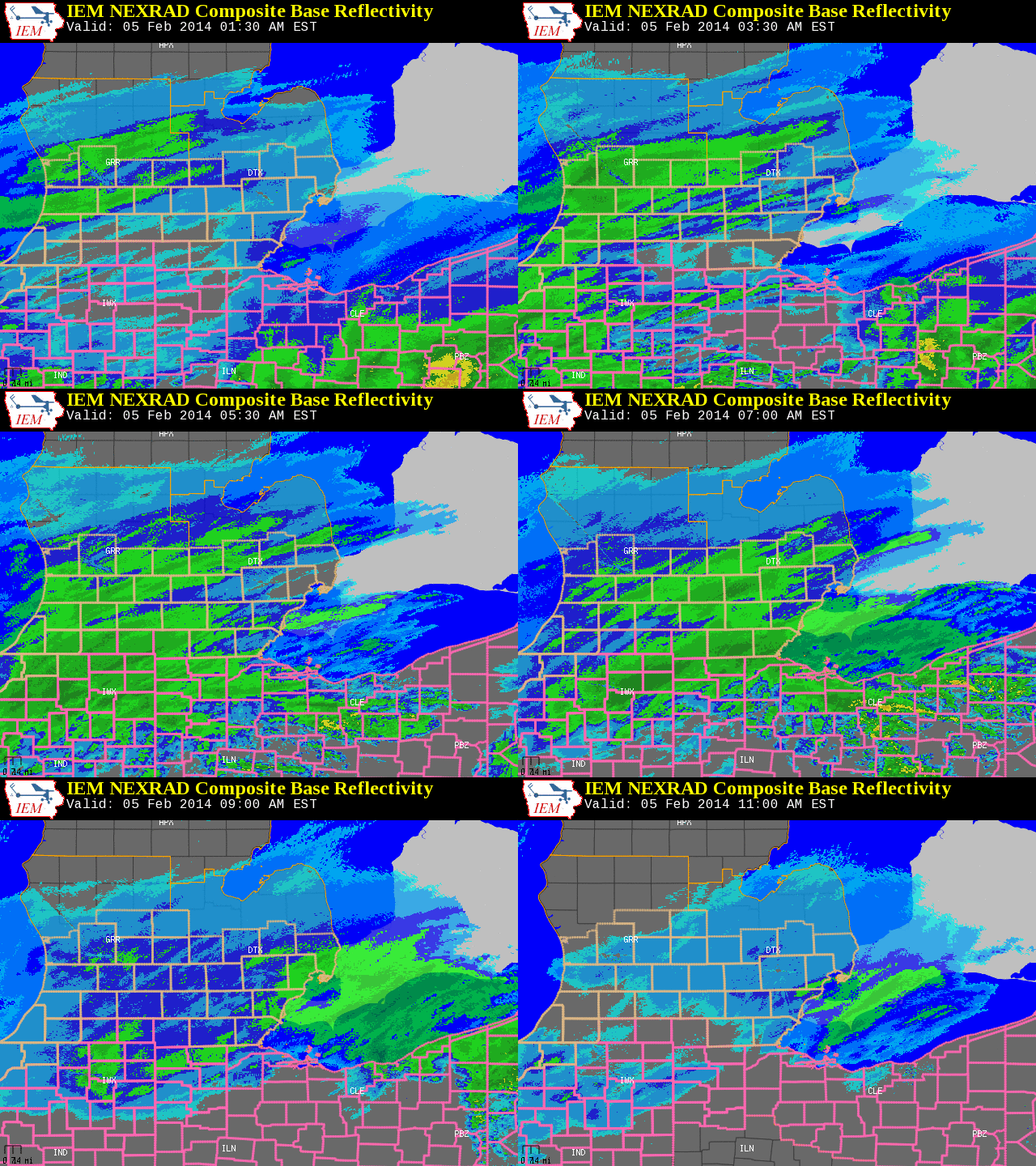
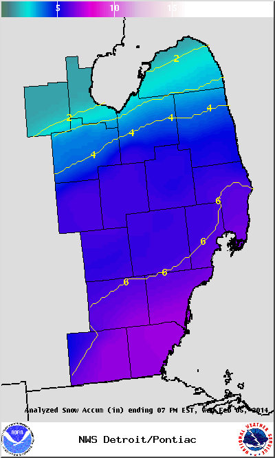
The brutal winter of 2013-2014 continues. Yet another winter system impacted Southeast Michigan during the morning of Wednesday February 5th. Snow actually developed during the late evening hours on the 4th. The snow increased in intensity during the morning of the 5th. Unfortunately, the snow intensified during the morning commute. In addition to the snow, gusty winds led to considerable blowing and drifting. Needless to say, roads become snow covered and extremely slippery. The snow was the result of a storm system which moved across the Ohio Valley and into New York state.This storm system dropped heavy snow from Kansas and Missouri, across the Ohio valley and southern Great Lakes and into the northeast.
The image below shows the weather map during the evening of Feb 4th, prior to the onset of snow across Southern Michigan.
Back to top
|
|
| Radar loop courtesy of Iowa Environmental Mesonet (IEM). Orange boxes are Winter Weather Advisories and pink boxes are Winter Storm Warnings. |
Event summaries from various local NWS offices:
Weather Forecasts
Fire Weather
Snowfall Forecast
Marine Forecast
Beach Forecast
Aviation
Digital Forecast Graphics
Current Weather Conditions
Local Observations
Today's Weather History
Observed Snowfall
Regional Radar Mosaic
Past Weather Records
Climate records by month
Additional Daily Climate Data
Top 20 Lists
Breakdown by Decade
Largest Snowstorms
Season Snowfall Maps
Year To Date Plots
Severe Weather
Daily Plots
Annual Plots
Event Summaries
US Dept of Commerce
National Oceanic and Atmospheric Administration
National Weather Service
Detroit/Pontiac, MI
9200 White Lake Road
White Lake, MI 48386
248-620-9804
Comments? Questions? Please Contact Us.


