339 PM EDT Wed Jun 17 2026
.HYDROLOGY...
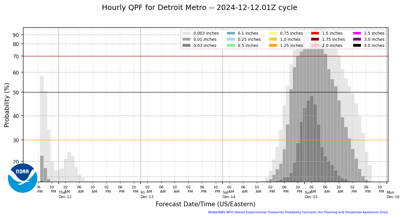
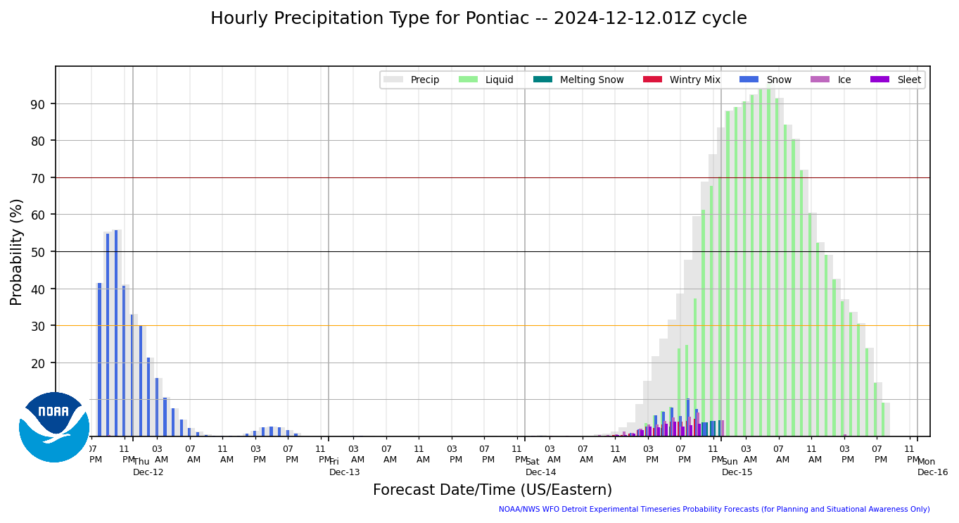
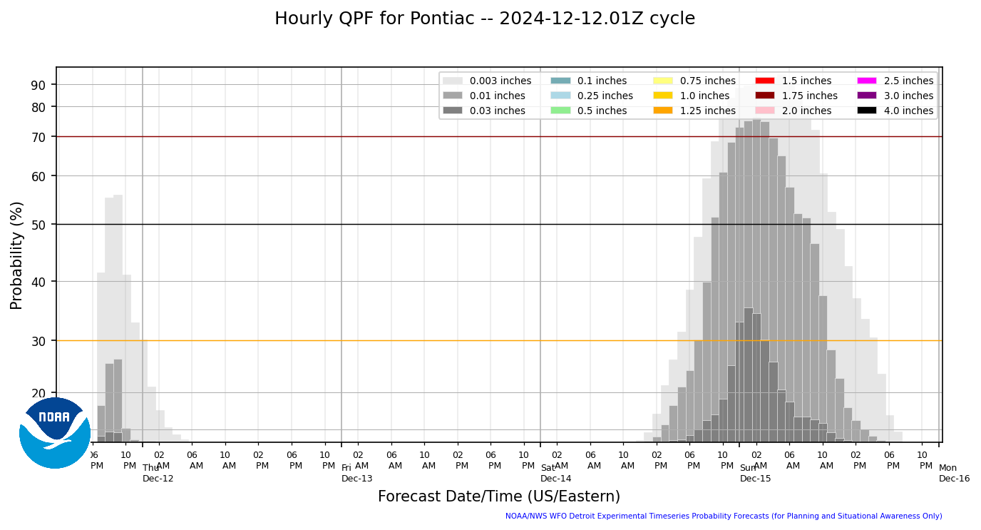
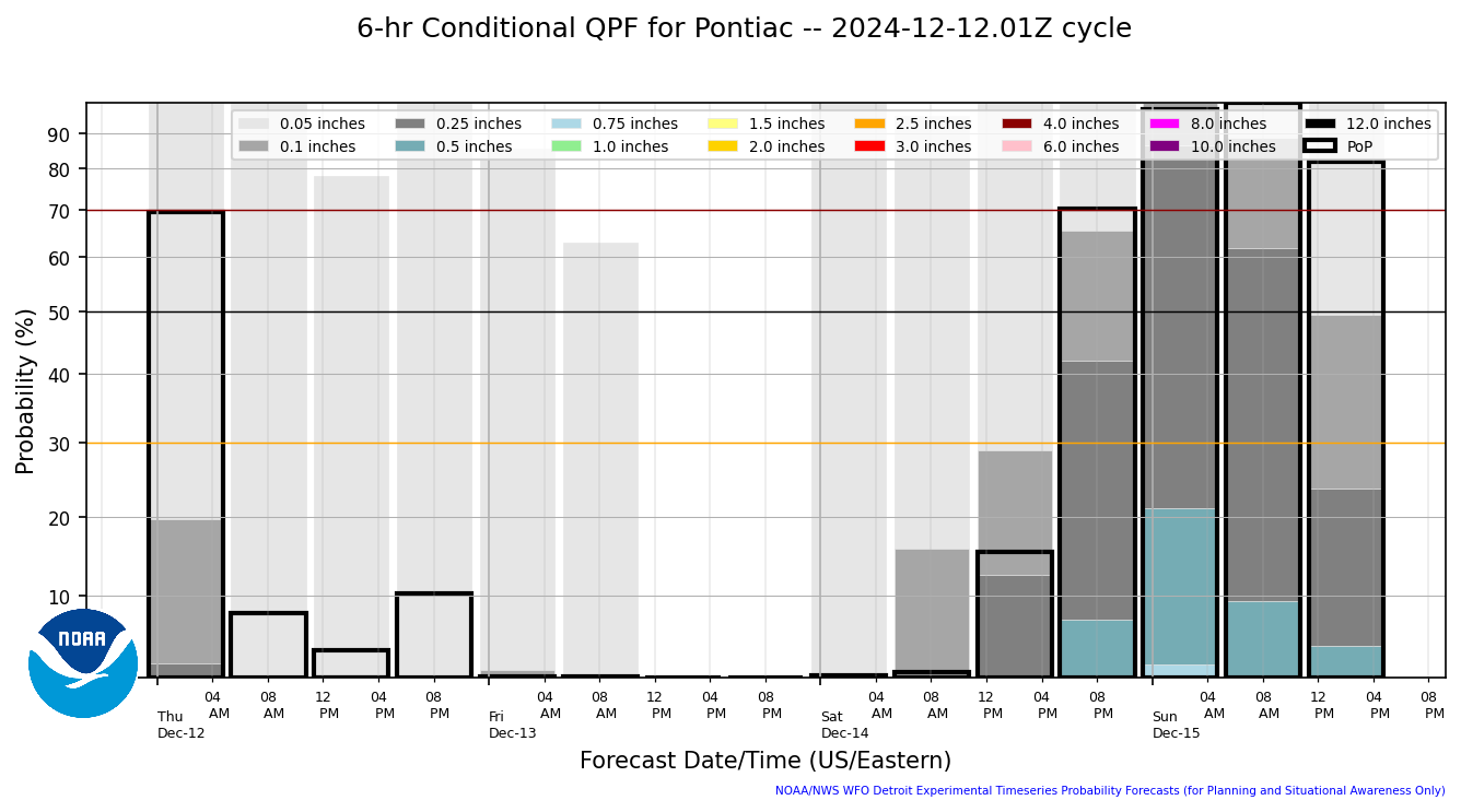
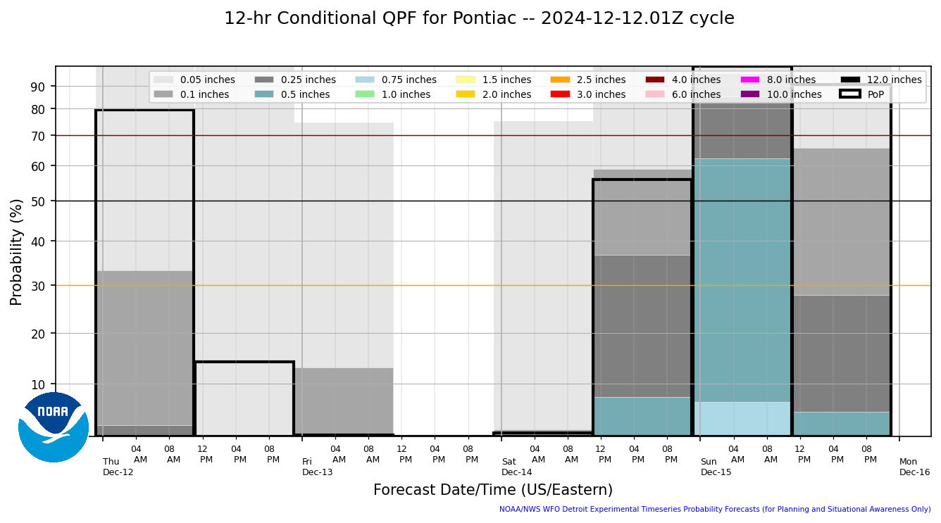
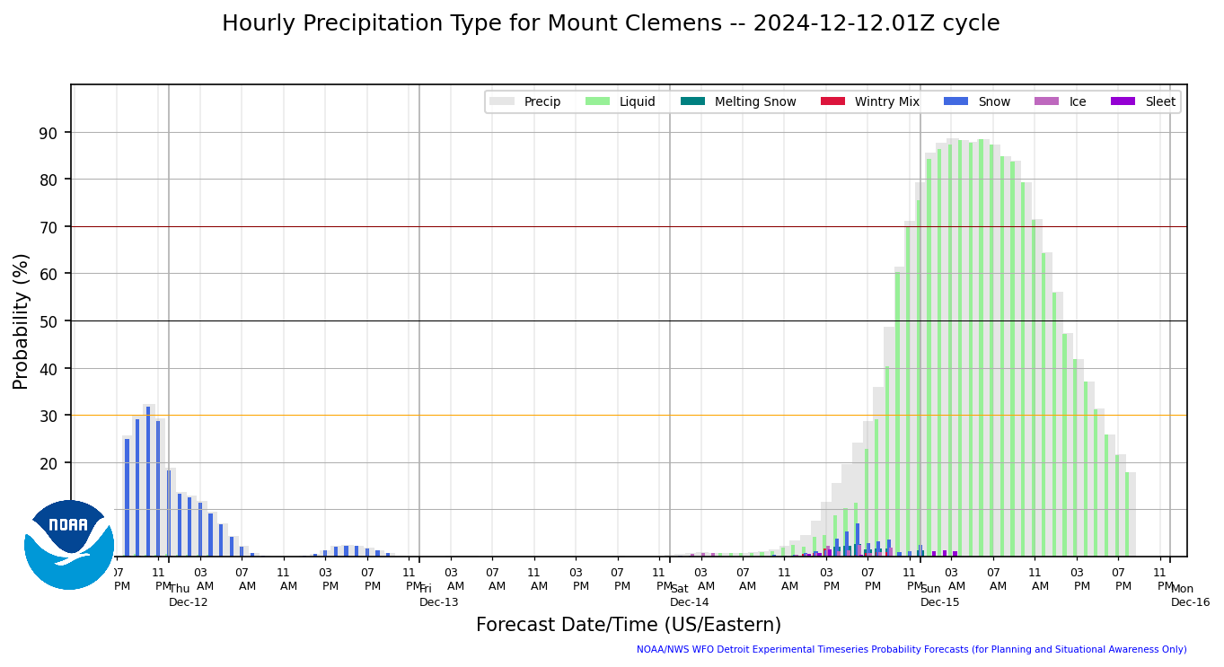
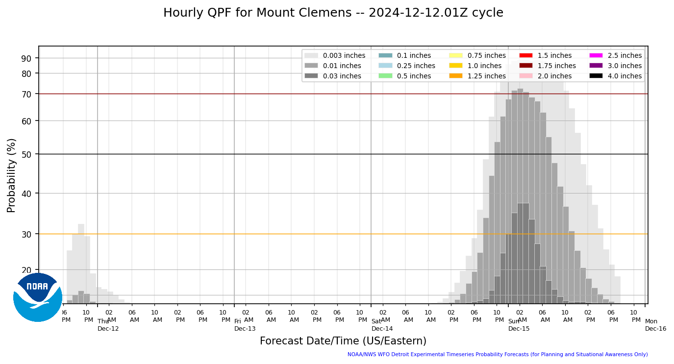
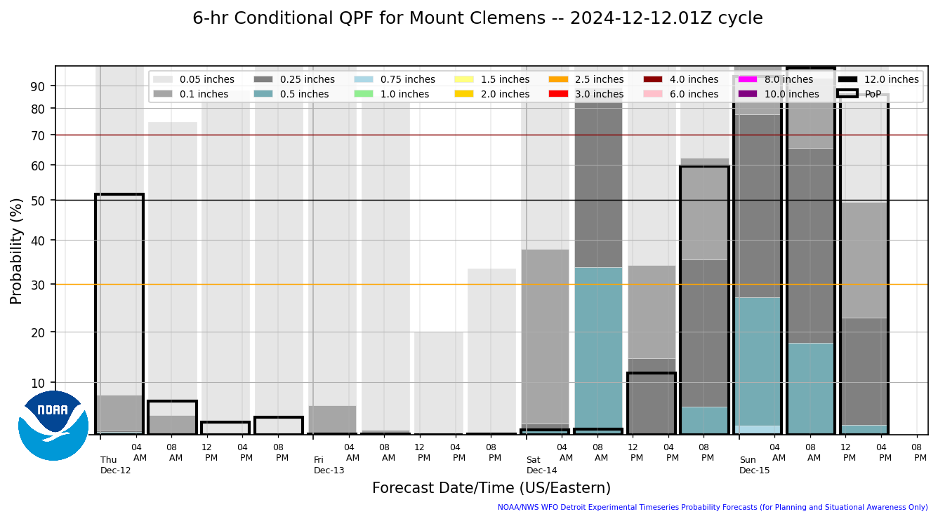
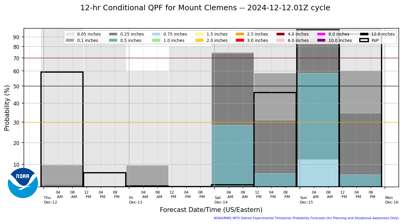
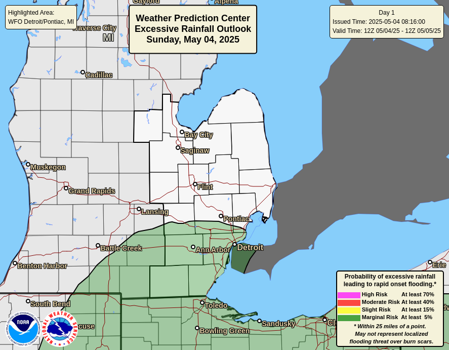
A strong low pressure system will arrive this evening, producing
widespread rainfall with numerous heavy thunderstorms through late
tonight. Rainfall totals up to 1 inch are likely for much of SE MI,
and isolated areas may receive 1 to 3 inches. Most of this rainfall
is expected to occur in 4 hours or less, currently centered between
8pm and 2am. Rainfall rates will likely exceed 1"/hr at times. The
most likely area to get the heavier rainfall has shifted farther
north to areas around Pontiac, Flint and possibly as far north as
Saginaw and Caro. This rainfall may pose a flash flooding threat,
mainly in urban areas, and rises on rivers and streams can be
expected. The Flood Watch has been expanded for areas along M-46 and
I-69. The watch continues for areas south of M-59 mainly due to
most of those locations being more urban with less rainfall still
leading to flooding concerns.
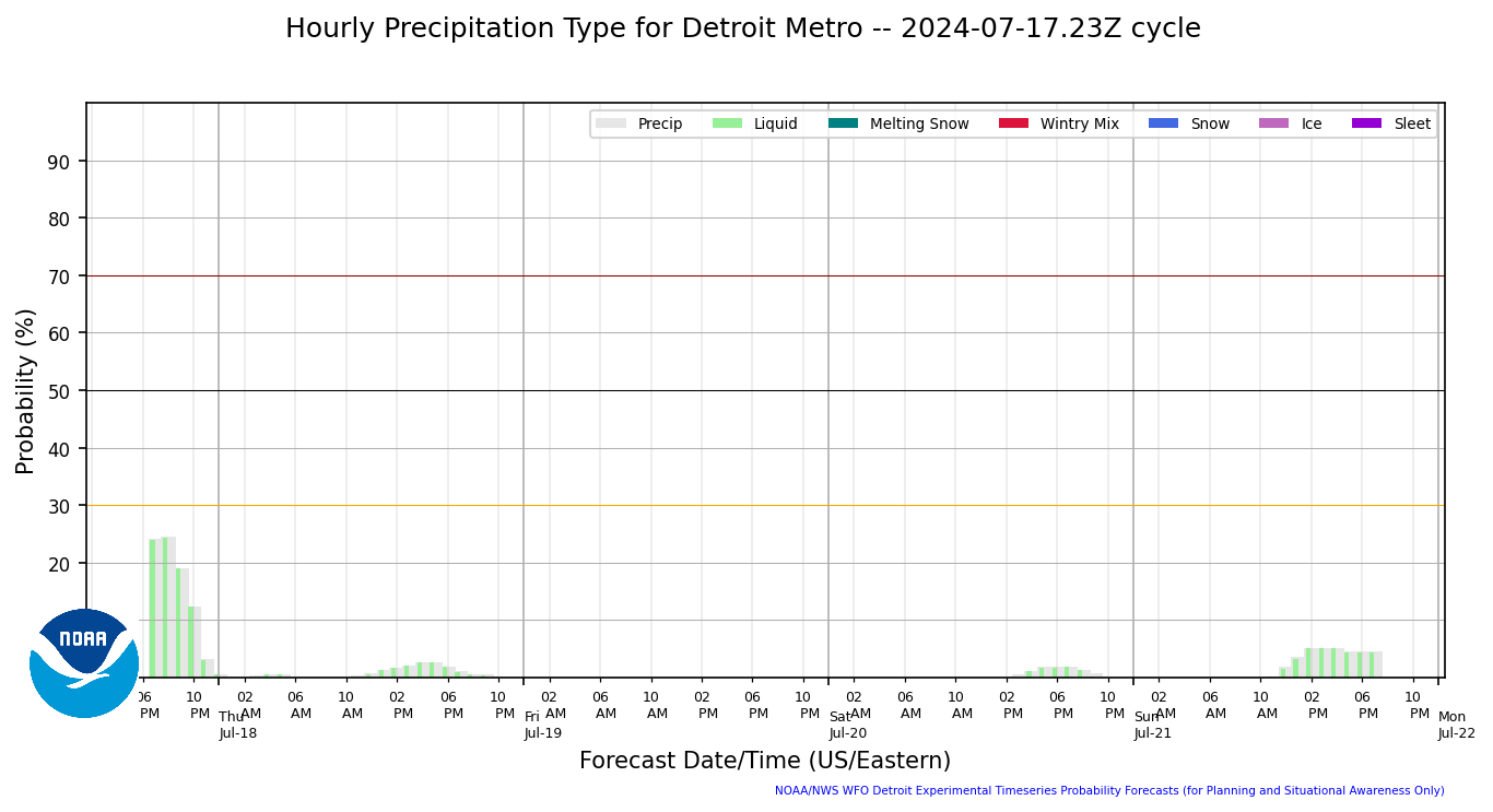
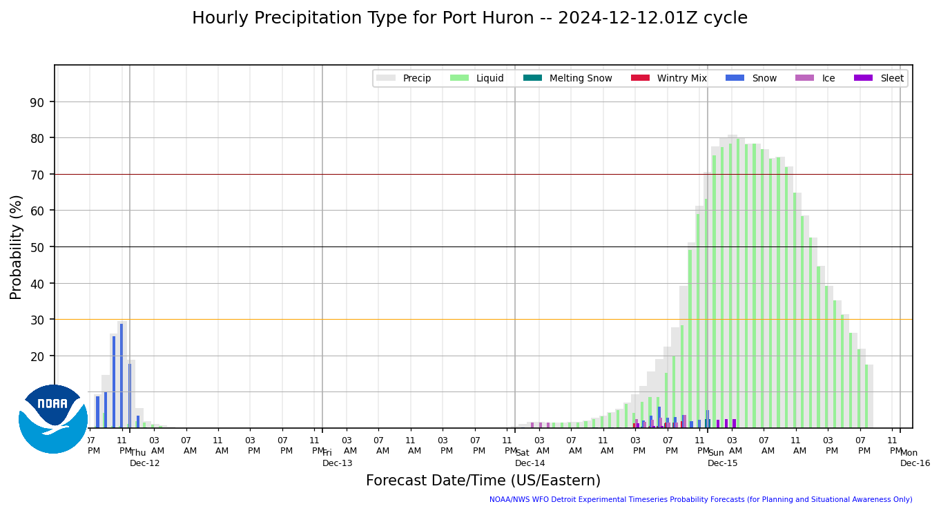
Hourly Precip Type
|
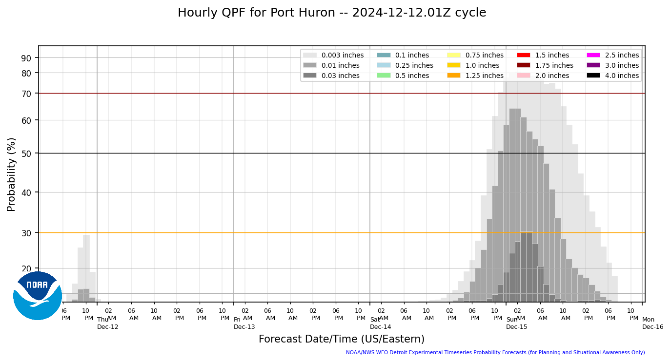
Hourly Precip Amount
|
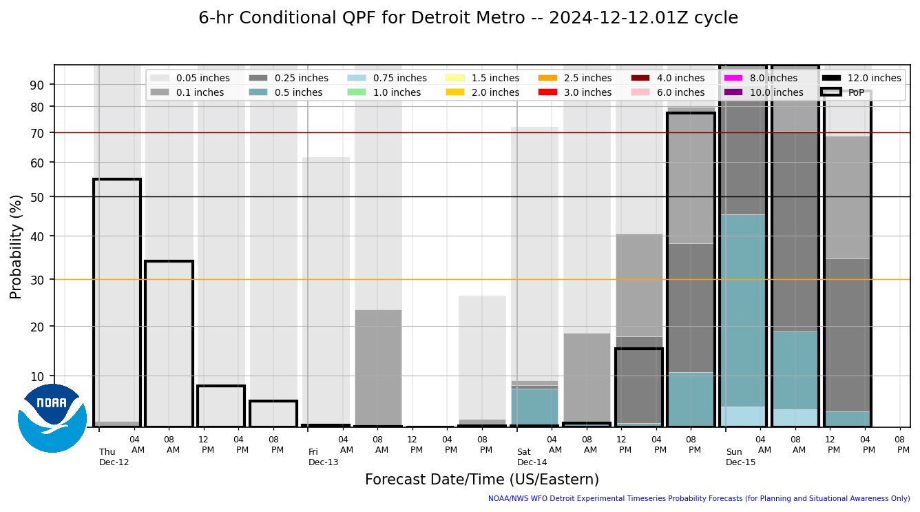
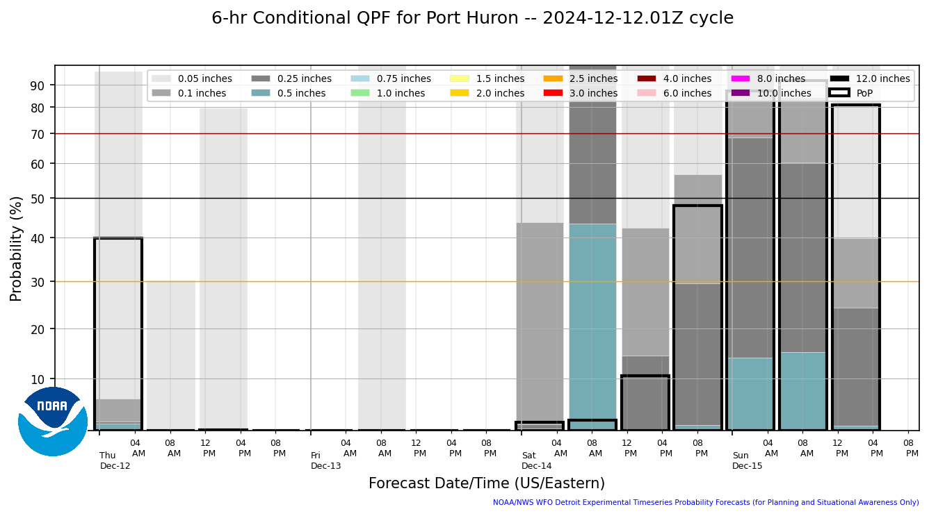
6 Hourly Conditional Precip Amount
|
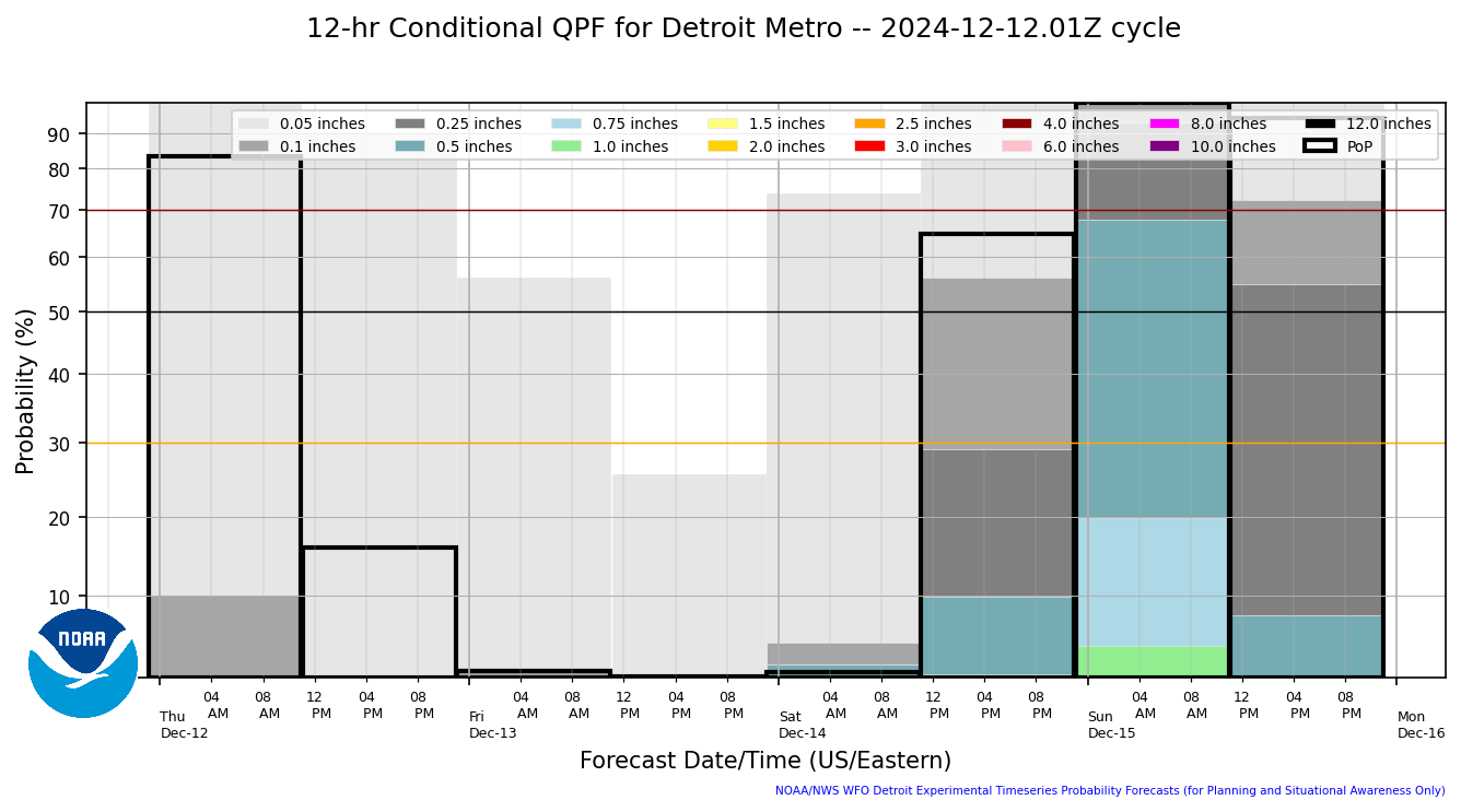
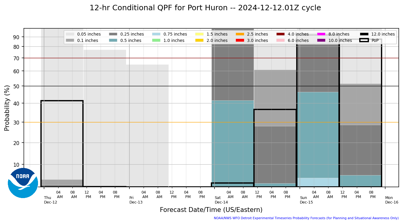
12 Hourly Conditional Precip Amount
|
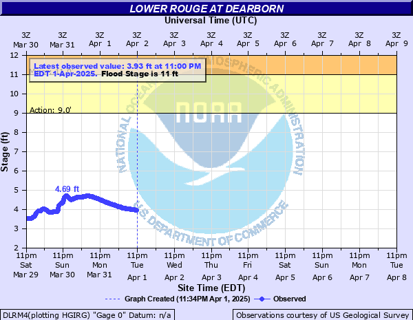
River Info - Dearborn Heights
|
River Info - Dearborn
|
River Info - Garden City
|
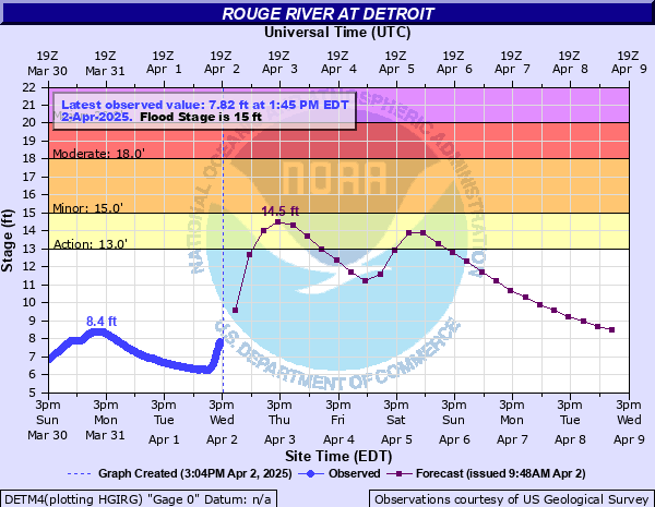
River Info - Detroit
|
Hourly Precip Type
|
Hourly Precip Amount
|
6 Hourly Conditional Precip Amount
|
12 Hourly Conditional Precip Amount
|
River Info - Southfield
|
River Info - Birmingham
|
River Info - Milford
|
Hourly Precip Type
|
Hourly Precip Amount
|
6 Hourly Conditional Precip Amount
|
12 Hourly Conditional Precip Amount
|
River Info - Fraser
|
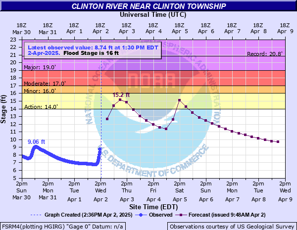
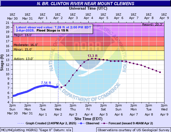
River Info - Mount Clemens
|
River Info - Mount Clemens North
|
Hourly Precip Type
|
Hourly Precip Amount
|
6 Hourly Conditional Precip Amount
|
12 Hourly Conditional Precip Amount
|
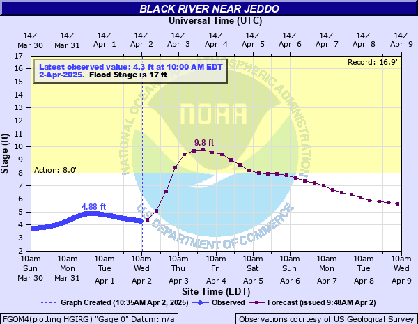
River Info - Jeddo
|
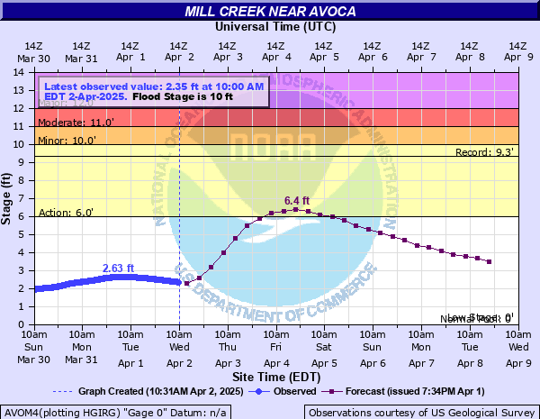
River Info - Avoca
|


Prototype: Under Development: Not to be relied on for Operational Decision Making.