| Overview | Radar | SPC Products | Additional Resources |
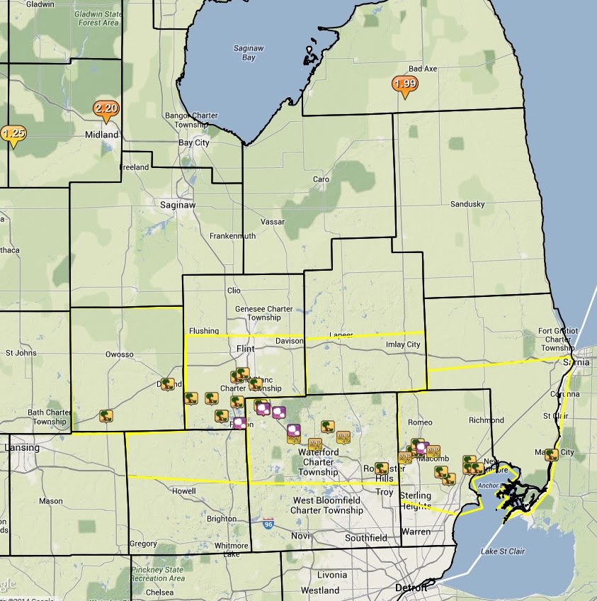
Michigan Severe Weather Awareness Week ended with the first severe weather event of 2014 for Southeast Michigan. A warm front that was set up across the state on Saturday served as the focus for multiple storms that traveled east across the middle of lower Michigan. One storm was able to gather enough strength while moving into a more favorable environment to produce a swath of wind and hail damage across the middle of the NWS Detroit/Pontiac county warning area (CWA). This storm packed high winds and lots of hail as it raced east at about 50-55 mph. Straight line winds up to 70 mph from this storm caused numerous damage, including uprooted trees, downed power lines, and building damage. Along with winds, numerous reports of hail also accompanied the storm with hail up to one inch reported in a few areas. What was impressive with the hail, was the high amount of small hail that fell. In some locations, hail completely covered the ground and was a couple of inches thick!
Back to top

Radar loop courtesy of Iowa Environmental Mesonet (IEM). (Yellow boxes indicate severe thunderstorm warnings)
|
SPC Products (More details can be found by clicking on the images)
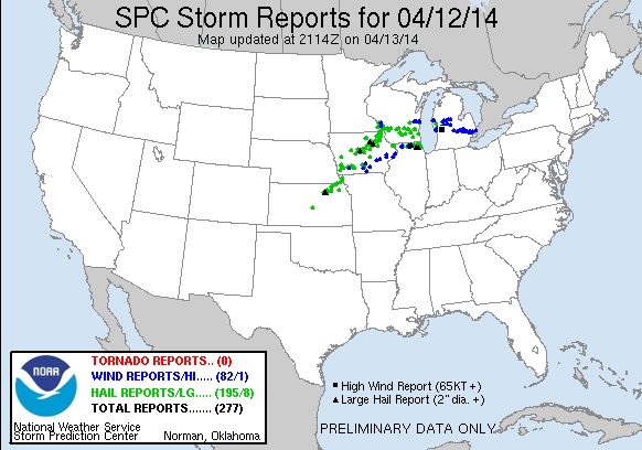
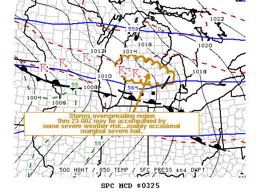
Storm Prediction Center (SPC) products include watches that were issued and mesoscale discussions (MCDs).
 |
 |