Detroit/Pontiac, MI
Weather Forecast Office
Overview
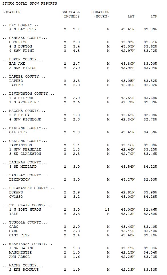
An upper-level disturbance (a disturbance in the upper atmospheric flow pattern which is usually associated with clouds and precipitation) combined with the intensification of a frontal boundary to the south resulted in an extended period of snowfall across SE MI, the bulk of which fell across Flint and north into Saginaw and the Midland/Bay area. Most locations along and north of I-69 saw anywhere between 2 - 4 inches of snowfall, with some localized higher amounts, across a 17-19 hour period. Locations along and south of I-96 saw two inches or less as snowfall got off to a later start and ended earlier relative to locations north.Snowfall Totals
.png)
Radar
Header
 |
|
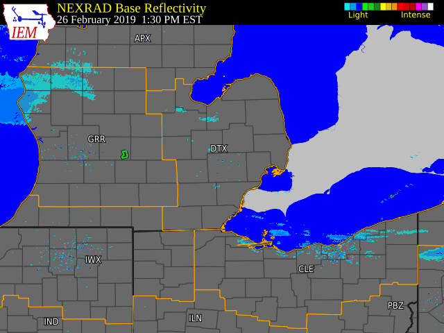
Radar Loop of Snow Event from Tuesday Night through Wednesday Afternoon (Loop courtesy of Iowa Environmental Mesonet) |
Storm Reports
 |
Media use of NWS Web News Stories is encouraged! Please acknowledge the NWS as the source of any news information accessed from this site. |
|
Weather Forecasts
Marine Forecast
Aviation
Snowfall Forecast
Enhanced Data Display
Fire Weather
Beach Forecast
GIS Forecast Maps
Current Weather Conditions
Local Observations
Today's Weather History
Observed Snowfall
Regional Radar Mosaic
Past Weather Records
Climate records by month
Additional Daily Climate Data
Top 20 Lists
Breakdown by Decade
Largest Snowstorms
Season Snowfall Maps
Year To Date Plots
Severe Weather
Daily Plots
Annual Plots
Event Summaries
US Dept of Commerce
National Oceanic and Atmospheric Administration
National Weather Service
Detroit/Pontiac, MI
9200 White Lake Road
White Lake, MI 48386
248-620-9804
Comments? Questions? Please Contact Us.

