Current Regional Radar

|
Current Hazards
|
Current Forecast
442
FZUS61 KCLE 141946
GLFLE
Open Lake Forecast for Lake Erie
National Weather Service Cleveland OH
346 PM EDT Tue Jul 14 2026
For waters beyond five nautical miles of shore on Lake Erie
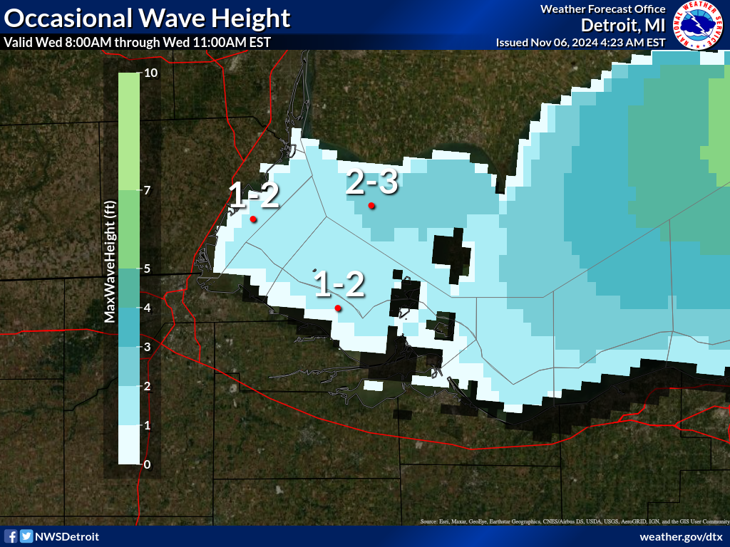
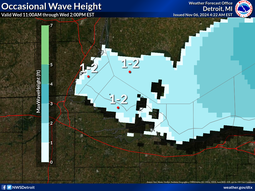
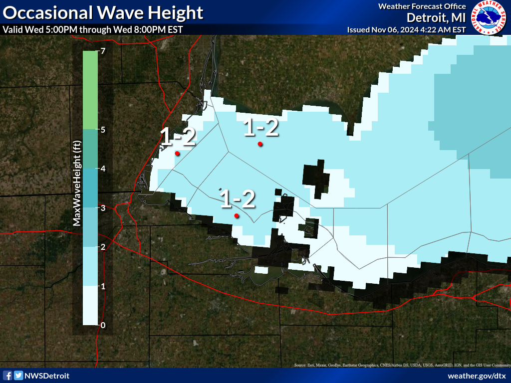
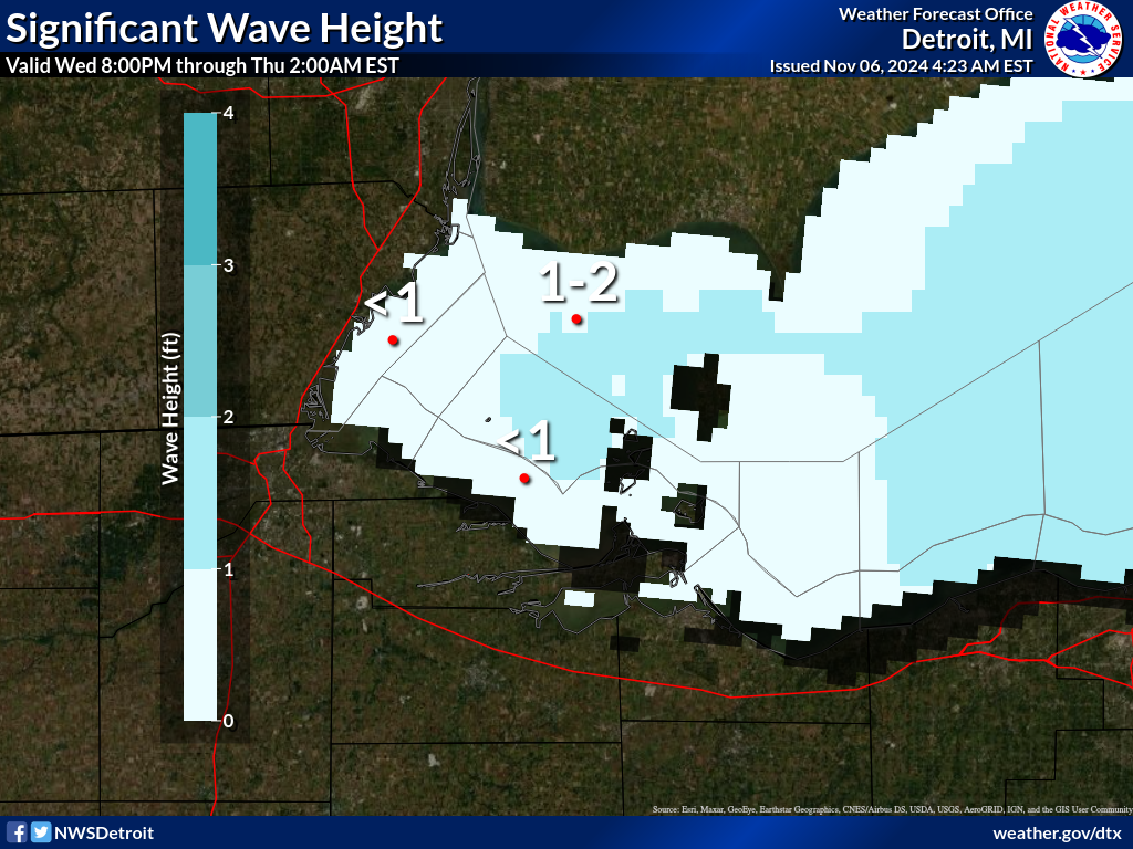
Waves are the significant wave height - the average of the highest
1/3 of the wave spectrum. Occasional wave height is the average of
the highest 1/10 of the wave spectrum.
.SYNOPSIS...
High pressure 30.20 inches continues to build across the Great
Lakes region and into the Ohio Valley through Wednesday. A cold
front will move south across Lake Erie on Wednesday night with a
secondary cold front pushing south on Saturday.
LEZ162-163-150230-
Detroit River Lt. to Maumee Bay OH to Reno Beach OH beyond 5NM
offshoreline to US-Canadian border-
Reno Beach to The Islands OH beyond 5NM off shoreline to US-
Canadian border-
346 PM EDT Tue Jul 14 2026
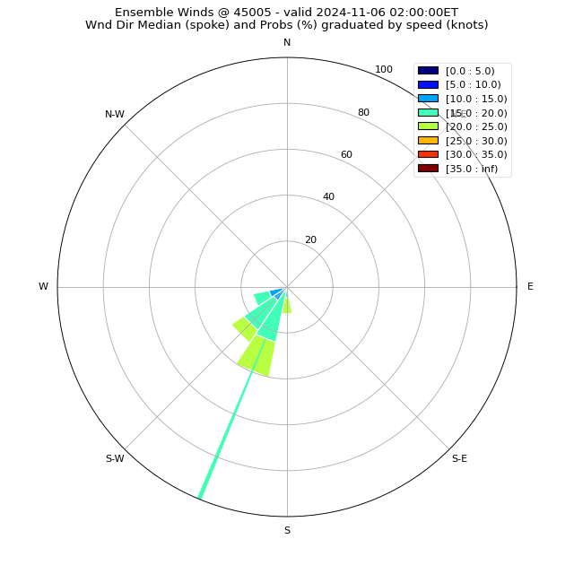
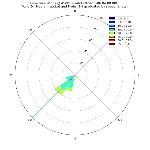
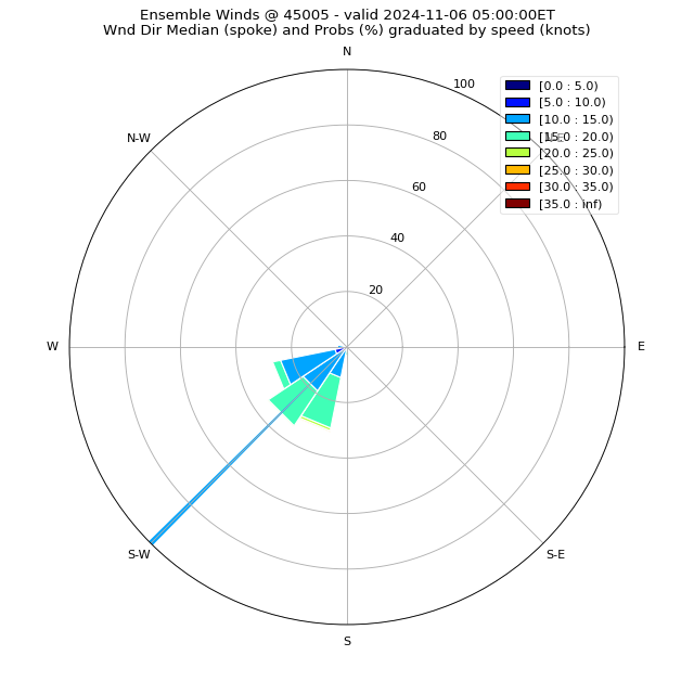
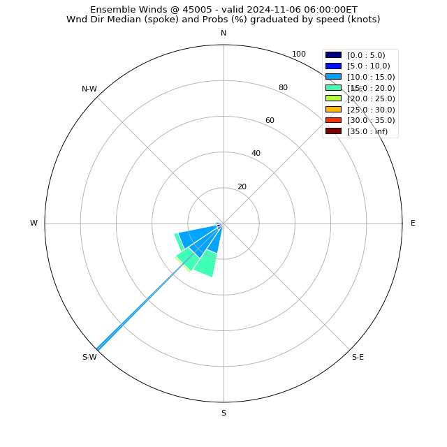
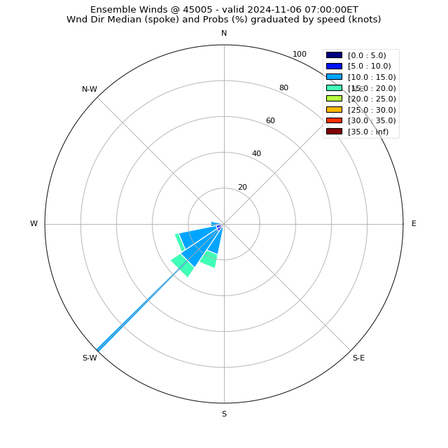
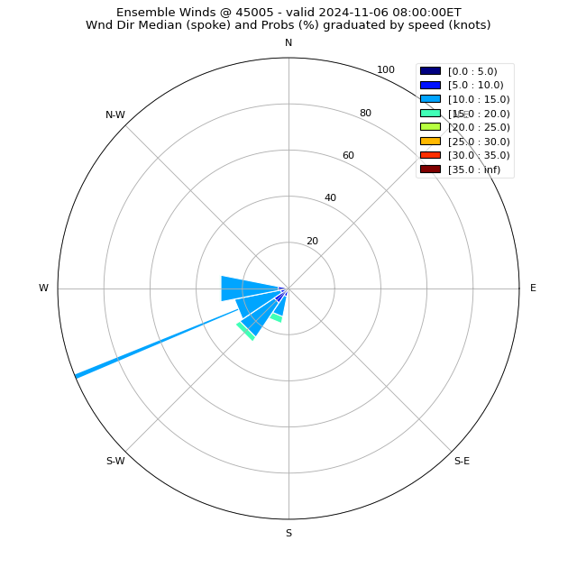
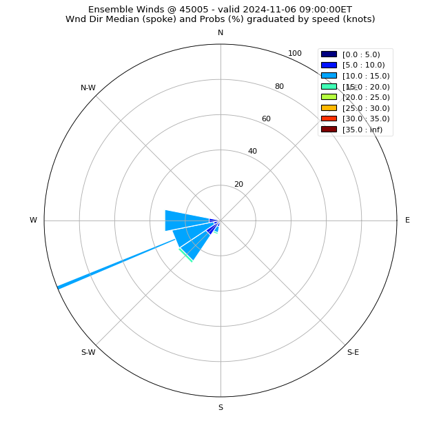
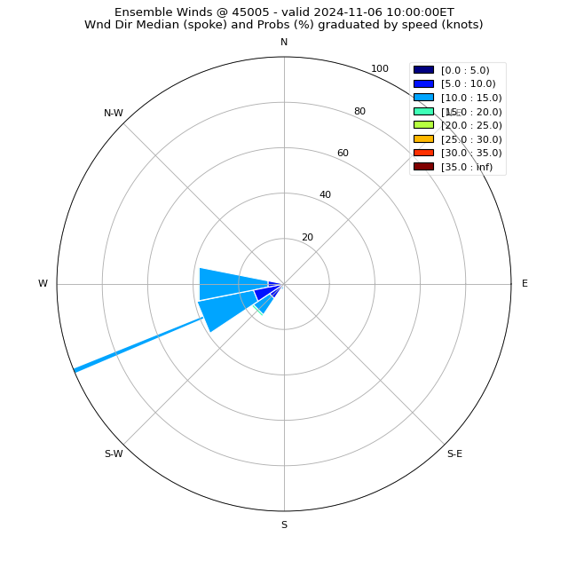
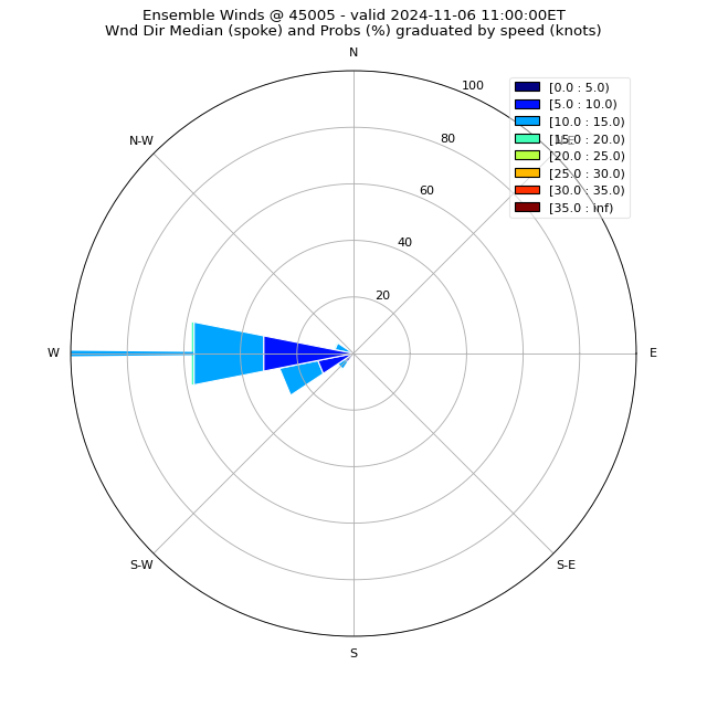
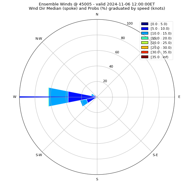
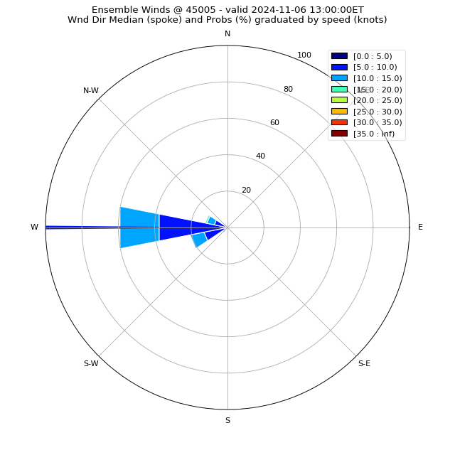
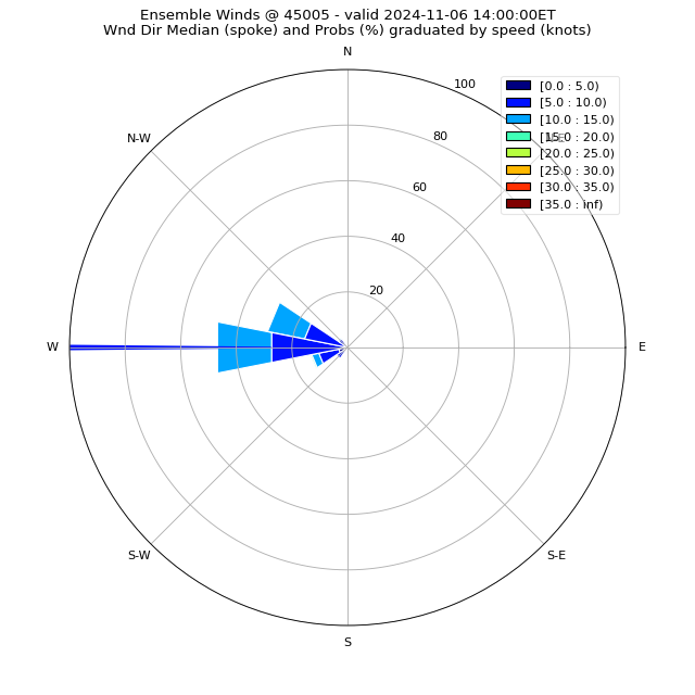
.TONIGHT...Southwest winds around 10 knots becoming west. Waves
2 feet or less.
.WEDNESDAY...West winds 5 to 10 knots. Waves 1 foot or less.
.WEDNESDAY NIGHT...West winds 5 to 10 knots becoming northeast.
Waves 1 foot or less.
.THURSDAY...Northeast winds 10 knots or less becoming east. Waves
1 foot or less.
.THURSDAY NIGHT...East winds 5 to 10 knots becoming southeast.
Waves 1 foot or less.
.FRIDAY...Southeast winds 5 to 10 knots becoming southwest. A
chance of showers and thunderstorms. Waves 1 foot or less.
.SATURDAY...West winds 10 to 15 knots becoming northwest. A
chance of showers and thunderstorms. Waves 1 to 3 feet.
.SUNDAY...North winds 5 to 15 knots becoming south. Waves 1 to
3 feet.
Winds and waves higher in and near thunderstorms.
$$
LEZ164>166-150230-
The Islands to Vermilion OH beyond 5 nm off shoreline to US-
Canadian border-
Vermilion to Avon Point OH beyond 5 nm off shoreline to US-
Canadian border-
Avon Point to Willowick OH beyond 5 nm off shoreline to US-
Canadian border-
346 PM EDT Tue Jul 14 2026
.TONIGHT...Southwest winds 10 to 15 knots becoming west. Waves
1 to 3 feet.
.WEDNESDAY...West winds 5 to 10 knots. Waves 1 to 3 feet.
.WEDNESDAY NIGHT...West winds 5 to 10 knots becoming northeast.
Waves 1 foot or less.
.THURSDAY...Northeast winds 10 knots or less becoming northwest.
Waves 1 foot or less.
.THURSDAY NIGHT...Northeast winds 5 to 10 knots becoming east.
Waves 1 foot or less.
.FRIDAY...Southeast winds 5 to 10 knots becoming south. Showers
likely with a chance of thunderstorms Friday night. Waves 1 foot
or less.
.SATURDAY...Southwest winds 10 to 15 knots becoming northwest. A
chance of showers and thunderstorms during the day, then showers
likely with a chance of thunderstorms Saturday night. Waves 1 to
3 feet building to 2 to 4 feet.
.SUNDAY...North winds 5 to 15 knots becoming south. Waves 2 to
4 feet.
Winds and waves higher in and near thunderstorms.
$$
LEZ061-167>169-150230-
Ripley to Buffalo NY extending from 5NM off shoreline to US-
Canadian border-Willowick to Geneva-on-the-
Lake OH beyond 5NM off shoreline to US-Canadian border-Geneva-on-
the-Lake to Conneaut OH beyond 5 nm off shoreline to US-
Canadian border-
Conneaut OH to Ripley NY beyond 5 nm off shoreline to US-
Canadian border-
346 PM EDT Tue Jul 14 2026
.TONIGHT...Southwest winds 15 to 20 knots becoming west 10 to
15 knots. Waves 3 to 5 feet subsiding to 2 to 4 feet.
.WEDNESDAY...West winds 10 to 15 knots. Waves 1 to 3 feet.
.WEDNESDAY NIGHT...West winds 10 knots or less becoming north.
Waves 2 feet or less.
.THURSDAY...Northwest winds 5 to 10 knots becoming west. Waves
1 foot or less.
.THURSDAY NIGHT...Northwest winds 5 to 10 knots becoming
northeast. Waves 1 foot or less.
.FRIDAY...East winds 10 knots or less becoming south. Showers
likely with a chance of thunderstorms Friday night. Waves 1 foot
or less.
.SATURDAY...Southwest winds 10 to 15 knots becoming northwest. A
chance of showers and thunderstorms during the day, then showers
likely with a chance of thunderstorms Saturday night. Waves 1 to
3 feet building to 2 to 4 feet.
.SUNDAY...North winds 5 to 15 knots becoming south. Waves 2 to
4 feet subsiding to 1 to 3 feet.
Winds and waves higher in and near thunderstorms.
$$
LEZ161-150230-
MAFOR 1421/
ERIE WEST 1/3 12510 12610 14600. Waves 1 to 3 feet tonight. Waves
2 feet or less Wednesday.
ERIE CENTRAL 1/3 11520 12510 11610 14600. Waves 2 to 4 feet
tonight. Waves 1 to 3 feet Wednesday.
ERIE EAST 1/3 12520 11510 11610 13600 11610. Waves 3 to 5 feet
tonight. Waves 2 to 3 feet Wednesday.
$$