Overview
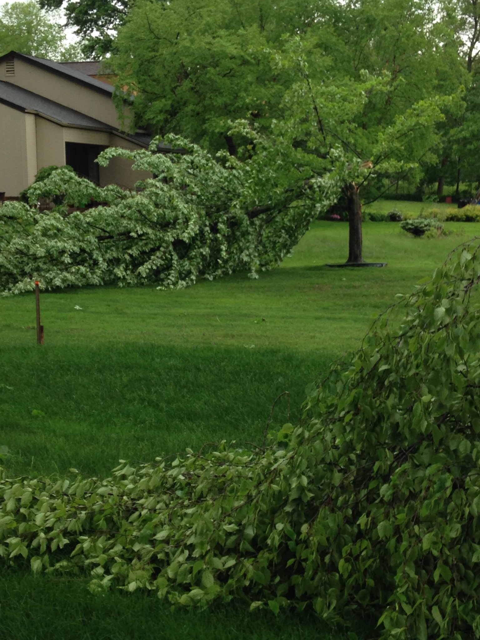
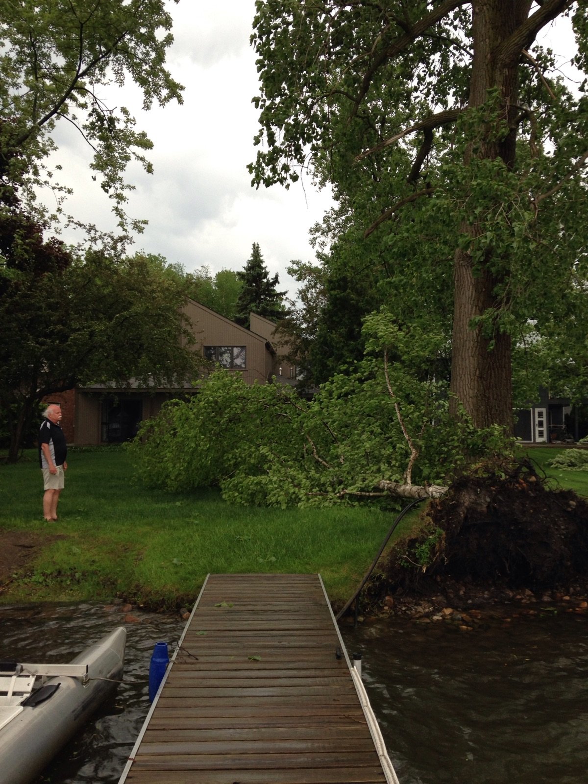
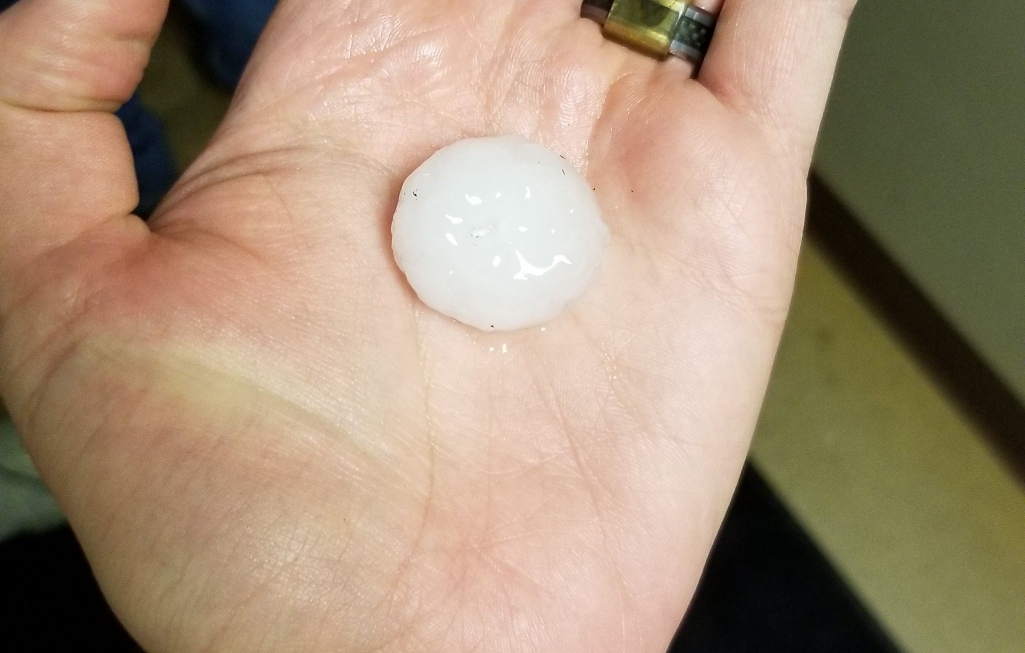
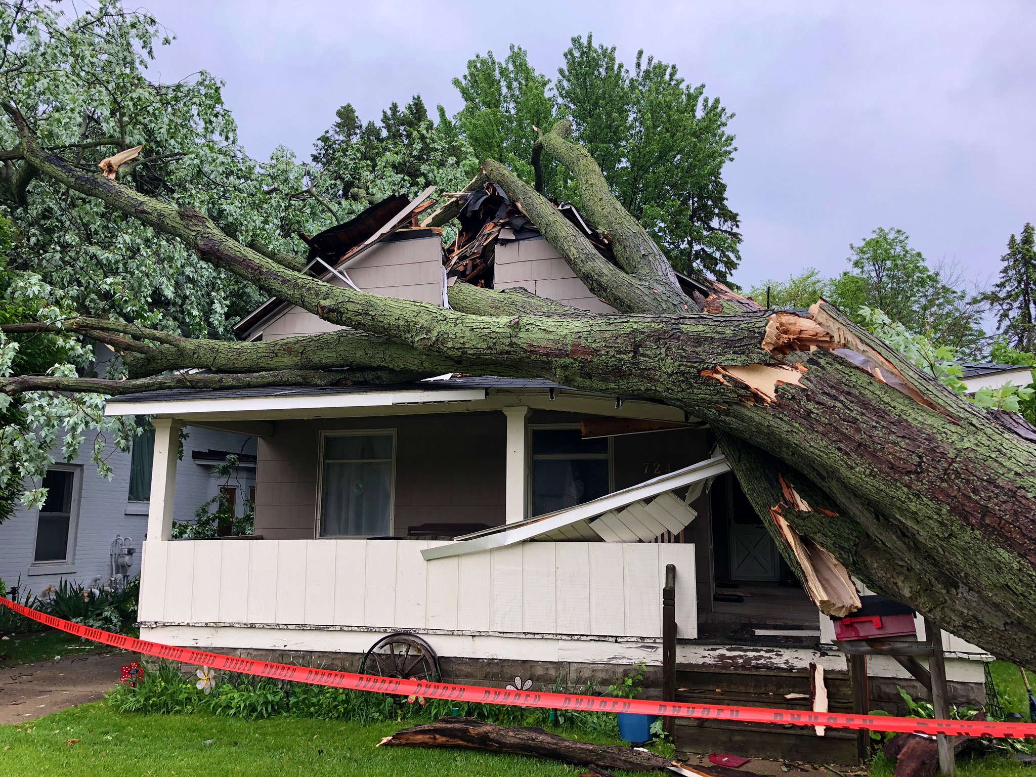
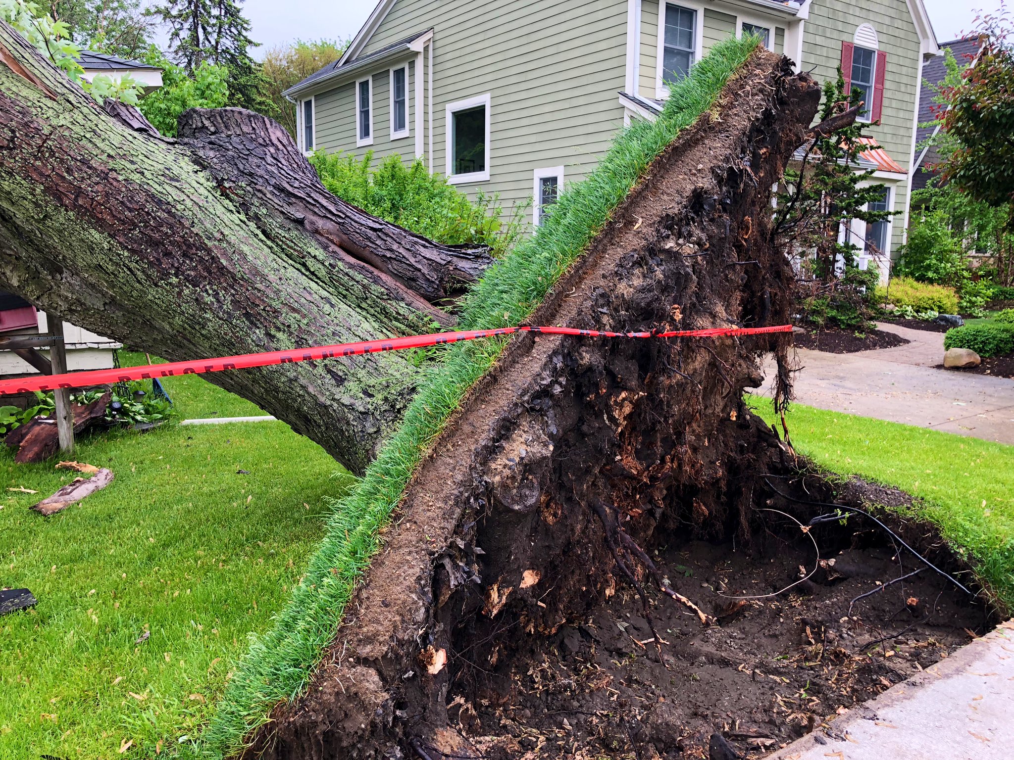
A wedge of instability built in across southern Michigan throughout the late morning and afternoon and was the source of numerous strong thunderstorms, many of which produced both severe wind gusts to 60 mph and hail up to 1.25 inches for locations along the I-69 corridor and south down to the Ohio border. Most of the severe hail to or in excess of one inch was confined to Lenawee County and Monroe County, but pea (1/4") to penny (3/4") sized hail was observed at multiple locations across SE MI. Additionally, a line of thunderstorms extending north from Milan and Ann Arbor up to Flint pushed east throughout the afternoon and produced sporadic 60 mph wind gusts, resulting in scattered tree damage, isolated building damage, and power outages.
Photos
 |
 |
 |
|
West Bloomfield Credit: Art and Beth Zelinsky |
West Bloomfield Credit: Art and Beth Zelinsky |
Blissfield Credit: Tim O'Donnell |
 |
 |
|
|
Rochester Credit: Jenn Schanz (WXYZ) |
Rochester Credit: Jenn Schanz (WXYZ) |
Radar
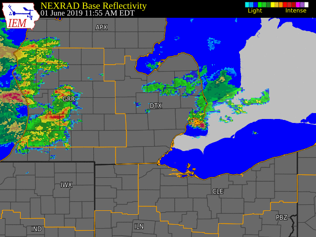  |
|
Click to Enlarge Radar loop courtesy of Iowa Environmental Mesonet (IEM) |
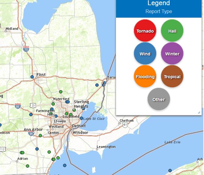
Storm Reports
Map of Local Storm Reports Depicting Hail to 1/2 inch or greater (green) and damaging wind gusts (blue):
----------------------------------------------------------------------------------------------------
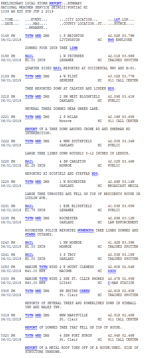
Severe Weather Local Storm Reports:
----------------------------------------------------------------------------------------------------
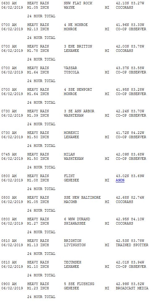
Excessive Rainfall Local Storm Reports:
Environment
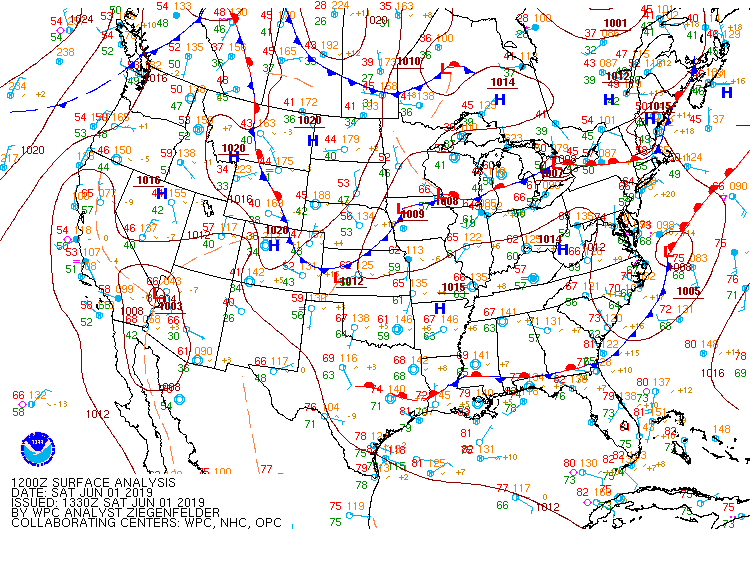
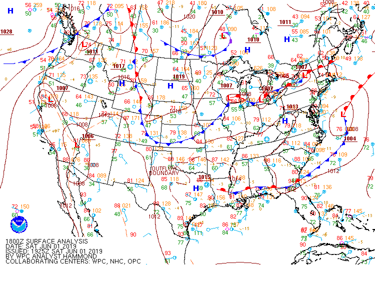
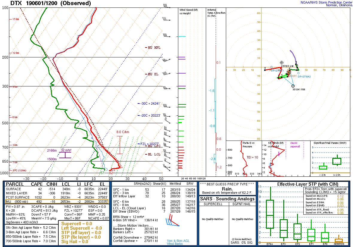
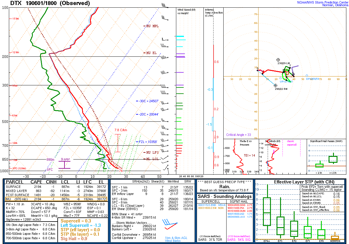
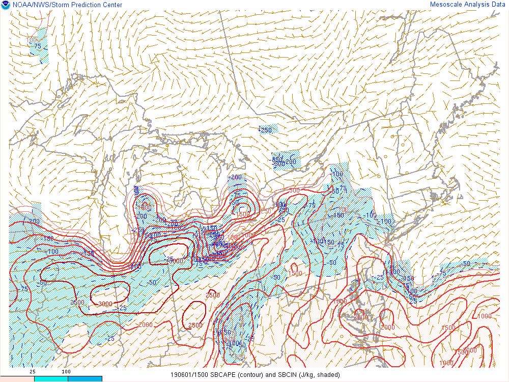
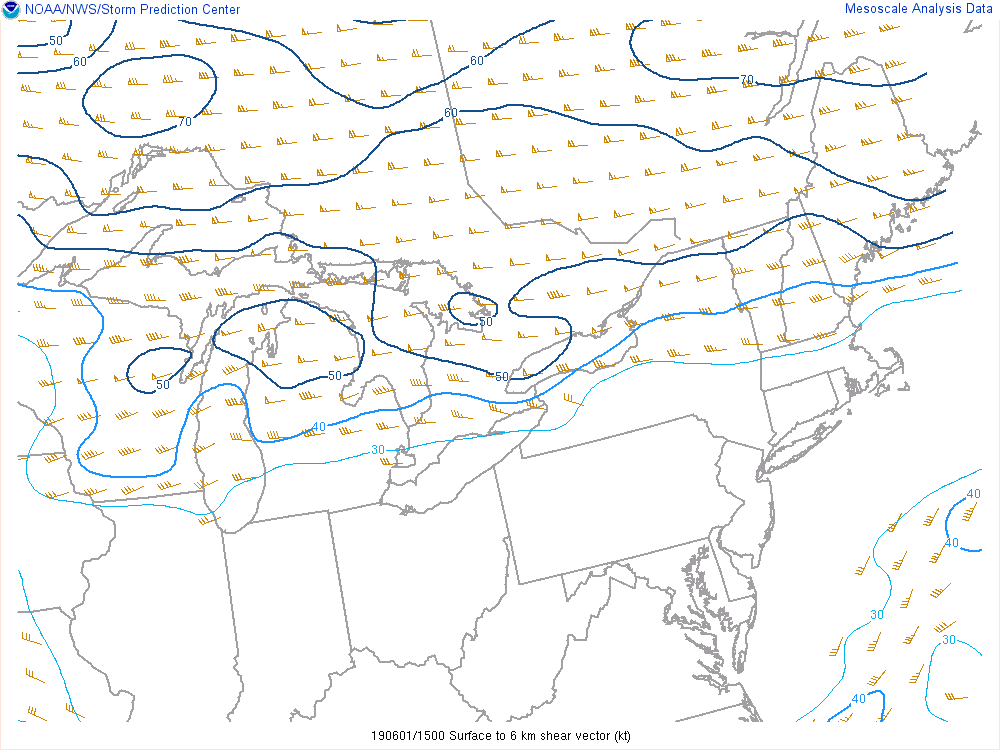
June 1 started with a midlevel ridge in place over southeast Michigan and a stationary front draped across the region (see Figure 1). A few storms moved into the Saginaw Valley and I-69 corridor in the 8-10am time frame but generally weakened as they progressed eastward due to this ridge. However, some pea-sized hail was reported around Flint. The ridge exited to the east by mid-morning and opened the door for better destabilization to occur. Steep midlevel lapse rates of around 7 to 7.5°C/km were observed in the 12z and 18z upper air soundings (Figures 4 and 5) which lead to convective available potential energy (CAPE) in excess of 3000 J/kg (Figure 7). Better 0-6 km bulk wind shear was displaced across northern Michigan (Figure 8), however shear of around 30 kt proved sufficient for storm organization across the southern third of the state. Good atmospheric moisture content - precipitable water values over 1 inch - resulted in heavy downpours with many of the storms.
Positive differential vorticity advection in the wake of the departing ridge and shortwave energy from thunderstorms that formed early in the day over northern Illinois and southern Wisconsin provided lift for storms to advance across southern Michigan early in the afternoon. These storms fed off the warm and humid air present (temperatures in the mid 70s and dew points in the 60s) and formed a line of strong to severe storms. Small hail was reported across much of southeast Michigan, but large hail occurred in a few locations near the Ohio border where slightly better instability existed and updrafts were able to remain a bit more discrete. Wind damage was scattered across the area where short-lived stronger downbursts developed. Subsidence in the wake of the afternoon convection led to a few hours of dry weather before another round of storms developed in the evening. These storms had much less instability to work with over southeast Michigan, but did produce very large hail in Battle Creek.
 |
 |
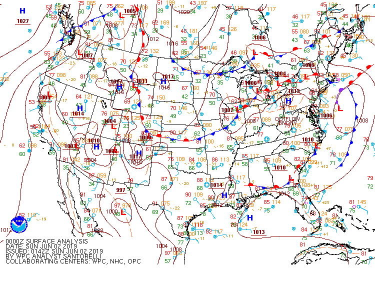 |
| Figure 1: Surface map, valid 12 UTC June 1, 2019. | Figure 2: Surface map, valid 18 UTC June 1, 2019. | Figure 3: Surface map, valid 00 UTC June 2, 2019. |
 |
 |
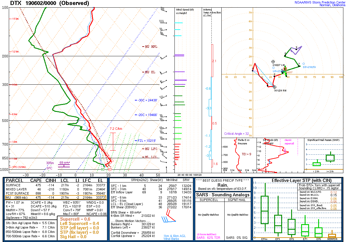 |
| Figure 4: DTX upper air sounding, valid 12 UTC June 1, 2019. | Figure 5: DTX upper air sounding, valid 18 UTC June 1, 2019. | Figure 6: DTX upper air sounding, valid 00 UTC June 2, 2019. |
 |
 |
|
| Figure 7: Loop of surface-based Convective Available Potential Energy (CAPE), valid from 15 to 21 UTC June 1, 2019. | Figure 8: Loop of bulk 0-6km wind shear, valid from 15 to 21 UTC June 1, 2019. |
 |
Media use of NWS Web News Stories is encouraged! Please acknowledge the NWS as the source of any news information accessed from this site. |
|

