Overview
A large and complex low pressure system took aim not only across the Great Lakes region, but also the Central Plains and the Southeast. Almost every weather event was seen with this system, as rain, snow, sleet, hail, tornadoes, freezing rain, and flooding battered areas over a 3 to 4 day period. Tornadic supercells developed along the strong cold front over southern portions of the US, while blizzard conditions pummeled portions of the northern plains and into the northern Great Lakes. Southeast Michigan saw heavy rain, snow, sleet and freezing rain that began on Friday and lasted through Sunday. This system brought 2 main periods of precipitation, with a short break in between on Saturday. This break, along with the timeline of precipitation, can be found on the radar tab. Southeast Michigan had 2-3" reports of heavy rain, 2-3" of sleet and about 1/4" to 1/2" of ice from freezing rain. In total, DTE and Consumers Energy reported power outages for nearly 500,000 customers due to the event. Additionally, strong and persistent northeast winds lead to lakeshore flooding around Saginaw Bay and on the Lake Erie shoreline.Photos & Videos:
 |
 |
 |
 |
(Courtesy of Tanner McCanham) |
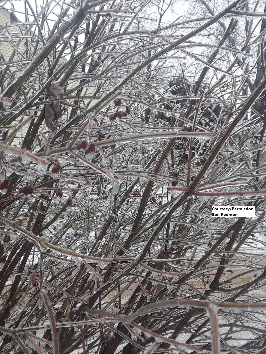
Lake Orion, MI (Courtesy of Ben Redmon) |
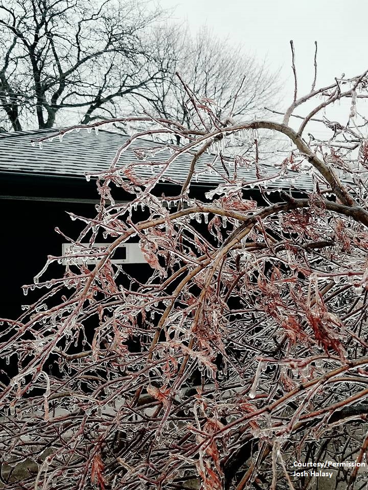
Wyandotte, MI (Courtesy of Josh Halasy) |
Wyandotte, MI (Courtesy of Josh Halasy) |
 |
 |
 |
 |
| Wyandotte, MI (Courtesy of Josh Halasy) |
Garden City, MI (Courtesy of Thomas Iwinski) |
Marlette, MI (Courtesy of Nancy Boyne) |
Columbus Township, MI (Courtesy of Amanda Jane Kisielewicz) |
 |
 |
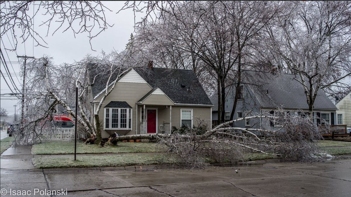
| Wyandotte, MI (Courtesy of Isaac Polanski) |
Garden City, MI (Courtesy of Isaac Polasnki) |
Video from @MattSmithWXYZ showing Monroe County flooding along Lake Erie on Sunday, April 15th.
Bay County video from @DaveBondyTV showing freezing spray on a house.
Flooding near Saginaw Bay via @WNEMTV5news
Radar:
Radar Loop of the entire storm from Friday, April 13th to Sunday April 15th.
 |
 |
|
Radar loop starting on Friday, April 13th, and going through Sunday, April 15th. (Radar courtesy of Iowa Environmental Mesonet (IEM)) |
Radar loops showing the changeover from rain to sleet/freezing rain on Sunday, April 15th.
 |
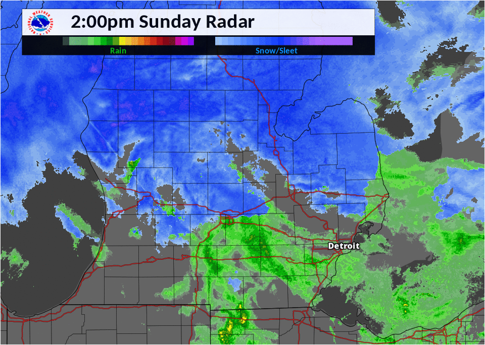 |
| Radar loop from Sunday, April 15th from 8 AM to 2 PM. | Radar loop from Sunday, April 15th from 2 PM to 8 PM. |
Storm Reports
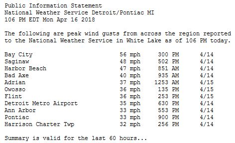
Peak Wind Gust Reports:
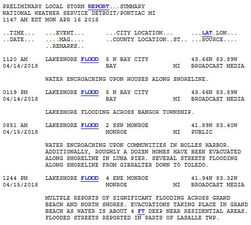
Lakeshore Flooding Reports:
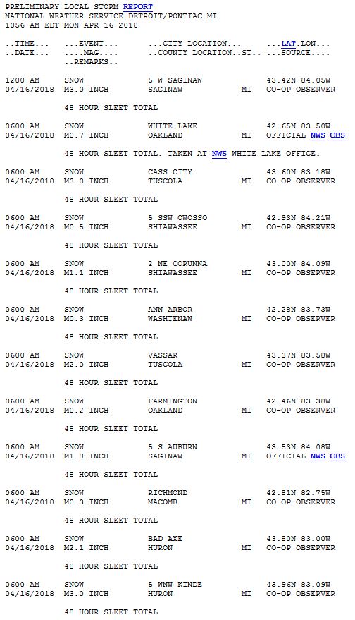
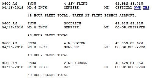
Sleet Reports:
For the latest Local Storm Reports, please visit our Storm and Precipitation Reports.
Local Storm Reports can also be viewed on the Iowa Environmental Mesonet (IEM).
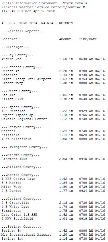
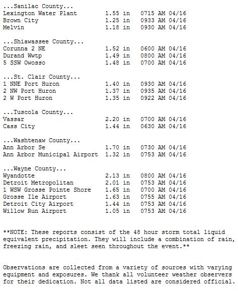
Rain Reports
Environment
NOTE*** Clicking on images below will take you to that specific webpage.
This large, expansive system not only created chaotic weather in Michigan, but across numerous states as the system moved eastward.
 |
 |
 |
| April 13th at 18Z (2PM EDT) | April 14th at 18Z (2PM EDT) | April 15th at 15Z (11PM EDT) |
SPC Filtered Storm Reports
 |
 |
 |
| April 13th | April 14th | April 15th |
SPC Convective Outlooks
 |
| April 14th |
 |
Media use of NWS Web News Stories is encouraged! Please acknowledge the NWS as the source of any news information accessed from this site. |
|

