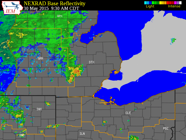
Two days of heavy rainfall occurred over much of Southeast Michigan on Saturday, May 30 and Sunday, May 31. The first round of significant precipitation began shortly after noon on Saturday. The airmass was very moist as evidenced by precipitable water values of 1.5" on the morning and evening KDTX soundings. Showers and thunderstorms quickly filled in over much of Southeast Michigan as a cold front eased into the region. This setup favored heavy rainfall, which prompted an areal flood watch to be issued Saturday morning through Sunday afternoon. Though there was isolated wind damage over portions of Macomb and St. Clair counties, the main hazard with the initial batch was heavy rainfall. Rainfall totals ranged from 0.5" to 1.5" by sunset on the 30th.
As the surface front cleared the area, the front at higher levels stalled over southeast Michigan allowing rounds of rainfall, heavy at times, to continue during Saturday night. Meanwhile, a wave of low pressure developed along the surface front over Indiana and passed just to the south of the Michigan/Ohio border, enhancing the forcing for vertical motion locally and allowing rain to continue into much of Sunday for areas mainly south of the I-69 corridor. Meanwhile, much of Sunday was dry for Flint, Saginaw, and the northern Thumb. Northeast winds in the wake of the surface front brought in much cooler air, with temperatures in the upper 40s and lower 50s much of the day. This is in contrast to the upper 70s and lower 80s early Saturday, and is comparable to normal low temperatures for late May!
When all was said and done, storm totals for the 30th and 31st ranged from 1-2" over the Flint and Saginaw Valley regions, with 2-4" across much of Metro Detroit. Rises occurred on area rivers, prompting river flood warnings for the Clinton and Rouge rivers for minor flooding. Most of the flooding was nuisance flooding, including flooding of normally flood-prone areas, ponding on roadways, and water in some basements. Relatively dry conditions leading up to this event lessened some of the impacts of the flooding.
Back to top
 |
| Radar loop courtesy of Iowa Environmental Mesonet (IEM). Yellow boxes are severe thunderstorm warnings and green boxes are special marine warnings. |
|
|
| Image courtesy of Iowa Environmental Mesonet (IEM). Storm total precipitation for May 30-31 is shown. |
|
|
|
|
| Image courtesy of Iowa Environmental Mesonet (IEM). Storm total precipitation for May 30-31 is shown. |
|
|
Text Listing of Local Storm Reports
Text Listing of Local Storm Reports Grouped by County

Storm total precip estimation by KDTX radar. The radar underestimated precip amounts for this event, so this image shows where relatively higher/lower rainfall amounts occurred.


.png)

.png)