Overview
Record February high temperatures in the lower 70s created enough instability to allow for strong thunderstorms as a very strong cold front pushed through during the overnight hours. A few thunderstorms reached severe limits, highlighted by an EF-2 tornado in Grand Blanc. Winds behind the cold front on February 28th frequently gusted between 40-50 mph throughout the day.
Tornado:
Tornado - Grand Blanc, MI
Genesee County
| Date |
February 28, 2024 |
| Time (Local) |
1:12 AM - 1:22 AM EST |
| EF Rating |
EF-2 |
| Est. Peak Winds |
115 mph |
| Path Length |
5.7 miles |
| Max Width |
450 yards |
| Injuries/Deaths |
0/0 |
|
Summary:
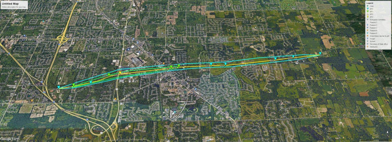
The tornado touched down in Creasey
Bicentennial Park damaging the south
pavilion and uprooting a pine tree.
The tornado tracked east northeast
across Westminster Cir where multiple
trees were snapped, two garage doors
were blown out, and a roof was partially
stripped from one home. The tornado
continued tracking east northeast across
Porter Rd and Reid Rd where multiple
limbs and trees were snapped. The peak
of damage occurred at an industrial
complex at the intersection of Reid
and S Dort Hwy. Damage to the complex
included blown out non load bearing
walls and significant loss of roofing.
Multiple transmission poles were also
snapped along S Dort Hwy. Damaged
continued into the Indian Hill
neighborhood near downtown Grand Blanc
where multiple large trees were downed
with some of them falling onto homes
along Old Bridge Rd to Stonybrook Dr.
The tornado tracked east northeast across
Genesee Road to Belsay Rd snapping
hardwood limbs and uprooting pine trees
before greater damage occurred along
Moonstone Dr and Brookview Dr. Damage
in these areas included more widespread
tree damage and one home with a garage
door blown out and a roof partially
uplifted. The tornado weakened and lifted
shortly after it crossed Perry Rd.
|
Track Map

|
The Enhanced Fujita (EF) Scale classifies tornadoes into the following categories:
EF0
Weak
65-85 mph |
EF1
Moderate
86-110 mph |
EF2
Significant
111-135 mph |
EF3
Severe
136-165 mph |
EF4
Extreme
166-200 mph |
EF5
Catastrophic
200+ mph |
 |
Radar
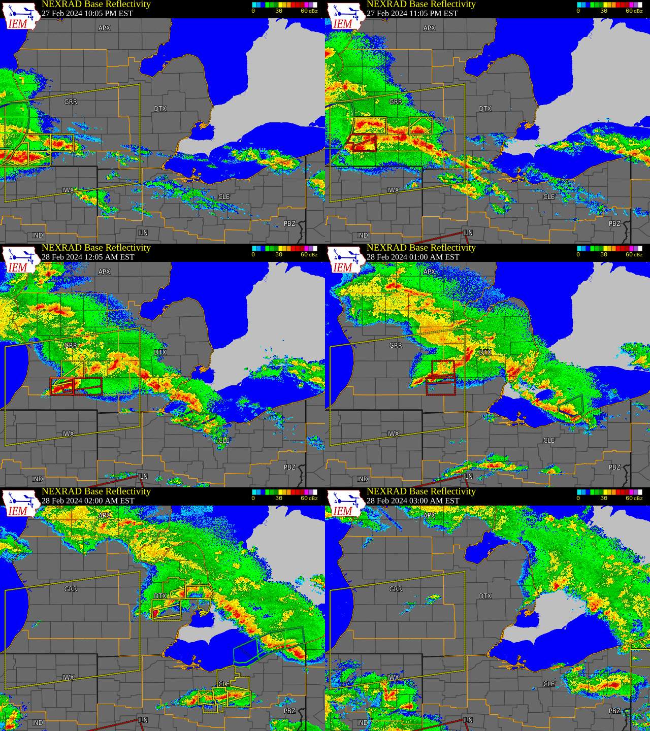
Radar Imagery for SE MI


Radar loop courtesy of Iowa Environmental Mesonet (IEM)
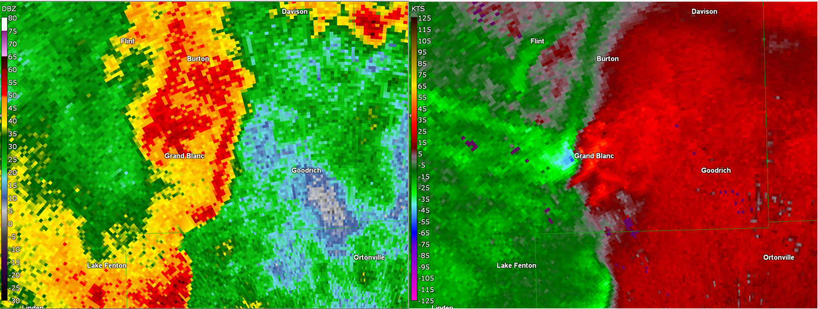
Radar Imagery for Grand Blanc EF-2 Tornado

Figure 1. DTX base reflectivity and velocity at 114 AM on 28 February 2024, centered on Grand Blanc, MI.
 |
Media use of NWS Web News Stories is encouraged!
Please acknowledge the NWS as the source of any news information accessed from this site. |
 |


