Overview
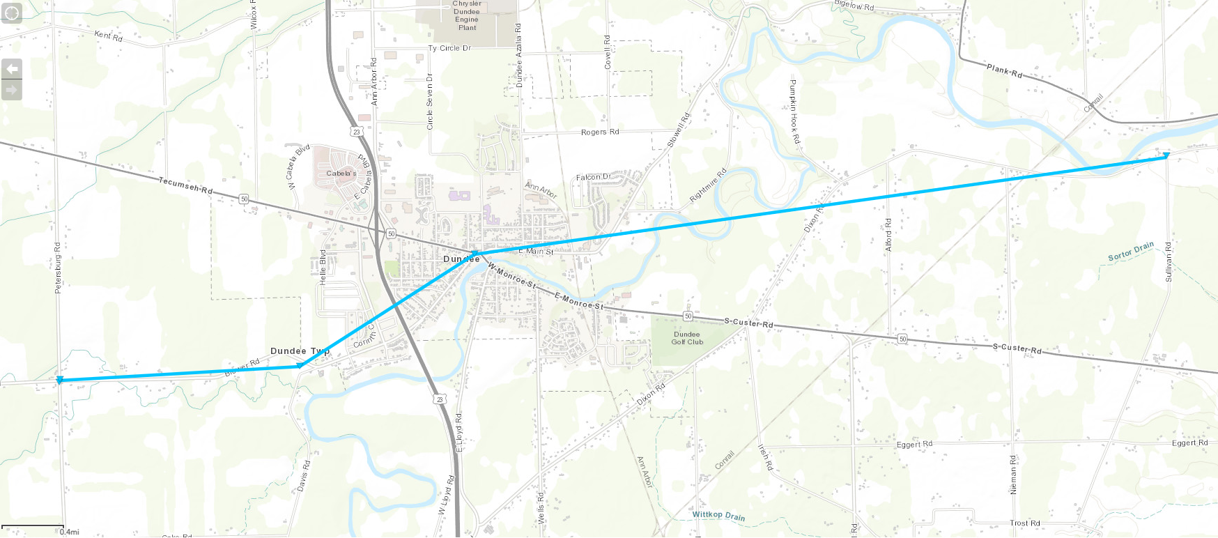
A disorganized area of showers and some embedded thunderstorms tracked into southeast Michigan during the late morning hours of April 1st, 2023. While the overall environment was marginal owing to lack of instability, locally favorable conditions for severe weather developed south of I-94 as upper and low level features briefly interacted. The thunderstorm complex reinvigorated between 10 and 11 AM, eventually becoming severe for a brief period over Lenawee/Monroe/southern Wayne Counties. These storms produced damaging wind gusts, sub-severe hail (spotters reported up to M&M size), and a brief/weak EF-0 tornado in Dundee. The tornado was on the ground for 5 minutes, causing damage consistent with 80 MPH wind gusts as it tracked through the heart of downtown Dundee. By noon, storms had shifted into Canada and the severe weather threat was over.
Tornadoes:
|
Tornado - Dundee, MI
Track Map

|
||||||||||||||||
The Enhanced Fujita (EF) Scale classifies tornadoes into the following categories:
| EF0 Weak 65-85 mph |
EF1 Moderate 86-110 mph |
EF2 Significant 111-135 mph |
EF3 Severe 136-165 mph |
EF4 Extreme 166-200 mph |
EF5 Catastrophic 200+ mph |
 |
|||||
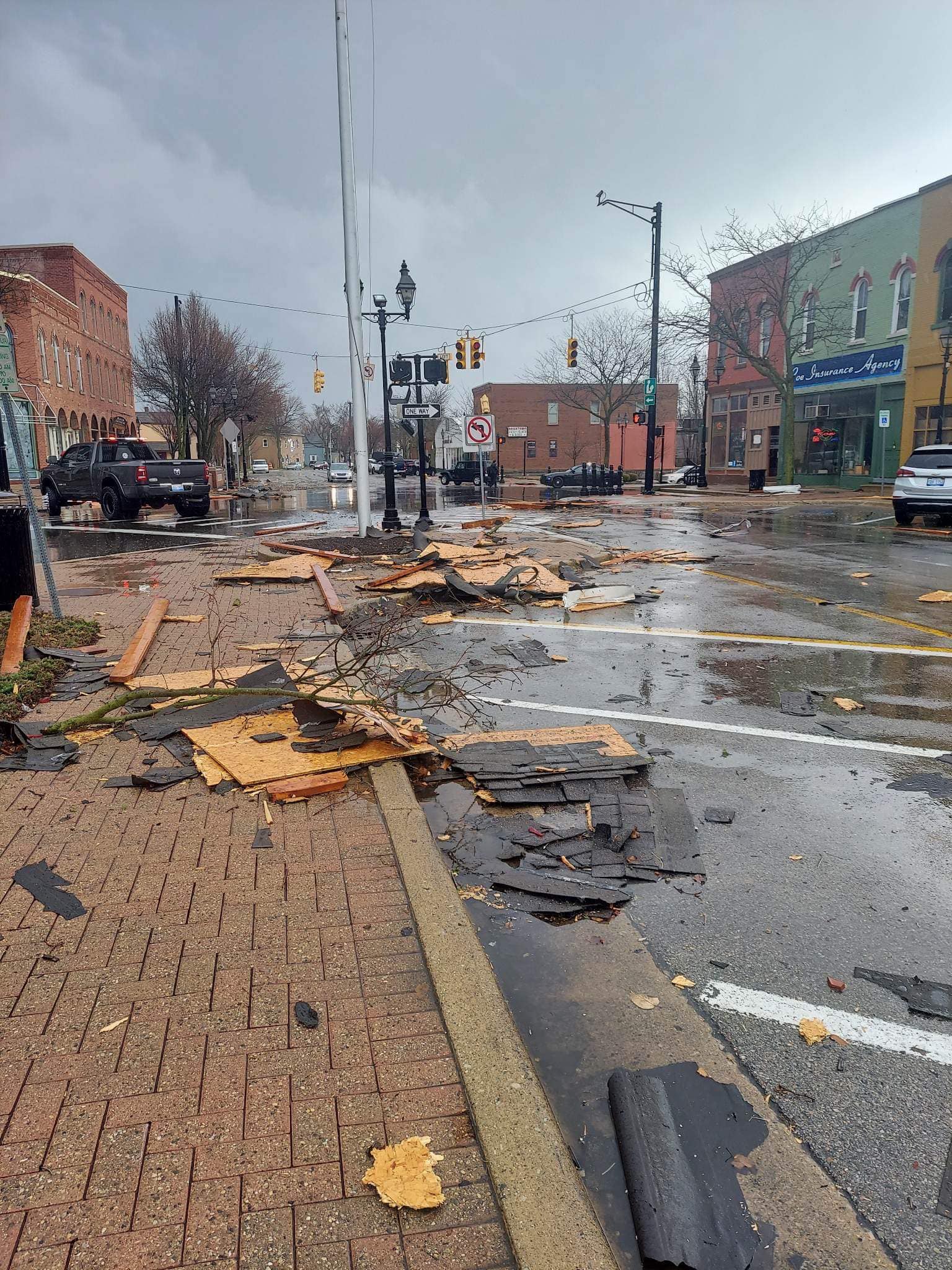
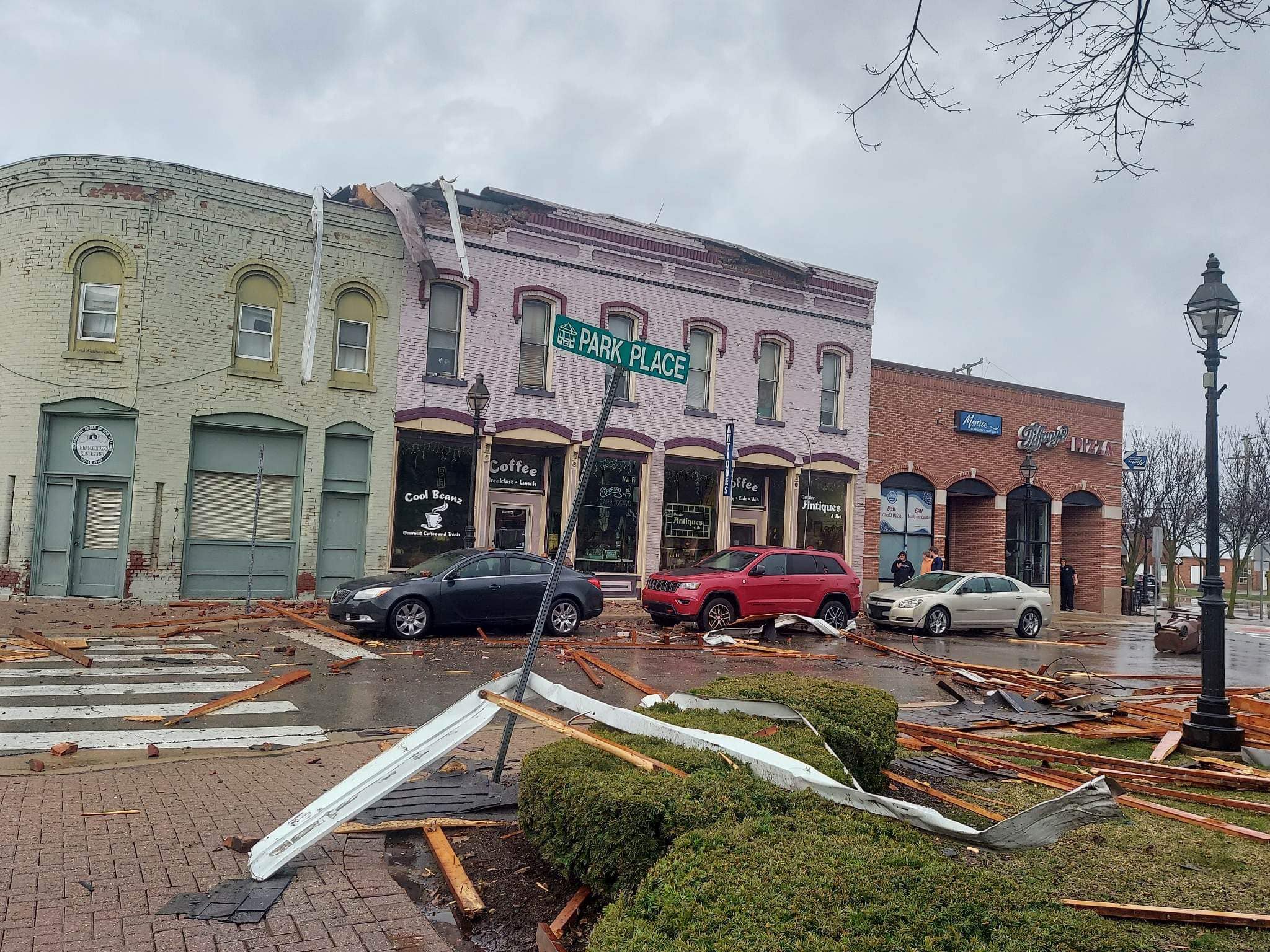
Photos
 |
 |
 |
|
|
Debris in Downtown Dundee Credit: Leslie Hayes |
Roof Damage in Downtown Dundee Credit: Leslie Hayes |
Debris in Downtown Dundee Credit: David Malmquist |
Radar
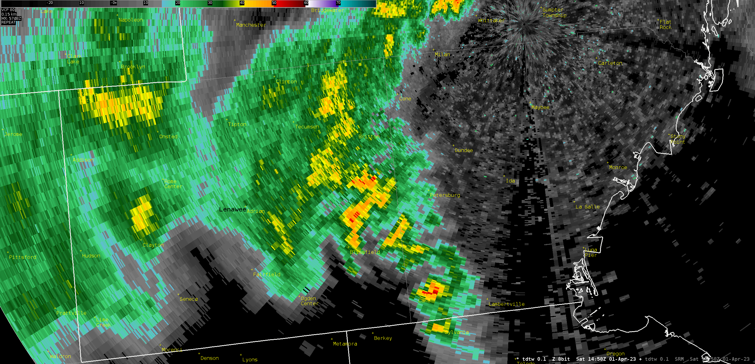
Figure 1. TDTW 0.1 degree reflectivity between 1504 and 1518 UTC on 01 April 2023, centered on Dundee, MI.
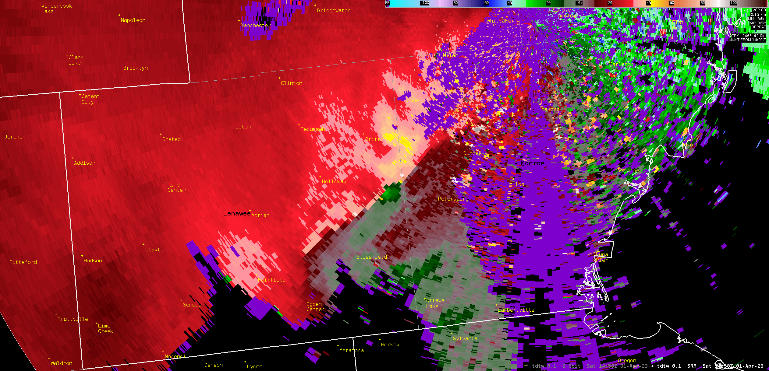
Figure 2. TDTW 0.1 degree storm-relative velocity between 1504 and 1518 UTC on 01 April 2023, centered on Dundee, MI.
Environment
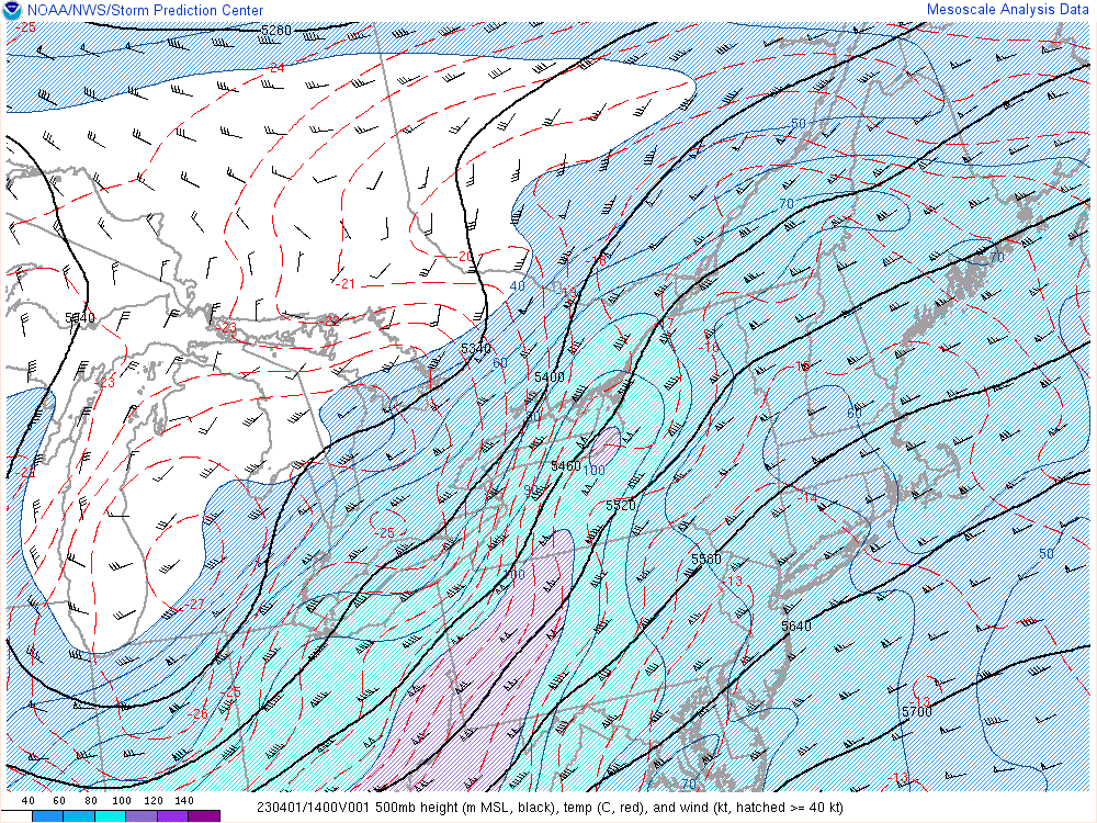
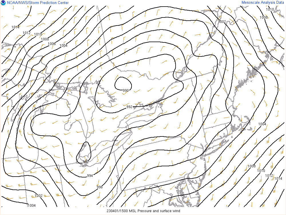
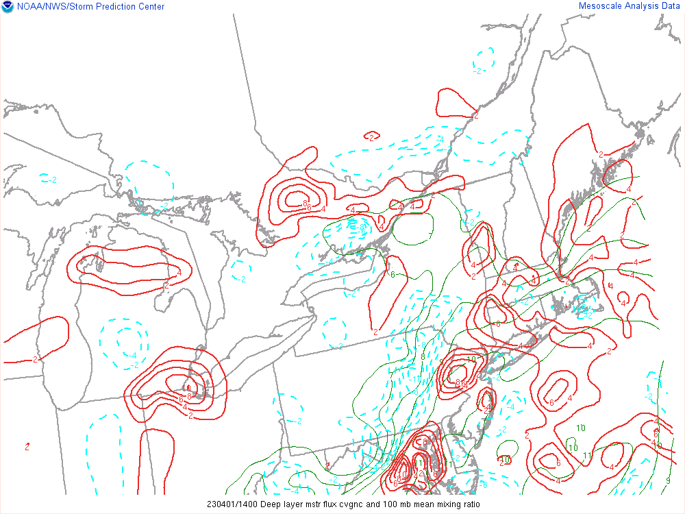
The severe weather observed during the late morning hours of 1 April 2023 began as a sub-severe shower/thunderstorm complex that tracked over southwest lower Michigan with minimal impact. As this convection shifted east, however, upper level features caught up to a modestly destabilized low level atmosphere and resulted in isolated severe weather and a brief EF-0 tornado over southeast Michigan. The upper-level synoptic pattern was characterized by a positively tilted upper trough that gradually gained a more neutral orientation as it tracked into the Great Lakes between roughly 13-15z (Figure 1). The disturbance aloft helped initiate surface cyclogenesis near Lake Erie, with the development of a 992mb surface low by 15z per SPC mesoanalysis (Figure 2). As this surface low deepened, a notable region of convergence extended from northern OH to roughly the I-94 corridor which served as a boundary for thunderstorms to latch onto (Figure 3).
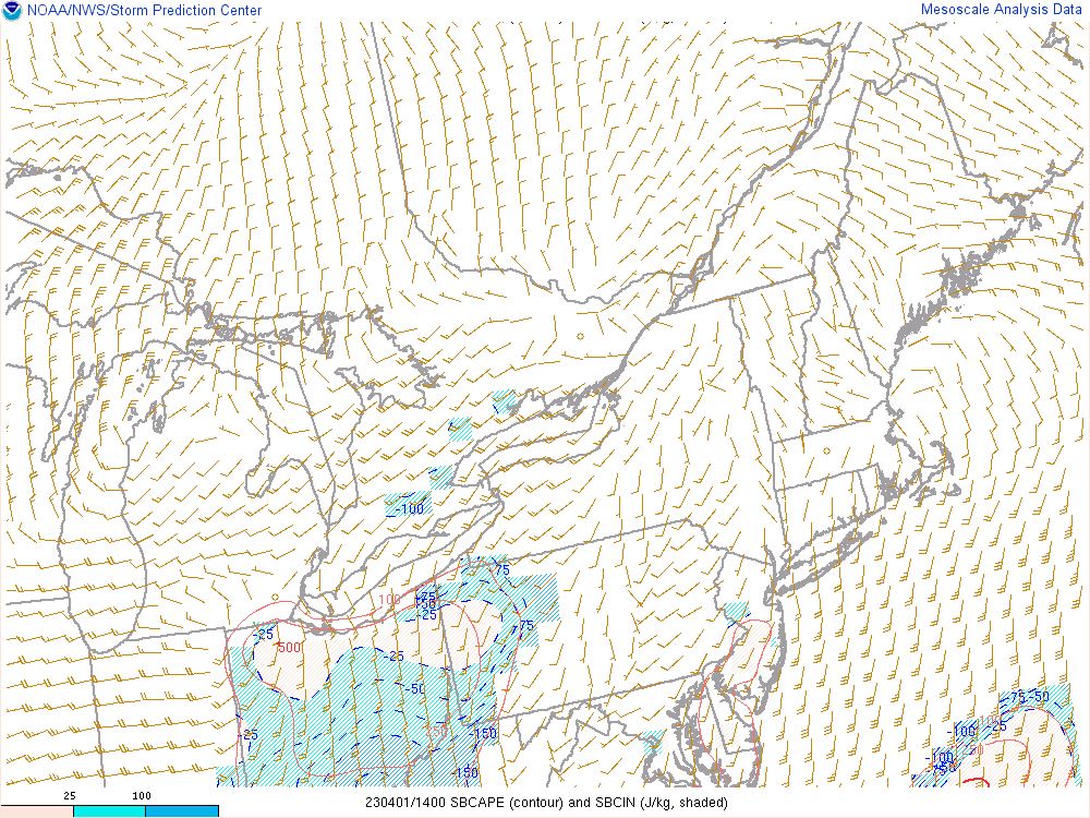
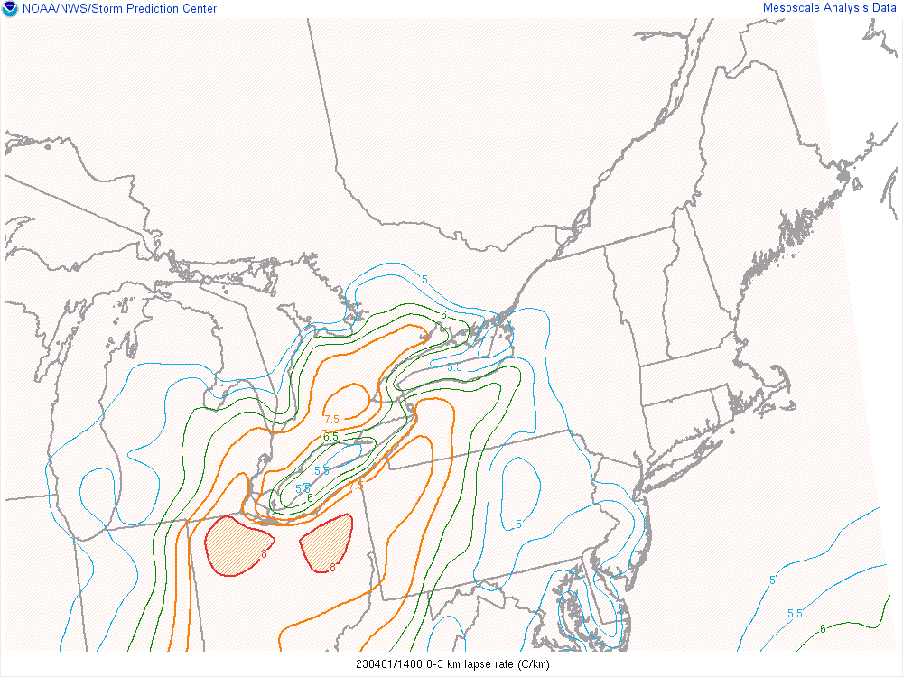
In terms of typical thunderstorm ingredients, this was a high shear, low instability scenario. SBCAPE at 14z was only a few hundred J/kg according to SPC mesoanalysis (Figure 4), as temperatures were only in the 50s and dewpoints in the mid 40s at their peak. Nonetheless, the thunderstorm complex was able to tap into the surface indicated by 0-3 km lapse rates of 7.5-8 C/km (Figure 5) and TDTW inbound base velocities over 60 knots below 500 feet (not shown). Shear profiles were certainly more impressive than instability, with a 50+ knot low level jet just clipping Lenawee and Monroe Counties. This resulted in a localized increase in 0-1 km bulk shear to 20-25 knots as the thunderstorm complex approached from the west (Figure 6). As this occurred, upstream surface winds had also backed to the south-southwest with KADG and KTTF ASOS sites both reporting wind directions of 160-190 degrees. Resultant hodographs were thus more favorable for rotation as the backed surface flow resulted in higher values of 0-1 km storm-relative helicity (SRH) up to 150 m2/s2. Similarly, the backed profiles allowed for more of a streamwise component to the storm-relative inflow.
While the overall environment was not supportive of widespread severe weather, the interaction between the localized increase in low level shear and the passage of the upper level vorticity maximum did produce a brief/weak EF-0 tornado that impacted downtown Dundee. The mid-level rotation associated with this cell was transient yet persisted until the storm departed into Ontario, and the EF-0 in Dundee was the only observed tornado. Additional severe reports consisted of straight-line wind damage with this same cell, with trained spotters also reporting pea-sized to M&M sized hail as far north as Washtenaw County.
 |
 |
 |
| Figure 1: 500mb Analysis, valid 1400 UTC 1 Apr 2023 | Figure 2: Surface Analysis, valid 1500 UTC 1 Apr 2023 | Figure 3: Deep Layer Moisture Convergence, valid 1400 UTC 1 Apr 2023 |
 |
 |
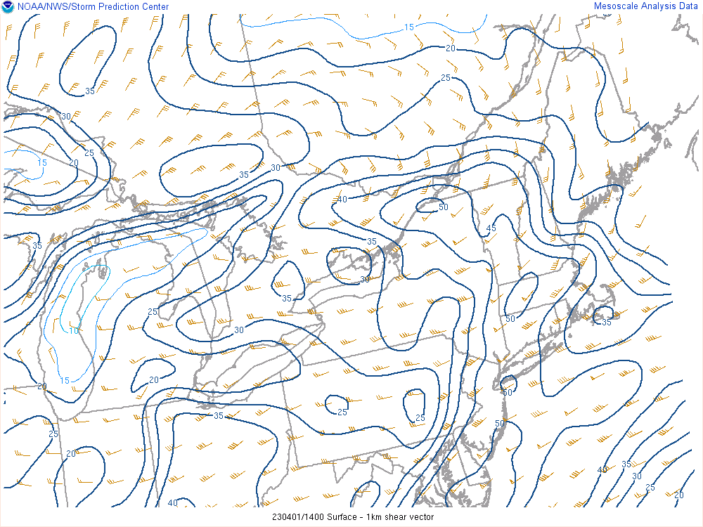 |
| Figure 4: Surface-Based Convective Available Potential Energy, valid 1400 UTC 1 Apr 2023 | Figure 5: 0-3km Lapse Rates, valid 1400 UTC 1 Apr 2023 | Figure 6: 0-1km Bulk Wind Shear, valid 1400 UTC 1 Apr 2023 |
 |
Media use of NWS Web News Stories is encouraged! Please acknowledge the NWS as the source of any news information accessed from this site. |
|