Overview
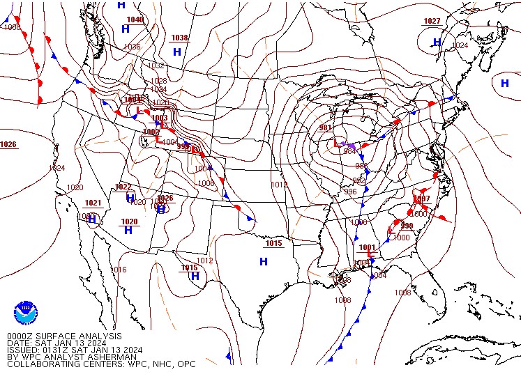
A major winter storm impacted the Great Lakes region on Friday Jan 12 2024 into Saturday Jan 13 2024. Precipitation quickly overspread southeast Michigan during the mid afternoon hours of Friday as the main low (~981 MB) reached Chicago in the early evening hours. Just enough mild air near Lake Erie/Detroit River caused some melting snow/rain. Otherwise, despite temperatures mainly 32-34 degrees, heavy wet snow was the predominant precipitation type during the late afternoon into the early evening hours. This was due to very strong forcing, which led to visibility down around a quarter of a mile in the heavy snow, with even thundersnow reported in and around the Detroit Metro Area. Storm totals reached 4-8 inches across the Detroit Metro Area, as well as the Tri-Cities region, with 1-5 inches elsewhere. Precipitation did taper off in the mid to late evening, and fell in the form of rain south of I-69 where the total liquid equivalent ranged from 0.5-1.25”.
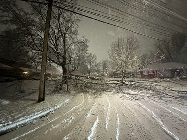
Due to the heavy wet nature of the snow, widespread tree limbs came down in several counties (Oakland/Lapeer to name a few), which caused power outages to well over 100,000 customers at the peak of the storm. Easterly winds also reached 30-40 mph ahead of the low, with southwest wind gusts topping out 40-55 mph south of M-59 Saturday morning as the low exited northeast.
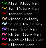
Snow Totals
Note:  Snowfall totals are from the early afternoon on Friday, January 12th through 11 AM Saturday, January 13th.

Public Information Statement...Summary
National Weather Service Detroit/Pontiac MI
1101 AM EST Sat Jan 13 2024


STORM TOTAL SNOW REPORTS

Location                  Snowfall     Duration
                          (Inches)      (Hours)        Lat       Lon

...Bay County...
   2 E Bay City            M   5.2           19     43.59N    83.85W
   Bay City                M   5.6           17     43.59N    83.89W
   Auburn                  M   5.8           16     43.60N    84.08W

...Genesee County...
   Flint                   M   2.0           17     43.02N    83.69W
   4 N Burton              M   3.5           18     43.05N    83.62W
   Clio                    M   4.0           19     43.18N    83.74W

...Huron County...
   Bad Axe                 M   3.9           16     43.80N    83.00W
   Port Austin             M   5.0           18     44.04N    83.00W

...Lenawee County...
   Morenci                 M   4.0           20     41.72N    84.22W

...Livingston County...
   Howell                  E   2.3           18     42.61N    83.94W

...Macomb County...
   Roseville               M   2.3           24     42.50N    82.94W
   Shelby Township         M   4.5           18     42.67N    83.03W
   Mount Clemens           M   4.9           12     42.60N    82.88W
   4 NW Richmond           M   5.9           18     42.85N    82.81W

...Midland County...
   4 SW Midland            M   5.5           16     43.58N    84.29W
   Nw Midland              E   7.0           17     43.62N    84.23W
   Oil City                M   7.4           16     43.61N    84.59W
   2 E Midland             M   8.0           19     43.62N    84.19W
...Monroe County...
   Dundee                  M   3.0           19     41.96N    83.66W

...Oakland County...
   Farmington              M   4.0           19     42.46N    83.38W
   4 E White Lake          M   7.9           18     42.65N    83.43W
   1 E White Lake          M   8.0           18     42.65N    83.50W
   Ortonville              M   8.5           18     42.85N    83.44W

...Saginaw County...
   8 NW Saginaw            M   5.6           16     43.50N    84.06W

...Shiawassee County...
   Durand                  M   3.0           18     42.91N    83.99W
   New Lothrop             M   5.0           20     43.12N    83.97W

...St. Clair County...
   Lakeport                M   3.0           17     43.12N    82.50W

...Tuscola County...
   Cass City               M   2.0           16     43.60N    83.18W
   Vassar                  M   2.0           16     43.37N    83.58W
   Caro                    M   3.2           16     43.49N    83.40W

...Washtenaw County...
   Ann Arbor               M   6.3           18     42.28N    83.73W

...Wayne County...
   Grosse Pointe Farms     M   1.5           19     42.41N    82.89W
   Wyandotte               M   4.2           19     42.21N    83.15W
   Dearborn                M   4.4           19     42.31N    83.21W
   2 SE Romulus            M   4.7           18     42.20N    83.34W


M = Measured
E = Estimated
Observations are collected from a variety of sources with varying
equipment and exposures. We thank all volunteer weather observers
for their dedication. Not all data listed are considered official.
 |
|
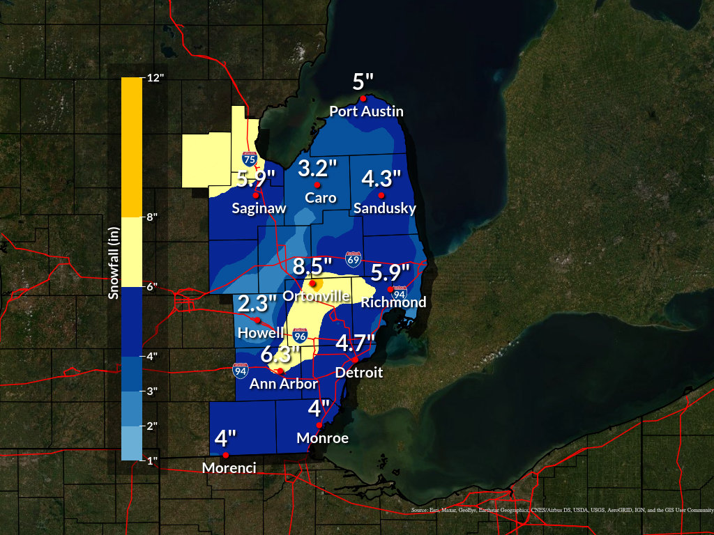
Storm Total Snowfall |
 |
|
National Snowfall Analysis: 24-hour accumulation ending 2024-01-13 12 UTC Courtesy of NOHRSC |
Wind Reports
Public Information Statement
National Weather Service Detroit/Pontiac MI
532 PM EST Sat Jan 13 2024

...Here are the highest wind reports received over the past 24 hours...

Location                     Speed     Time/Date       Lat/Lon
Detroit Willow               53 MPH    0601 AM 01/13   42.23N/83.53W
Detroit Wayne                52 MPH    0936 AM 01/13   42.23N/83.33W
Ann Arbor                    47 MPH    0650 AM 01/13   42.22N/83.73W
Pontiac                      46 MPH    0222 PM 01/13   42.67N/83.42W
Detroit City Air             44 MPH    0507 AM 01/13   42.40N/83.02W
Gregory                      44 MPH    0445 PM 01/13   42.38N/84.01W
Oxford                       41 MPH    0650 AM 01/13   42.83N/83.28W
Detroit Grosse I             40 MPH    0635 AM 01/13   42.10N/83.15W
Grosse Ile Middle School     40 MPH    0850 AM 01/13   42.14N/83.14W
Fort Gratiot, MI             39 MPH    1248 PM 01/13   43.01N/82.42W
Saginaw Browne               39 MPH    0259 PM 01/13   43.43N/83.87W
Saginaw                      38 MPH    0130 PM 01/13   43.53N/84.08W
Clawson                      38 MPH    0640 AM 01/13   42.54N/83.16W
Troy Oakland                 38 MPH    0335 PM 01/13   42.55N/83.18W
Port Huron                   36 MPH    0900 PM 01/12   43.01N/82.42W
Owosso                       36 MPH    0235 PM 01/13   43.00N/84.13W
Canton                       35 MPH    0645 AM 01/13   42.31N/83.46W
Peck                         35 MPH    0255 PM 01/13   43.30N/82.79W
Minden City                  35 MPH    0317 PM 01/13   43.69N/82.77W

Observations are collected from a variety of sources with varying
equipment and exposures. We thank all volunteer weather observers
for their dedication. Not all data listed are considered official.

$$
Photos
 |
 |
 |
|
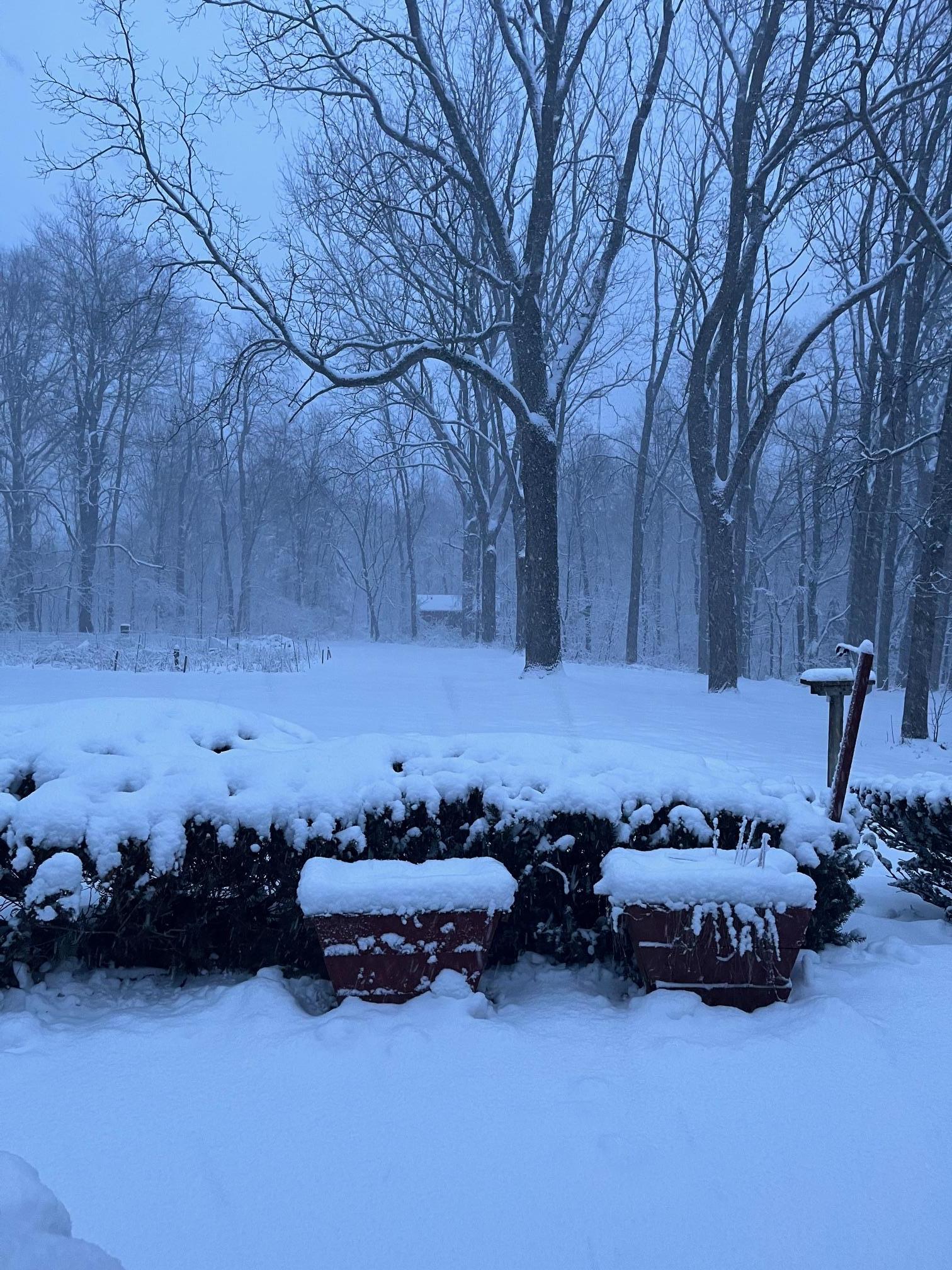
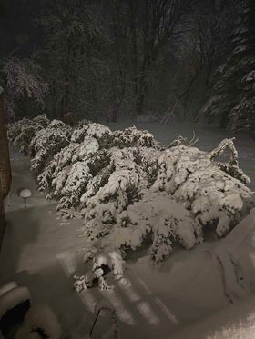
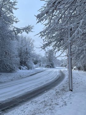
North Clarkston, MI Credit: Marcie Lemieux |
North Clarkston, MI Credit: Marcie Lemieux |
North Clarkston, MI Credit: Marcie Lemieux |
 |
 |
 |
|
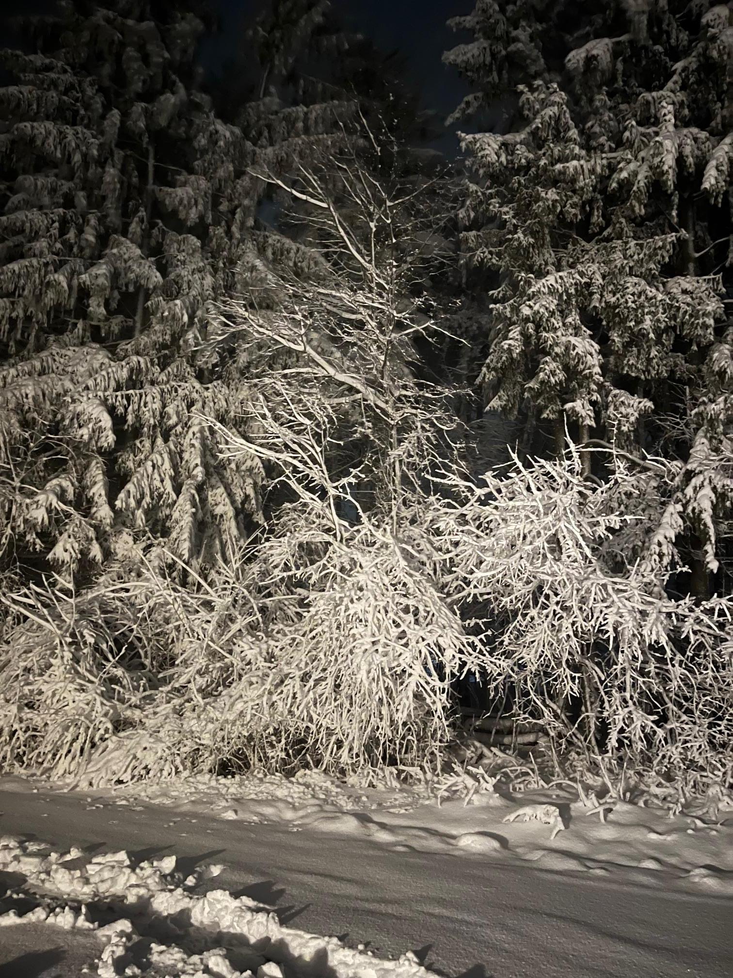
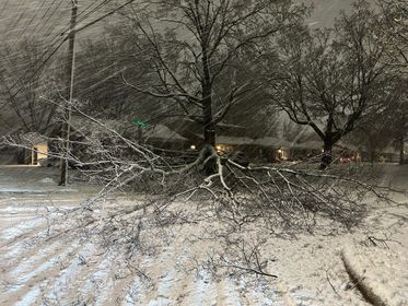
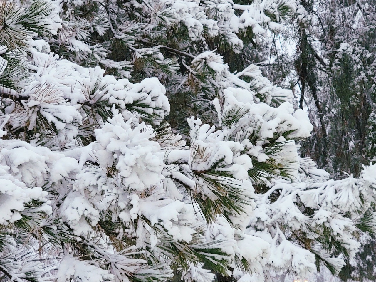
Rochester Hills, MI Credit: @MiWxAnthony |
Rochester Hills, MI Credit: @MiWxAnthony |
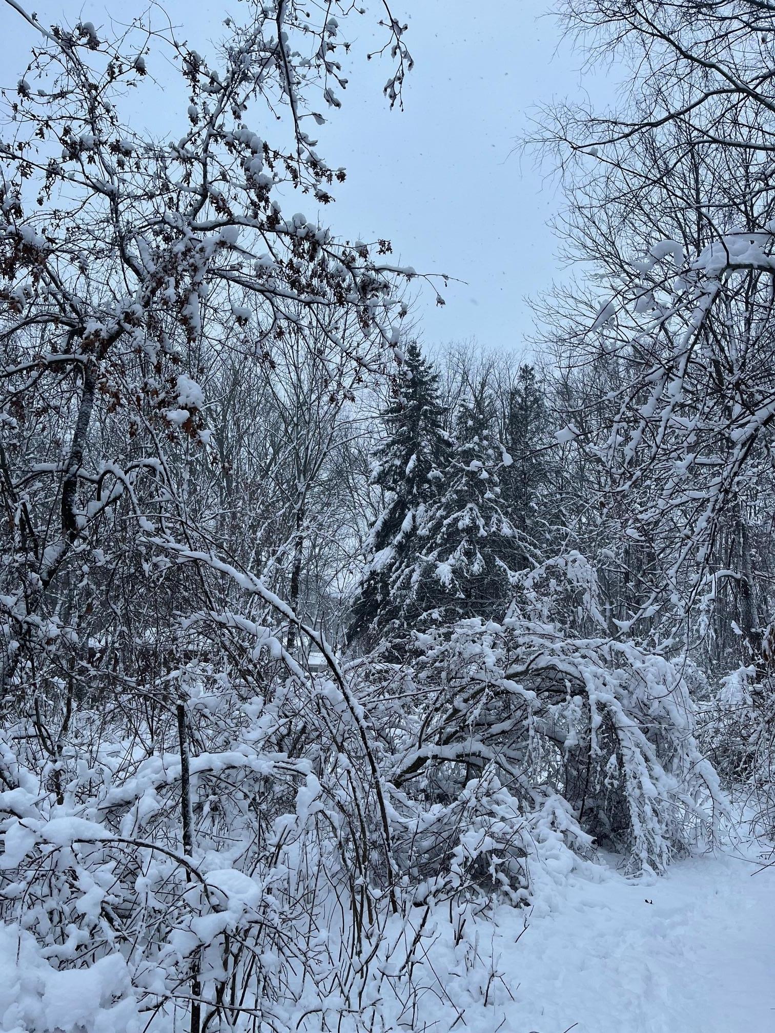
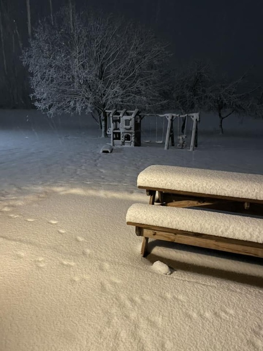
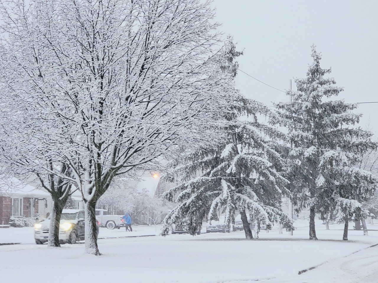
Oakland Township, MI Credit: Ryan Jake Jakubowski |
 |
 |
 |
|
Oakland Township, MI Credit: Ryan Jake Jakubowski |
Oakland Township, MI Credit: Ryan Jake Jakubowski |
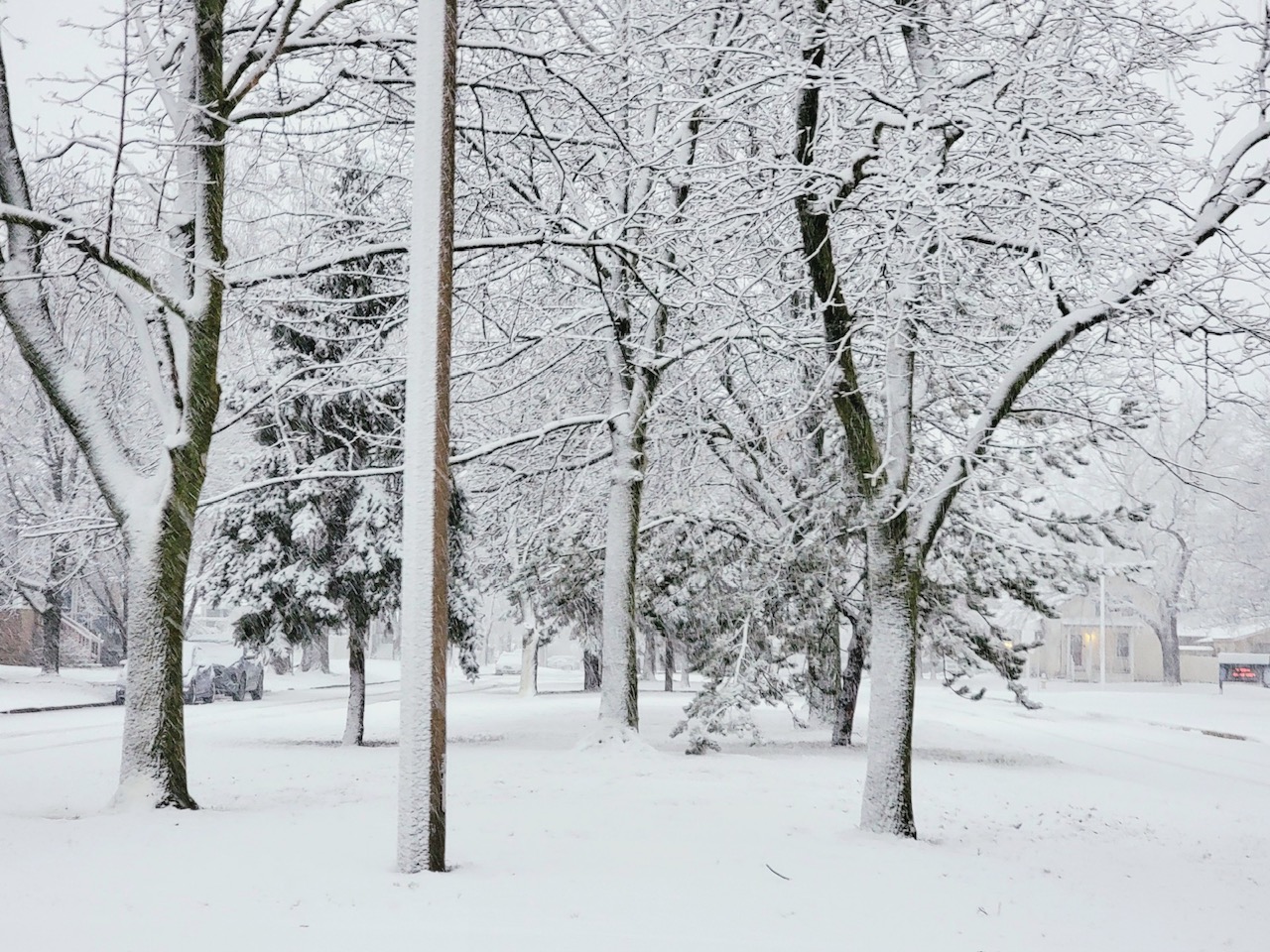
Shields, MI Credit: WNEM |
 |
 |
 |
|
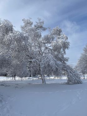
Midland, MI Credit: Tanner McCanham |
Midland, MI Credit: Tanner McCanham |
Wyandotte, MI Credit: Josh Halasy |
 |
 |
 |
|
Wyandotte, MI Credit: Josh Halasy |
Wyandotte, MI Credit: Josh Halasy |
Wyandotte, MI Credit: Josh Halasy |
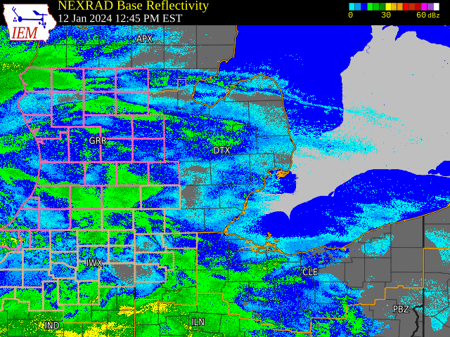
Radar
|
|
|
Radar: NEXRAD mosaic base reflectivity radar loop from 1245 PM January 12, 2024 through 11 AM January 13, 2024.
|
Environment
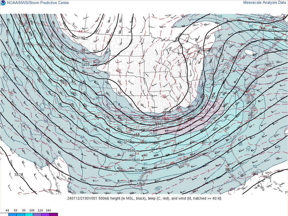
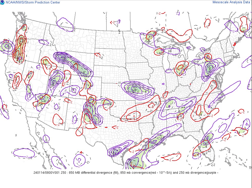
The early evening segment of this winter storm came in with a burst of wind driven heavy/wet snow complete with several lightning strikes during the peak. The enhanced lift and instability was driven by a strong mid level circulation on the mesoscale which rapidly accelerated moisture transport in phase with the occlusion of the parent mid level low back toward Chicago. This strong occlusion lifted north through southeast Michigan during the late evening and overnight hours, allowing precipitation to taper off.
 |
 |
 |
|
Figure 1: WPC Surface Analysis Valid Jan 13 2024 00 UTC |
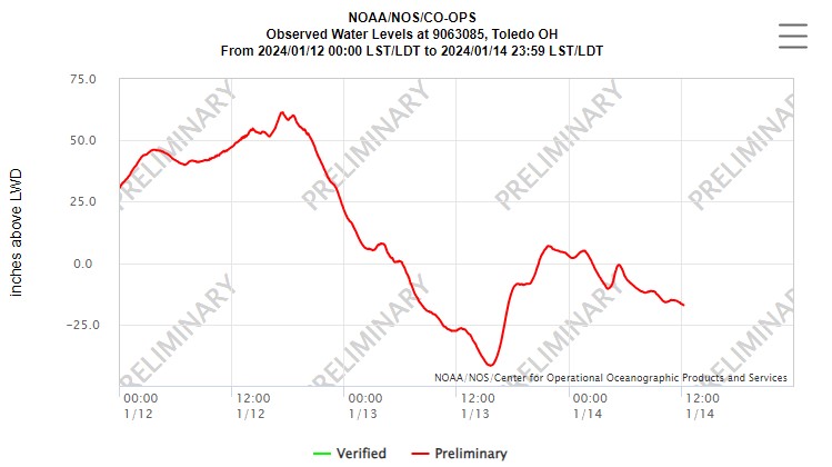
Figure 2: NOS/CO-OPS Water Level Chart at Toledo |
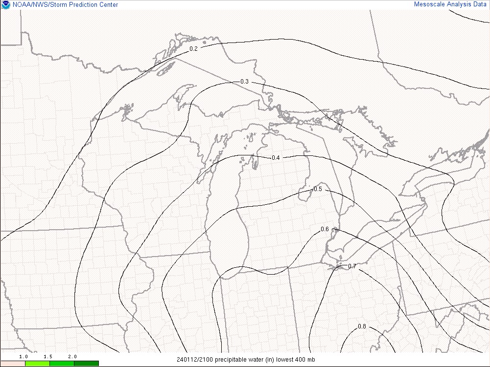
Figure 3: SPC Mesoanalysis Precipitable Water Valid Jan 12 2024 21 UTC |
 |
 |
 |
|
Figure 4: SPC Mesoanalysis 500mb Map Valid Jan 12 2024 21 UTC |
Figure 5: SPC Mesoanalysis 250-850mb Diff Divergence Valid Jan 12 2024 21 UTC |
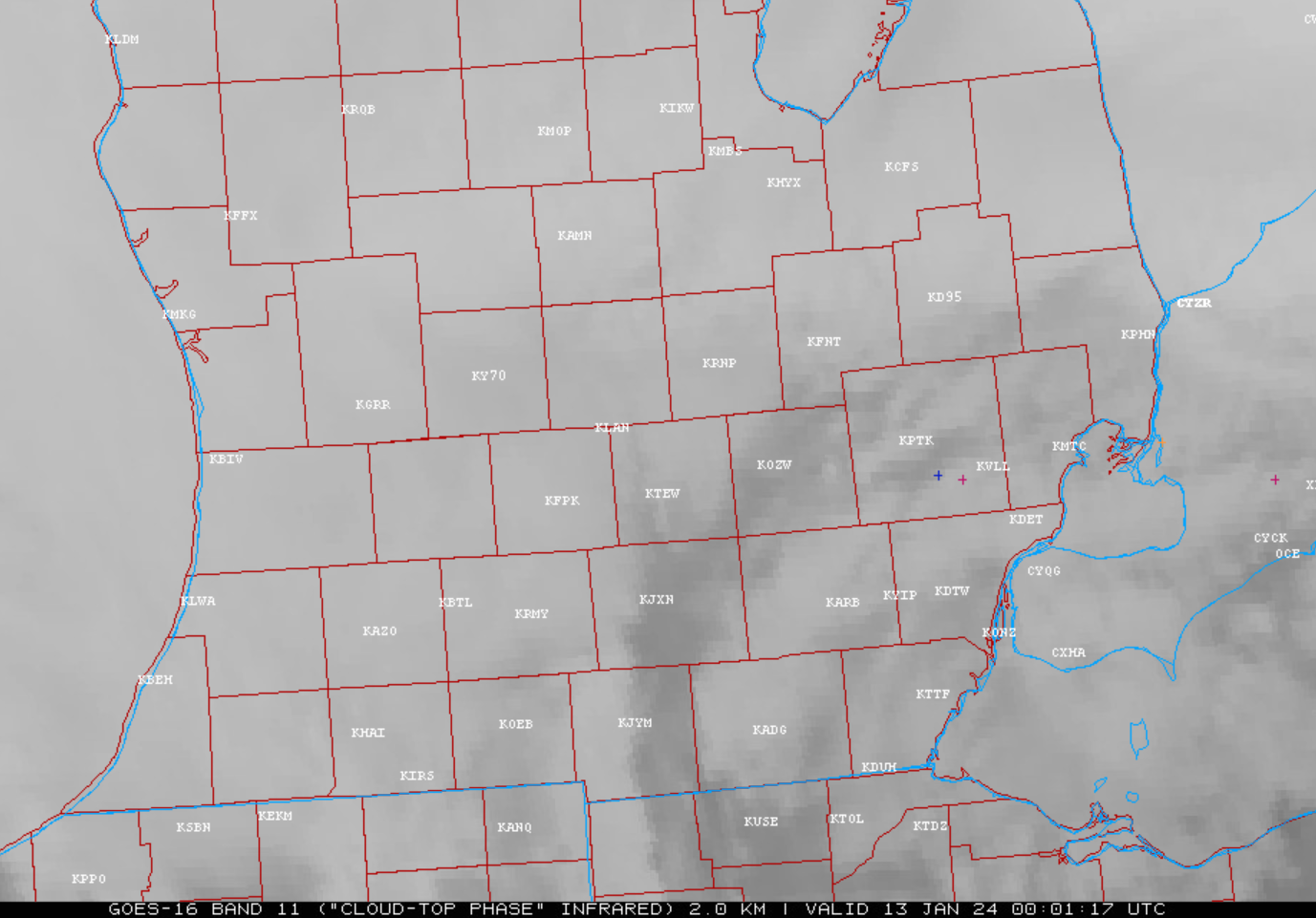
Figure 6: GLM 1 Hour Lightning Plot valid ~ 23-00z JAN13 & infrared satellite (cloud-top-phase) |
 |
 |
 |
|
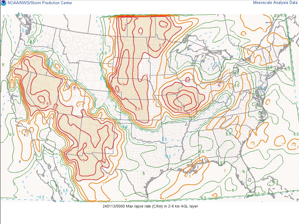
Figure 7: SPC Mesoanalysis 2-6km Max Lapse Rate Valid Jan 13 2024 00 UTC |
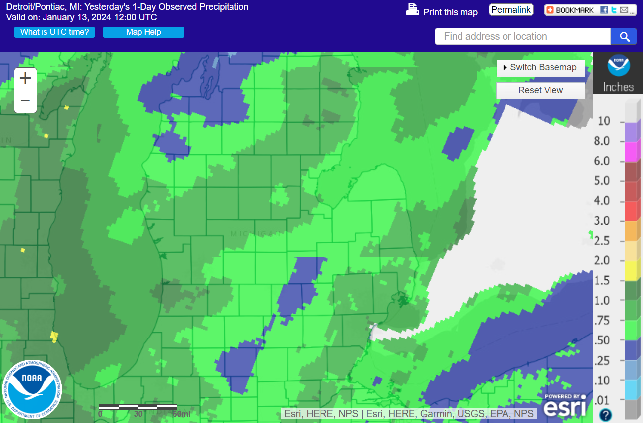
Figure 8: NOHRSC 24 Hour Scaled Snow Precipitation (Liquid Equivalent) Valid |
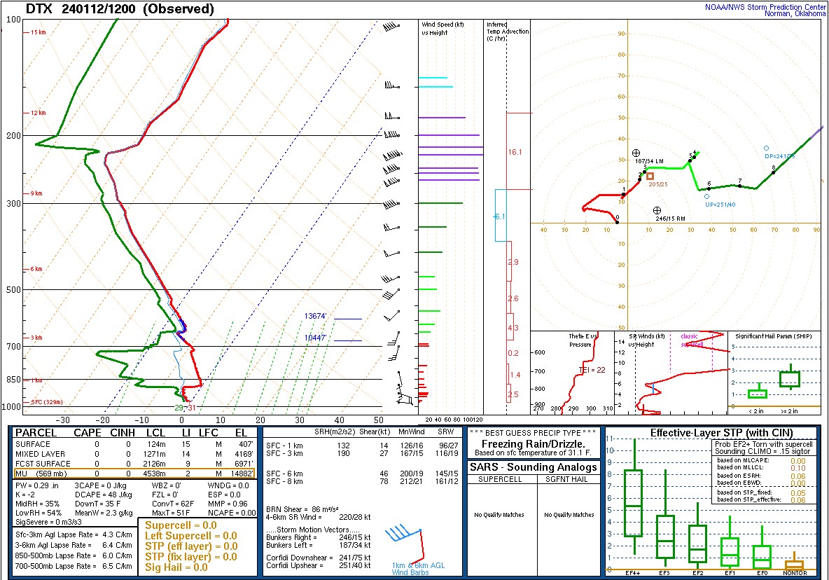
Figure 9: DTX Upper Air Sounding Valid Jan 12 2024 12 UTC |
 |
 |
|
|
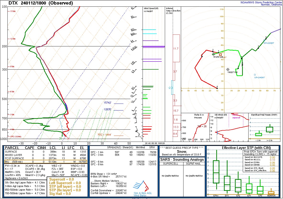
Figure 10: DTX Upper Air Sounding Valid Jan 12 2024 18 UTC |
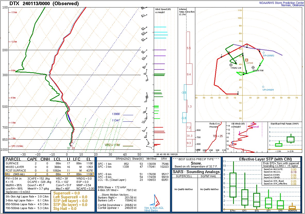
Figure 11: DTX Upper Air Sounding Valid Jan 13 2024 00 UTC |
 |
Media use of NWS Web News Stories is encouraged! Please acknowledge the NWS as the source of any news information accessed from this site. |
|