First Severe Weather Event of 2016
March 16, 2016
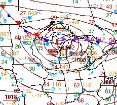
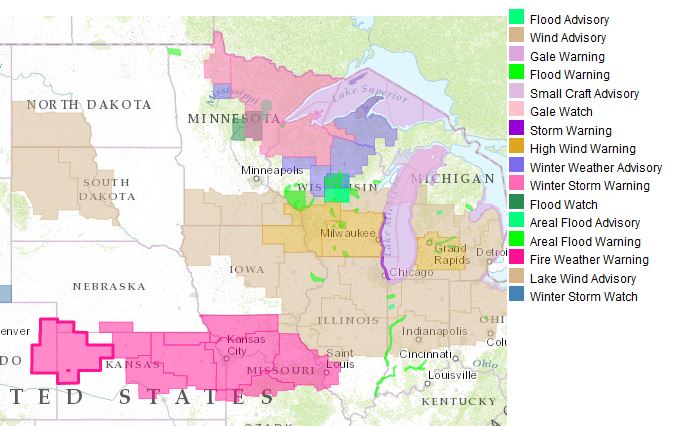
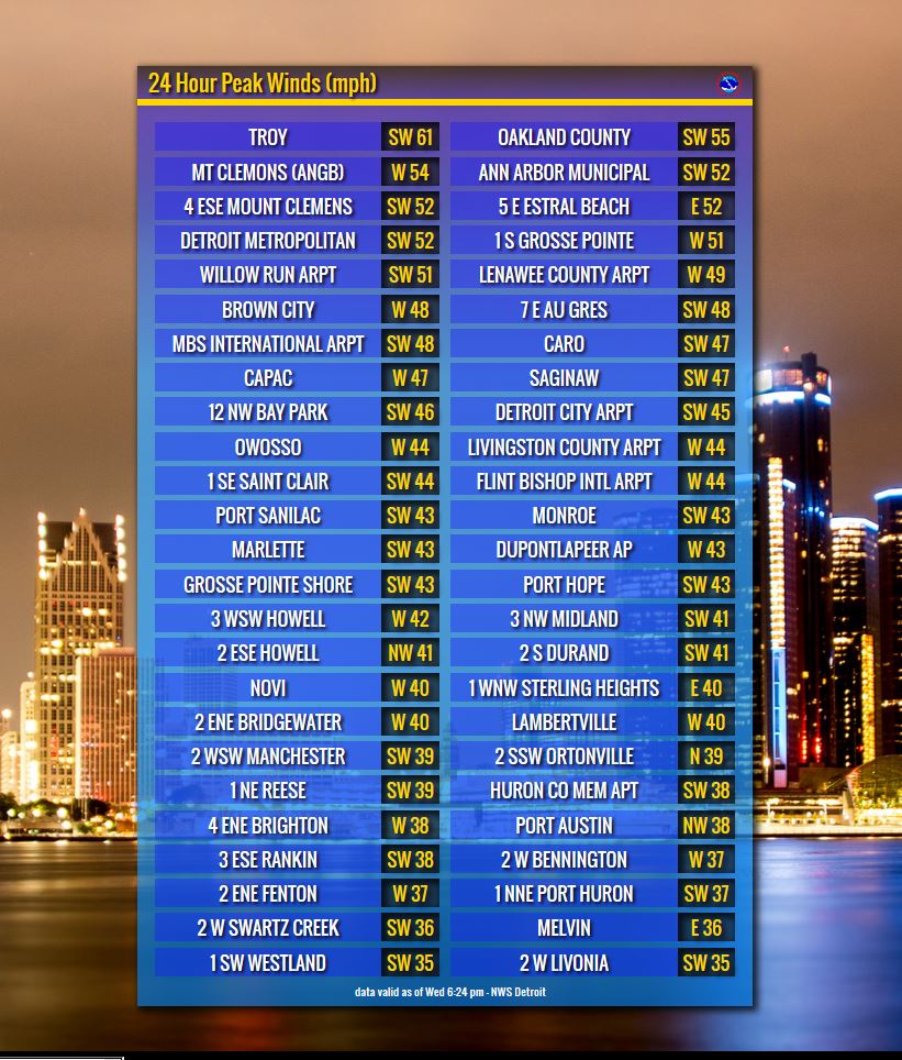
A strong low pressure system strengthened as it moved over the western Great Lakes region Tuesday evening into Wednesday. This system brought numerous tornadoes to areas across Eastern Iowa and parts of Illinois Tuesday evening resulting in widespread damage. As the system moved northeast across Wisconsin, a tightening pressure gradient brought gusty winds to the Midwest & Great Lakes with wind advisories and high wind warnings in effect for multiple states. Peak wind gusts across the region reached up into the 60 mph range while locally Southeast Michigan saw gusts in the upper 40 to lower 50 mph range. Two rounds of showers and thunderstorms moved across Southeast Michigan during the morning and afternoon hours on Wednesday. The second line of thunderstorms that moved through in the afternoon resulted in wind damage across Oakland, Macomb, and St. Clair counties. This damage consisted of downed trees and power lines across the three counties.
 |
 |
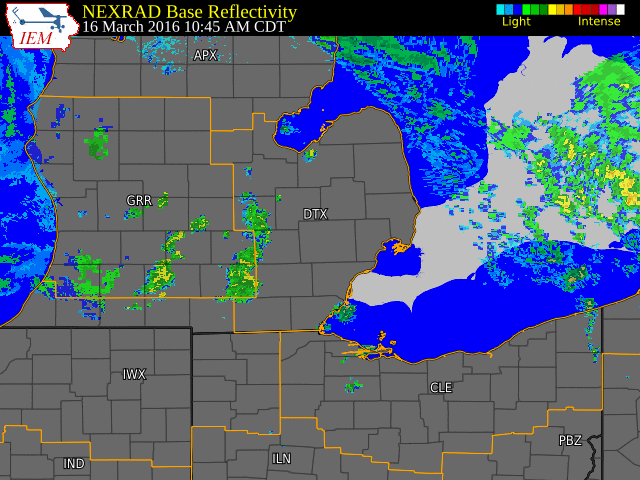 |
| Radar loop courtesy of Iowa Environmental Mesonet (IEM) |

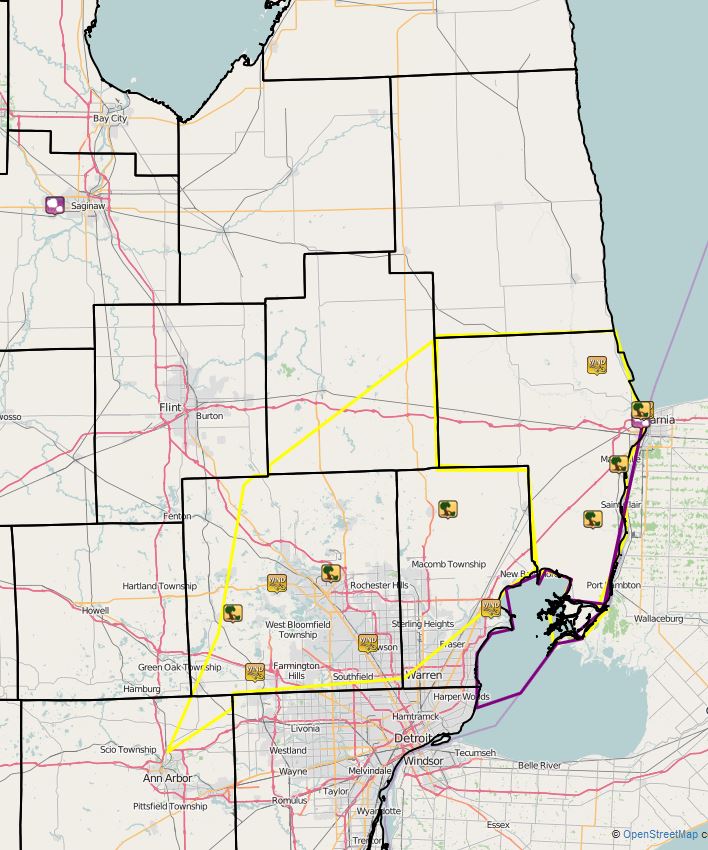
Note: Above image is linked to the Iowa Environmental Mesonet (IEM) local storm report webpage.
Valid through 7PM (3/16)
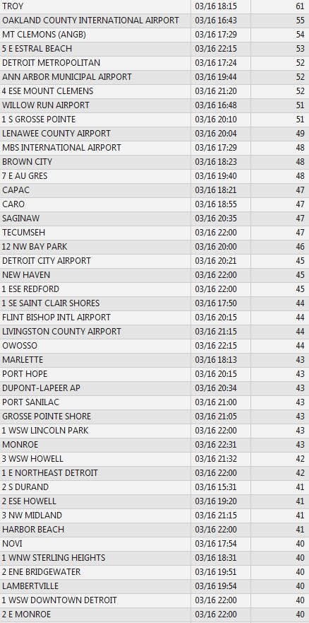
Here is a more extensive list...please note that time is in Zulu time.
 |
Media use of NWS Web News Stories is encouraged! Please acknowledge the NWS as the source of any news information accessed from this site. |
|

