The following is a summary of the findings related to three tornadoes that occurred early June 6, 2010 across far Southeastern Michigan (see track summary map).
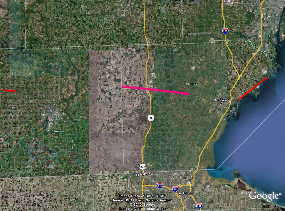
Track Summary Map
A National Weather Service storm survey team confirmed that a tornado touched down at 148 AM at Southard Highway and Woerner Road in Lenawee County (see track map 1). The tornado tracked 2.5 miles east-southeast to Springville Highway before lifting at 152 AM. The path width was 250 yards with maximum winds of 90 mph (EF1) as it crossed Onsted Highway just south of Woerner Road (see radar image 1). Several buildings were destroyed and numerous trees downed by this tornado. No injuries were reported with this tornado.
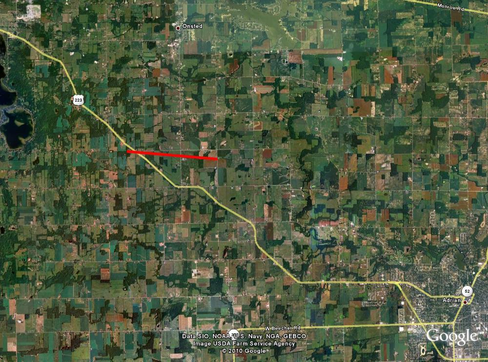
Track Map 1: Depiction of tornado track across northwestern Lenawee County
.jpg)
Radar Image 1: KDTX radar imagery @ 148 AM when the tornado was crossing U.S. 223 (Left - Normalized Rotation indicating the location of maximum rotational velocity. Right - Reflectivity showing the overall storm structure.)
A National Weather Service storm survey team confirmed that a tornado touched down at 211 AM at County Line Road and Rankin Road in extreme western Monroe County (see track map 2). The tornado tracked east-southeast along M-50, moving through Dundee at 217 AM (see radar image 2). Maximum sustained winds of 130 to 135 mph (high end EF2) were estimated from damage just west of Dundee (see photo). The width of the tornado at that time was 800 yards. As it passed through Dundee, the tornado was still producing damage consistent with maximum winds of 115 mph (low end EF2). The tornado then tracked another 7 miles along M-50 producing damage consistent with winds of 70-80 mph (EF0) before lifting at 227 AM at the Dixon Road intersection. The path length of this tornado was 13 miles. There were 11 injuries reported with this tornado.
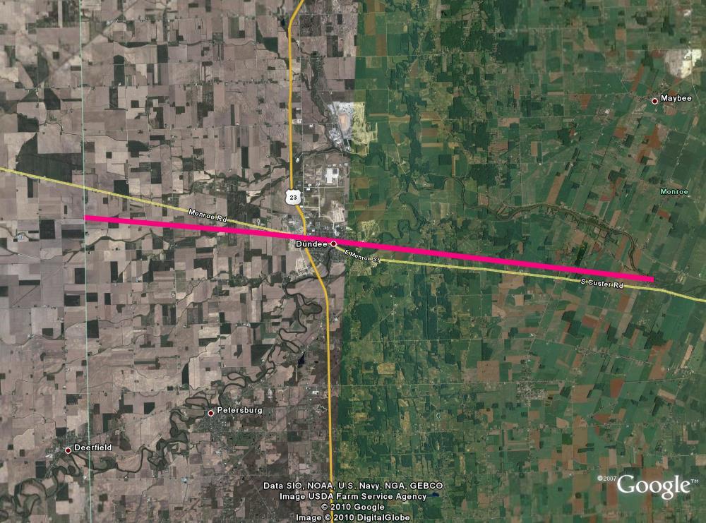
Track Map 2: Depiction of tornado track across western and central Monroe County
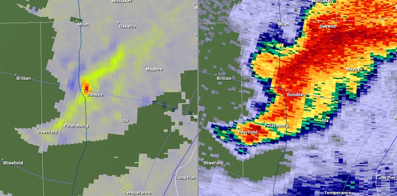
Radar Image 2: KDTX radar imagery @ 217 AM when the tornado was impacting Dundee (Left - Normalized Rotation indicating the location of maximum rotational velocity. Right - Reflectivity showing that the tornado was embedded within an area of heavy rain.)
A National Weather Service storm survey team also confirmed that a tornado touched down at 233 AM at the southwest portion of Detroit Beach (see track map 3). The tornado tracked 6.5 miles to the northeast, reaching Estral Beach at 239 AM before moving over Lake Erie. The path width was 500 yards with damage consistent with estimated maximum winds up to 110 mph (EF1). This tornado also impacted the Fermi Nuclear Power Facility. No injuries were reported with this tornado.
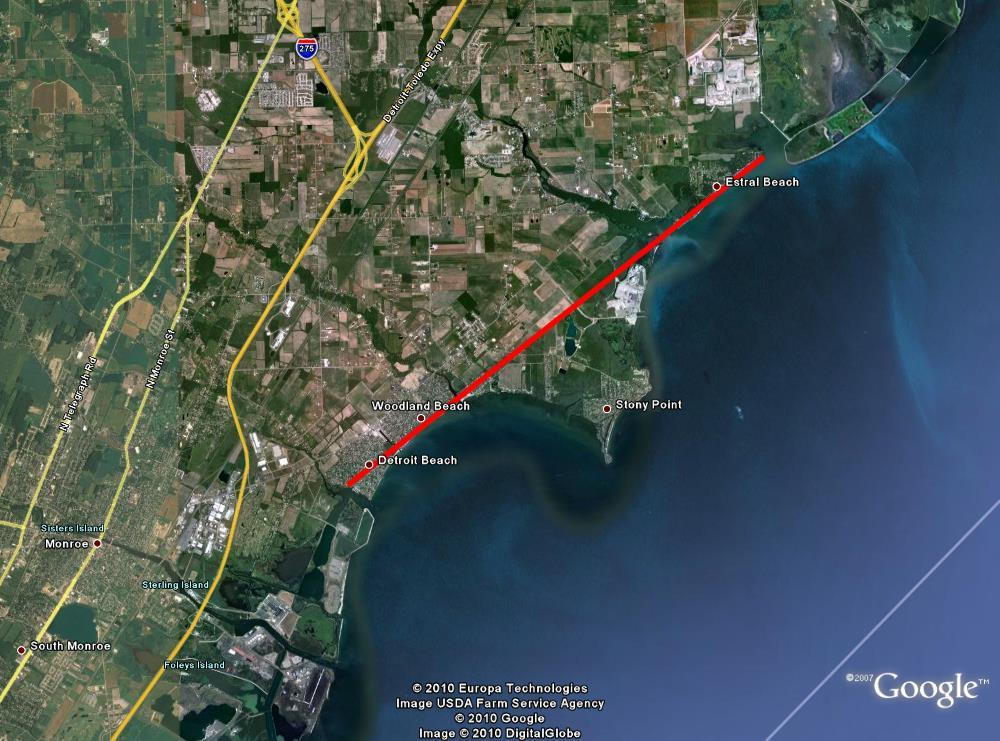
Track Map 3: Depiction of tornado track across far eastern Monroe County
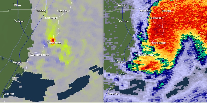
Radar Image 3: KDTX radar imagery @ 239 AM when the tornado was impacting Estral Beach (Left - Normalized Rotation indicating the location of maximum rotational velocity. Right - Reflectivity showing that the tornado was embedded within an area of heavy rain.)

