| Overview | Radar | Additional Resources |
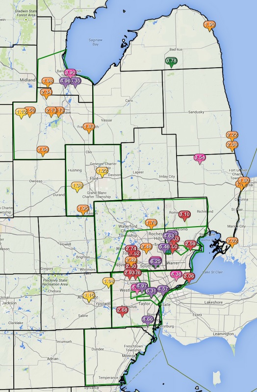
A historic rainfall event unfolded over Southeast Michigan on Monday, August 11, leading to significant flooding and major road closures. This event was caused by a low pressure system moving over the area and with the atmosphere being very moist created the heavy, continuous rains that were seen. The hardest hit areas included Metro Detroit and surrounding communities, along with Flint and the Saginaw Valley areas. Wayne, Southern Oakland and Macomb counties saw the worst of the flooding as 4 to 6 inches of rain fell over a 4 hour period.
Back to top
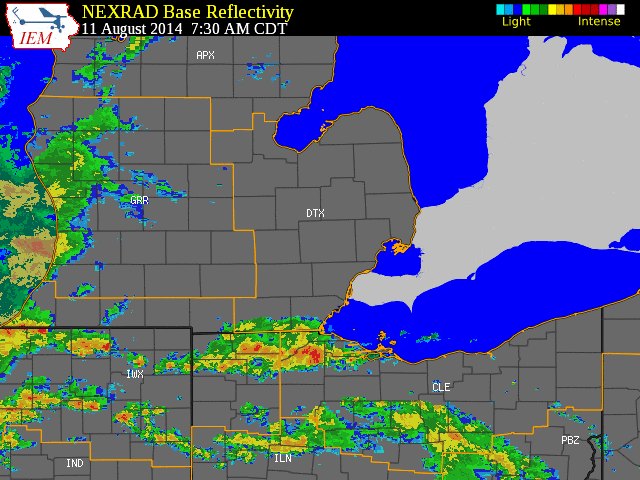 |
| Radar loop courtesy of Iowa Environmental Mesonet (IEM). Local storm reports are plotted on the above map. |
|
|
| Image courtesy of Iowa Environmental Mesonet (IEM). Green boxes indicate flood advisories, flood warnings, and river flood warnings. Local Storm Reports (LSR) are also shown plotted on the map. |
|
|
Text Summary of Local Storm Reports (LSRs)
Pictures from this event can be found by visiting the news links below:

 |