Early Morning Severe Weather Event Across Southeast Michigan on July 1, 2014
| Overview | Radar | SPC Products | Additional Resources |
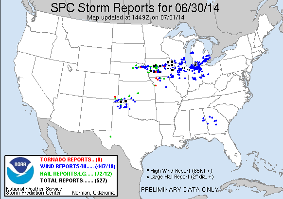
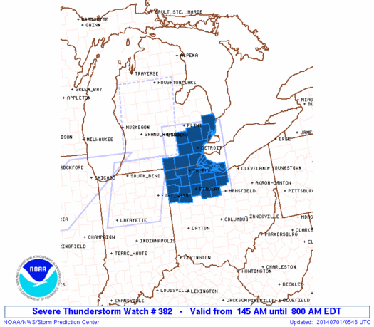
The last day of June and into the first day of July, saw a line of severe storms form out over the plains that quickly raced east across Iowa, Southern Wisconsin, Northern Illinois, Northern Indiana, and into Southern Lower Michigan. These storms produced widespread wind damage, with reports of 60-90 mph winds; along with reports of hail and tornadoes back out in Iowa. Southeast Michigan saw these damaging winds move through between 2:30 am and 5:30 am on the morning of July 1st. Southwestern Oakland, southeastern Livingston, and parts of Washtenaw counties saw the most extensive damage as numerous trees and power lines were taken down. The highest wind gust was reported in Wixom, MI at 74 mph! These storms were later classified as a derecho by the Storm Prediction Center (SPC). More information about the entire derecho event, along with the definition, can be found in the additional resources section below.
Back to top
 |
| Radar loop courtesy of Iowa Environmental Mesonet (IEM). Warnings and local storm reports (LSR) are plotted on the map. Severe thunderstorm warnings are shown in yellow, torndao warnings in red, and special marine warnings in blue. Orange lines indicate county warning area (CWA) boundaries. NOTE: Time is displayed in Central not Eastern time. |
|
|
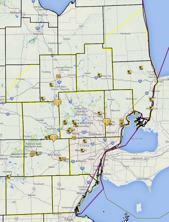
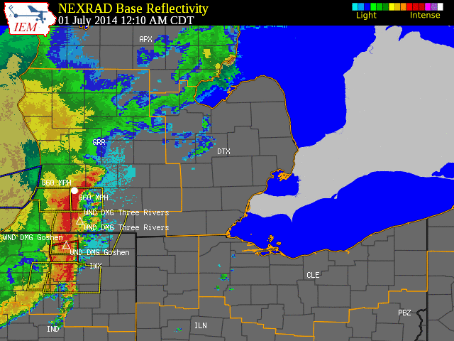
| Image courtesy of Iowa Environmental Mesonet (IEM). Yellow boxes are severe thunderstorm warnings and purple boxes are special marine warnings. Local Storm Reports (LSR) are also shown plotted on the map. |
|
|
Text Summary of Local Storm Reports
Back to top
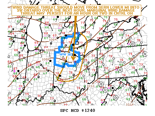
SPC Products (More details can be found by clicking on the images)
|
|
|
 |
|
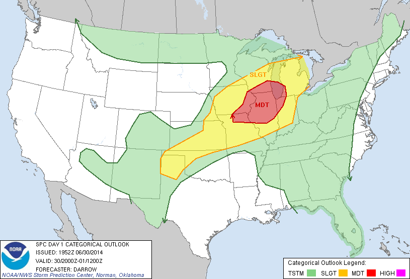
The image below is courtesy of the NWS Chicago office and SPC. This event was classified as two seperate derechos by the SPC.
Click on the picture for more information.
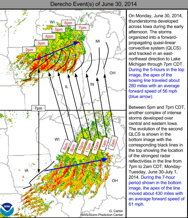
Above image created by SPC
More information about derechos can be found at: http://www.spc.noaa.gov/misc/AbtDerechos/derechofacts.htm
Event summaries from area NWS offices: