Detroit/Pontiac, MI
Weather Forecast Office
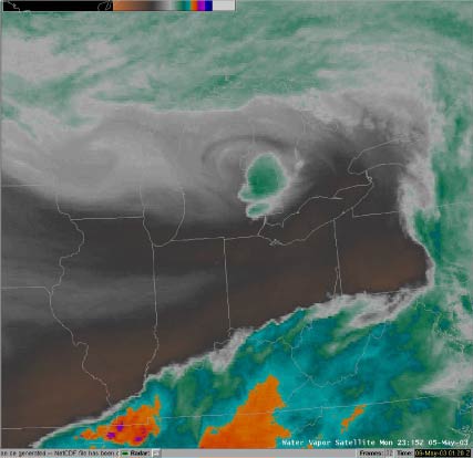 |
GOES-East Water Vapor imagery (715 pm EDT) depicting the developing thunderstorm complex over Southeast Lower Michigan. |
| GOES-East Visible imagery (715 pm EDT) offering another view of the developing thunderstorm complex over Southeast Lower Michigan. | 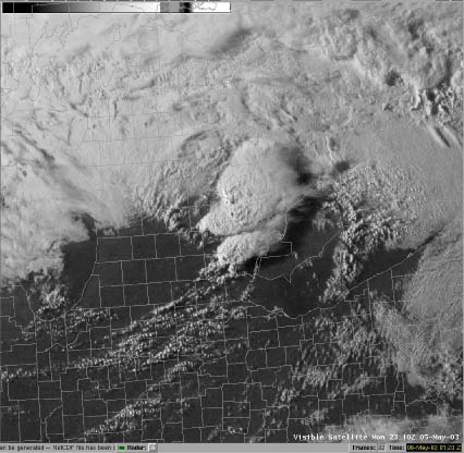
|
 |
|
|
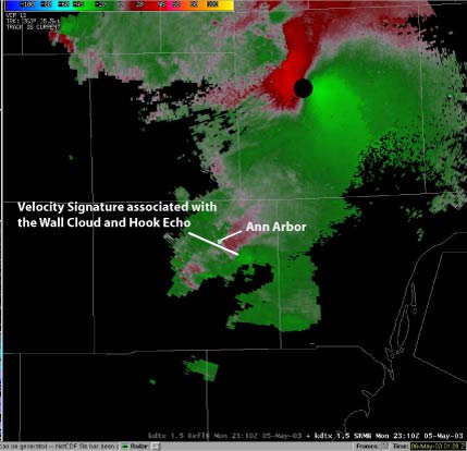
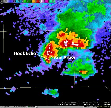
National Weather Service Doppler Radar imagery (Reflectivity upper left and Storm Relative Velocity upper right) of the thunderstorm that produced the wall cloud near Ann Arbor in Washtenaw County. |
|
 |
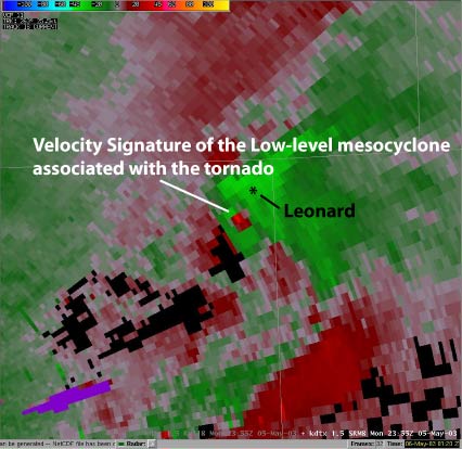 |
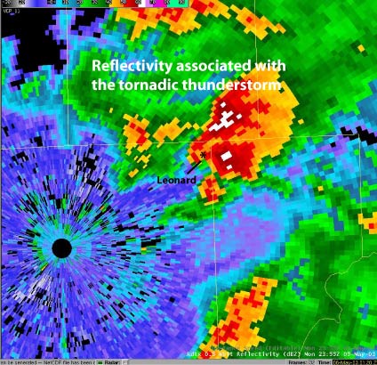
| National Weather Service Doppler Radar imagery (Reflectivity left and Storm Relative Velocity right) of the thunderstorm that produced the tornado near Leonard in Oakland County's Addison Township. |
Weather Forecasts
Fire Weather
Snowfall Forecast
Marine Forecast
Beach Forecast
Aviation
Digital Forecast Graphics
Current Weather Conditions
Local Observations
Today's Weather History
Observed Snowfall
Regional Radar Mosaic
Past Weather Records
Climate records by month
Additional Daily Climate Data
Top 20 Lists
Breakdown by Decade
Largest Snowstorms
Season Snowfall Maps
Year To Date Plots
Severe Weather
Daily Plots
Annual Plots
Event Summaries
US Dept of Commerce
National Oceanic and Atmospheric Administration
National Weather Service
Detroit/Pontiac, MI
9200 White Lake Road
White Lake, MI 48386
248-620-9804
Comments? Questions? Please Contact Us.


